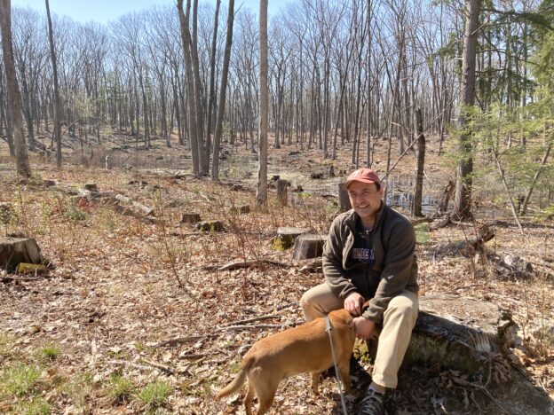
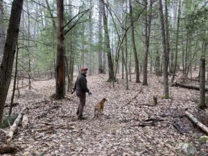
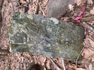
April 3: We see two bald eagles on the Durham Greenway
Given that we’ve been stuck pretty much in the same place for over a year, it’s tempting to wish ourselves somewhere else. But, really, we’ve got everything we need right here. Look at all the great hiking experiences with in few miles of our house.
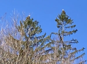 AND LOOK AT THESE TWO BALD EAGLES WE SAW ON OUR MORNING WALK TO THE TOWN LANDING THIS MORNING!
No, that’s not Alaska. That’s the two tallest trees looming over the Three Chimneys Inn. The two tallest trees looming over the Three Chimneys Inn were each adorned with it own bald eagle this morning, and we were there to witness it.
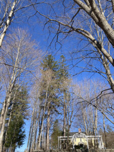 It was not the first time we saw a bald eagle on our walk along the Durham Greenway, but it was the first time we, or probably anybody else, saw two awesome bald eagles standing out in full relief against the light blue morning sky over our town, which is in New Hampshire and not Colorado, or somewhere else where one might expect to see such a thing.
God Bless America.
April 18: Moharimet Woods/Powder Major Trails
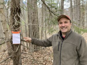 Technically, this walk is not in our back yard, but major portions of today’s hike were extremely familiar. We have had an association with Moharimet Elementary school since at least 2006, when Zoe started kindergarten there. I currently walk a portion of the trails every day (at least twice) for work. I was able to show off some the trees kindergartners and I identified and tagged last fall.
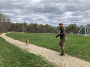 Then we hit the portion of the walk — leading up to and circumnavigating Tibbets Field — that were part of the high school cross country course when Zoe was an underclassman. The U10 girls soccer team that was practicing did not seem to notice us as we went by.
After that, we entered the woods on the far side of the fields for some unexplored territory. The Powder Major Trails are pleasantly flat, sufficiently wooded, and wonderously complex. That is to say that beyond three or four marked trials the property is honeycombed with seemingly dozens of paths. Many of them beckon exploration.
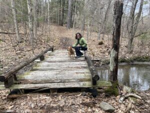 They also seem to defy explanation. Is this an snowmobile park? Was there a neighborhood here in colonial times? Was this land once worked by generations OCD farmers? How many people are at this moment wandering the side trails of the Powder Major Perseve, trying to find their way out?
Fortunately for us, the map we have in the Trails of Durham folder shows some of this intricacy. We noticed all the lines and made firm plans to stay on the yellow-blazed trail that follows the perimeter of the preserve; we would stick to the yellow trail even if presented a whole field of poppies.
Though there was a left turn that promised exposure to even deeper, darker Madbury. Who knows what was waiting in that direction. Maybe even Lee. It will have to wait for another hike.
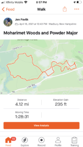 We stuck to our plans, and, despite all the trails we did not walk down, we still managed to rack up a four-mile loop.
April 24: John Hatch Park/snow mobile trails/Audubon Society preserve
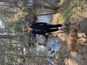 Local hiking does not get the attention it deserves from the extreme sporting community. Not only is there addictive thrill of seeing what’s behind the next turn. There’s also the not-entirely-uncommon threats to life and liberty — actual threats to actual life and actual liberty — that we encounter on the trail. Within the past year we’ve verbally threatened with gun violence for wandering on the wrong trail. It’s a trail we won’t be wandering on again.
Mostly, though, the threats come in written form, like the sign we saw along the banks of the Lamprey River. The sign was near a gate and a fence that not only blocked our path but extended all the way down to the river. Someone was taking no chances that we might ignore the sign that promised prosecution or death if we followed the pleasant trail east towards Packer’s Falls, impinging, I guess, on someone’s back yard.
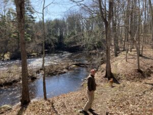 That was on the north bank of the river. Having crossed the dam and followed a similar trail on the south bank we eventually came to another sign. This one merely posted no trespassing sentiments and forewent threats and fences. We turned around here, too, giving us a little more time along the lovely river as we headed back to dam. Here’s one more view of the inviting island, free of No Trespassing signs, that we would like to storm and claim for wanderers everywhere — as soon as we can sew up a flag and as soon as the river level drops enough that we can hop the rocks across.
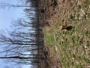 Property rights are property rights, and I’m not really interested in finding out how vaild those threats are, but this was not going to get us to the 3.5 mile goal my phone app was expecting. Luckily, we are good at noticing things, and we’re often ready for adventure. So when a well-worn path departed from the bank, and when we looked and did not see any No Trespassing signs, we decided to follow it for a while.
Here we got into “just around the corner” mode, and we found ourselves in an extensive forest. Portions had recently been harvested for timber, but they were not clearcut. We still felt like we were in the woods, under a nice canopy, but we could see for quite a distance between the sparse tree trunks and follow the rocky landscape for a fair distance in all directions.
The path turned into a network of snowmobile trails punctuated by a few traffic signs nailed to trees. Jen went on her phone to find out when we’d come to a street, or to a building with a no-trespassing sign, but things looked pretty empty for quite a while on her phone map.
Talk about adventure!
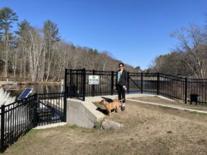 We enjoyed a nice walk through this thinned forest, but we did not encounter any boundaries — or any other hikers. We turned around with plans of returning sometime soon to try to see around a few more corners of these trails. On the way back, we notice a few signs announcing the boundary of an Audubon Society preserve, but it was not clear if we were inside the boundary or outside of it. There sure was a lot of land around.
When we made it back to the car, we had not only had our hearts full of extreme sports and adventure, we also reached our mileage goal. All was right with the world.
April 30: Marion J. Stolworthy Wildlife Sanctuary/Merrick Conservation Easement
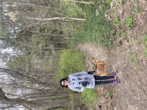 Once more on familiar grounds, we stomped our way through two seprate trail areas in one morning’s walk. Parking in an Oyster River High School parking lot emptied by April Break, we had quick access to the Stolworthy preseve after short sidewalk trek along Bagdad Road. We have walked here before, and our children certainly have spent time in this preserve. It’s brimming with middle schoolers when school is in session.
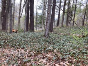 Today was a quiet stroll, brushing against neighborhoods where so many of our friends live. Still, you can find yourself in the middle of the woods here and not see schools or houses in any direction. You have to be in the heart of the preserve, though; and you have to ignore clues like the carpet of virginia creeper, or the overgrown Japanese holly bushes, if you want to imagine you’re not practically in someone’s back yard.

It was quite interesting and different to come upon so many domesticated plants in a wild setting. Daffodils and hyacinths were popping up in random clumps. There is a patch of pulmonaria like the one in our garden. Myrtle stretched off in several directions.
Then, we looked up and saw the imposing wall supporting the new middle school parking lot. It does not seem like there is currently any access to the school from the trails, which makes sense, given that the school is construction site. Hopefully, middle schoolers will be able to get into the Stolworthy again once the dust settles.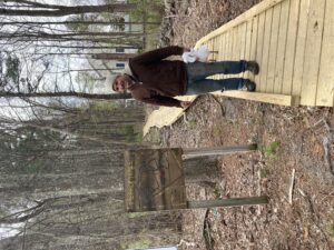
We rebounded off the wall and forked onto a side trail that led to the high school athletic fields. Then we swerved back and found ourselves on Bagdad again. About a quarter mile up the sidewalk, past the high school, our car, and route 4, we found the entrance to the Merrick Conservation Easement. From this entrance you enter the trails via a well-maintained boardwalk that keeps you out of the mud and gives a nice view of the backyards of the adjacent Nobel K. Peterson neighborhood.
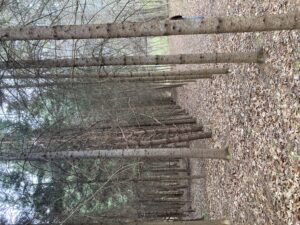
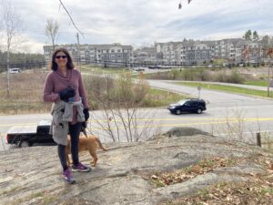 The trail marked in white on the map carried us a full 3/4 of the way around the property, past a grand view of Riverwoods Durham across route 108 and back along Canney Road. The white trail dropped us off in a large patch of fir trees that were planted in a grid formation, perhaps by someone intending to sell them as Christmas trees a long time ago. A spooky, tunnel-like trail led through the heart of this grove, and after that we were ushered on to the blue trail that led us the final 1/4 of the way around the loop.
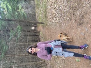 Two loops in two parks forged into a figure eight in the heart of a lot of people’s back yards. There wasn’t even much elevation gain, and the parking lot had plenty of spaces on a Friday morning during April break. There really is no reason not to go walking in this town. Unless maybe if you don’t have a dog.
