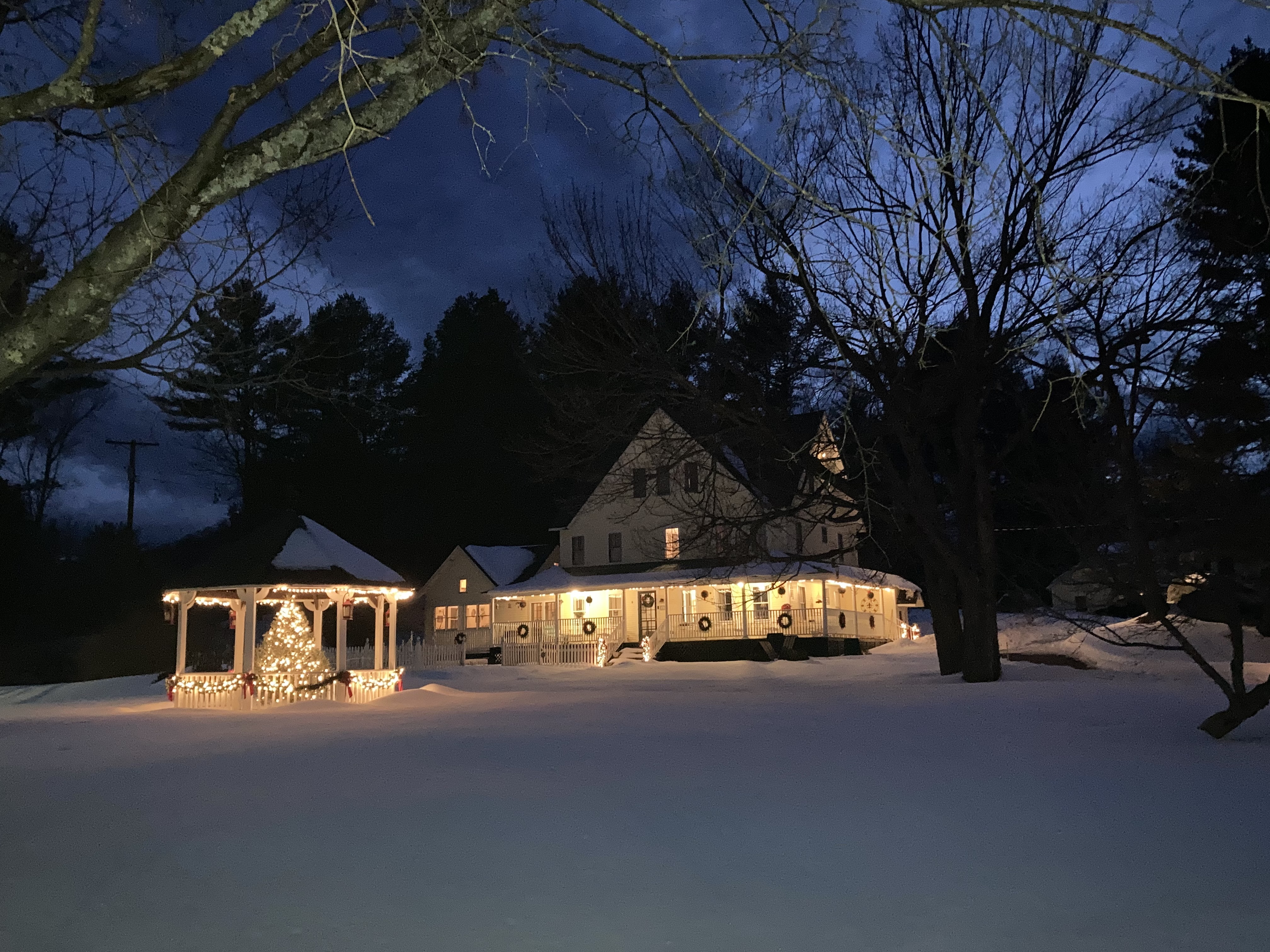
Category Archives: Anniversarymoon

Our first winter anniversarymoon

The Riverwood Inn

We generally alternate planning an anniversary weekend getaway each year, but I’ve been slacking off a bit.  I should have planned one for fall 2019, but we were so busy with school stuff and college visits and kids’ sports — plus a fun weekend trip to NYC with friends — that it didn’t quite happen.  Then 2020 rolled around and things were even worse — lockdowns and travel restrictions, Zoe starting college and the other kids stuck schooling at home, social distancing preventing them from staying with various friends and family while we were away.

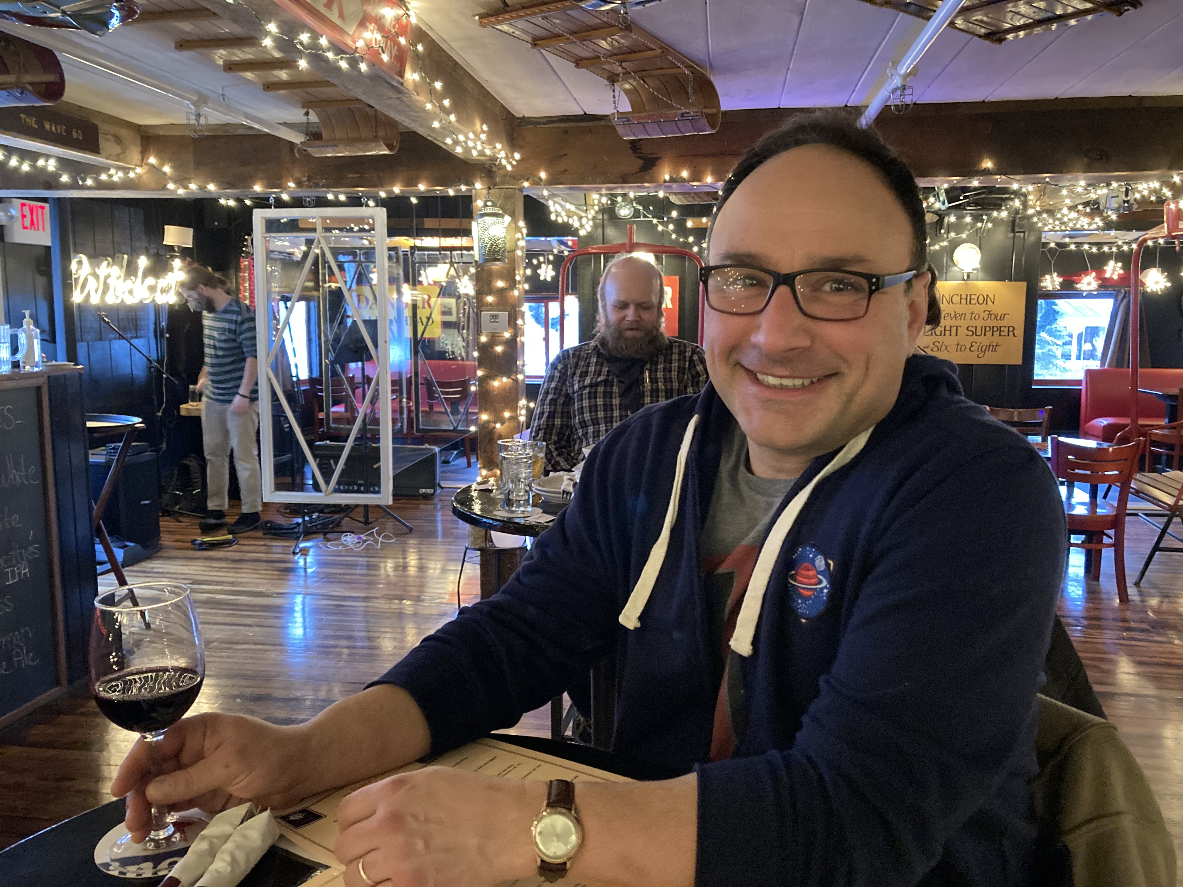
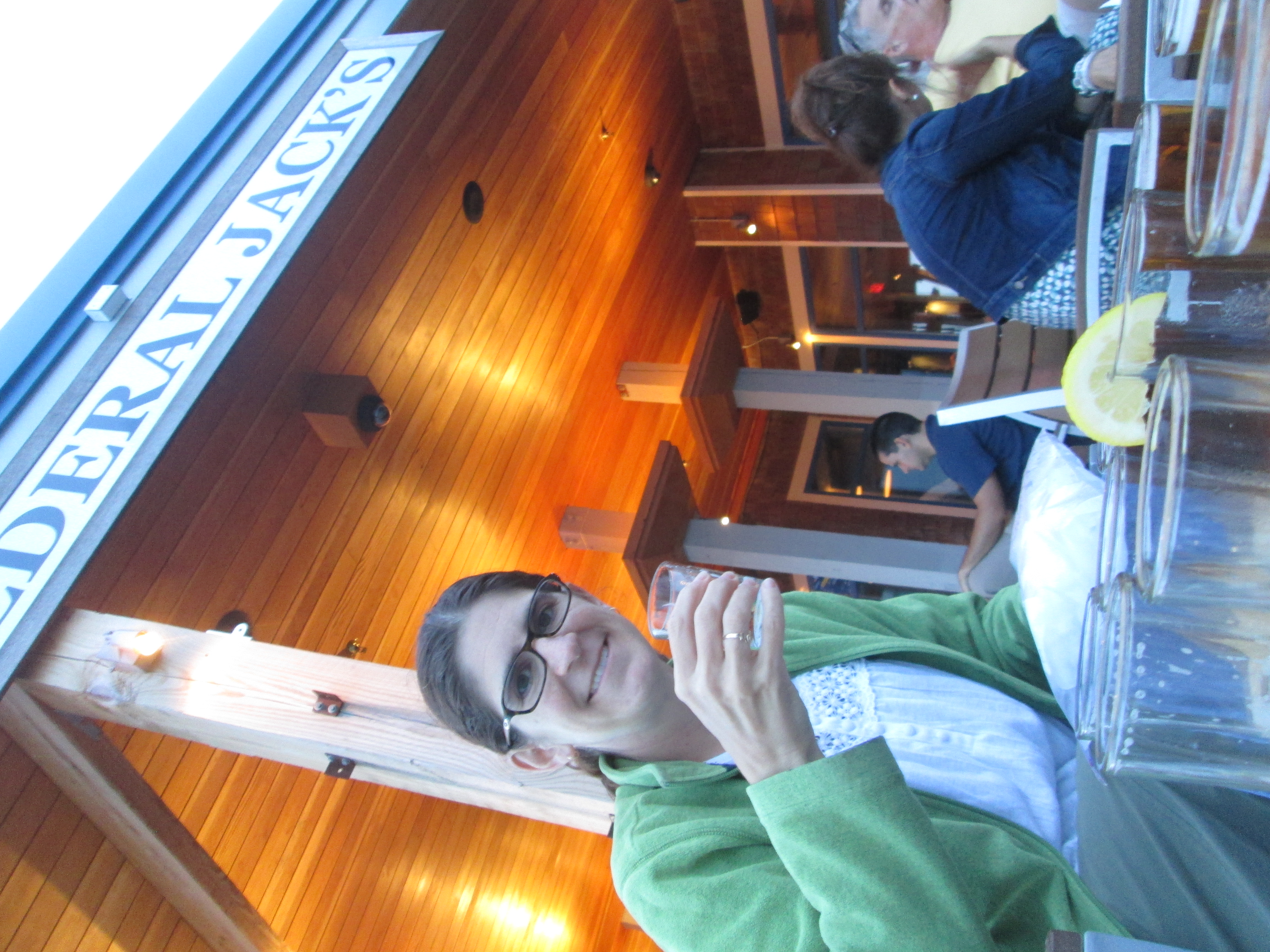
At the Wildcat Tavern — first time in a bar in almost a year!

So when winter 2021 dropped a getaway opportunity in our laps, I seized it.  Lanie is skiing at Sunday River with one of her friends in her “pod”, and Nadia is visiting colleges with her best friend.  That, combined with Bob’s recent big birthday, made a perfect case for our first ever winter anniversarymoon trip.  Options were, of course, somewhat more limited than usual.  Because of COVID concerns and travel restrictions, we needed to stay in NH or ME.  I wanted to have kitchen 
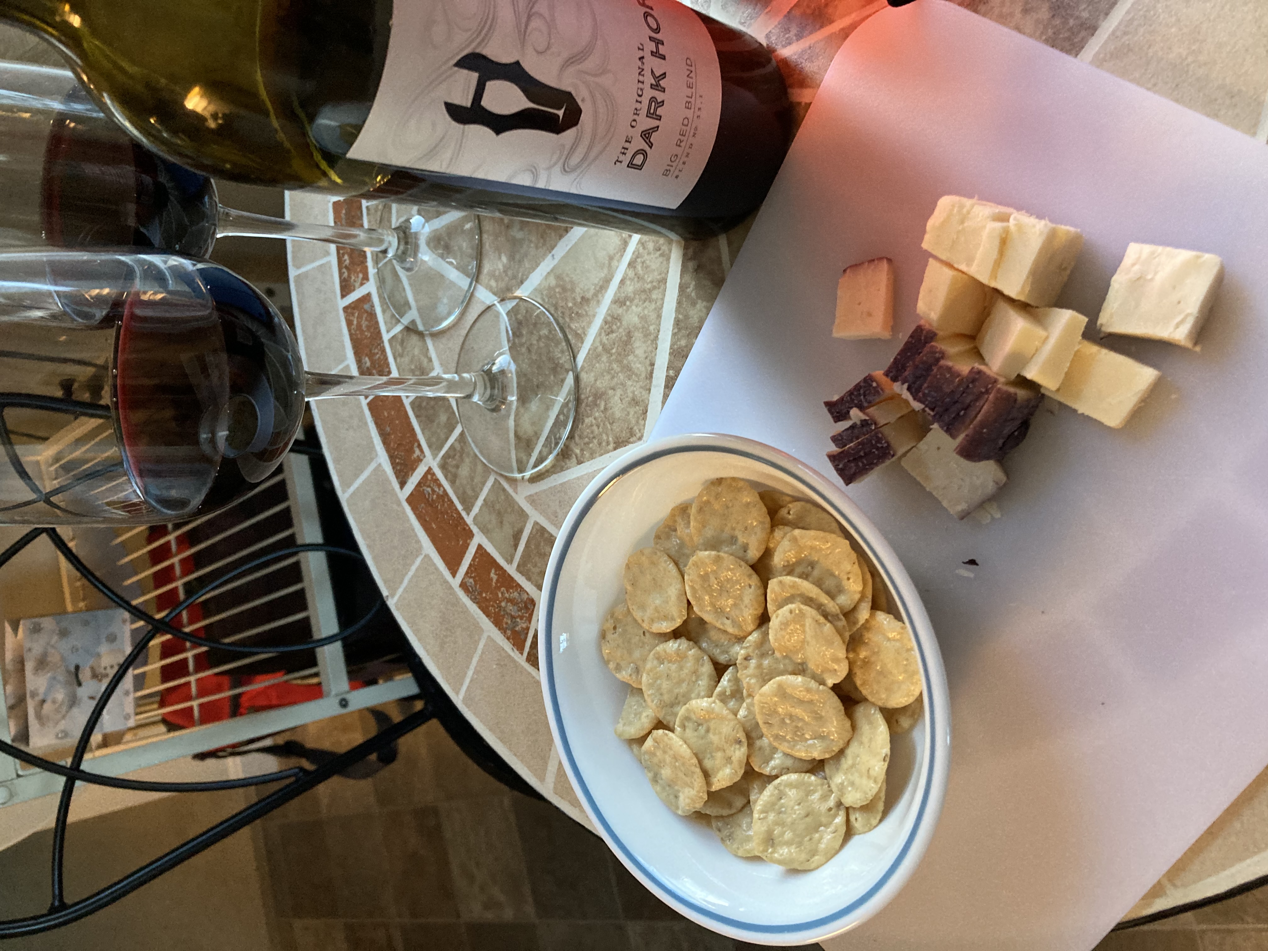
facilities so we wouldn’t have to eat at restaurants.  And any activities we planned to do would need to be outdoors.

Fortunately, we found all of these things at the Riverwood Inn in Jackson.  Our room included a kitchenette that allowed us to make most of our food.  And its location in the mountains, directly on the Jackson XC cross country ski network and nearby to all manner of winter outdoor adventures, was perfect.

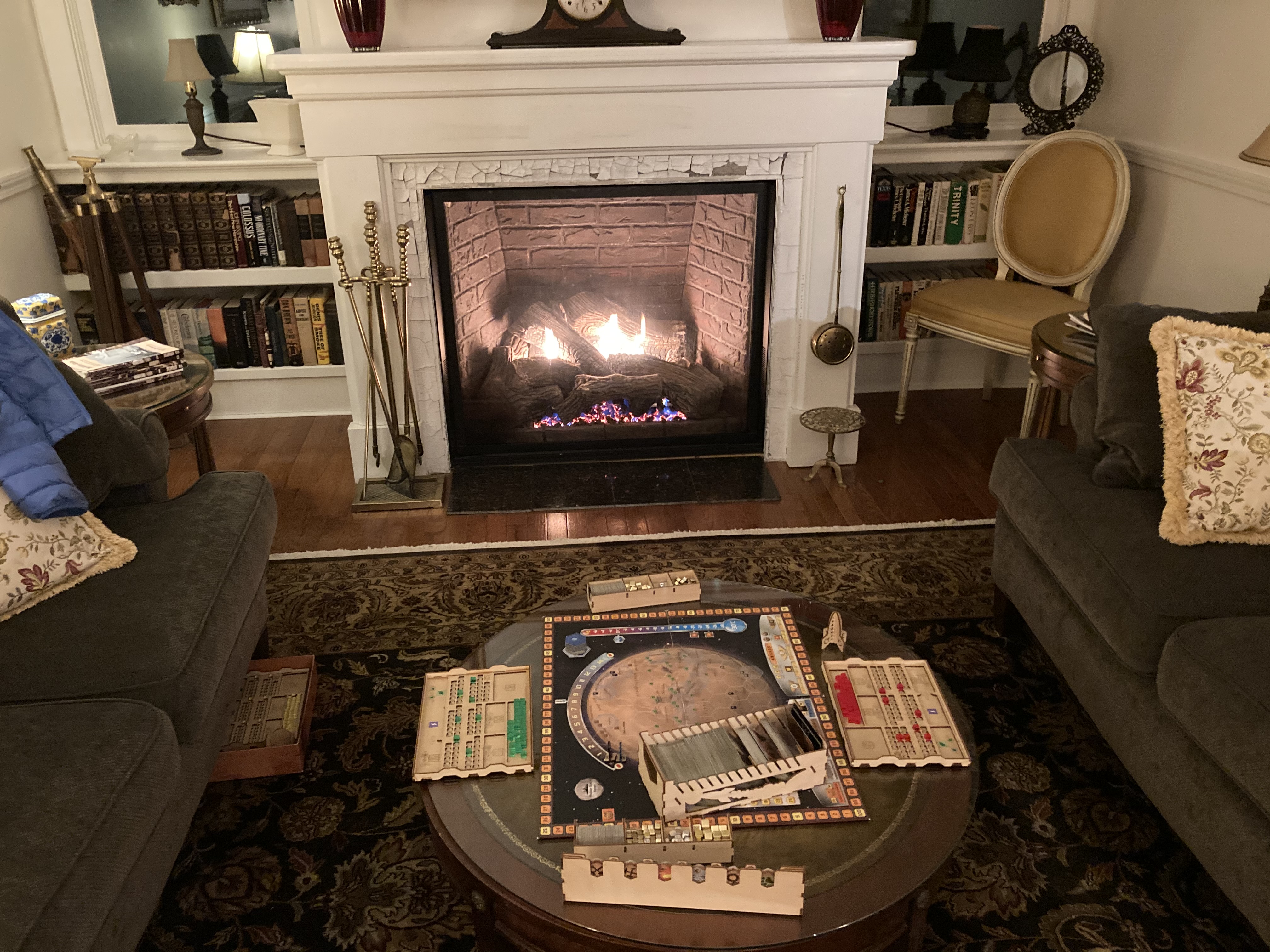
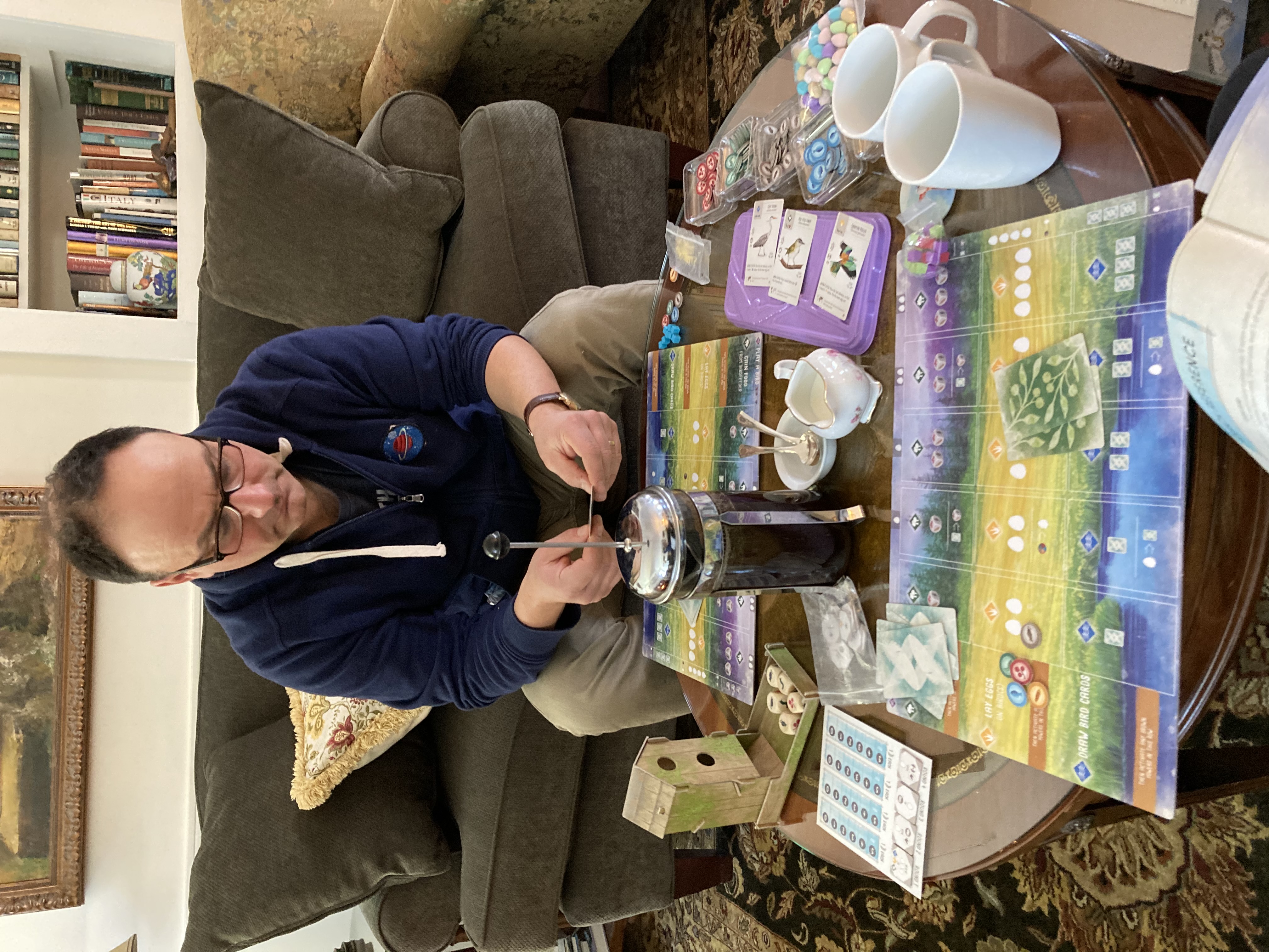
Terraforming Mars by the fire

We arrived in the late afternoon on Wednesday and had the whole place to ourselves.  We got a warm welcome from one of our hosts, James, who showed us around the first floor of the inn.  (We stayed in the carriage house, a separate outbuilding, but were welcome to spend time in the inn’s lovely living room in front of the fire, sipping coffee, tea, or cocoa.)


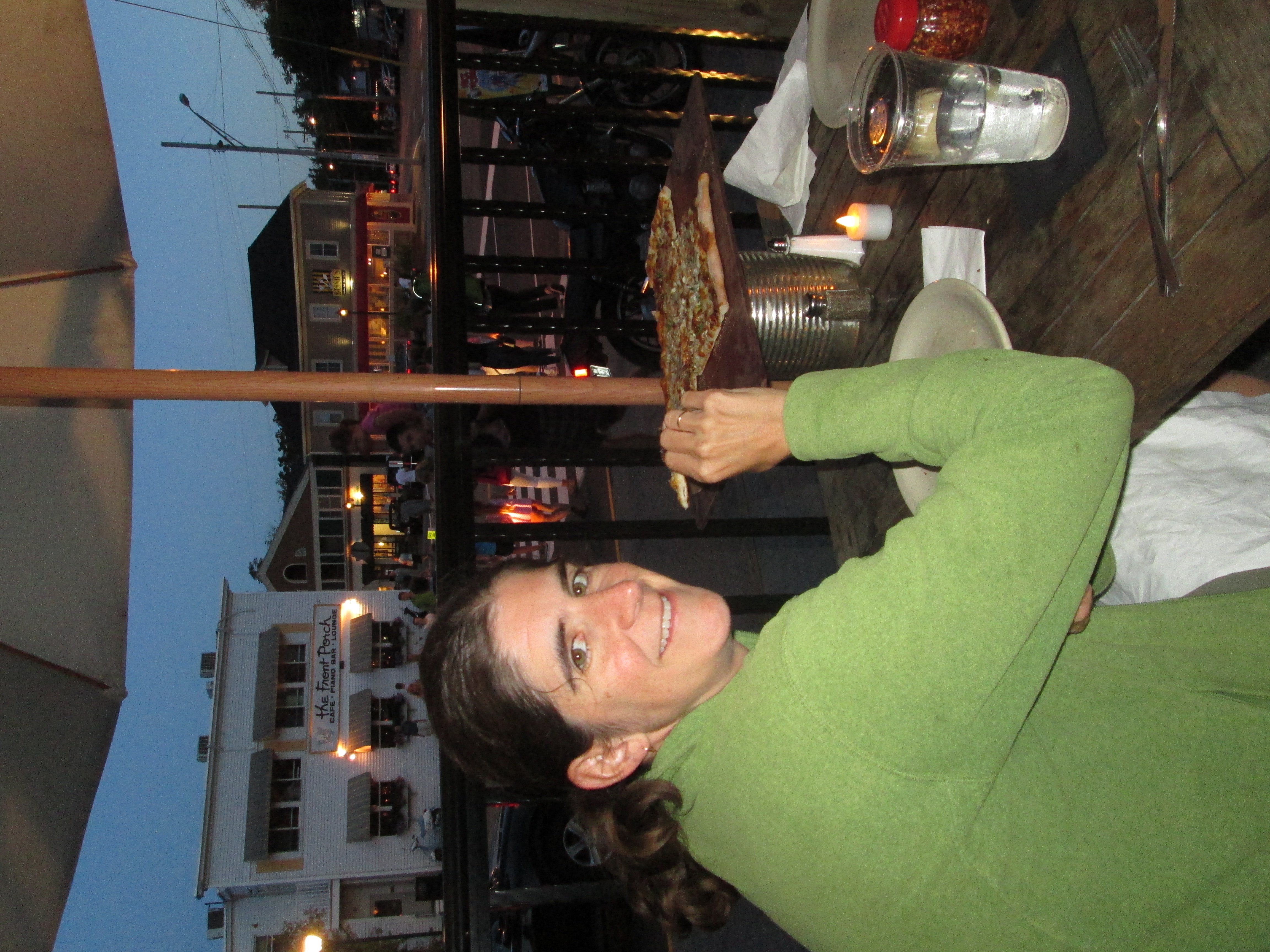
We decided to treat ourselves to dinner out for our first evening, assuming that if we went very early we’d avoid any crowds.  Accordingly we strolled down the street to the Wildcat Tavern at 4:30, and initially were successful in our strategy.  The Wildcat must get a big apres-ski crowd after the mountains close, though, because by the time we finished our (delicious) dinner, the place was pretty packed (at least by COVID standards).  It was very odd being in a bar with live music and lots of people.  Though it was a fun interlude in a way, we didn’t linger.  Instead, we returned to the inn for a solitary evening playing a game by the fire.

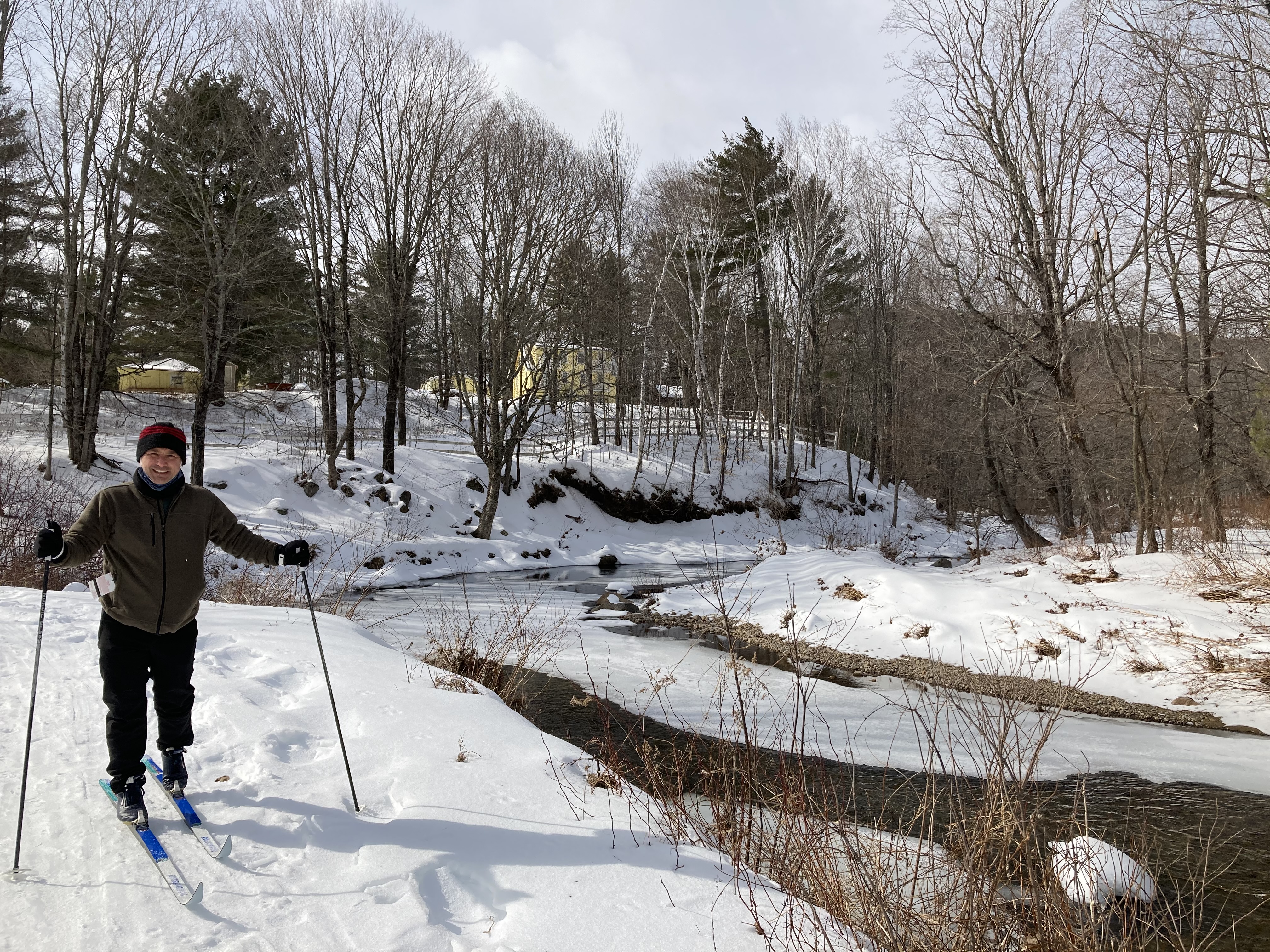
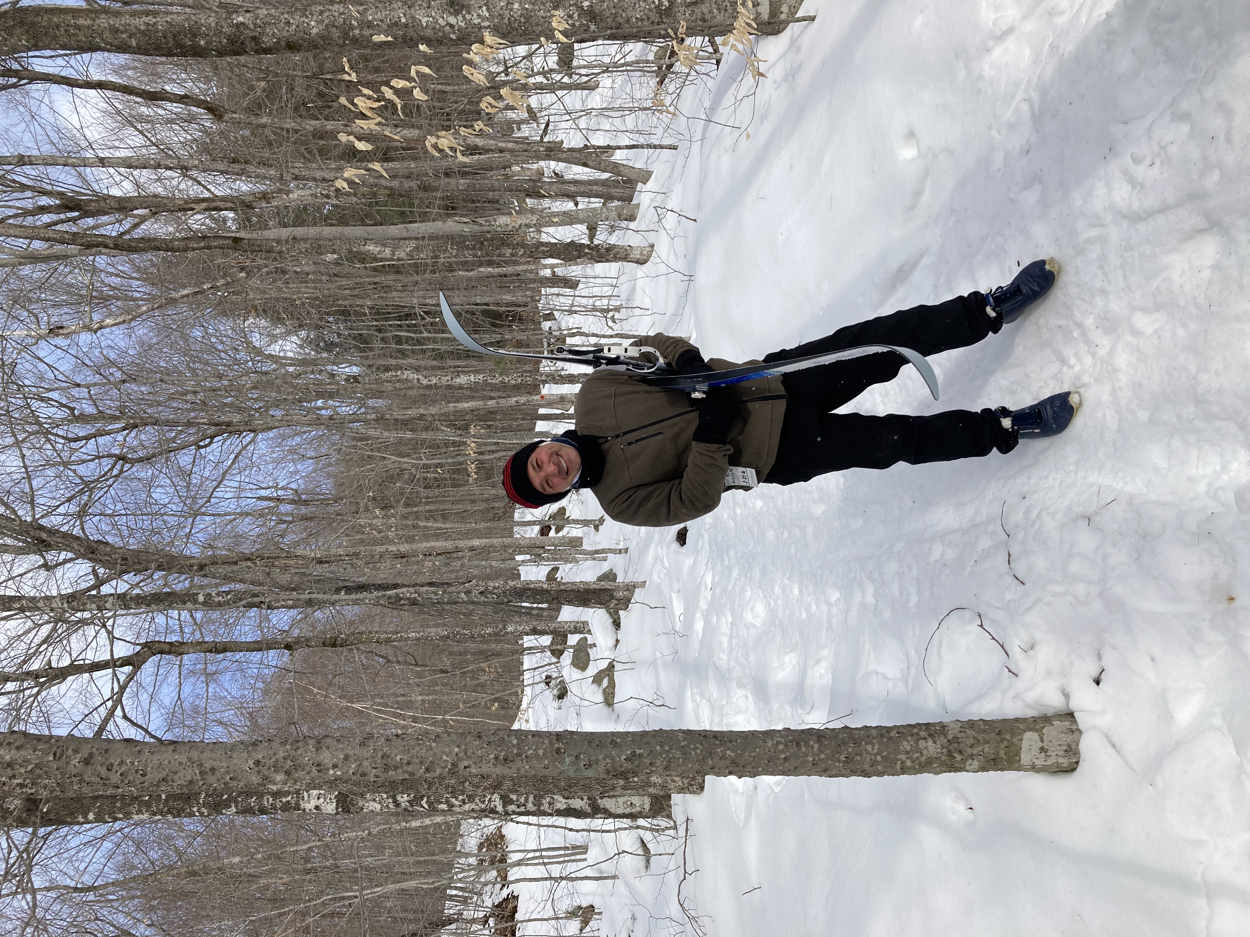
Setting off on our skis, with our inn visible on the hill

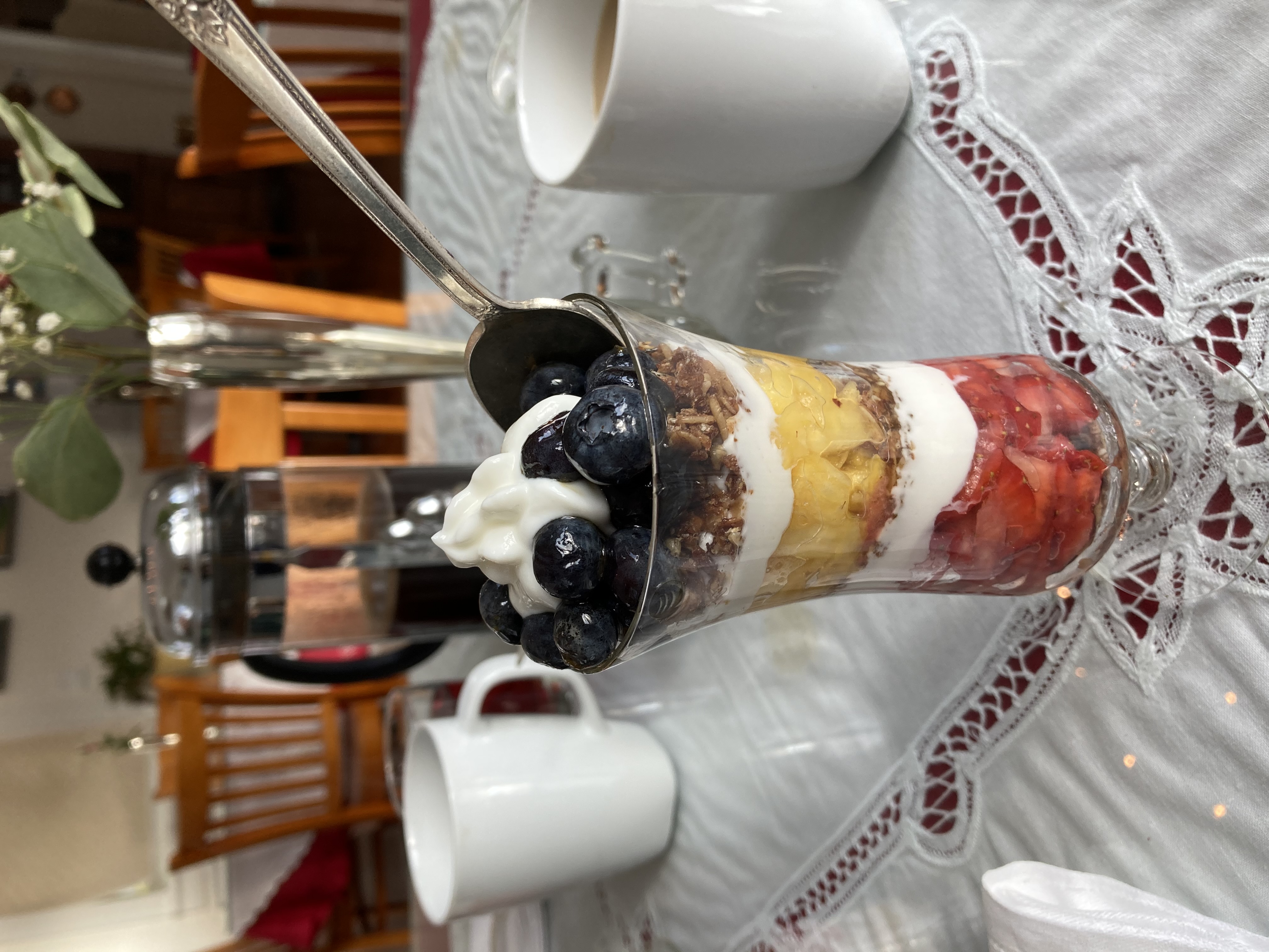
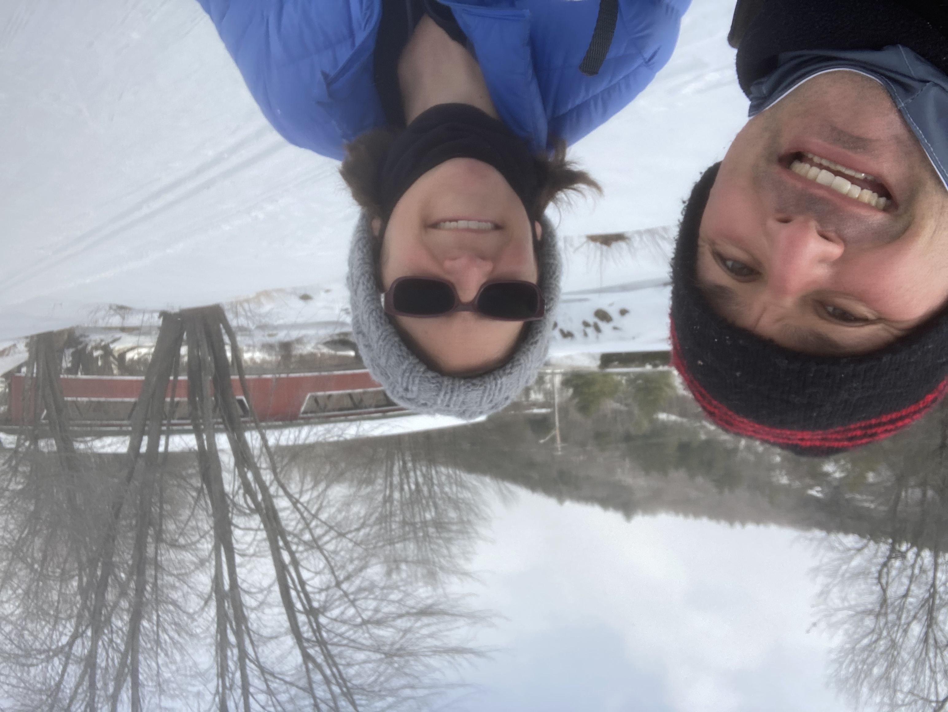
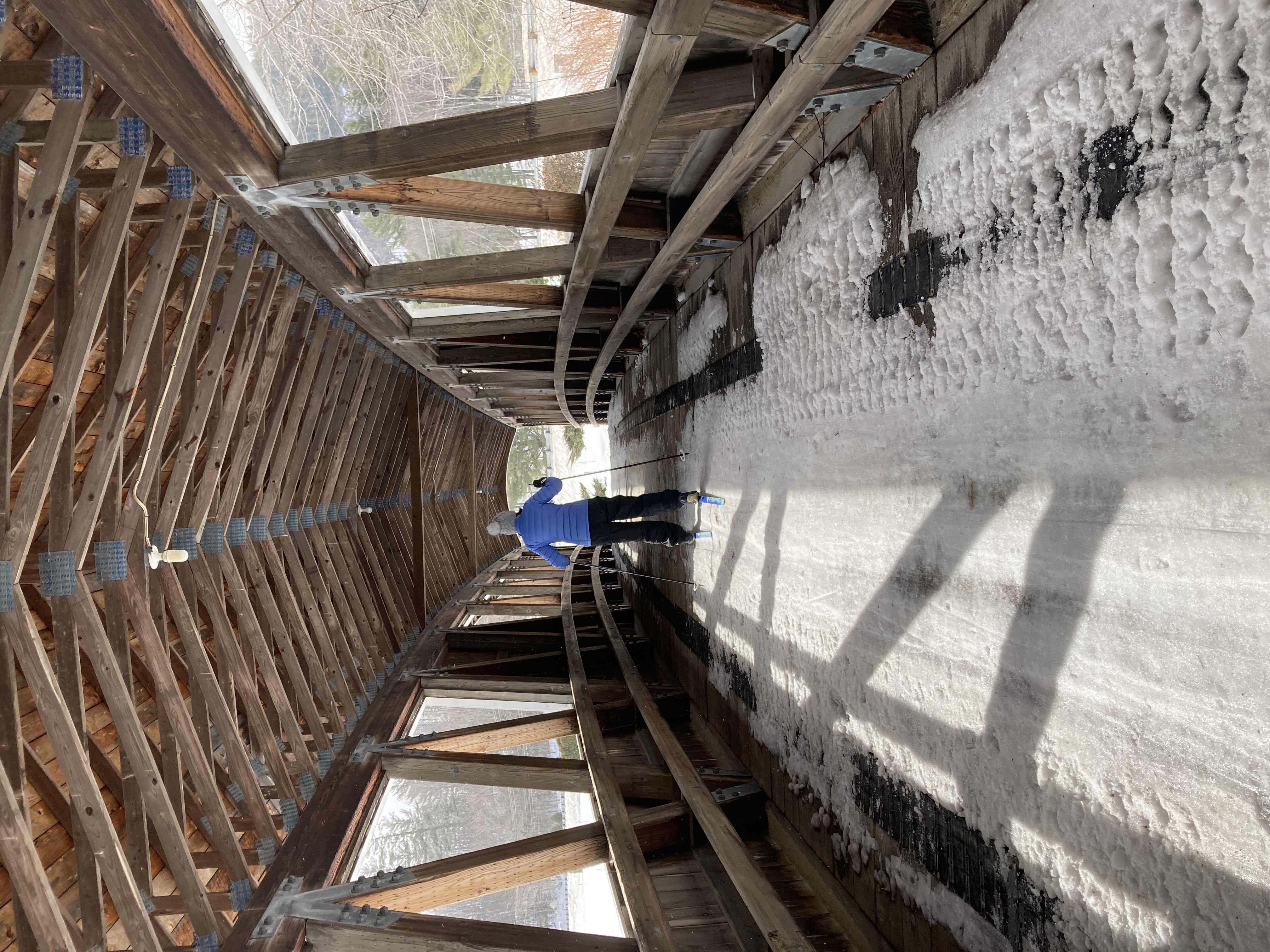
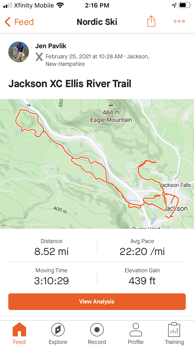
The next day, after a delicious breakfast prepared by James’s wife Susan, we headed out the back door to hit the cross country ski trails.  Jackson XC maintains a huge network of groomed trails, and is one of the best places in New England for Nordic skiing.  Bob and I are enthusiastic skiers, but not very skillful ones, so we started off skiing the loops around the large, semi-flat golf course right in Jackson village.  We then crossed over the iconic covered bridge and headed out on the Eliis River Trail.  This 
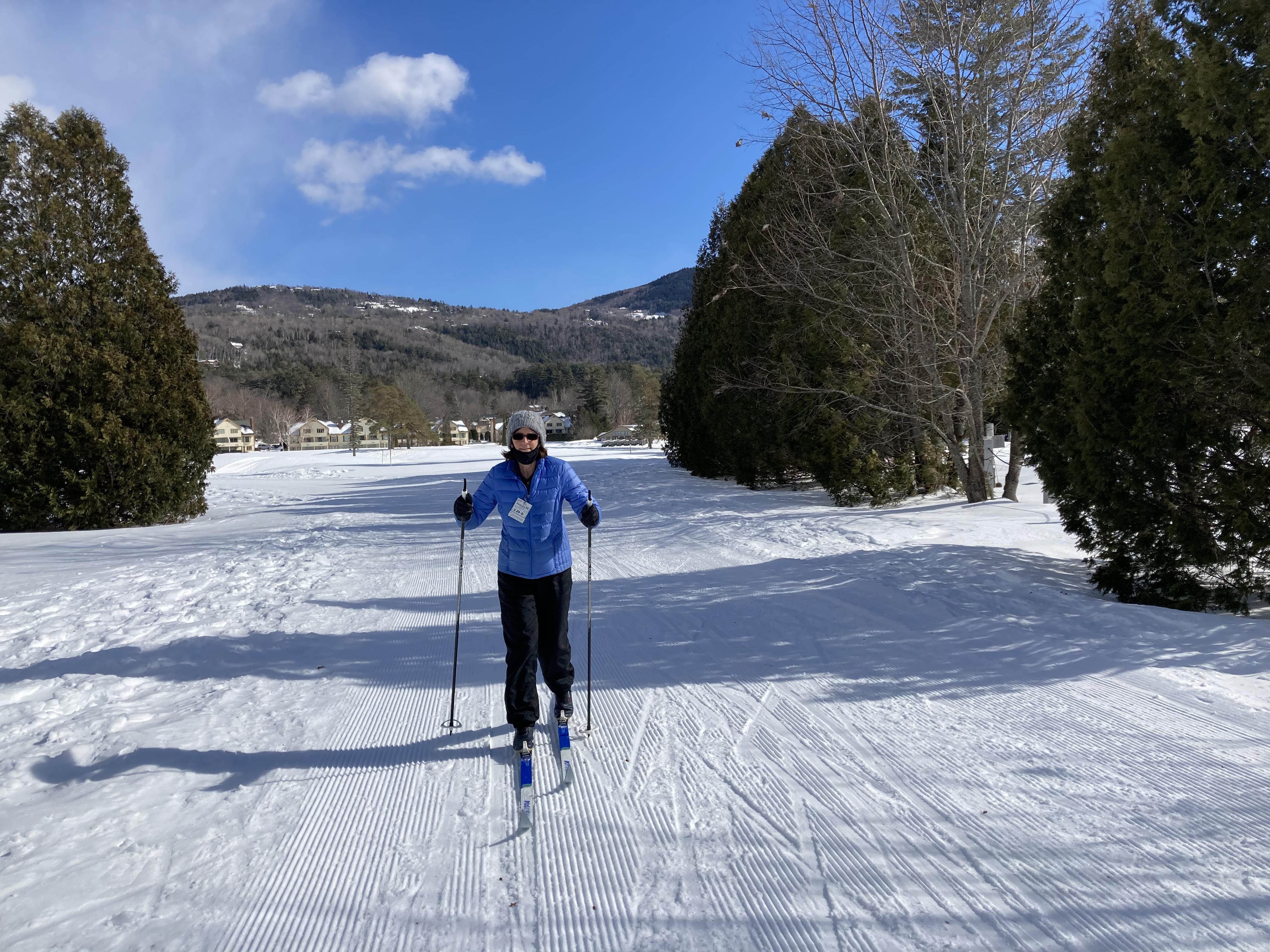
was rated as “easy” but still contained plenty of challenges for us, especially with the somewhat icy conditions.  (We just cannot figure out how you are supposed to stop, or turn, on these skis.  If your instincts take over and you attempt to do it the way you would on downhill skis, disaster quickly ensues.  So we approach every downhill, especially those that involve a curve, with great trepidation.)


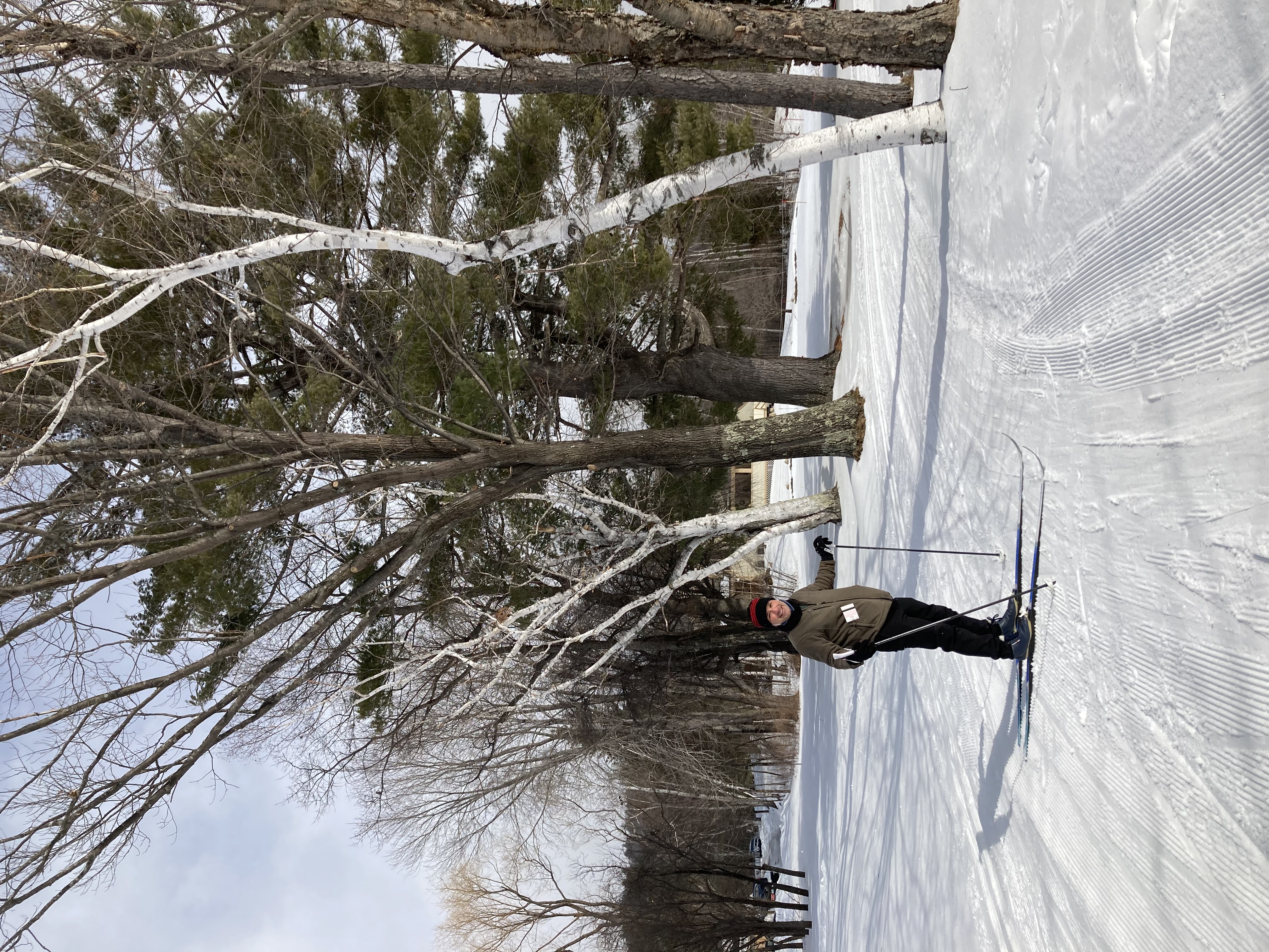
Well, we managed to get out and back on the river trail without serious incident, and wanted to keep going.  We were hoping to make our way to the Eagle Mountain House for a trailside snack and some skiing on the network of green (easy) trails surrounding it.  Unfortunately there was an ominous section of blue — 1.1 miles, to be exact — that we would have to traverse to get back to the green area.  We decided to give it a try, figuring we could always take off our skis and walk down any particularly scary hills.

Throwing in the towel

A few tenths of a mile in, we were rethinking this plan.  We’d been duck-walking the whole way (nearly falling over repeatedly in the process), up a trail that climbed ever more steeply.  We already knew there was no way in hell we’d be able to ski back down — in fact we couldn’t understand how it would even be possible for ANYONE to ski back down, without careening off the icy path into the trees at very high speeds.  After close to half a mile of this, with no end in sight, we threw in the towel.  Fortunately, we were close to a snowshoe trail that was sufficiently packed down for us to walk on — so, carrying our skis, we retreated in defeat.

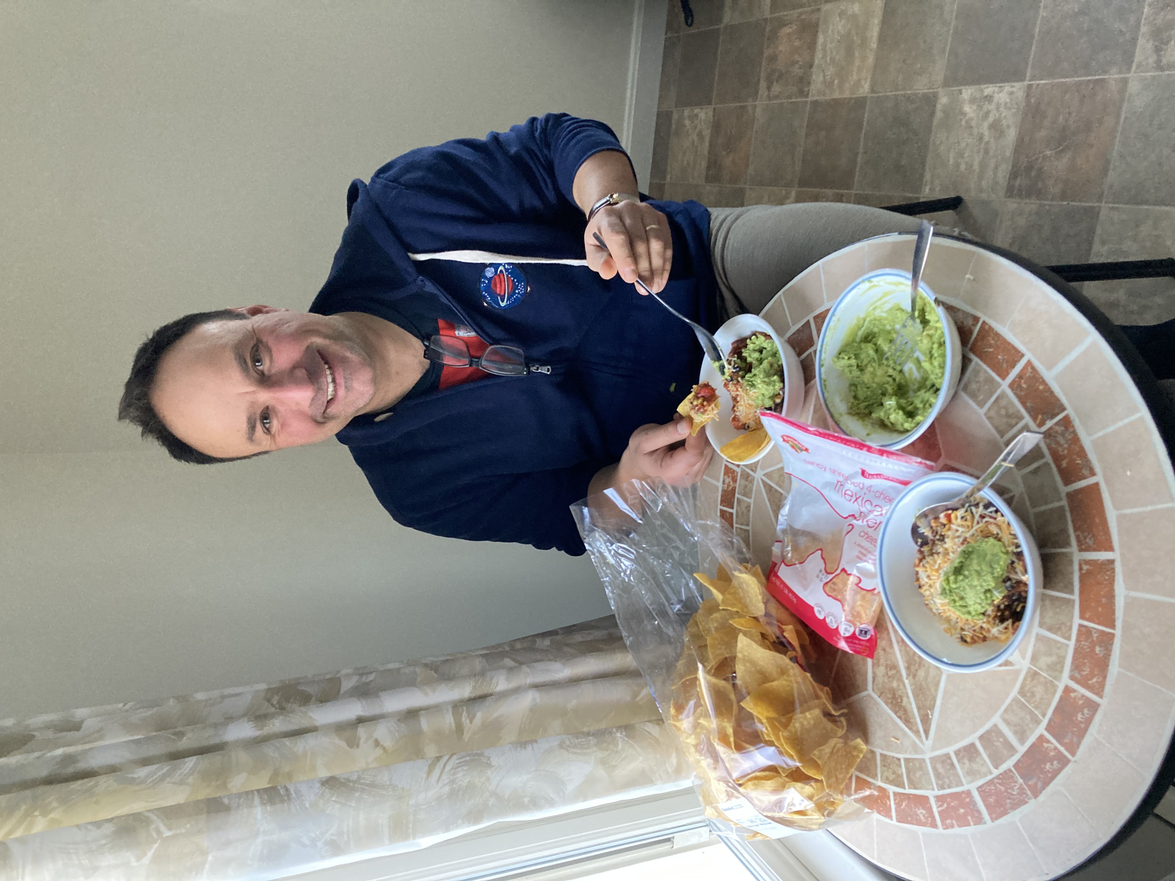
Luckily we were able to console ourselves with wine and cheese followed by a delicious dinner that we’d set up in our crockpot that morning.  We enjoyed another evening of games by the fire (we’re still the only guests here) followed by a much-needed early bedtime.

Because we’d skied earlier this week at Sunday River, and because Lanie was telling us ski conditions weren’t great, we decided to go for a winter hike the next day rather than pulling out our downhill skis.  Fortified by another excellent breakfast and large pot of coffee, we drove up to the Tin Mountain 
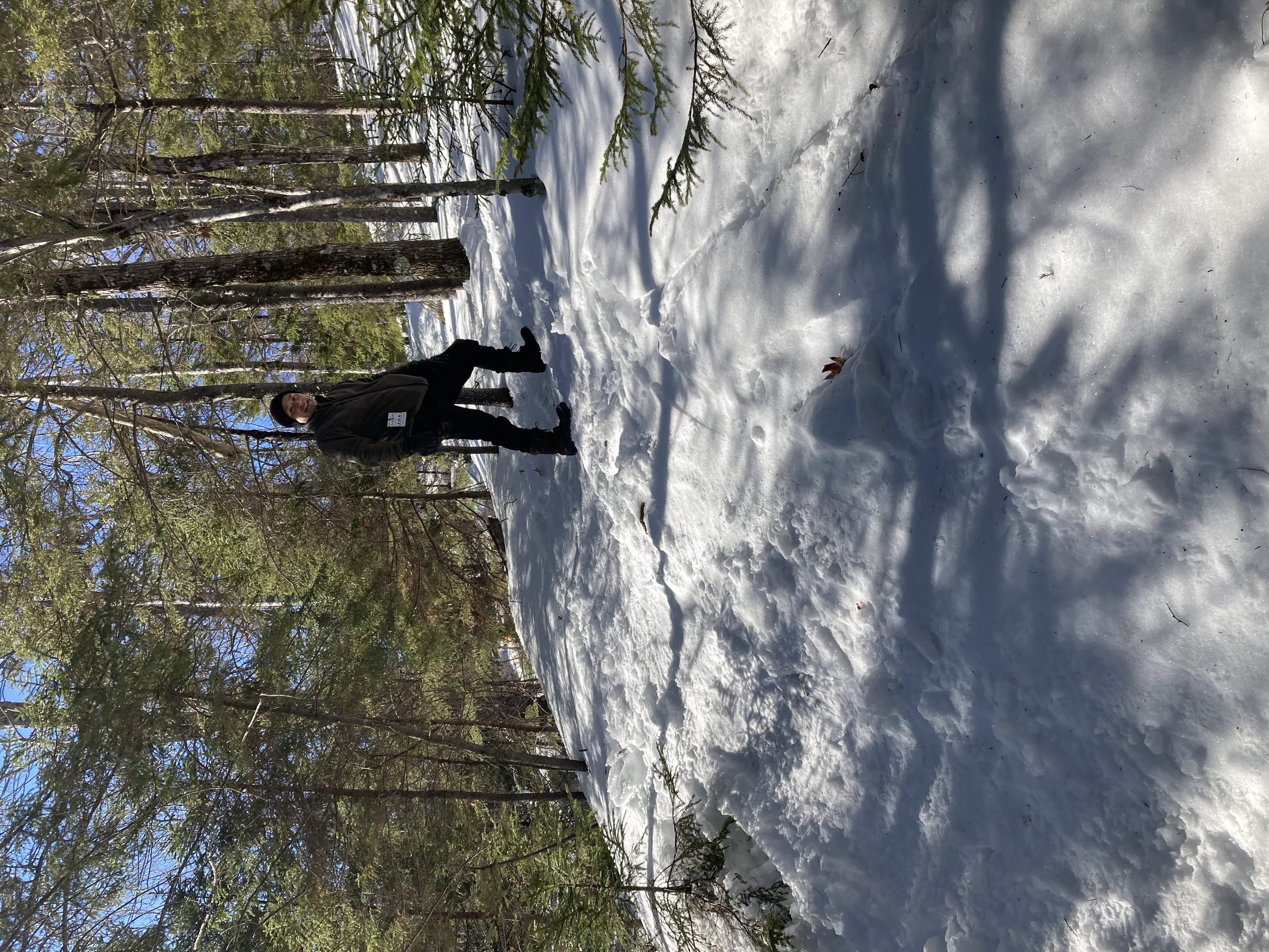
Conservation Area on the infamous Tin Mine Rd.  (We were in Jackson last month with the whole family and our 
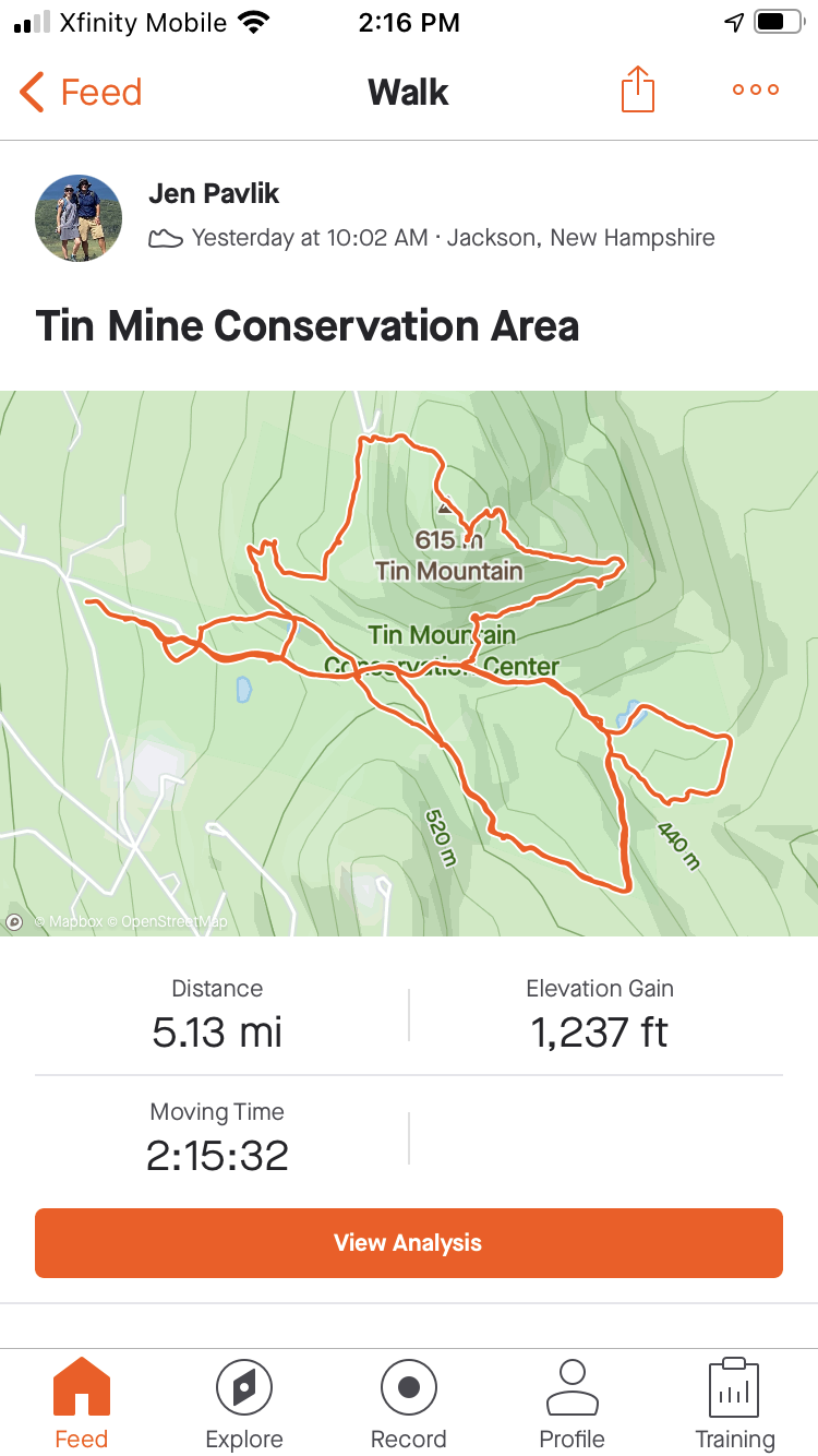
friends the Halls, in a big rental house way, way up on the mountain.  After a semi-disastrous day attempting to ski in a blizzard, we found ourselves unable to drive up said Tin Mine Rd., and had to abandon our cars and hike the rest of the way back to our house while jumping into the snowbanks on the side of the road anytime a car came skidding by.)  Luckily the weather was clear and we were able to make it up the steep track without incident.

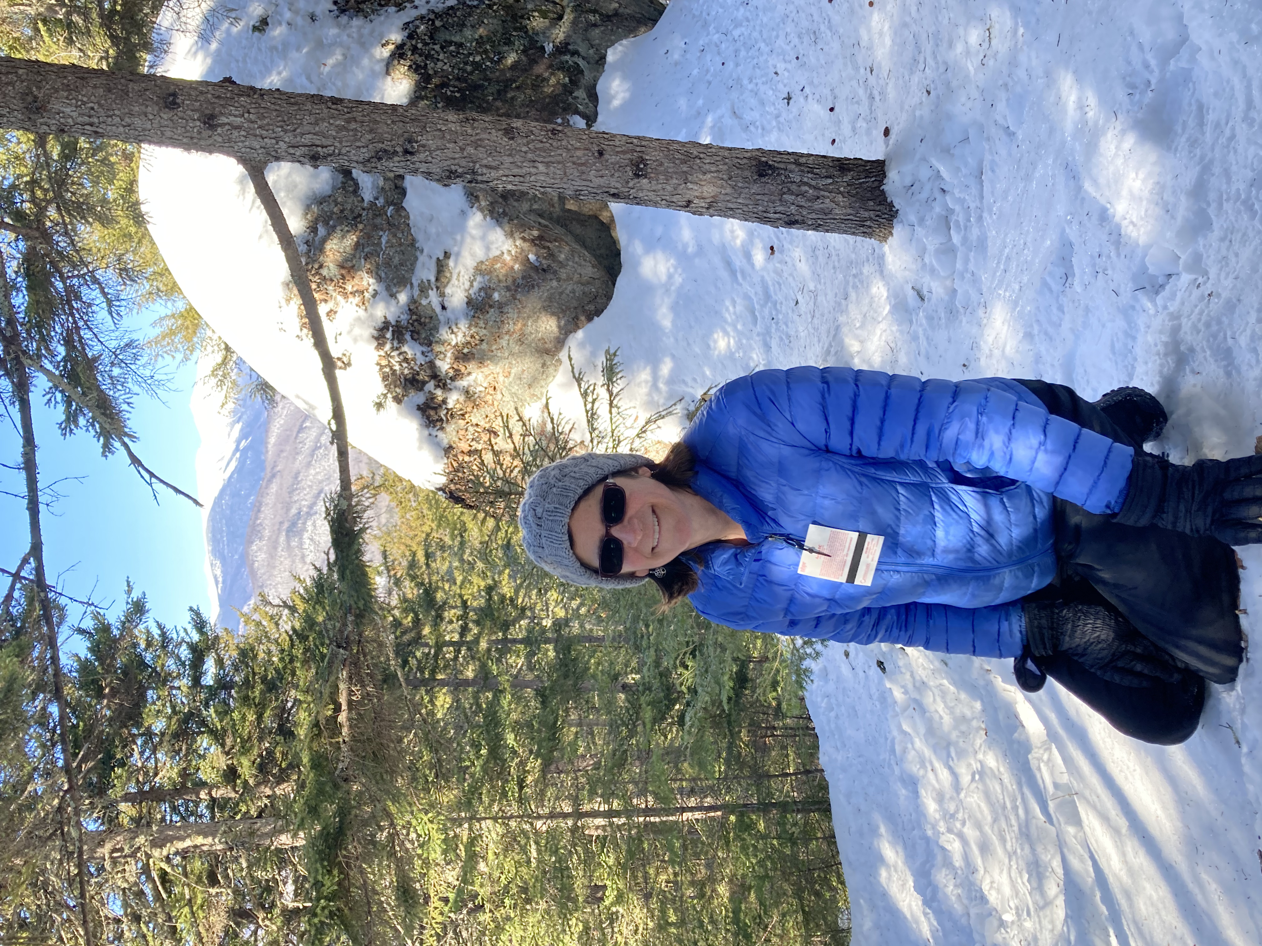
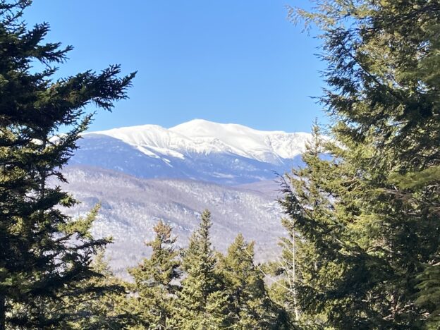
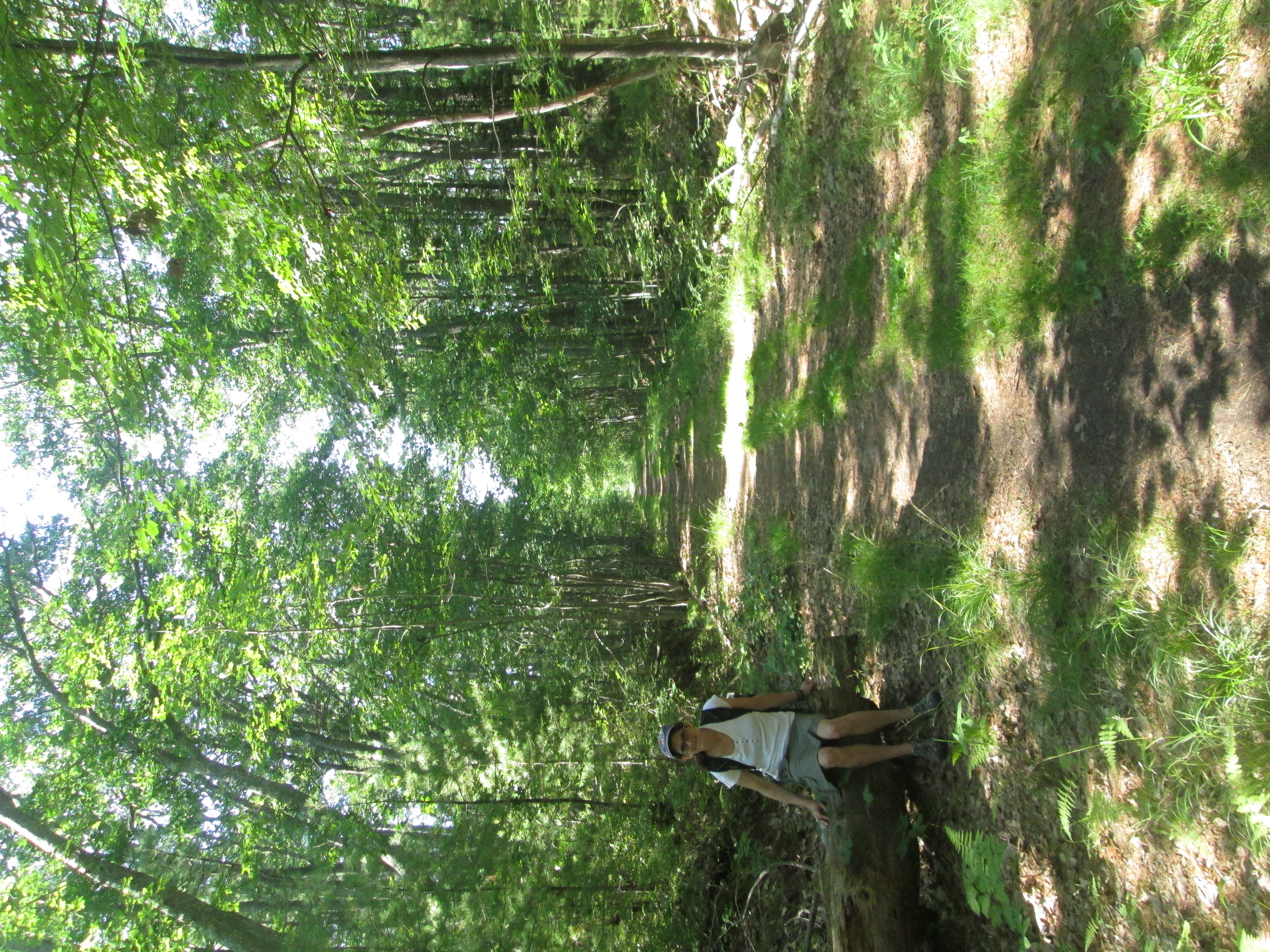
That’s snow-capped Mount Washington in the background

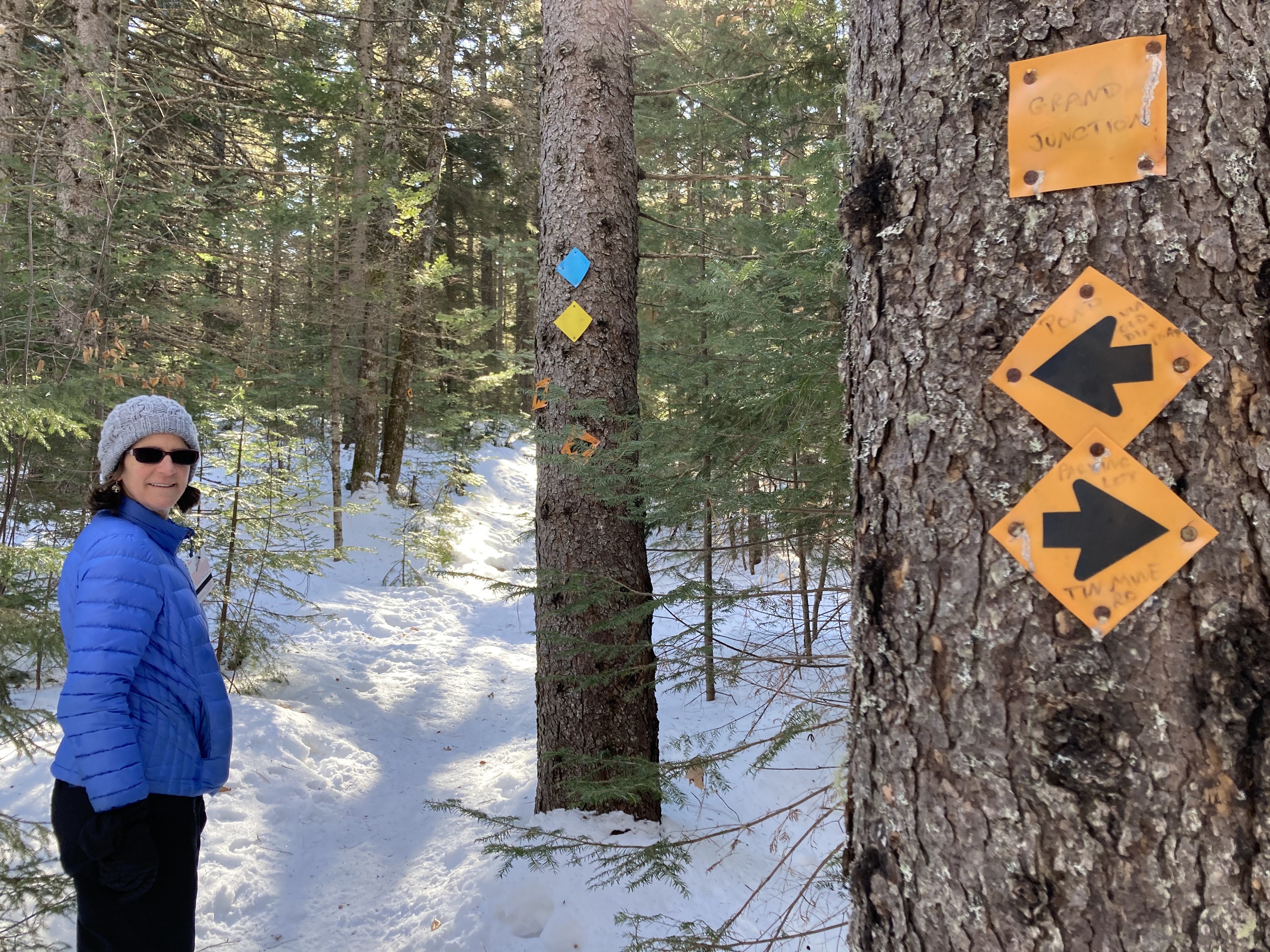
This was a beautiful place for a hike.  Technically these are snowshoe trails, but they’ve been packed down enough that we were able to walk in just our boots –– though stepping off the side of the trail resulted in sinking up to your knees.  The nice thing about this area is that it’s crisscrossed with many trails, but there are signs at every junction and they all loop back on each other — so you can just wander pretty freely with confidence that you’ll eventually end up back at the Grand Junction.  We eventually made our way to the summit, up some pretty steep paths, and earned great views of Mount Washington as well as Attitash and Black ski areas.  Getting back down was less elegant, and we sometimes resorted to sliding on our bottoms.  We were enjoying our walk in the 
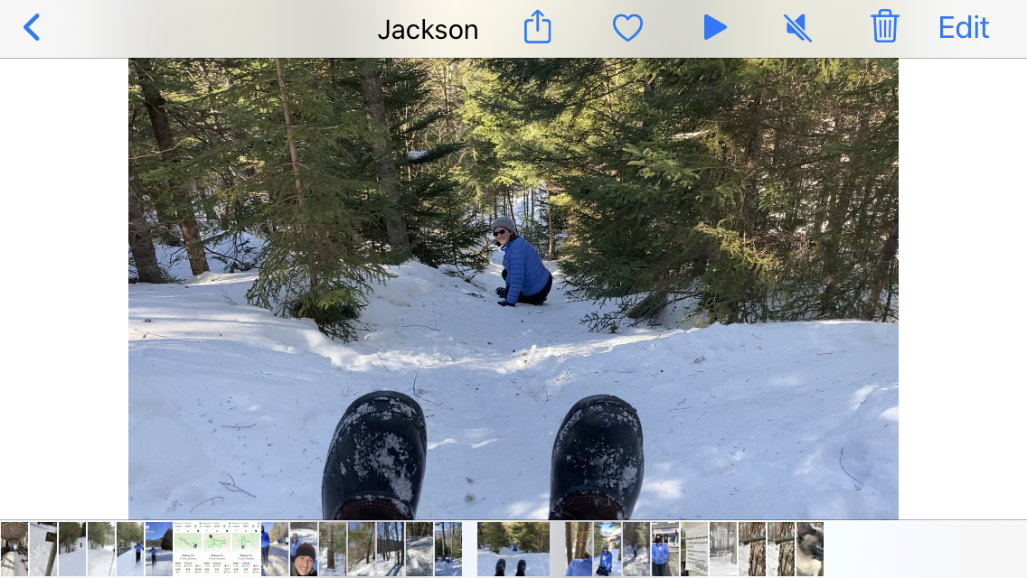
woods so much that we just kept taking new side routes to visit the various landmarks mentioned in the signs — the summit, the pond, the old tin mine, the stone boundary wall.  It was a very pleasant, if strenous, few hours.

James had noticed that we had brought some of our complicated strategy games with us, and so that morning he’d shown us a game that earlier visitors had accidentally left behind — Wingspan.  We’d heard of this and were eager to try it out, so that’s how we spent our late afternoon.  (Seemed like a good game, and not too difficult to learn, although neither of us felt like we had much of a grasp on the strategy.)  We also took the opportuntity to visit the nearby White Mountain Puzzles store and stock up — I’ve been doing a lot of puzzles these days.

Today was Saturday — time for us to head back home.  The inn had filled up the night before, so there were a lot more people at breakfast than we were used to.  (This did allow us to overhear a funny conversation — a rare instance of womansplaining.  Wife: “These tablecloths have really nice embroidery.  Embroidery is when you take a needle and –“.  Husband (testily): “I know what embroidery is.”)

Along with the new 
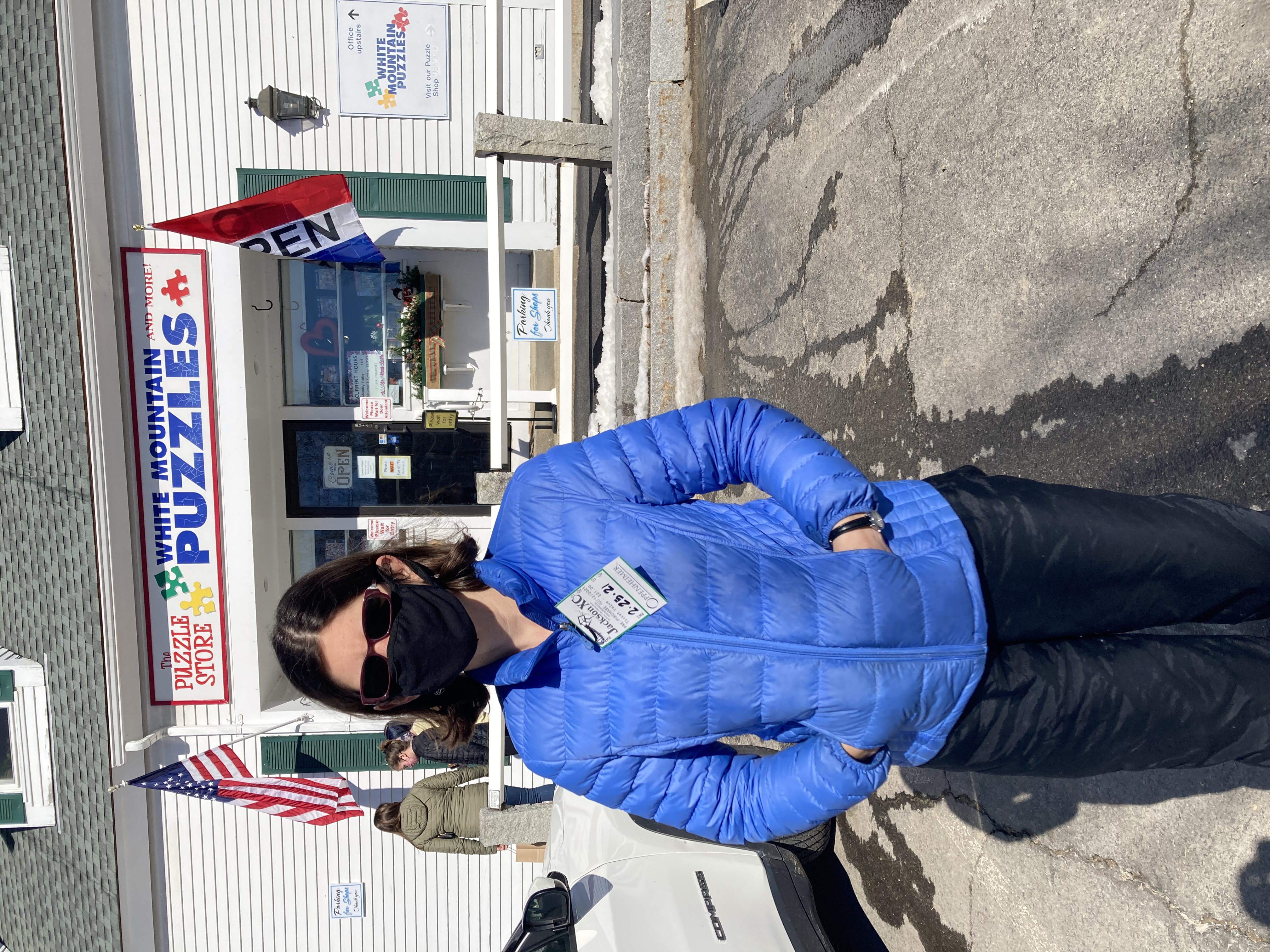
guests, snow also arrived — just in time for our drive home.  Given the weather we didn’t linger — though we did make a quick stop in North Conway to visit the Naked Bohemian store and pick some cool garden art for the lake.  The kids don’t return until tomorrow, so we’re taking the opportunity to have a dinner that they wouldn’t like and one more quiet evening.


Overdue re-visit

With a world full of places to explore, it’s been our general policy to steer away from revisiting.  There are notable exceptions:  Orlando,  San Francisco, Boston, New York.  They’re all in the archives of this blog more than once. 

On the other hand, this list is tiny compared to the list of places we’ve loved but will likely not see again.  The cayes of Belize.  Quito.  Cody Night Rodeo and Custer State Park.  Rome, wonderful Rome. We might not even make it back to the St. Louis City Museum.

So, readers might infer that there is something special about Quebec City.  This is our third time visiting here, and we’re dedicating to it a milestone anniversary and a lovely long fall weekend.

Infer away.   From the cobblestones right to the top of the tallest buildings, you’re surrounded here by rich history and cool modernism.   Th restaurant scene (which Jen covered a bit yesterday) and the sounds of the street musicians shout out Quebec’s culture and class.  It’s the kind of city where you can find anything you want if you walk around enough (more on this later).

Peak foliage and apple harvesting time make for a nice setting for cider tasting.

In some ways, it feels like a new city to us.  Where’s the white winter coat it wears for Carnival (and the day-glow snowmobile suits everyone was wearing 22 years ago)?  Even in fall, this city  is very clean and well-maintained, and the foliage rivals that which causes tourists from away to flood New England this time of year.  It’s crowded with tourists here, too, but things seem bustling and convivial as opposed to oppressive and claustrophobic. 

This is the first time we’ve ventured significantly outside the old city.  On Saturday we walked down the hill to patronize the wonderful farmers’ market and to (somewhat unsuccessfully) seek out a hip neighborhood called the Saint-Roch district.  

Then, on Sunday, we struck out even farther, to the farmlands that seem to surround this city in a way that suburbs and sprawl surround every other city we’ve explored in the past.

Also good for a vineyard visit — note the Chute-Montmorency is that white smudge in the distance toward the top left of the picture. This was during a break in the fog.

Jen orchestrated this trip and she should be congratulated for steering us toward the Isle d’Orleans.  This island in the St. Lawrence River is 15 minutes from the walls of the old city, but calm, quiet and pastoral. It’s quiet, but the concentration of agro-tourism outlets is quite rich.  To find a setting like this outside their city, a Bostonian might have to drive two hours to get to Vermont or lakes region New Hampshire or far-western Massachusetts.   

Once across the bridge and onto the island, we had 40-plus miles of vineyards, cideries, bakeries and farm stands for us to wander through, and some of them were in view of the city!  That is to say they would be in view of the city except that for much of the morning we were frustrated by drizzle and fog.  During our first vineyard visit,  the fog broke briefly and we were able to see first the river, then the mainland, and then we were even able to make out the white smear of the Chute- Montmorency, a waterfall higher than Niagra Falls, way over on the the far bank.

Then the fog came back and rain.  Then more rain.  Then rain and wind.  We kept on driving along.  The attractions on the north side of the island were mostly art galleries, we were told, and we were ok passing them by while staying dry in the car.  

That’s sunlight peeking our behind me while I wait for the Resto de la Plage to open.

Just before noon, we stopped at almost the halfway point along the route.  We waited for a restaurant by the water to open, and, wouldn’t you know it, first the wind went away, then the rain, and by the time we were eating, there was blue sky and sun.   It was the nicest weather for the whole trip so far, and it allowed for extensive views east and west along the river.  The soup was nice, too.

The sun and clouds battled each other for the rest of the afternoon while we stopped in a bakery, a locally-made vinegar shop, a boutique selling Quebecois-designed clothes that Jen really liked, a dairy that produces a version of the first cheese made in the Americas (we were not around back then to verify its accuracy, but it tasted very good roasted in a pan),  a few cideries, a few vineyards, and a microbrewery.  The tastings offered at the latter locales were small and Jen and I were sharing them; still, the day started to take on a bacchanal-like feeling.   (The last vineyard we went to was even named after Bacchus.)   The wines and hard ciders seem of fine quality to us, especially the ice wines and ciders which are produced from fruit harvested after they’ve frozen on their vine or tree.  

Here’s where we tried the first cheese made in the new world.

All along the route were farms, some for hay and livestock, and others for the main produce crops on the island: strawberries, apples and grapes.  Such is the climate here that all three of those crops were being harvested as we wandered past.  (Strawberries in October!)

One other stop of interest was to climb a four-story tower (during one of the day’s sunnier moments) on the northeast corner of the island.  Not only could we see well down the St. Lawrence, we could also look across to the north bank and see Mount Saint Anne, the ski resort that we’ll be visiting during February break.   This weekend’s itinerary is serving as a reconnaissance mission for February’s family trip.

Mount Saint Anne in the background. See you in February.

With the this reconnoitering goal in mind, we turned ourselves loose on the Old City again this evening in search of the fondue restaurant we visited during our first visit here — or something similar.  It seems like the kind of dinner the girls would appreciate.  We walked by dozens of other highly promising restaurants to investigate a “fondue” offering at one of the bars in the lower city,  only to find  the description on the menu drew a picture of something much more like mozzarella sticks than we had in mind.

Mission accomplished! Course three of the fondue trio

So we walked back up the hill (no funicular for us this trip).  Before we could decide which of the promising restaurants we might try, guess what we found at the base of the Chateau Frontenac itself?  A creperie that featured a three- course fondue meal.  Ask here, and ye shall receive.

And if you ask in makeshift French like ours, you’ll likely get answered in cheerful English.

Revisiting our youth

When planning a trip for our 20th anniversary, I thought it might be fun to return to a place that we enjoyed long ago, before children and houses and all the associated responsibilities of middle age.  So we returned to Quebec City, a place we visited a few times before we were married.

Of course, a few things have changed since the days where we were roaming around the Winter Carnival with our friends Sarah and Chris, carrying a hollow red cane shaped like Carnival’s mascot, Bon Homme, that was filled with a mysterious liquor known as

It’s Bon Homme himself!

“caribou”.   For example, not even once today did we take swigs from a random bottle of alcohol that we found protruding from a snow bank.  (There are not yet snow banks available, even up here in the north.)  Also, in October there are not so many people wearing comical snowsuits.

Another difference is that we’re at an even greater language disadvantage.  For one thing, I’m 20+ years further out from my high school French classes.  Also, I discovered that attempting to learn Spanish a couple of years ago, during our Central America trip, has had a disastrous affect on what little French I used to possess.  Last night I told someone “gracias”, and today realized that I’d been responding to the parking lot attendant with “si”.  It’s all jumbled up in my head as “language that is not English” and there’s no telling which will emerge when under pressure.

Still, it’s pretty cool to drive a mere six hours from our home and feel like we’ve been transported to Europe.  Melodious (and incomprehensible) strains of French swirl around us as we pass by patisseries, cafes, and ancient buildings of brick and stone.  Our airbnb rental is a tiny flat on the outskirts of the old city, looking out over the cannons guarding the old wall.

The drive was pretty good, too.  The foliage colors in Vermont were stunning, and St. Johnsbury proved to be an excellent dinner stop, even if it did prove a bit challenging to actually find a restaurant.

Apart from miles of wandering, today’s main excursion was a food and drink walking tour of old Quebec.  I did a food tour with some friends in Charleston a few years ago, and realized that this is a great way to get an overview and orientation to the area.  On our six stops we sampled local favorites such as poutine, smoked meat sandwiches, and seafood fritters, as well as wine, a cocktail, and herbal tea from the local monastary (which has become a health spa).

At some point we’re planning to venture beyond the walls of the Old City into the Sainte Roque district for dinner.  But now rain has begun to fall, and we are enjoying a bottle of ice cider that we purchased at the farmers’ market — so it may need to wait until tomorrow.


Rhymes with pain

Oh, Maine, with your winding country roads, pebbly beaches and charmingly spaced out bistros.  You’re killing us.

Not very rapidly, but palpably all the same.  To be sure, we probably would have made it as far as Portland or even Freeport before any of our body parts actually started falling off or became ground down to actual nubs.  Depending on the shuttle service.

Anyone observing the way we limped into Biddeford, though, would have wondered why we were walking away from the Southern Maine Medical Center and not directly to the emergency room.

I'm wearing size 10 ladies flip flops and multiple bandages.

I’m wearing size 10 ladies flip flops and multiple bandages.

I had multiple blisters and abrasions on both my feet.  My beloved Keens sandals, which carried me through so much of Central America, were not up to 10-plus miles of hiking a day, particularly in a sandy environment.  Tighten up, leave them loose. It didn’t matter.  I ducked into a pharmacy on Rt. 1 north of Kennebunk and bought a pair of flip flops, just to give the sore parts of my feet a little break.  The best they had were ladies size 10.  They helped moderately.  I didn’t really get relief until we decided to bungle around in circles in a large grassy park in Old Orchard Beach.  But I had to put my shoes back on eventually.

IMG_8626Jen was amazingly brave and resilient in the face of a smattering of pains, the most acute focusing on her right knee.  It was difficult for her to bend the knee so when she walked she kind of had to swing it around.  It wasn’t quite Ministry of Funny Walks, but it didn’t look very comfortable, either.  Add to the top of this the general soreness that comes from walking, and it’s plain to see why we were both grimacing for much of the last few days — especially when standing up again after a brief rest.

You may have noticed that we stopped at a few bars and beer halls along the way.  We were self-medicating.

Actually, each morning of the trip we got up with good energy and positive attitudes.  We’d leave our lodgings feeling better than we did when we booked in the evening before. This, Jen says, is why we’re not hiking the Appalachian Trail.  To walk even the relatively short distance we were covering (AT-wise), and then have to sit down on a rock and cook our own food, and then try to sleep on the ground?  Too much, even for us.

Even as it was blazing our trail in Maine, we would hobble into our next evening retreat feeling a little worse than we did the evening before.   The walking didn’t really get more difficult.  The first day was the worst, with winding Rt. 103 in the morning and the afternoon slog to find accommodations.  After that, I think we were clever in learning from our mistakes.  We booked a room in advance in Ogunquit and found car-free conveyance for good stretches of walking on the next two days.  (Dodging cars takes a lot out of you, trust me.)

Next stop: Adagio Salon, Spa & Wellness Center

Next stop: Adagio Salon, Spa & Wellness Center

But these little maladies accumulate, and we weren’t taking any days off to allow ourselves to heal.  By the time we made it to Saco, we had no trouble making the decision to let Sha-zoom! cover the last five miles of the coast for us.  (We had taken shuttles before during this trip, but mostly it was east-west travel.  The Kennebunk trolleys didn’t really save us much walking,  they just set us up to walk on better trails.)  Once in OOB,  even with the soothing grass of the big park, it didn’t take too much to nudge us into calling it a day.  To be sure, it was evident that the available lodgings we saw would be neither comfortable nor, based on their proximity to the beach, inexpensive.  Also, there were grey skies that evening and predictions of only moderate temperatures the next day (not encouraging for beach time).

Jen’s idea, once we had purchased our train tickets, was to take the money we would have spent on a hotel room on by the beach and get ourselves massages the next day in New Hampshire.

The two miles from the Durham train station and our house were among the most comfortable to walk of the whole trip.

End of the road

IMG_8648

Entering the Eastern Trail.

Last night, snug in our top-floor aerie at our B&B in Kennebunkport, we listened to rain pattering on the roof and watched lightning flash out the windows.  This morning, we awoke to a gray drizzle.  But happily, by the time we finished our enormous breakfast and packed up our stuff, the sun was shining again.

IMG_8649

Biddeford seems OK so far.

We debated a few different options for the day.  Heading all the way to Biddeford/Saco via the coastal route was a bit daunting at 15+ miles, especially since my knee had been giving me trouble since the previous day.  Going straight there was a more manageable 10 miles, but on not-very-appealing roads.  Finally, we settled on a third option — making another use of the handy shuttle bus to go back to Kennebunk, then walk to Biddeford on a route that was largely an off-road rails-to-trails bike path (the Eastern Path).  It was about the same distance, but seemed like it would be a much more pleasant walk.  (Google identified this path for us, so I was confident that it was in fact a real path unlike yesterday’s situation.)

Unimpressed with downtown Biddeford.

Unimpressed with downtown Biddeford.

All went well and we made good time, despite frequent stops for me to ice my knee with a bag of ice that I’d brought from the inn.  We rolled into Biddeford around 3pm, without a firm plan for the evening.

Our usual M.O. in these situations is to find a place to have a drink and/or snack and use the free wifi to figure out our next move.  This proved to be more of a challenge than expected.  No offense to any Biddeford readers out there, but Biddeford is kind of a hellhole.  We wandered, dispirited, through downtown, unable to find a cafe or non-sketchy-looking bar in the whole place.  The skies were darkening ominously.  We came upon a brewery with a tasting room but it was closed.  So we developed a single-minded mission: Get the Hell Out of Biddeford (GTHOOB).  With that in mind, we headed toward the train station, located across the river in Saco.

We had a wish to get out of Biddeford.  And then, Sh-Zoom! all our transit wishes came true!

We had a wish to get out of Biddeford. And then, Sh-Zoom! Our transit wishes came true!

Fortunately, Saco proved a substantial step up, greeting us immediately with the Run of the Mill brewpub, which provided us with excellent beer, snacks, and free wifi.  We used the latter to determine that we could GTHOOB by catching a shuttle right down the road at the train station and take a shortcut to our final destination, Old Orchard Beach.  (We also learned that in fact we could have taken the shuttle from right where the Eastern Trail ended, thus allowing ourselves to GTHOOB a few miles sooner and avoid all the strip malls and disreputable businesses.)

Triumphant arrival in OOB.

Triumphant arrival in OOB.

Old Orchard Beach provided its own challenge, that of finding a hotel room.  We put on a lot of steps wandering back and forth.  The train goes through right along the beach, which is convenient for those of us relying on public transportation — but inconvenient for those who just want to walk to the beach and are blocked by train tracks that require large detours to get over.  The skies were also still threatening, although we’d miraculously avoided getting rained on thus far.

Threatening skies

Threatening skies

In the end, rather than pay a fortune for a sketchy-looking hotel, we decided to hop on the 7:30pm train home.  This gave us time for a walk on the beach and a margarita, which was about all we needed from Old Orchard Beach.  And the two-mile walk home from the Durham train station felt like nothing at all.  (As walking connoisseurs, we saw it through new eyes, and looked approvingly upon its wide, comfortable sidewalks, finely manicured lawns, and attractive buildings.)

Total miles walked today: approx. 14

IMG_8661

Why walk?

We are not out to convince people that this is a vacation for everyone, but in light of some feedback we’ve received since announcing our intentions, we need to point out a few reasons why walking the southern Maine coast would be a good idea for some people.  Here are some of the joys of our trip so far; you can decide how much they appeal to you:

Take that, motorize vehicles!

Take that, motor driven vehicles!

We can go where we want.   I know automobiles are seen as a great liberator but it shouldn’t take too much of an imagination to see that they come with their restrictions.  This is particularly true in coastal New England, where the towns were well established before the first Model A came to town.  There is only so much they can widen the roads in Ogunquit.  There is only so much parking space they can build at Short Sands.  When we hobble into town now, it is a very comforting feeling to know that we don’t have to wait in traffic (motorized progress always stalls coming into these towns in the summer), hunt for a parking space (they are always scarce and often require parallel parking skills that for me are itinerant at best), worry about citations, and decide what can or can’t be left in the car.  We don’t have to look for appropriate spots to make u-turns (though, unfortunately, we’ve had to turn around an retrace our steps a few times so far).  I’m not fumbling with my key (or worrying about losing them) every time I look for something in my pocket. We’re not searching for gas stations or trying to decipher directions on the fly.  Correction, we’re often deciphering directions on the fly, but we’re not in danger of running anyone over while we’re doing it.

The beach was our highway yesterday.

The beach was our highway yesterday.

We can walk on the beach as far as we want.  Anyone who says she likes to walk on the beach should have been with us today.  Of our first seven miles or so, between five and six were on firm-packed sand.  Our feet were in the water for much of it.  We went on without care.  We didn’t have to go back and get our car.

The rising tide did make it difficult to follow the beach in some places.

Though the rising tide did make it difficult to follow the beach in some places.

There was no meter to feed. When the opportunity arose to change our route a bit by taking the trolley inland to Kennebunk (yes, it’s true, we did not walk the whole distance from Ogunquit to Kennebunkport) we were able to jump on it and not worry about having to come back and get our car.  We were un-tethered.

There are fewer distractions.  With car travel, there are more options, which seems like it would make people happy.  Today we did not have to worry about what we would crank through the radio, whether we would use A/C or open windows, who would drive and who would navigate.  Did we want to try for street parking or should we go to the $25 lot?  Maybe we could find a $10 lot and walk a little?  Should I drop you off with the stuff or find a place to park first?

Sure, we had a lot of other decisions to make, but they were interesting, thought-provoking decisions — Coastal route or straight path?  Stop for lunch or press on? Do you think they’d mind if we walked down their driveway?  Can this possibly be North? How far do we think can we go in one day before our bodies give out?  These are all distracting questions, I guess; or maybe you’d call them engaging, because for some of them it really makes a difference which way we decide.

Ready to leave our inn in Ogunquit, with everything I need on my back.

Ready to leave our inn in Ogunquit, with everything I need on my back.

There are fewer things to carry.  I know this also seems like an illogical defense of walking.  You can carry many more things in a car.  That’s why we have cars.  Having to carry everything on our backs makes it easy to decide what to bring.  We may not have everything we want at the beach, like a folding chair and big blanket, but we have everything we need.  We have found all we really need is a towel to sit on, some sunscreen, a water bottle or two, something to read, maybe a change of clothes eventually.  These things and more are all waiting for us in our backpacks, just like they will be in our B&B room tonight and the place we eat lunch tomorrow.

Also, we’re not tempted to buy stuff.  We usually aren’t great consumers, but now it’s not even a considerations because we don’t want to carry anything more.

There are more things to notice.  Billboards on highways are really big so you can’t miss them as you speed by.  Walking people can notice much smaller things; they notice even more than people moving at bike speed.  Back in Kittery a cyclist managed to blurt out, “Great blue back there,” as he rolled by in his speedy bike outfit.  A few dozen feet up the road, we saw the heron that had caught the cyclist’s attention, and then we saw the heron gracefully pulse its wings, raise itself out of the marsh and fly away.  Jen noted how amazing it was that herons can fly so well while moving their wings so slowly.  The biker didn’t get to see that.

IMG_8608This time of year, the best thing we get to notice is berries.  If anyone out there decides to recreate this journey or attempt a similar trek through the same landscape — and no one may ever do this; there are many reasons why someone would not want to attempt this walk, which we’ll surely get to in a future post if not before — we might share the secret location of a blueberry patch off Shore Road in Cape Neddick or try to explain the difference between huckleberries and the ones that look like huckleberries but are probably poisonous.  Future trekkers might want to know this before taking on the Kennebunk Bridle Path, which features each these, plus several other kind of berries.

These places seem more exotic because it’s taken a while to get here.  Kittery, York and Ogunquit are not unfamiliar territory for us.  I visited my family on vacation just north of Short Sands immediately after having my first date with Jen.  (She was kind of a detour on my way north.)  We walked right past the church we got married in the and reception hall driveway.  This time around, though, everything feels more exotic and new.

Trailblazing

Trailblazing


We get to blaze a trail.  This is not something people get to do that much anymore.   This adventure certainly isn’t on the scale of what earlier pioneers and explorers used to endure, but we’re still not entirely sure if it can be done, or if it can be done in a way that is somewhat pleasurable, interesting, and generally fulfilling without landing us in the hospital or prison. (Though we have considered prison as an inexpensive way to spend the night and extradition to New Hampshire as an easier way to get home than walking.)  We think it can be done, and we start out each morning with that intention, but we’re not at all sure it’ll all work out.

Staying and swimming some more at Wells was an option.

Staying and swimming some more at Wells was an option.

For instance, today we set out not know if we could make it all the way to Kennebunkport, which would be our goal, or if we would have to stop in Wells.  Wells would be a much shorter walk and would allow us to heal a little after two days of longer treks than we envisioned (particularly the first day when we stumbled around for a while before finding a place to stay).  Stopping in Wells would basically wreck our plans of hiking all the way to Old Orchard Beach. It would leave too many long walks across areas where resting opportunities would be scarce.  Even if we made it to Kennebunkport, tomorrow’s walk to Biddeford would be stretching our endurance.  We now know what 14+ miles can do to us.

Then, we stumbled on an opportunity when we arrived at Wells Beach, after pleasant morning of walking almost entirely on beaches:  There is a system of trolleys that connect York to Kennebunkport.  The trolleys pick up people at various hotels and parking lots on Route 1 and ferries them and their folding chairs to the string of beaches nearby.  This cuts down on the traffic; it gives people a chance to stay in one place and experience multiple recreation centers; and, perhaps more importantly, it only costs $1 for a one-way trip.

IMG_8595

On board the Shoreline Explorer


Sure, we told people we were going to walk to OOB, but really our goal was to get there without a car.  Shaving off a few miles — particularly miles on four-lane, commercial Route 1 — would not really taint the intention of our trip, particularly if it allowed us to get to Kennebunkport and keep us on track for our goal.  Also, the trolley line is called “Shoreline Explorer,” which is kind of how we view ourselves, as explorers; so it seemed like a good fit.

By cross-referencing her downloadable map of Maine with the Seacoast Explorers’ route map, we saw that we had a few options.  We could have taken the blue line going north from Wells to the Maine Diner on Route 1, turned off onto Route 9, which eventually intersects with a hiking trail in the Rachel Carson National Wildlife Refuge that looked to lead right into Kennebunkport.  Or, we could have taken the blue line right into downtown Kennebunk and walked about half a mile to something on the map labeled Bridle Path, which also stretched on the computer map right to our destination.

Coffee in Kennebunk

Coffee in Kennebunk

We chose option two, which promised to cut about two miles off our original walking-only path to Kennebunkport, and also remove the specter of another afternoon navigating a winding Maine back road.  We were immediately happy with the results.  Motorized transportation, after all, is pretty easy on the feet.  There. was a nice little cafe in Kennebunk where we got a coffee drink to share, used the wifi to book a room, and changed out of clothes still damp from a plunge in the Atlantic just before we left our beach walking for the day. (Jen also took the opportunity to throw away a pair of bathing suit bottoms that nearly malfunctioned spectacularly in the waves, thanks to a waistband that had relaxed with age.)

Resting along the Bridle Path.

Resting along the Bridle Path.

We enjoyed a brief walk through town and found the Bridle Path without much problem.  The entry to the path was near a school parking lot, and there were multiple signs dedicated to explaining the trail and keeping cars and motorcycles out.  The trail actually extends from the Kennebunk railway station to downtown Kennebunkport.  It used to be a spur railroad line allowing tourists to travel the four miles from Kennebunk to the port without much time and effort.  It was a fantastic place to walk — not crowded, not buggy, no cars to contend with.  The path is shaded and peppered with historical markers and berry bushes.  It offers great views of the Mousam River.  After crossing Route 9, it turns into the wildlife refuge trail we considered aiming for.  Spaces in trees allowed for ocean and marsh views.  The blueberries in particular were plentiful.

Then we crossed another road and the trail disappeared.

No warning, no sign.  Just a golf course where the trail should have been.  Jen’s downloadable map did show the grey and white line skirting along the edge of a golf course, then going right through the middle.  It didn’t seem entirely right; but, then again, there were no signs on the golf course that said we couldn’t walk through.  The golf-cart path did seem to go right along the edge of the course and follow the path that the railway might have taken.  Taking any other route at this point, according to the map, would mean walking on winding Maine backroads.

Jen slinks away from the golf course.  Note the open gate across the street.

Jen summons stealth to slink away from the golf course. Note the open gate across the street.

So we crashed the golf party — and there were plenty of golfers to witness it as they knocked around their shots in the late afternoon sunshine.  No one seemed to notice us.  Not even when the path we were taking appeared to be wiped out by a raised tee box.  Skirting that, we found a green in the way, then a row of hedges.  We walked around in cirlces, first trying re-capture the path, and then just trying to get off the darned golf course.  There were houses all around it and hedges and fences.  There’s probably a series of security videos showing us stumbling blindly around the course.  At some point they’ll speed it up a little, set it to the Benny Hill music, and play it at the country club Christmas party for laughs.

Finally, following the cart path all the way around a green off into a direction that  would have brought us clear into a major golfing thoroughfare, we recognized what appeard to be the foundation of an old bridge, possibly a railway bridge.  It crossed a small culvert and ended right in someone’s driveway.  We slinked across the bridge and down the driveway away from the golfers.

And we found what looked like the Bridle Path, across the street from the driveway, behind a gate that was almost closed but not completely.  Again, no signs encouraging or discouraging progress.  Beyond the gate, the trail was mowed and appeared to continue through a copse on the edge of the salt marsh.

Strange? Yes.  Inviting? Not entirely.  But eventually irresistible.  This path promised to drop us off right in the center of Kennebunkport.  No cars or narrow shoulders or anything.  We triple and quadruple-checked the map.  It sure looked right.  Even the salt marsh was there, and a bridge that would carry the trains over the salt marsh.  Just a small span across a narrow place in the marsh.  Surely the bridge would still be there.

We made it through the copse.  We bungled across an open area that appeared to be part of several houses’ back yards.  Not a single sign.  No one theere to ask us what the heck we were doing.

Wading in

Wading in

We made it to the woods on the other end of the clearing.  The trail was still there, clearly visible through the woods.  Past a few more houses.  The woods started to thin out.  The trail started to narrow.  Then it was strangled in a wall of bushes.  Wait, a path crept off to the right.  Around a bend we saw the bridge — or the granite-blocked foundation of the bridge, still solid and vertical.   And, at its closest point, four feet from shore and in two feet of running water. This remind me of a conversation I was having with my friend the other day, she told me about the time she went to San Antonio with her family on a big walk and she got hit by a car! She thankfully found a really good San Antonio injury lawyer to deal with her case. She tells me they were fantastic at dealing with her situation and wrapped it up with the settlement she deserved for her distress, but I digress.

Jen was un-deterred.  She took off her sandals, handed me her backpack and waded in.  The made it to the bridge support.  She climbed the bridge support (in a travel skirt and bare feet!).

More trail blazing?

More trail blazing?

Then the dream ended.

The other bridge support was eight feet away from the first and through the gap flowed much deeper water.   We would have swum.  Travel skirts and Amphibian shorts are quick drying.  But backpacks, laptops and kindles aren’t.

Still, it was tough to turn around. We could see the roadbed for the path on the other side of the water.  Plus, when you’re walking 12 miles a day — after this misadventure, 14 miles today —  you don’t want to turn around and retrace any steps.  We also didn’t want to walk through anyone’s yard, but arrest for trespassing, in this instance, was seen as preferable to a half-mile of backtracking.

IMG_8619
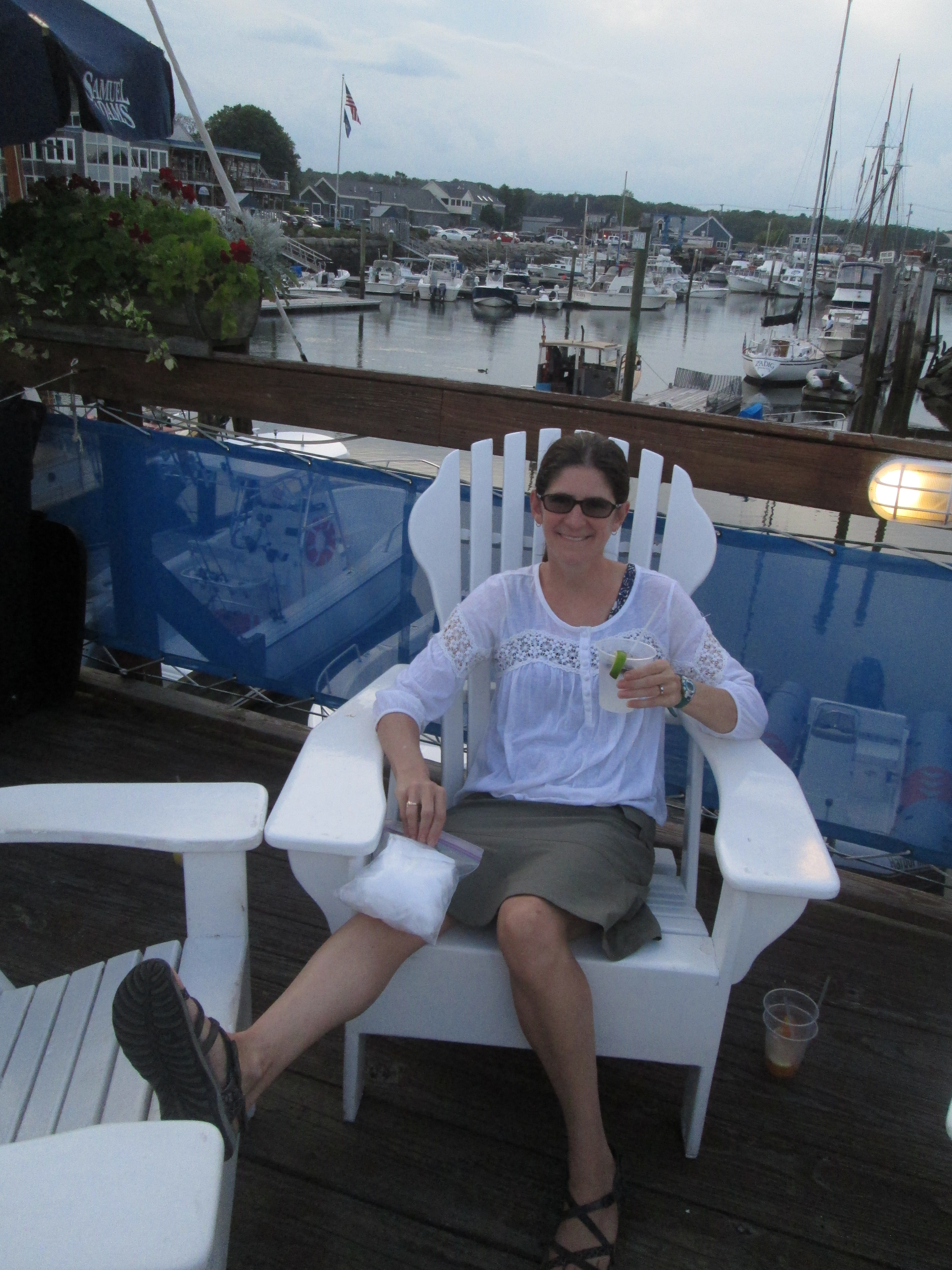
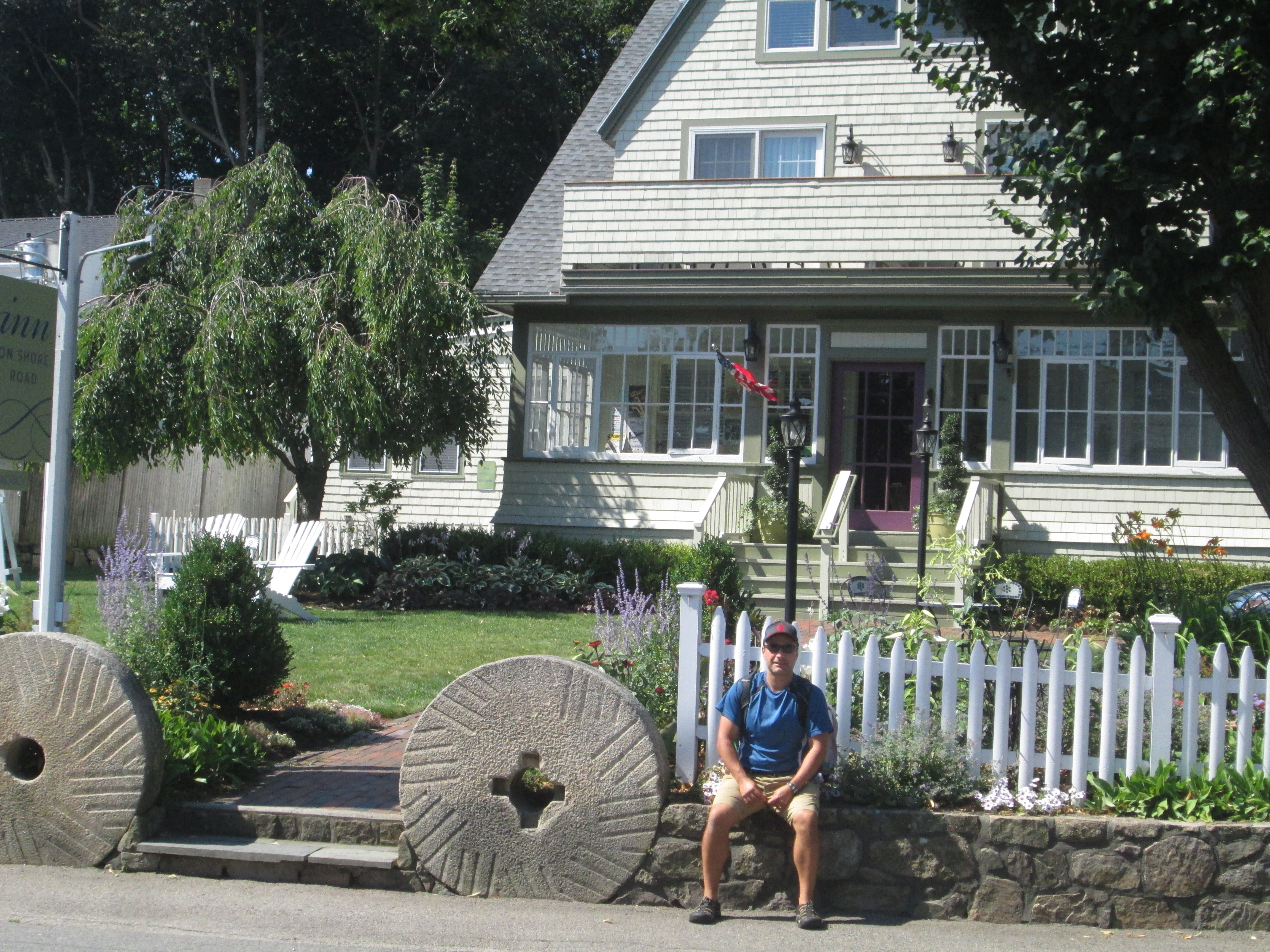
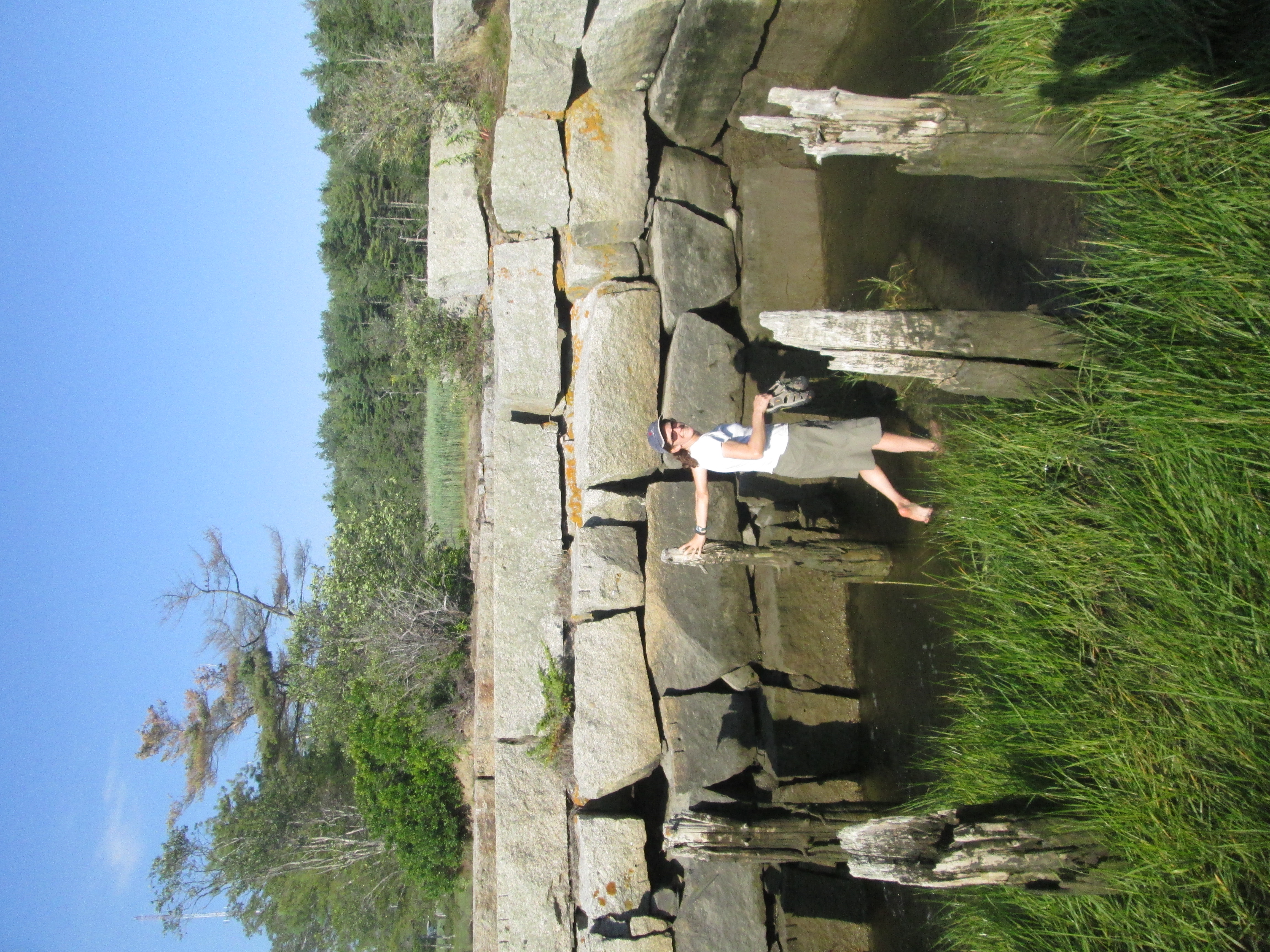
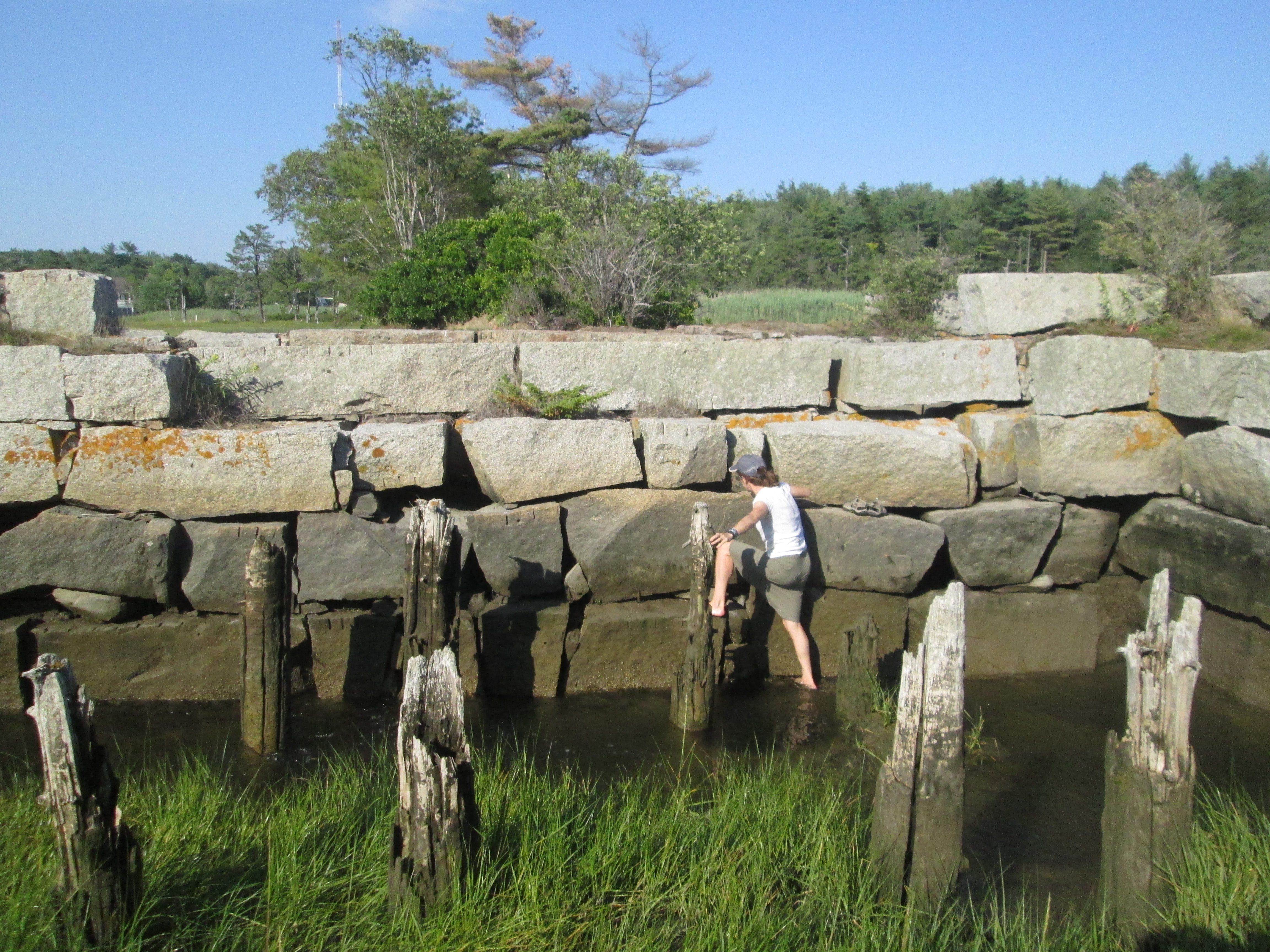
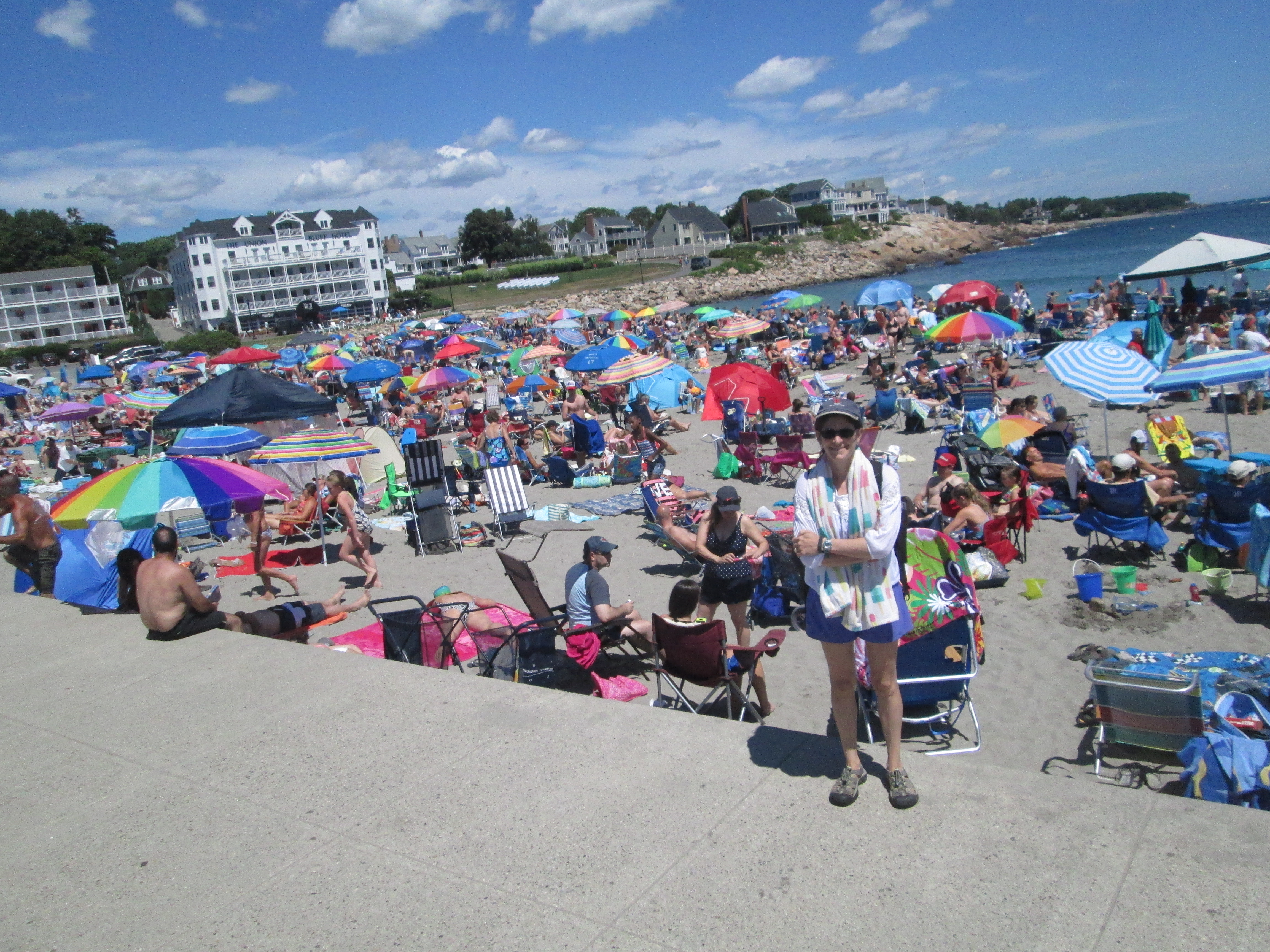
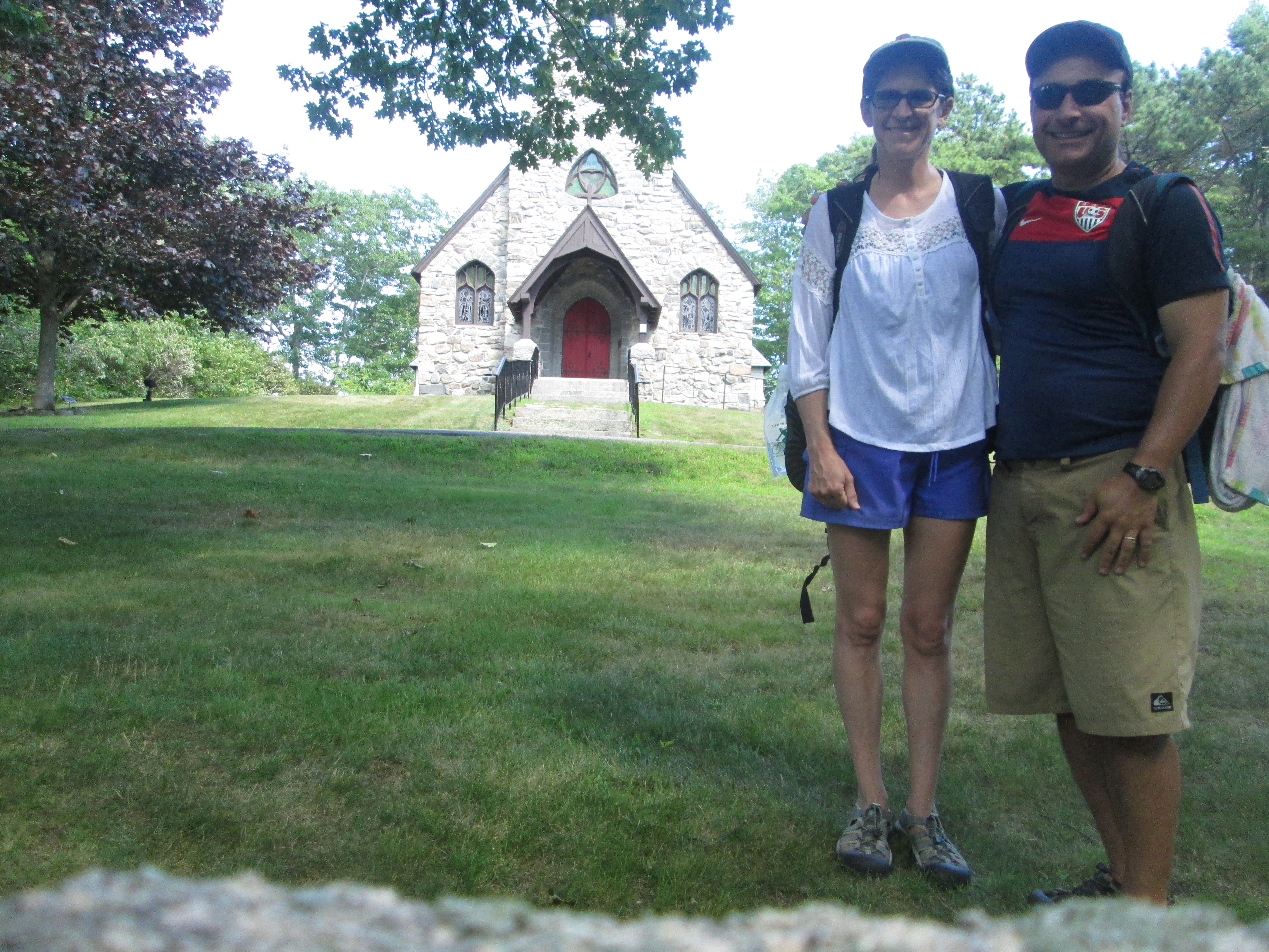
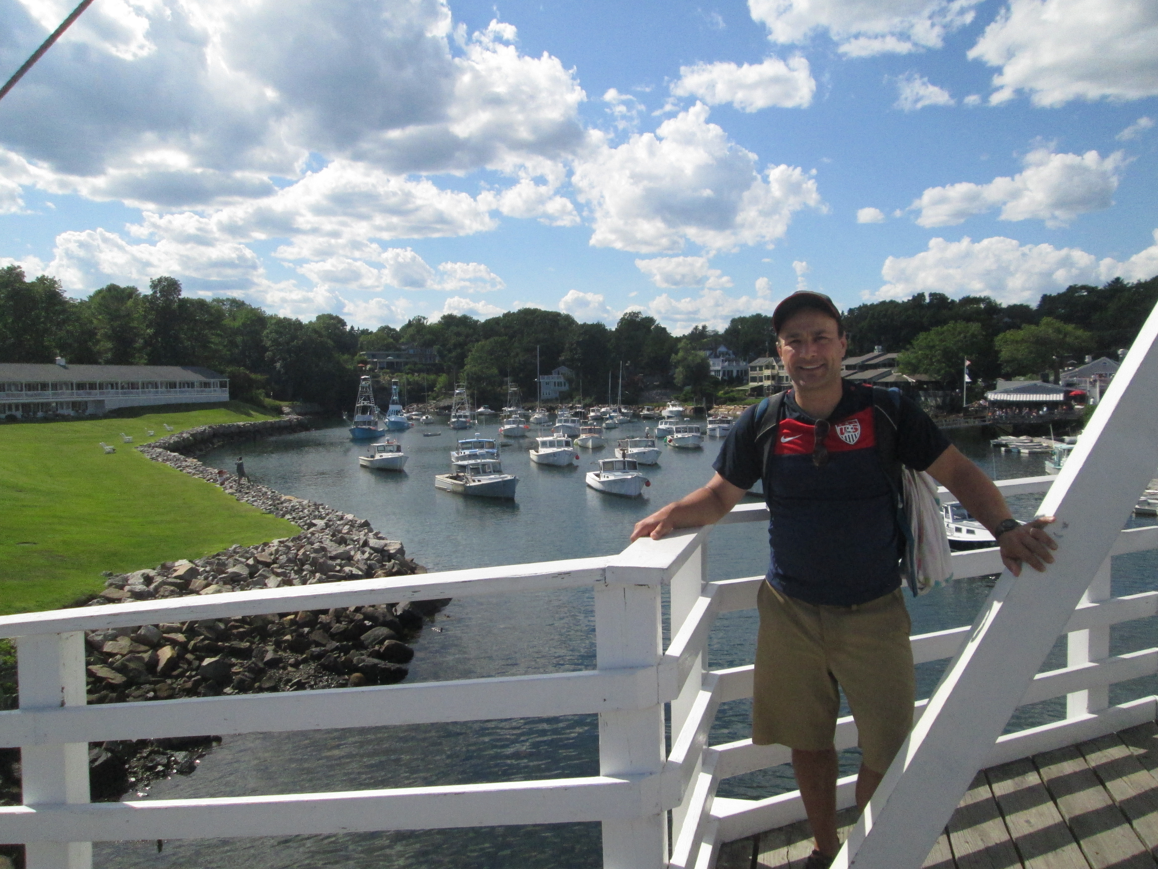
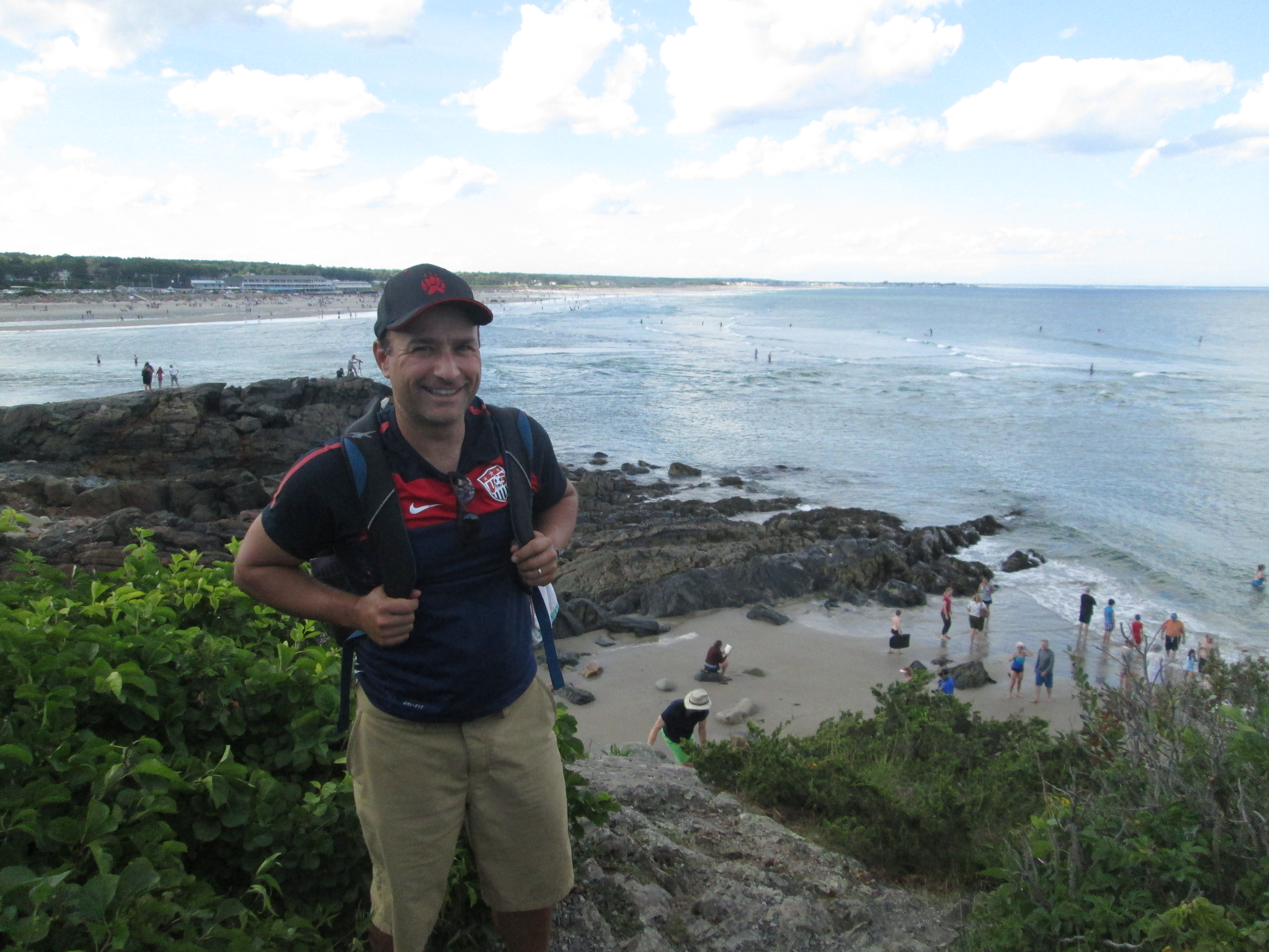
If any of the residents of Governors Way, Kennebunk, ME, called the cops, we had stumbled out of the vicinity by the time the flashing lights showed up.

So there’s another reason to walk.  A little bit of adventure.  Something to tell the grandkids.  And something to pass along to future trekkers: You can follow the Bridle Trail through the golf course, but don’t take it any farther, unless you bring along a few sturdy planks.

IMG_8624Actually, Kennebunk should fix that bridge and mark the trail.  It’s a great way to get around, and it could only help lessen traffic down in Kennebunkport.  Like most of the other centers we’ve been to on this trip, it was very pretty, but choked with traffic.

We managed to get there, get cleaned up in our B&B, and hit the town for drinks, the a beer sampler and dinner at the famous Federal Jack’s.

IMG_8630Tomorrow, more decisions and, possibly, more adventures.

Stay tuned.

Who knew there were so many people in Maine?

IMG_8507Here’s the thing about the Sea Latch Inn.  There were a couple of places in the vicinity with Vacancy signs, but we chose to go in there because they advertised “Free Hot Breakfast”.  Little did we know that this would be provided at the Lobster Cove, the very restaurant we’d gone to for lunch the day before, three quarters of a mile south of the hotel.  I’m not sure if you all can appreciate the degree to which Bob and I did not want to start walking south in the morning.  But breakfast awaited, so southward we went, and in the end I was halfway to my 10,000 step goal on the fitbit before we even officially set off for the day.

IMG_8523It was a gorgeous morning on Long Sands, but high tide was approaching, which led to the funny sight of a huge stretch of empty beach, with big crowds of people clustered together on the very upper fringe.  (Not much of Long Sands is around at high tide.)  We started our walk down on the beach, and caught a little of a surfing competition as we went by.

Even though it added substantially to our mileage, we set off down the Cape Neddick peninsula in order to see the Nubble Light at the end.  Lots of people here, too, and it gratified us to see that they were having trouble finding parking spaces.

IMG_8528If we thought Long Sands was crowded, that was nothing to Short Sands, on the other side of the peninsula.  It also seems to have a high-tide problem, and every inch of sand seemed to be covered in humanity.  Bob and I were getting pretty warm by this time, so we found a spare bit of rocks on which to put our bags and took a quick dip in the water.  By the time we got out, the tide was threatening that spot, too.

One highlight on Shore Road -- the church where we got married 18 years ago.  We elected not to visit the Cliff House next door, where we had our reception, because of the very long, uphill driveway.

One highlight on Shore Road — the church where we got married 18 years ago. We elected not to visit the Cliff House next door, where we had our reception, because of the very long, uphill driveway.

The water, by the way, is…bracing.  Last time we went to the beach in NH it was surprisingly not-frigid, and checking in at the Sea Latch we heard the woman at the desk tell someone, “The ocean is really warm.  They measured it at 68 this morning!”  (This was not meant for sarcasm.  68 is in fact very warm for the ocean in Maine.)  But alas, by the time we got to the beach, the currents had changed or something and the ocean was back to its usual breathtaking, ankle-numbing temperature.  Still, though it was not entirely pleasant to jump in, it felt very good afterward — and gave us a little chilling that would last well into the walk.

Perkins Cove

Perkins Cove

The walk today was similar to yesterday in that the start was pleasant and fun — some beaches to swim at, a nice restaurant for lunch in Short Sands, lots of beauty around to look at — but then we ended up on a long slog on a rather boring road that was not made for pedestrians.  This time it was Shore Road leading between York and Ogunquit, and for most of its 4.4-mile length it proved to be similar to the dreaded Brave Boat Harbor Road from yesterday.  In this case, we were at least occasionally rewarded with scenic water views.

IMG_8561The end of the walk really shone today, though.  After coming into Ogunquit, we took a side street and footbridge into incredibly scenic (and again, incredibly crowded and hard-to-park-in) Perkins Cove.  We took a break to have drinks at a restaurant overlooking the Atlantic (and oddly, staffed entirely with young Eastern European women.  We would later find this to be the case with many places in Ogunquit.)

IMG_8564The last mile was down the stunning Marginal Way footpath, which winds along the rocky coastline.  And the best part was that we knew exactly where we were going.  After our debacle trying to find a hotel in York, we decided to book ahead in Ogunquit — and through some kind of tripadvisor loophole were able to book the last available room in a B&B that, like almost everywhere, typically has a two-night minimum.  It’s right in the heart of town and is lovely, with a porch swing looking out over a broad lawn and the busy (oh, yes, it’s incredibly crowded here as well) streets (and also a nice lady who gave us Band-aids for our blisters).  We sat there at the end of the day, eating our ice cream, after a pleasant stroll around town and dinner at a gourmet pizza & craft beer restaurant.

Total mileage (not including side trips): 11.2 miles

A happy ending

I was asleep by the time Bob posted last night, so I didn’t get to make any editorial comments.  That being said, I need to officially object to the term “little bit” as used to describe the extra amount we ended up walking yesterday.  Checking our route on google maps, I see that we walked an extra 4.2 miles, not counting some of the extra back and forth to the beach, the restaurant, etc.

IMG_8427And we did it without a lot of breaks, either.  There was a restaurant immediately after Fort McClary State Park, about 3.5 miles into our journey, but we weren’t really hungry yet and we’d just taken a little break at the park, so we passed it by.  (We considered getting lunch to go at the general store next door, which advertised the “world’s best sandwiches” — but then we saw the “Trump 4 President” sign in the window and Just Couldn’t Do It.)

IMG_8474Restaurants — or anything else of interest, really — proved to be pretty thin on the ground after that.  The first part of our walk, through Portsmouth and downtown Kittery, was really lovely, with an active waterfront full of quaint businesses.   (We definitely fail to properly appreciate them since they’re so close to home.)  Kittery Point was lovely, too, with its perfectly maintained New England houses, gorgeous gardens in the front and glimpses of lobster boats and floating buoys in the background.  But once we got past the fort, it was just road and vegetation and the occasional house.

IMG_8446As a result, we didn’t end up stopping to eat until about 3:00 in the afternoon, when we fortified ourselves with beer, crab cakes, and sweet potato fries at the Lobster Cove.  Luckily, this set us up well for our dinner, since the earliest reservation available at Mimmo’s was 8pm.  (It was crucial that we get into Mimmo’s, not because of its great reputation but because everything else would have meant a longer walk.)

Long Sands Beach

Long Sands Beach

And so, despite the fact that the day didn’t turn out quite as planned, it all ended happily.  Our huge and delicious Italian dinner (followed by a brownie sundae at a nearby ice cream stand) was just what we needed.  Afterwards we watched a group of people releasing some kind of candle-powered floating lanterns out over the ocean, with a huge almost-full moon in the background.

Total mileage for the day (not including side trips): 14 miles.

Leg One, Plus a Little Bit

Ready to go in Market Square, about 9:35 am.  Thanks to Charles for the ride into town, and for snapping this photo.

Ready to go in Market Square, about 9:35 am. Thanks to Charles for the ride into town, and for snapping this photo.

Who says you have to go far from home to have an adventure?  Not us. Especially after Jen looked at air fare and decided that we weren’t going to jet anywhere for the girls’ camp weeks.  Instead, we’re self-propelled.

And we’re walking mostly on routes we’ve driven before — in some cases, very often.   One of our working theories is that we’ll see more if we take the time to walk fro m place to place.   We may not see as many places as we would if we were zipping around in the Fit, but we’ll see more of the world around us.

Would we notice the views of the harbor if we drove east along Whipple Road into Kittery Point?  Probably.  But we wouldn’t have noticed the Gundalow saling out with the tide.  Walking, we found a tiny secret beach, got a good view of a submarine at the shipyard, and poked into a funky garden stand near the Kittery/York line (too bad you can’t drink leeks).

Our route brought us past the Portsmouth Post Office, where Jen mailed letters to our campers.

Our route brought us past the Portsmouth Post Office, where Jen mailed letters to our campers.

Also, on a Saturday morning in August, we may have made better time walking through southern Maine than many of the people driving up routes 95 and 1.

Even keeping a steady pace, we ended up needing to propel ourselves a little bit farther than planned because the York Harbor Inn was full (and seems to own all the other inns in its immediate vicinity, and these inns, they told us, were also full).  We walked an extra two miles to Long Sands, saw some hotels with vacancies, inexplicably walked past them, then backtracked to finally secure our lodgings at about 5:30.

It was an adventurous day.

Kittery started here and ended a long time later.

Kittery started here and ended a long time later.

The highlight might have been walking across the Memorial Bridge from Portsmouth into Kittery. After that it seemed like a long time that we were walking in Kittery.  Oh, the joy when we saw a sign that talked about York’s policies towards littering.  We knew we were close to our goal for the day — and also that we were never going to litter in York.

Sometimes the shoulder got a little narrow.

Sometimes the shoulder got a little narrow.

We appreciated the flat, smooth hiking terrain and generally  light traffic. Mostly there was a wide shoulder or at least a flat grassy section to walk on away from the road.  Sometimes there were six inches of pavement between the white line and a cliff.  Sometime there was a whole sidewalk for us.   The weather was nice:  sunny and breezy for most of the day; a bit of clouds while we were stopping for a break at Fort McClary State Park made us wonder what we were going to do if the skies opened up.  The two options we settled on were to wear our raincoats or use them to cover our backpacks, which contain everything else we need for the rest of the trip.    Jen hit her Fitbit goal of 10,000 steps sometime before the noon hour.  We walked on past the Frisbee Market and Cajun Lobster restaurant in Kittery.  Perhaps we should have stopped in for a bite.  There’ s really not much else past there for a while.

The Gundalow and Constitution light as seen from Fort McLary.

The Gundalow and Constitution Light as seen from Fort McLary.

After a long, lonely stretch on Rt. 103, we hit civilization again in York, with the Wiggly Bridge Park (where we had granola bars) and a cool path along the water called the Fisherman’s Walk.  This path led us right to the York Harbor Inn where the clerk said his inn was full and don’t bother asking about any of the other ones on either side of it.  He directed us instead toward York Beach, which is surely what he does to all people who look like they’ve just walked in from Portsmouth.

IMG_8486

Barely starting to get tired at Wiggle Bridge Park.

We made it to the beach and wandered for a time, hopeful that some nice place would take us in.  None did, but the place we’re in is good enough — maybe not good enough for $260 a night, but good enough.  We are right across the street from the beach and not too far up from Mimmo’s Restaurant, which I have wanted to try for a while and can now say is worth the visit.

After securing a room and a reservation at Mimmo’s, we went down to the beach and hopped into the ocean.  Sorry, I did that.  Jen sat down in the shallows and chilled her legs down in the cold Maine waters.  She was not interested in chilling the rest of her body.

Mimmo's deson't sell alcohol (or charge for opening a wine bottle you bring in), but they'll give you a shot of amaretto of Mimmo likes you well enough.

Mimmo’s doesn’t sell alcohol (or charge for opening a wine bottle you bring in), but they’ll give you a shot of amaretto if Mimmo likes you well enough.

Then we went back, hopped on the Internet and reserved a room for tomorrow in Ogunquit.   As shorter walk and a little more security, that’s what the next day should bring.


On the road again

Well, we’ve been back at home for three months now, and in many ways it feels like we never left.  After jumping back into our usual routine of school, work, and activities, our Central America trip seems like another world.  So, time for a new (mini) adventure!

MEcoastwalkWith the kids all away at camp for two weeks (!), Bob and I had three criteria for what we wanted to do: (1) not too expensive, and (2) fairly close to home in case we needed to do an emergency camp pickup, and (3) something that we couldn’t easily do with the kids along.
My mind immediately jumped to some kind of walking or biking trek.  I’ve always wanted to do one of those European vacations where you walk from village to village, past castles and sheep and cheese shops, and arrive each night at a quaint little inn where your bags are waiting for you.  Though I did briefly toy with this idea, it didn’t meet criterion #2 and a quick look at air prices made #1 right out as well.  I started to look closer to home.  Apart from one possibility in Vermont (which, despite the name “inn to inn tours” seemed to imply that a car was a necessity), I didn’t come up with anything.
So, then I started thinking, we can do this by ourselves, right?  I mean, we could pack really light.  Our bags wouldn’t be very heavy.  (I have yet to confirm this with a test run.  Based on past experience, I’m a bit apprehensive about this assumption.)
Will this get me through five days?  Will it fit in my pack?  Time will tell.

Will this get me through five days? Will it fit in my pack? Time will tell.

And in terms of destination — well, we have one of the most beautiful areas in the country right here.  And a little googling revealed that there are indeed quaint little towns (possibly with cheese shops, though castles and sheep seem unlikely) strung out at convenient 10- to 15-mile intervals along the route.

So, we’ll be walking up the Maine coast, starting in beautiful downtown Portsmouth, NH.  We’ll cross the bridge into Kittery, ME and continue on for five days or so, hopefully ending in Old Orchard Beach.  When we arrive at our final destination, we’ll hop on the Downeaster Amtrak line and cruise right back to Durham.
The plan was to avoid car travel entirely by starting our journey with the COAST bus from Durham (a short walk from our house) to Portsmouth.  Unfortunately, this morning I discovered a little note on the schedule that indicates, “No weekend routes in reduced service season.”  Given that this bus is run by UNH, summer falls squarely into that category.  So we may need to prevail upon a friend for a ride to the starting line.
Along the way we’ll see state parks, lighthouses, cliff walks, arcades, T-shirt shops, and lots and lots of coastline.  First stop: York Harbor, approximately 11 miles (via a coastal route) from Portsmouth.  We’re crossing our fingers on finding a convenient hotel, since it’s a high-season Saturday night and most places have a two-night minimum.  Still, I figure someone will take pity on us if we show up on the doorstep.  (If not, one of you locals might be getting a phone call.)