It’s part 2 of our quest to walk every Durham/UNH trail in 2021! You can read part 1 here and part 2 here. Also, we are enjoying our ten minutes of fame after this was published in the UNH newspaper (see page 6).
Ah, March — my least favorite month. You feel like it SHOULD be spring, but in New Hampshire it generally isn’t. It teases you with a warm day here and there and then plunges back into cold that seems even worse by comparison. It’s either snow and ice or rivers of mud, the ground and trees barren and gloomy. Winter activities are either not possible or not appealing, but it’s not warm enough for much else. But this year March gave us a bit of a break, with lots of sunshine and temperatures ranging from a little chilly to very pleasant. In a year when we’re waiting for spring even more desperately than usual, this was much appreciated.
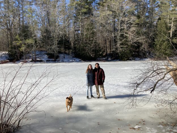
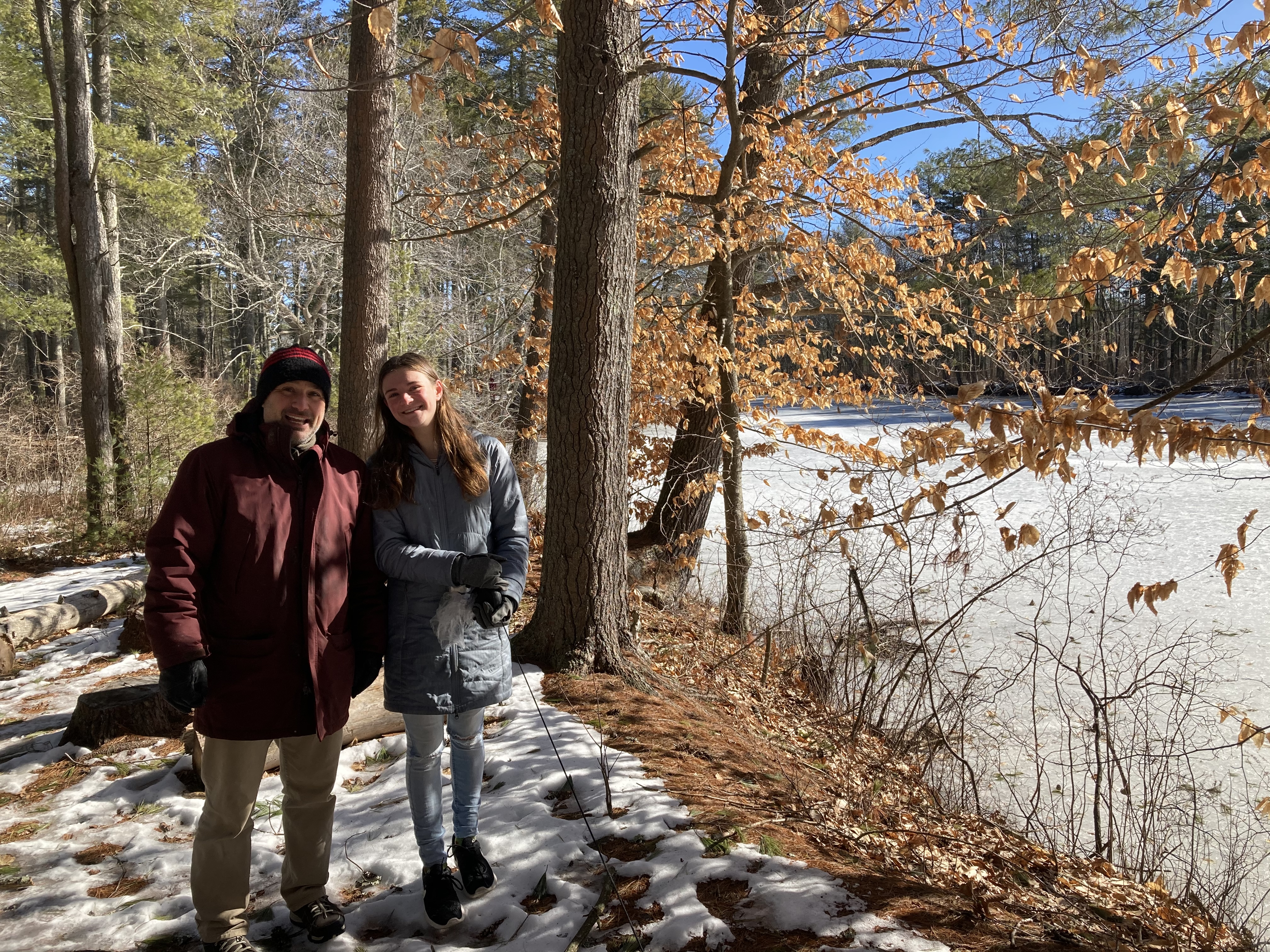
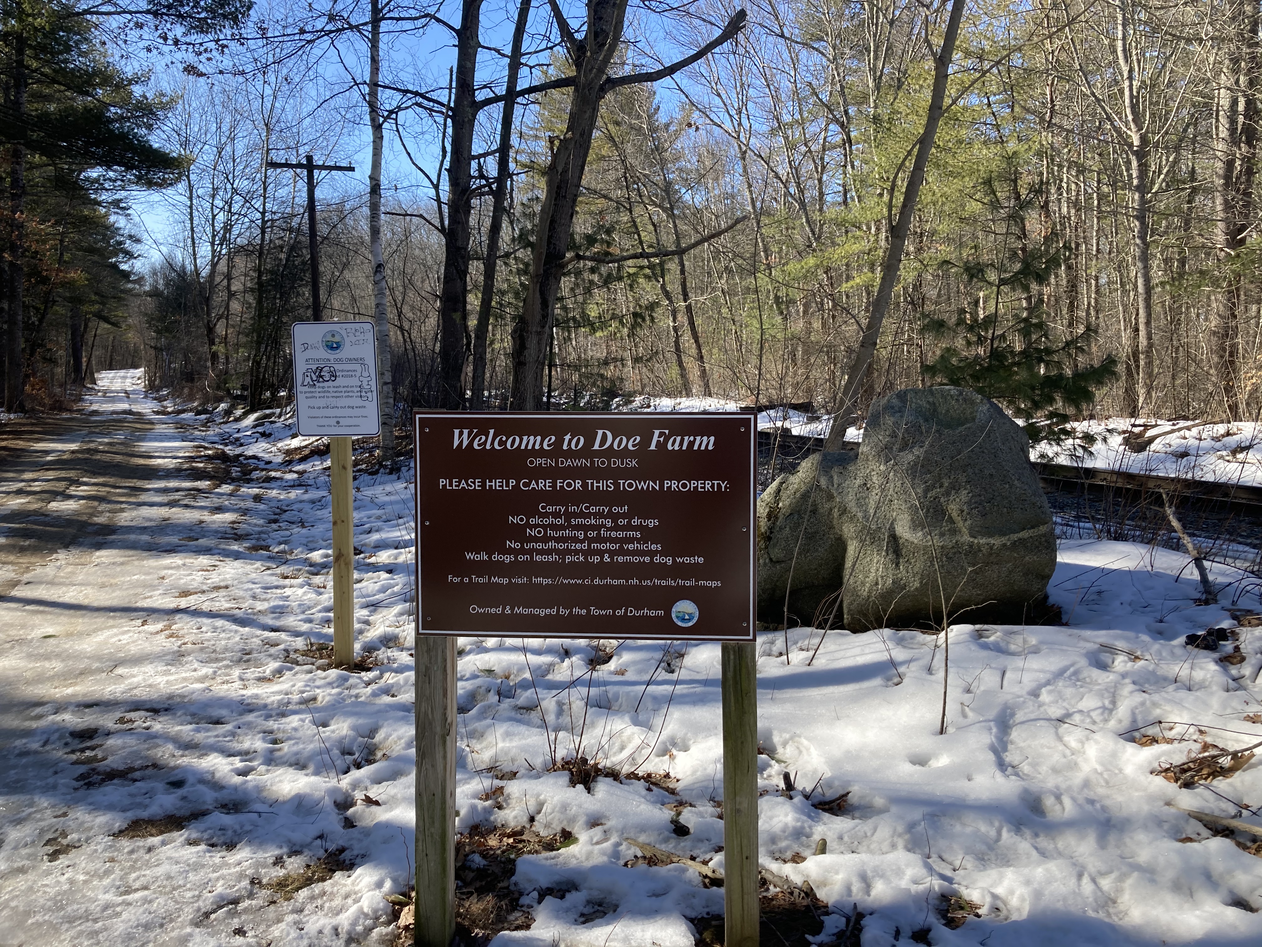
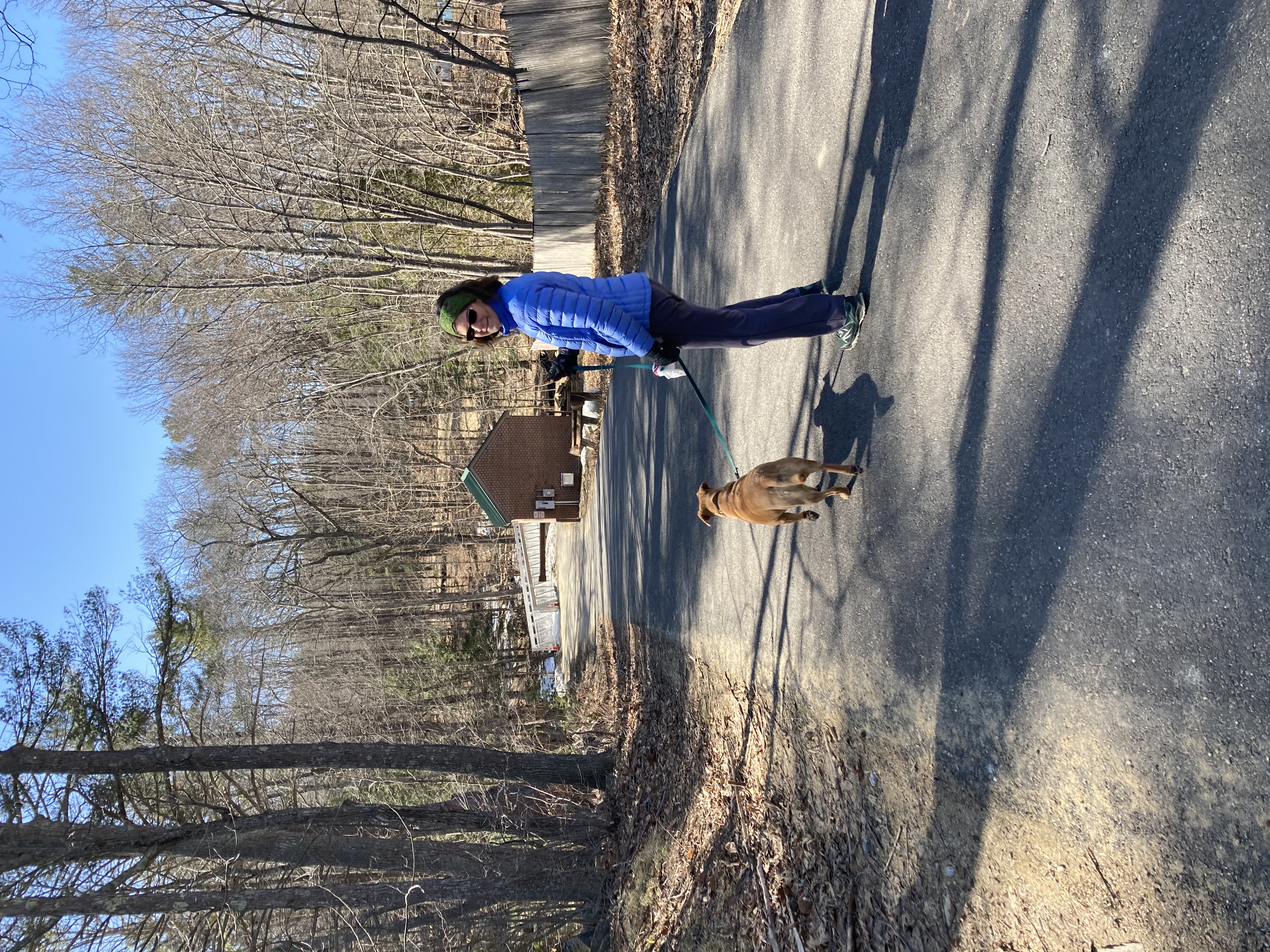
March 6: Doe Farm with special guest Zoe Pavlik!
 We had a special treat for our walk today — Zoe was home from college for the weekend and decided to join us. In addition to enjoying her company, it also meant we could get a rare non-selfie photo of the two of us!
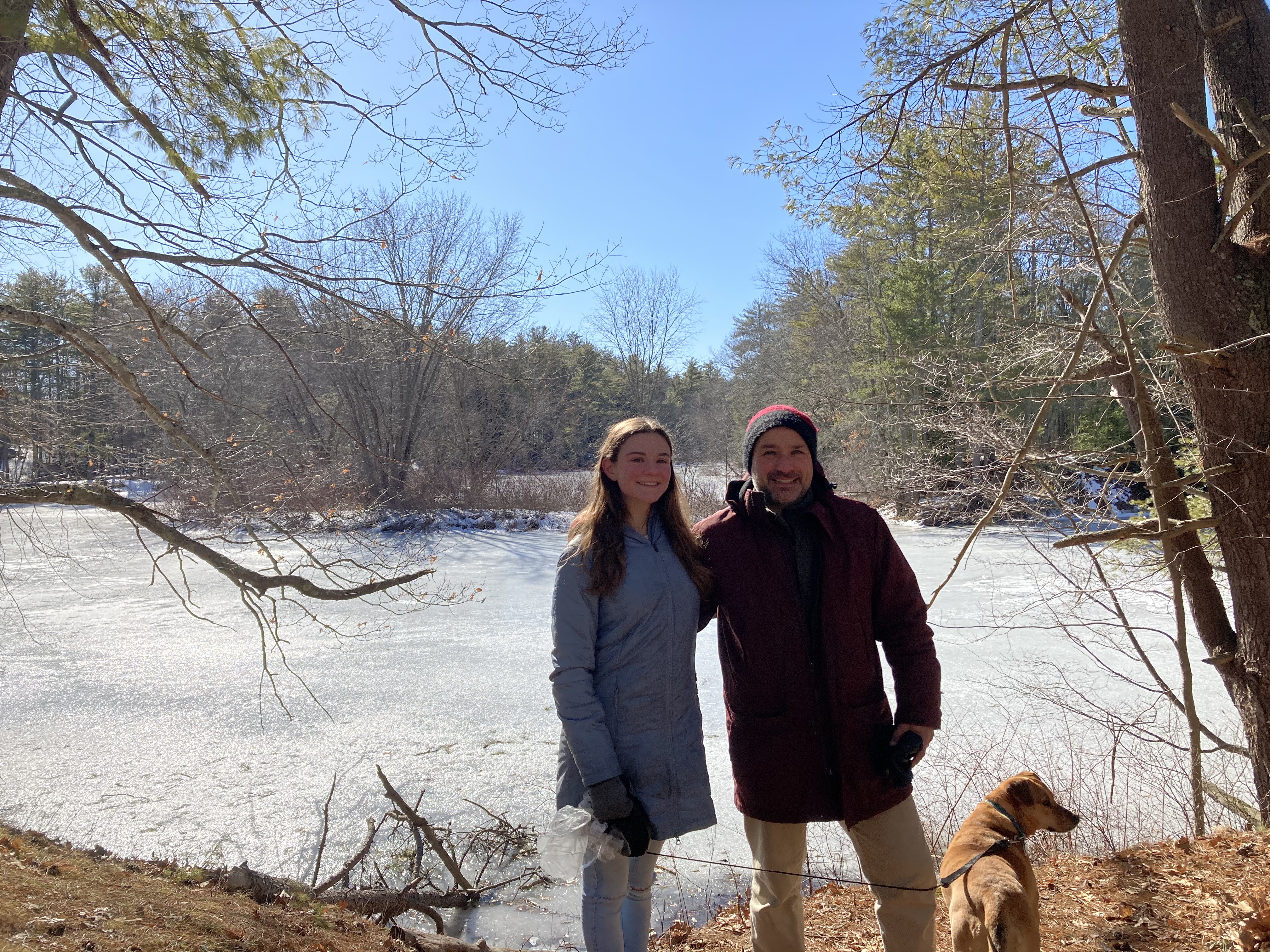
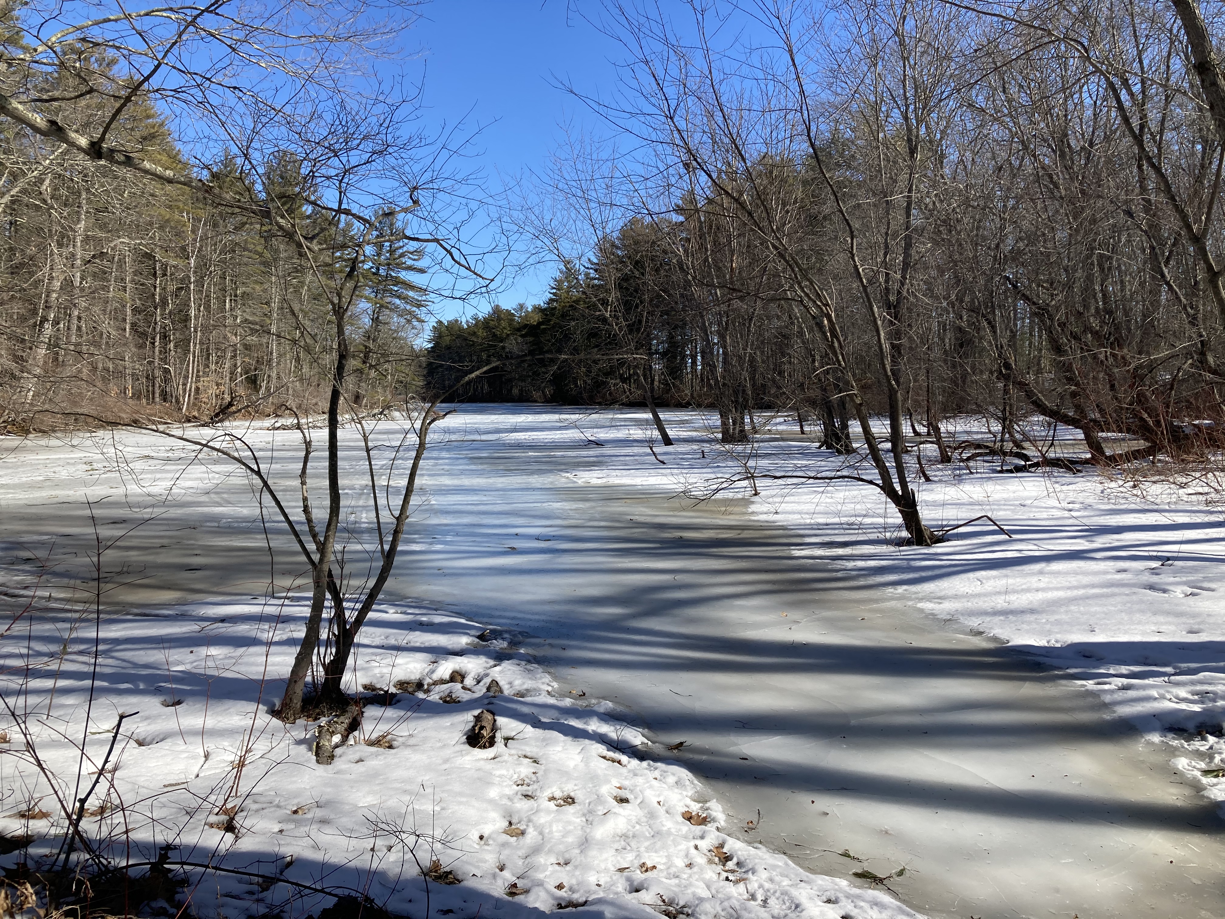
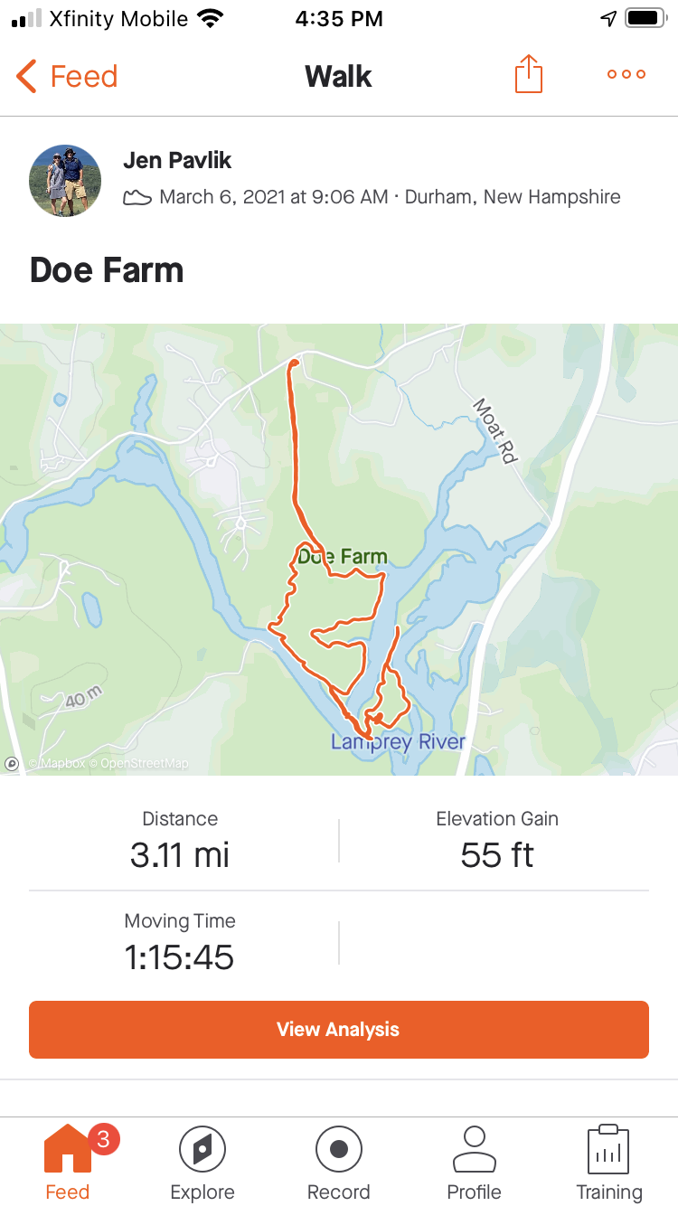
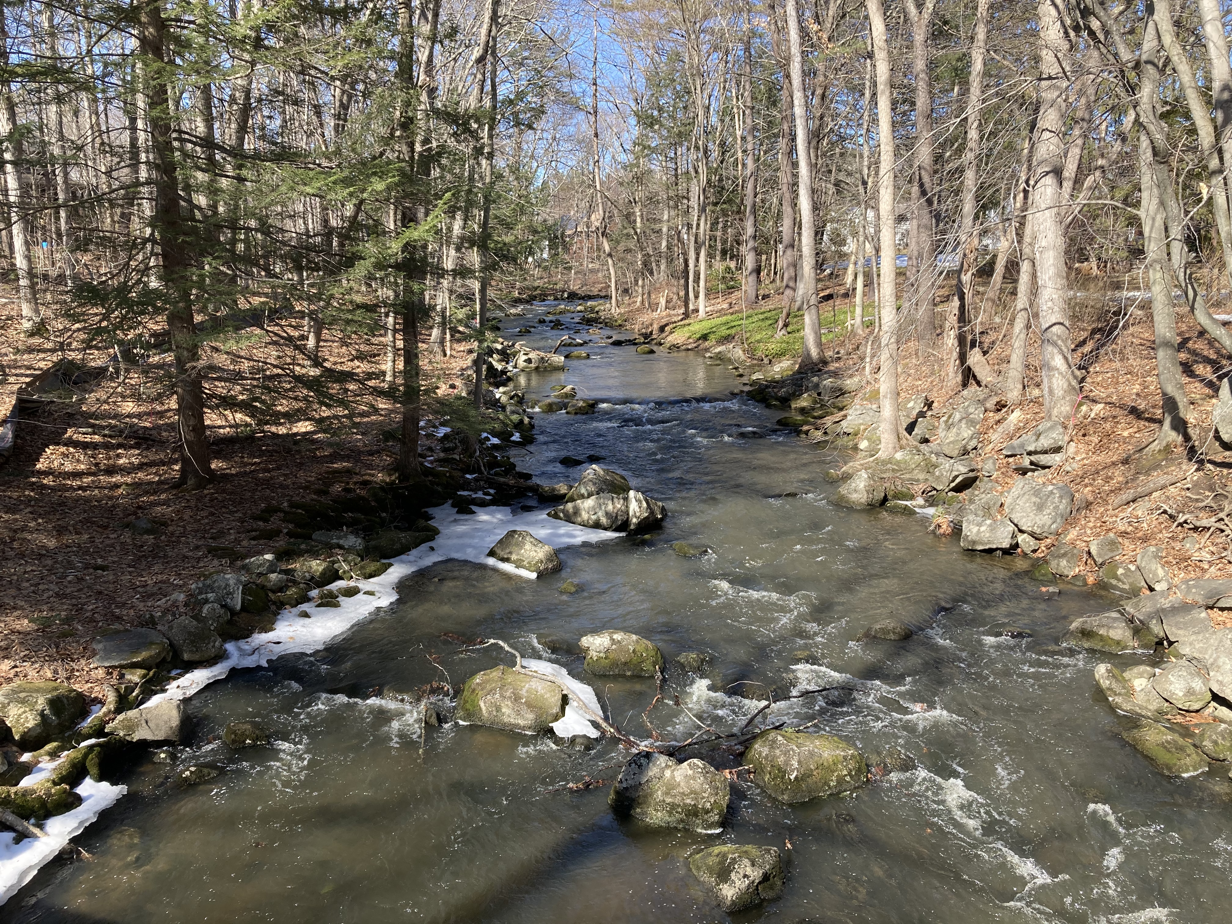
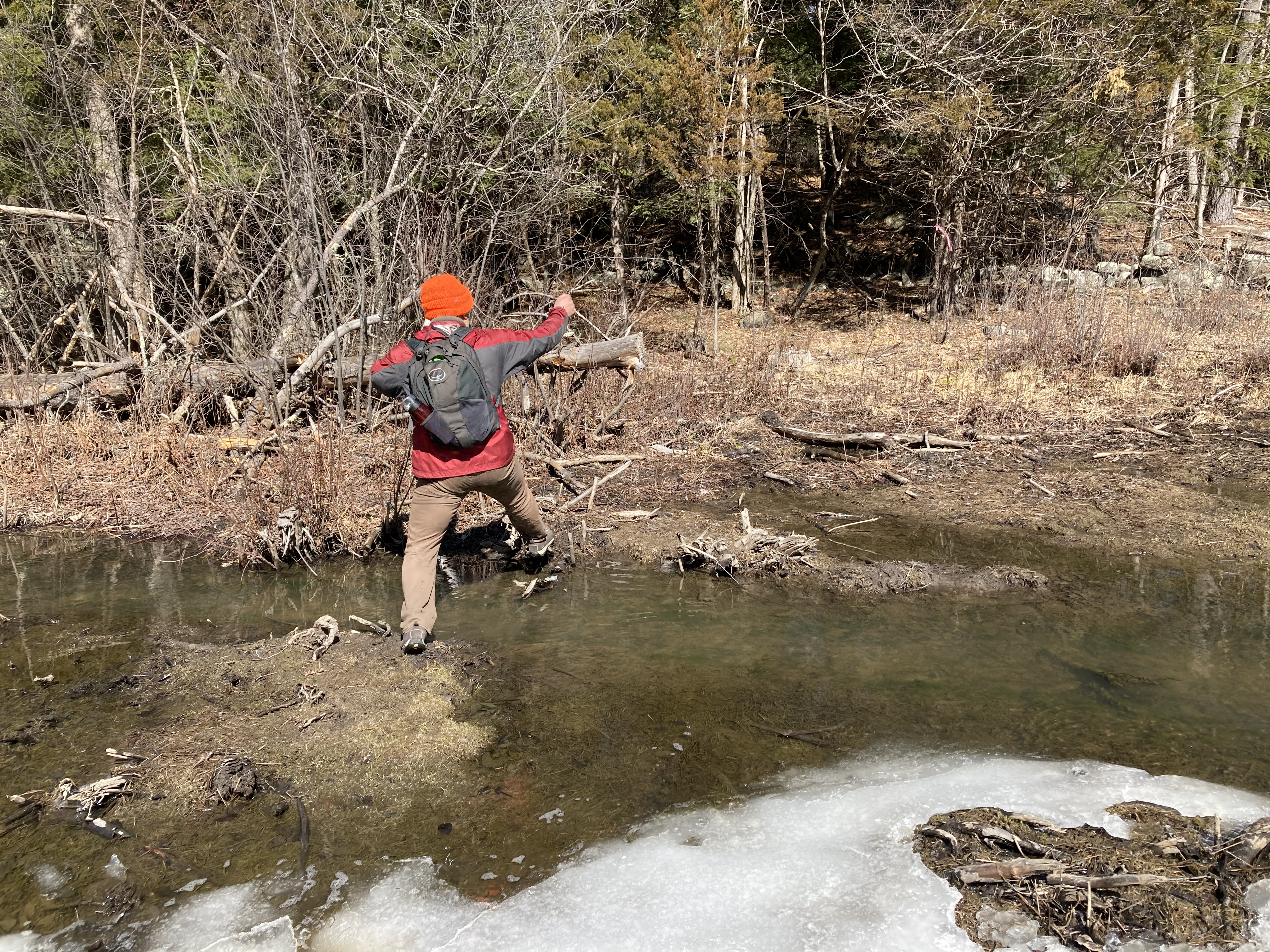
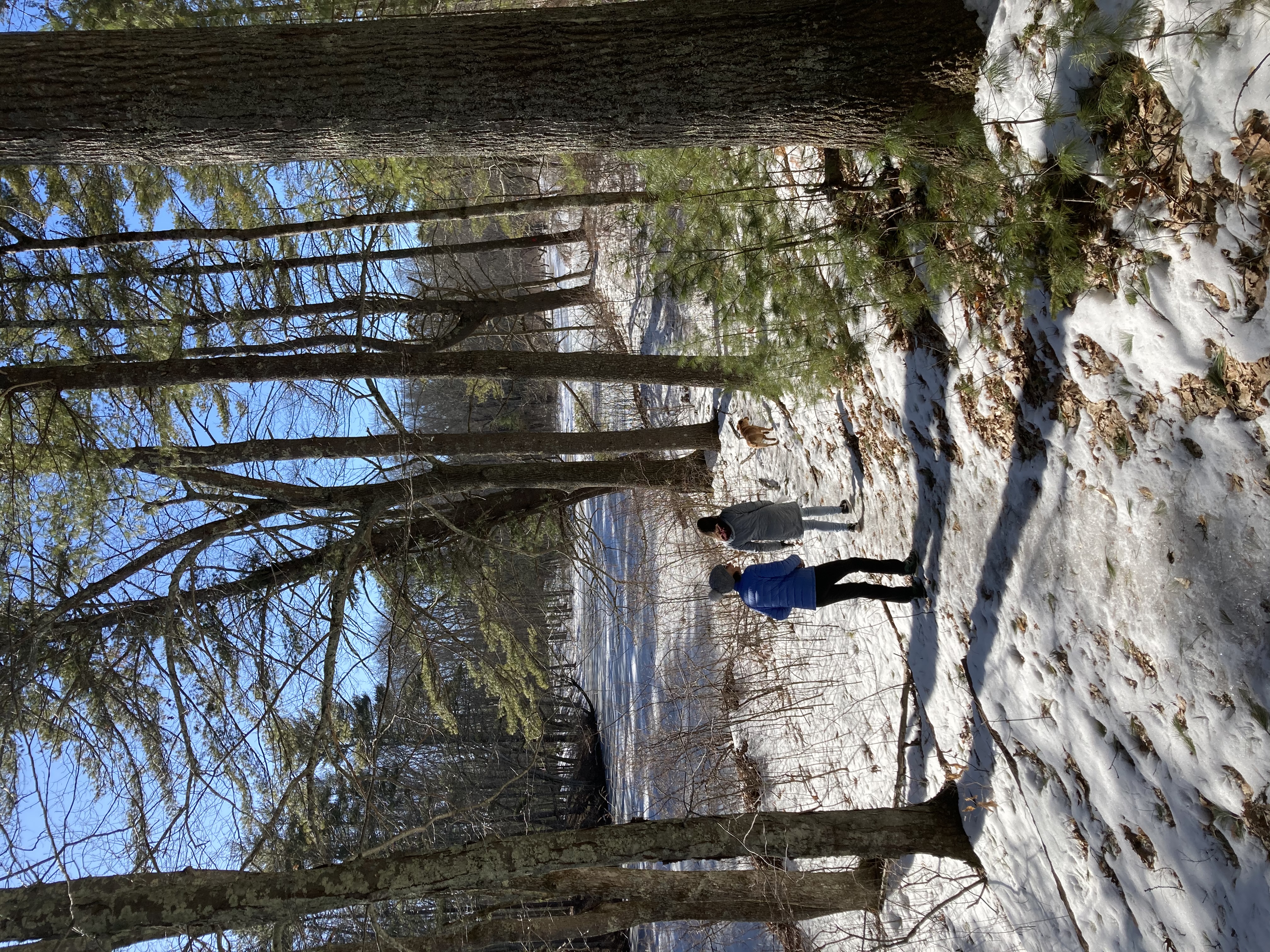 This was another area where we somehow had never been before, even though it was only a couple of miles from our house. (We did leave for our Doe Farm to Foss Farm walk from this location, but didn’t actually venture into Doe Farm itself.) And it was another hidden gem. The path we followed was bordered by the beautiful frozen river almost the whole way, sometimes on both sides. We probably could have walked or skied right across the river itself, but with March and slightly warmer weather having arrived, we’ll save that adventure for next year.
The path started out along the railroad tracks, and we got to see the train go past at one point — maybe the same train Zoe will be taking to Portland tomorrow en route to Orono. But soon we left the train tracks behind for the quiet of the woods and the river. We barely saw another soul during our whole 3+ mile walk, other than one man who was there with a chainsaw to clear the path of trees that had fallen during the recent high winds.
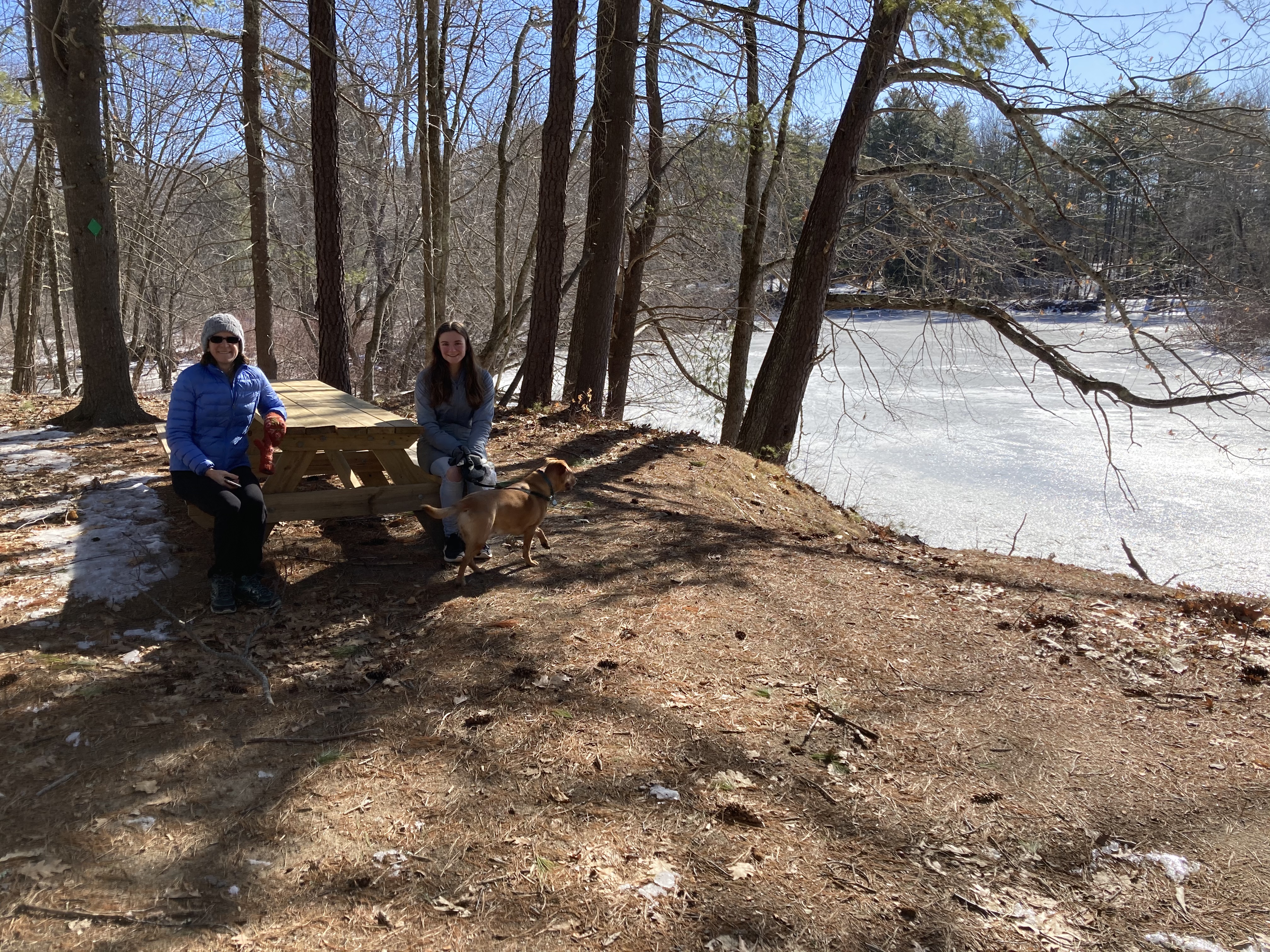 We also discovered yet another lovely picnic area, complete with a picnic table and charcoal grill. We are mentally filing away the locations of all of these areas, and are geared up for lots of outdoor socializing this summer (although we are very much hoping to be in a place where indoor socializing is also a possibility).
March 13 – Wedgewoord/Faculty/Bennett loop
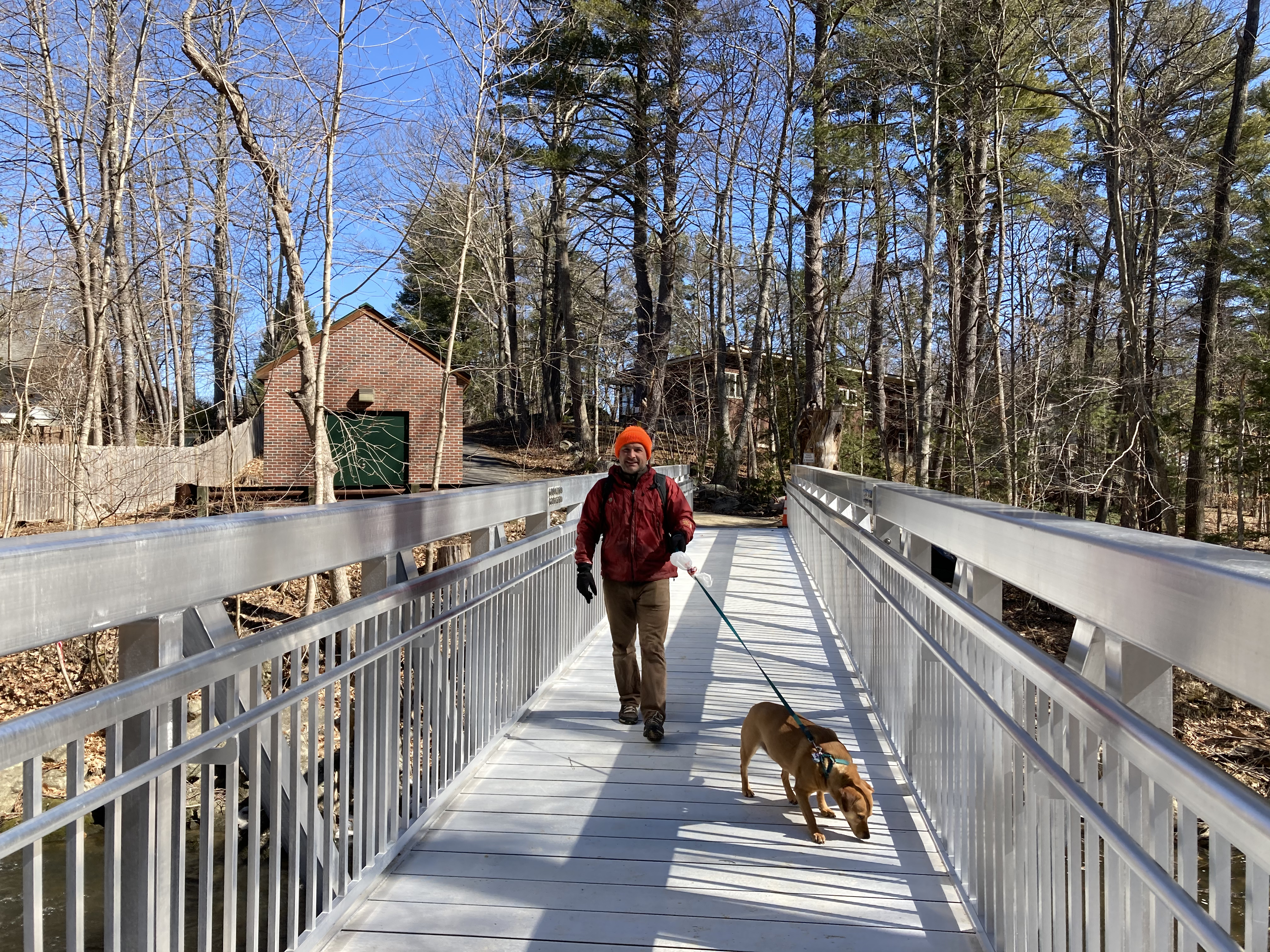
 With the warm temperatures earlier this week (sadly, not today), we knew we would be likely to encounter mud anywhere we chose to go. We decided to do a long loop walk, partially on trails and partially on the roads. AND we had heard on good authority from our friend Yvon that the new Kenny Rotner bridge is actually, really in place this time, as opposed to how things turned out on our last attempt.
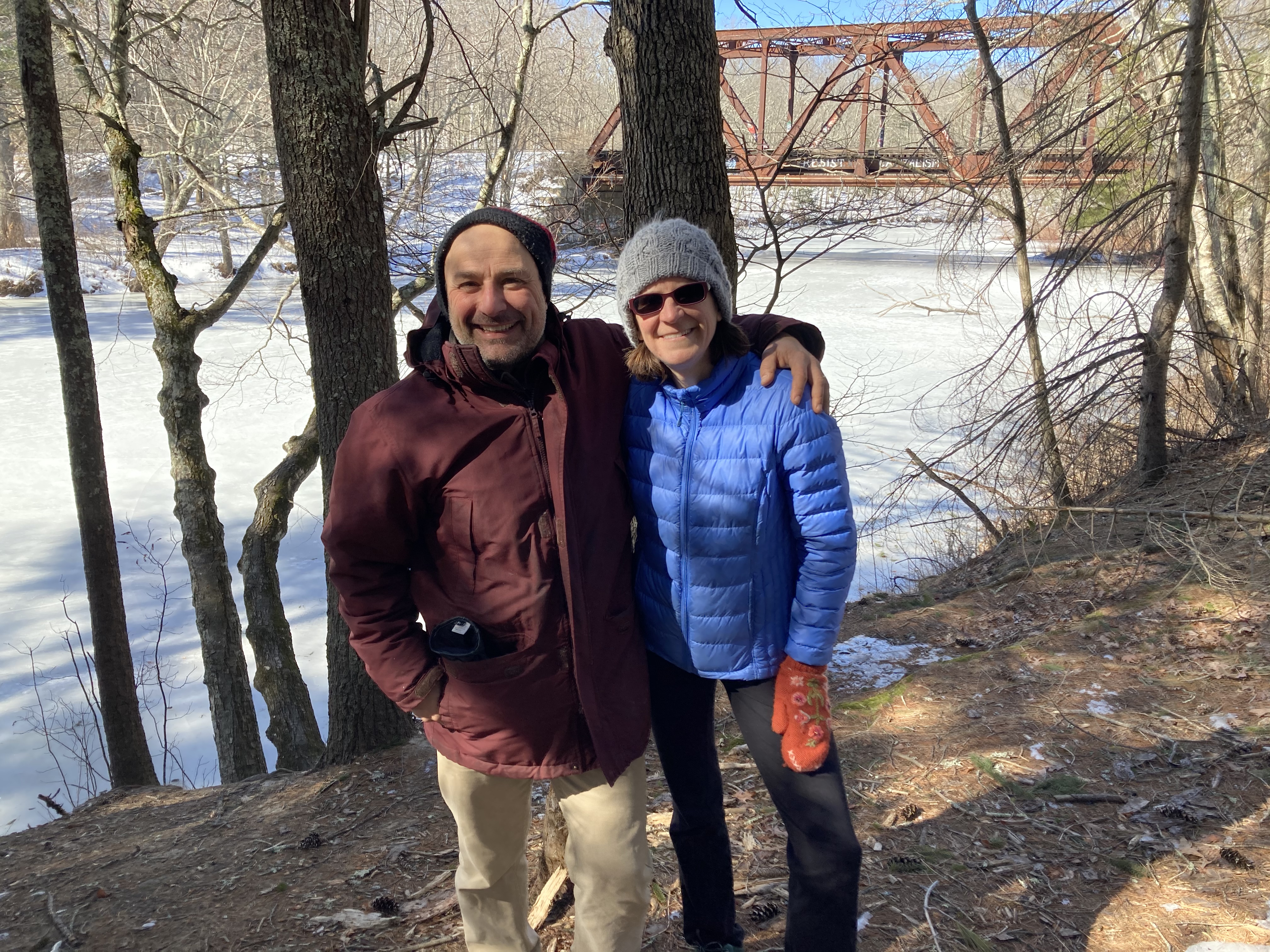
The view from the new bridge
We left from our home in the Wedgewood neighborhood, starting off with our usually walk to the town landing. From there we headed into the Faculty neighborhood and down to the site of the new bridge on Mill Pond Road. It is a thing of beauty, and 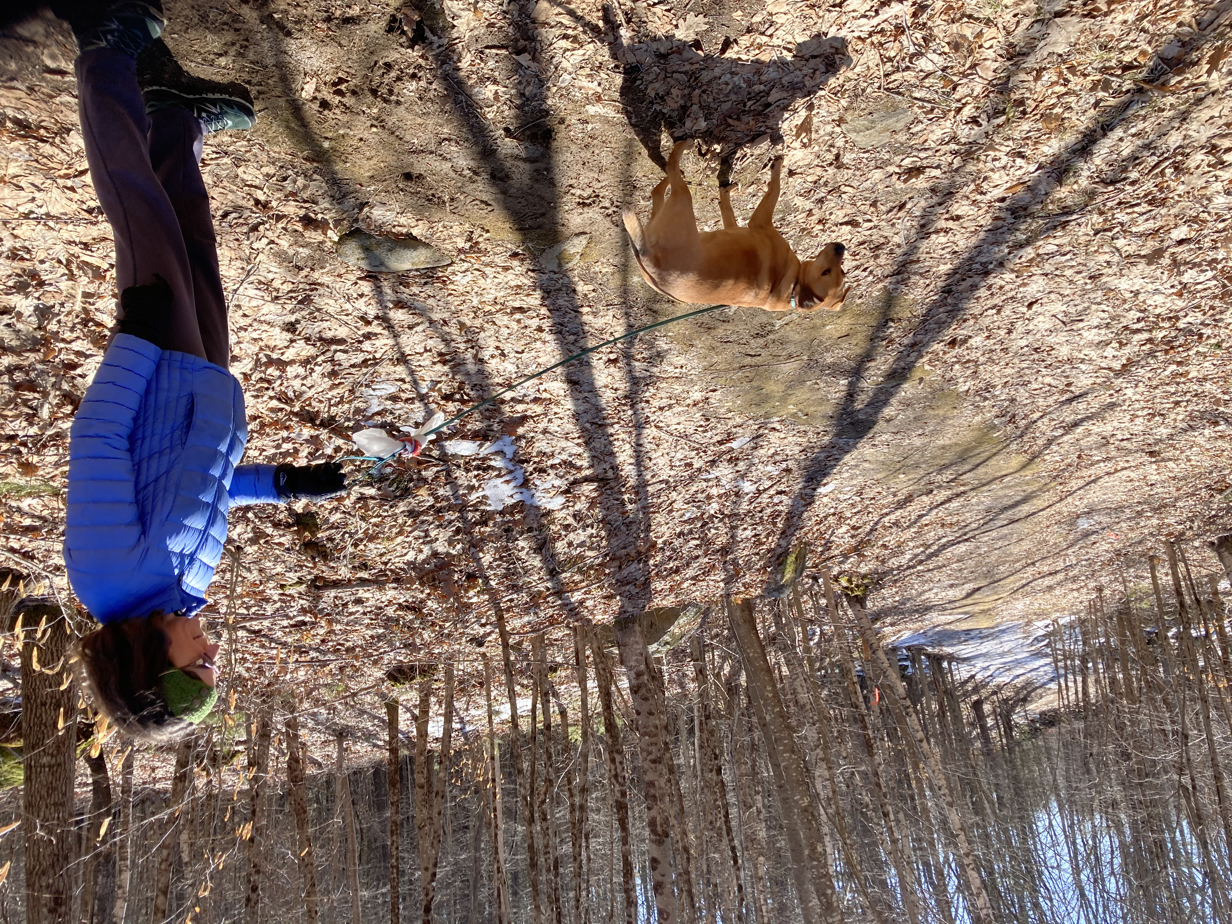 bore us safely across onto Foss Farm Road and the start of the Foss Farm trail system. We had to start out by retracing our steps from our last time here (the missing bridge incident), but this time were traveling in reverse. We then took the trail that we’d intended to take last time, but missed, which would lead us to Bennett Road.
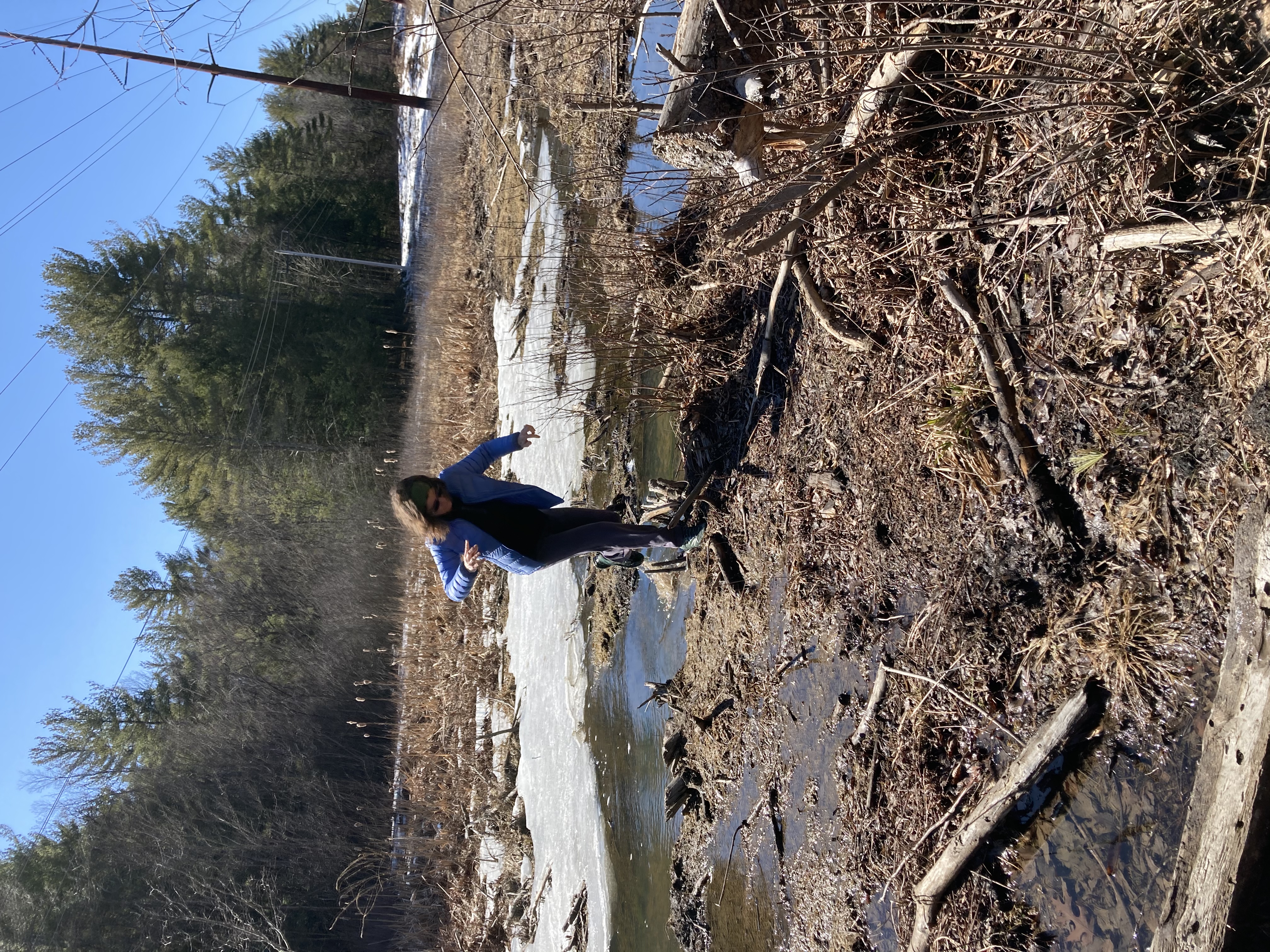
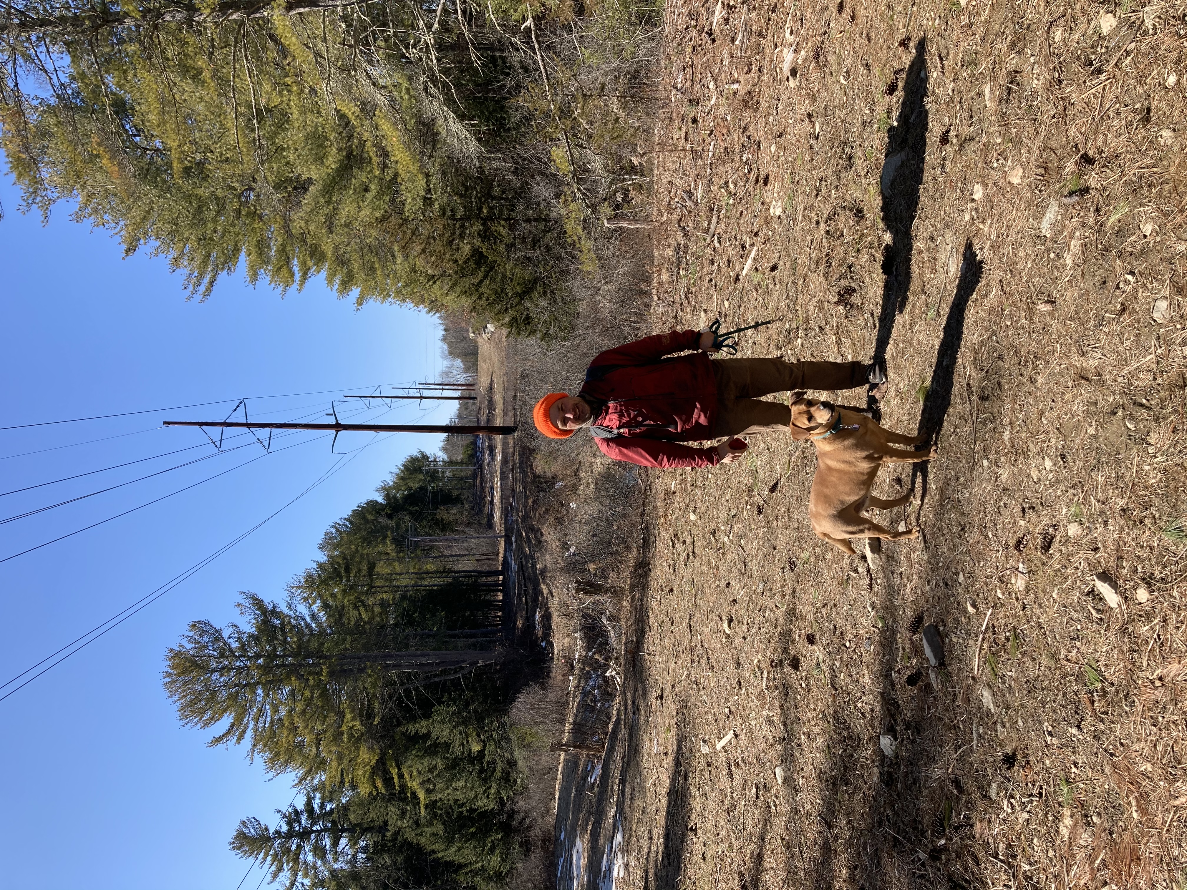 We stopped a bit short of actually going onto Bennett itself — not very pedestrian-friendly — and instead walked under the power lines all the way to 108. (We did this accidentally last time we were walking in this area; this time it was intentional.) The power lines are built on a series of rolling hills, and we more than once found ourselves in difficulties getting through wet and marshy sections without soaking our feet. The final culvert, just before hitting Rt. 108, was a particular challenge. Daisy ended up wet and muddy from her belly downwards.
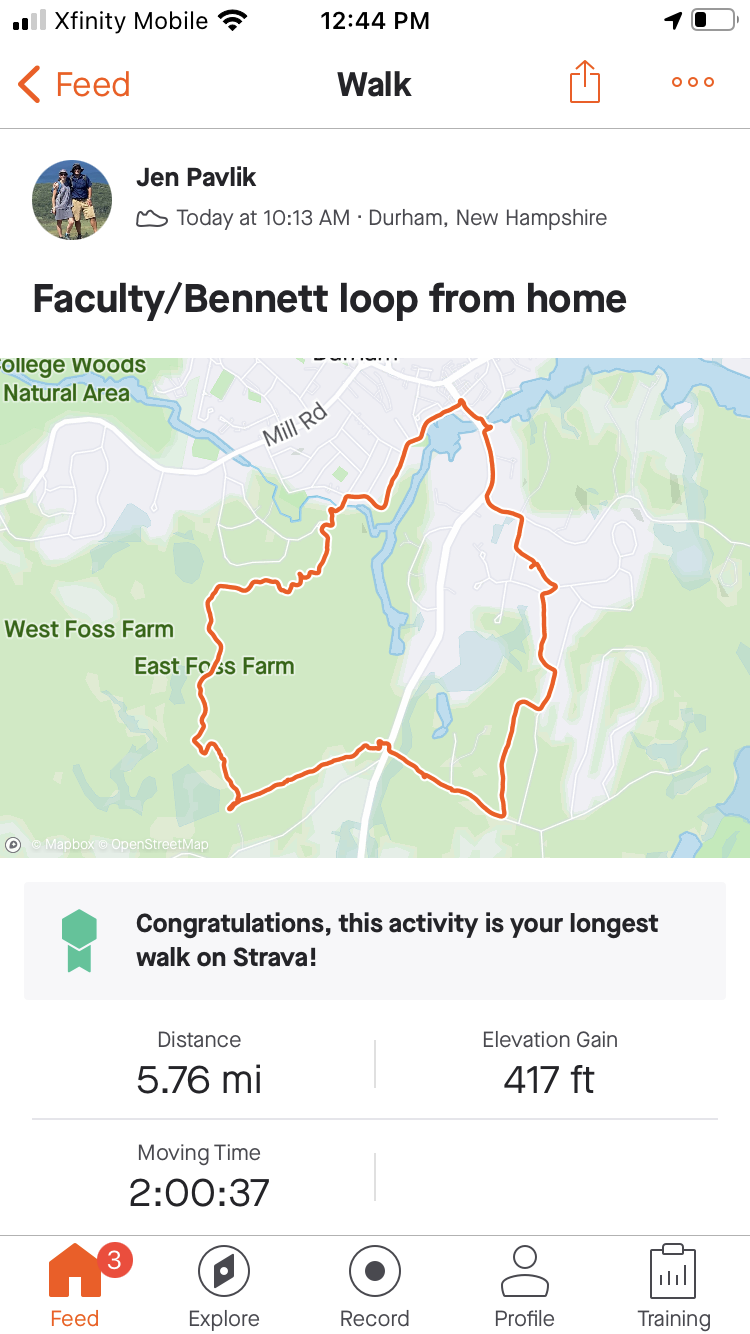 Anyway, we eventually made it across 108 and onto Longmarsh Road — and from there back to our starting point at home, two hours and almost 6 miles later. We were tempted to keep following the power lines down to Cutts and Ffrost, closer to our house — but we deterred by the marshy areas we could see (and also slightly uncertain if getting out would require us to walk through someone’s yard). We plan to try it eventually, once we’re into a drier season.
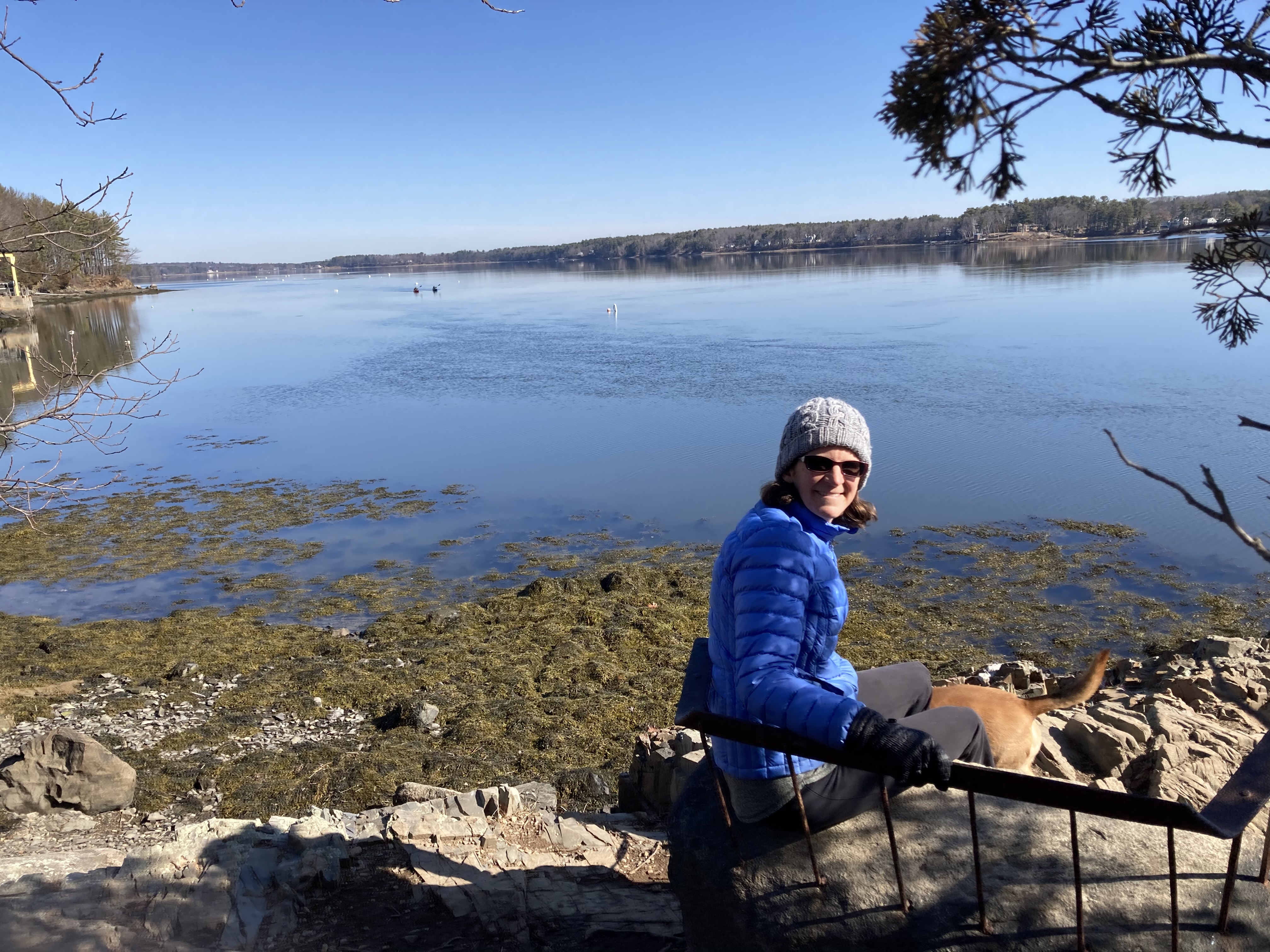
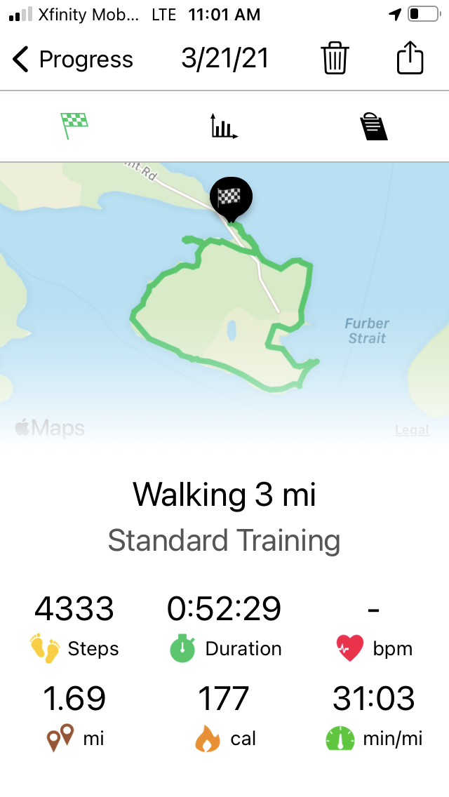
March 21 – Adams’ Point (Perimeter)
 Great Bay is considered by many people around here to be the thing we have to drive around to get to the ocean. That’s when people think of Great Bay at all.
I had this in mind today when I floated my theory about Adams Point being a mini-Mount Desert Island, both in shape and setting. I was prepared for pushback.
But, really, all we could come up with to separate today’s hike from one in Acadia National Park were:
-

Almost the Precipice Trail
No mountains here
- No waves here
- This place is 3 1/2 hours closer to our house.
All three are valid points, but third one made up for a good portion of the drawbacks of the first two, as we walked Adams Point this weekend.
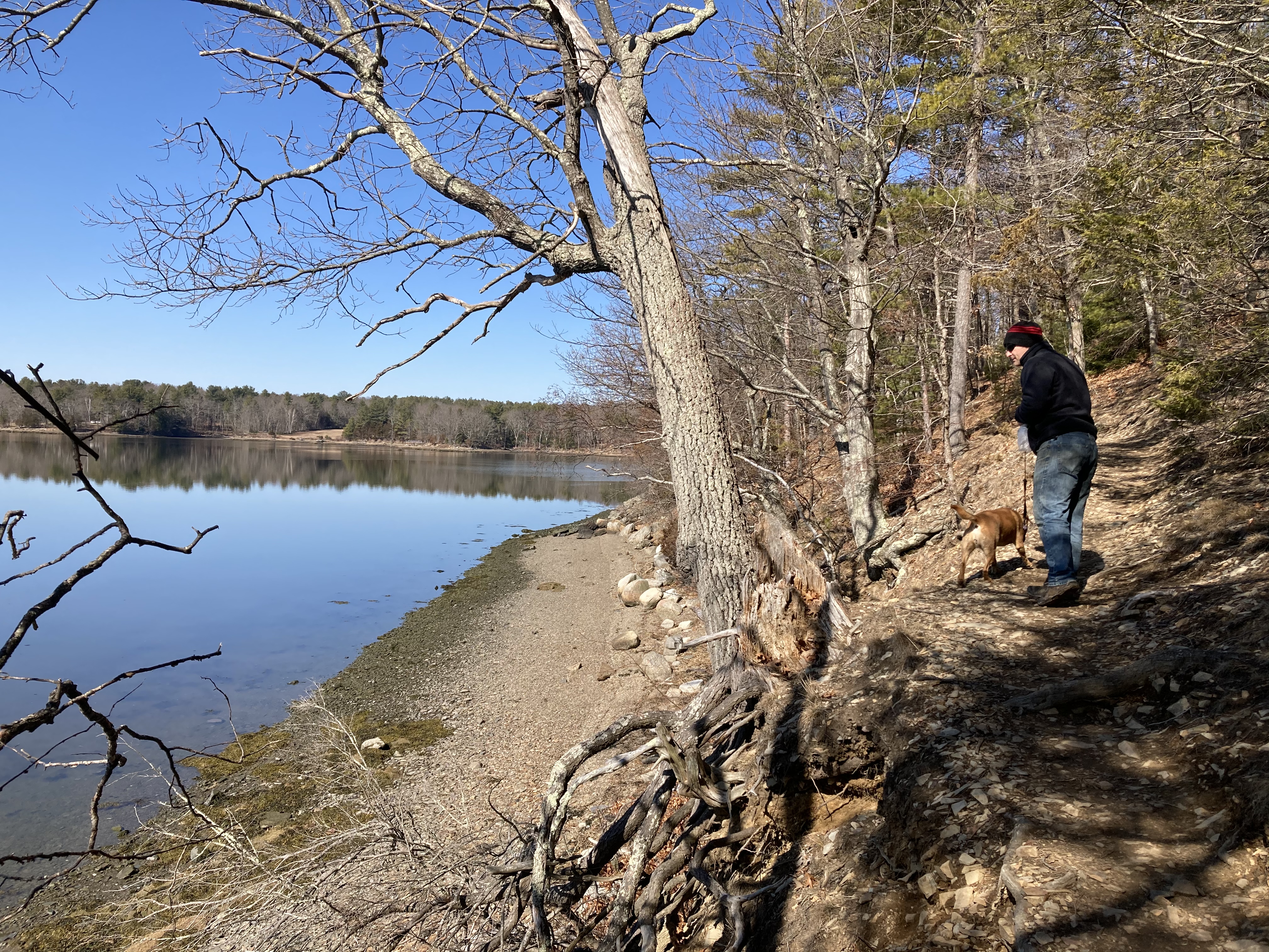
Great Bay shone in the early-spring morning sun, and it accompanied us the entire way along the perimeter path around the point. The water perhaps even benefitted from the calmness of the day. It reflected the clear sky and surrounding forest almost perfectly.
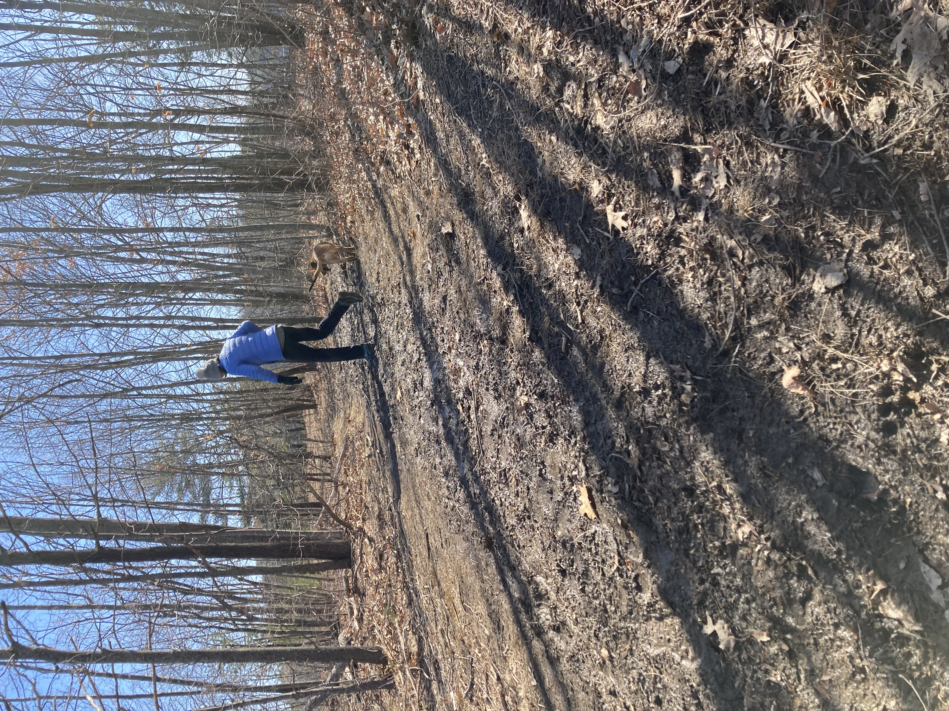
Muddy trails in the field
The paths through the wooded sections unfolded in stone and pine needle carpeting, though the open field segments were quite muddy.
Adams Point is a popular spot, as the full parking lot and the bootprints in the mud can attest, but also like Acadia, it has lots of folds and nooks where people can hide themselves away and look out over the mostly un-molested surface of the bay. (Two kayakers left from the boat launch as we were walking past, but other than them, two islands, and a bunch of water birds, Great Bay’s surface was unoccupied. )
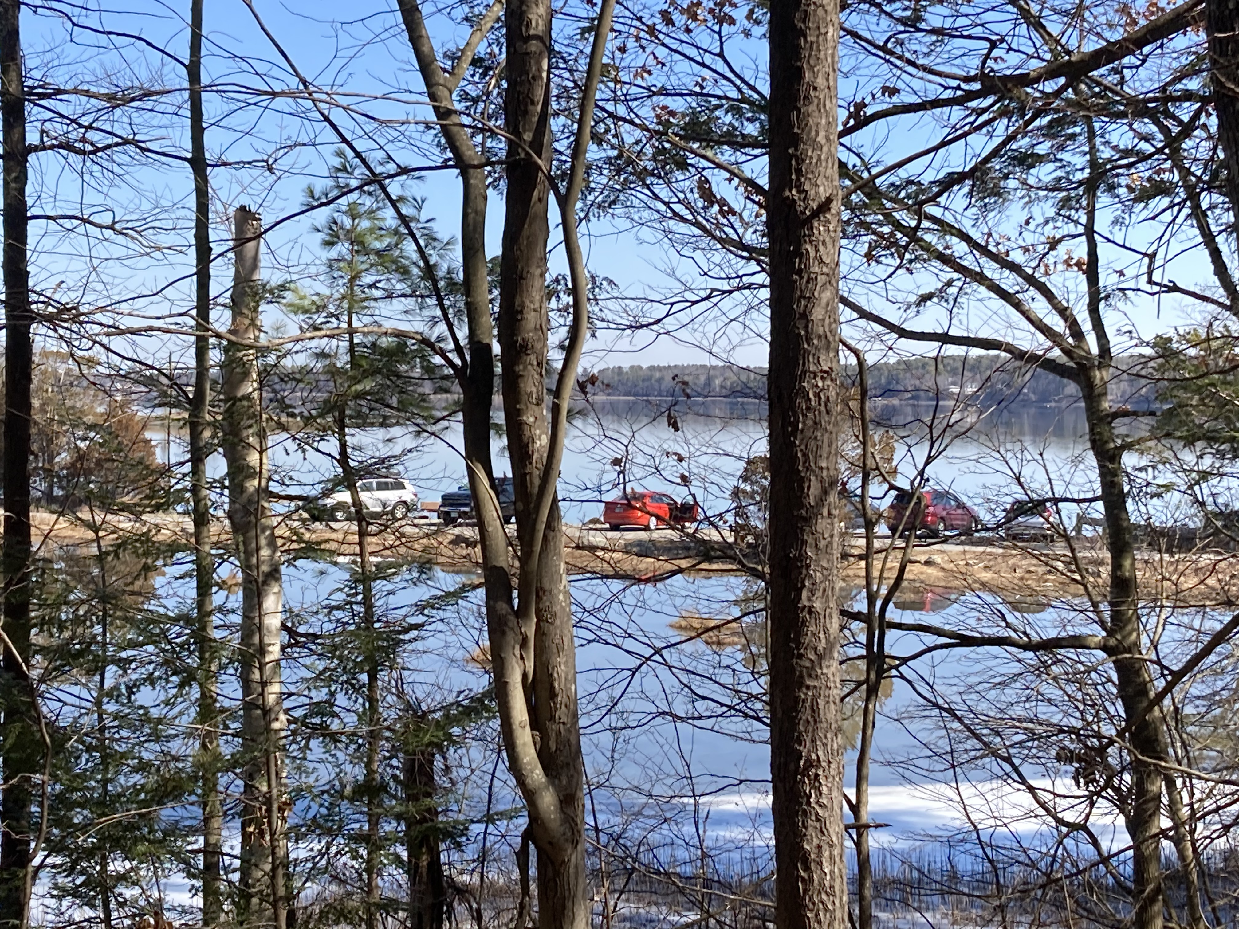
Almost full parking lot at the boat launch
Sometimes we would glimpse a portion of someone seated among the rocks, but who knows how many people we walked past and didn’t see. The park did not seem crowded, though both parking lots were close to capacity when we walked past.
There are more trails criss-crossing the interior of the park, but the one drawback of being so close to home is that we are closer to things we have to get back to. No wandering all morning long like we did in the Tin Mine Conservation area.
 We will get to those interior trails on another trip; today we were content to stay near the water and follow the point’s perimeter loop. And we managed to get home before the breakfast Lanie had prepared for us had gone cold.