Author Archives: Jen

Day 1: A Nibble at the Big Apple

Bagels on the New York Public Library terrace

It’s spring break and we’re on the road again.  Or at least 3/5 of us are.  Zoe and Nadia are focused on wrapping up their semesters and preparing for finals, but the rest of us decided to head south.  Lanie never got to go on her 8th grade trip to DC due to Covid, and we have beloved friends and family in the area who we haven’t seen in way too long, so that’s our primary destination.

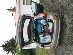
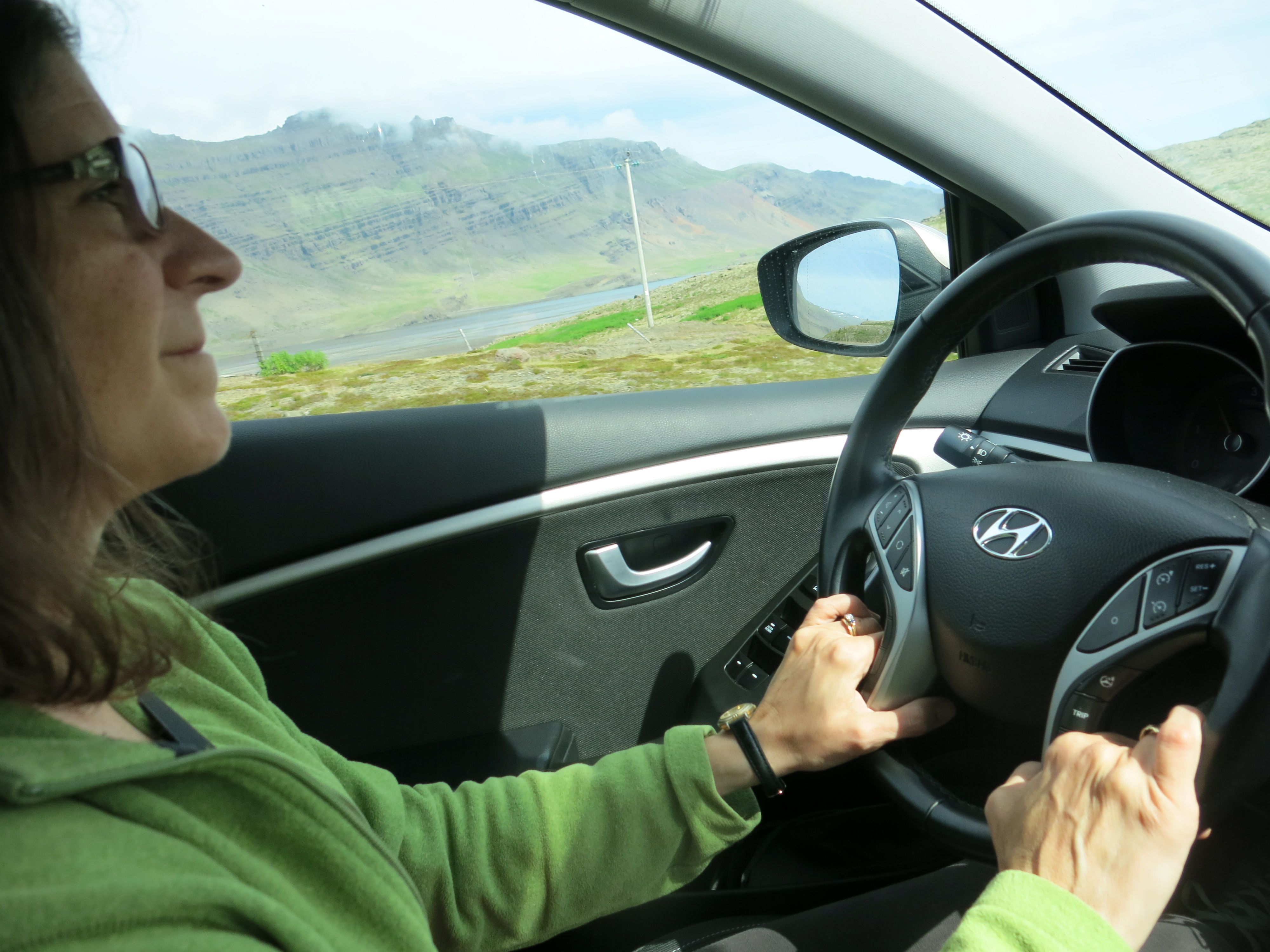
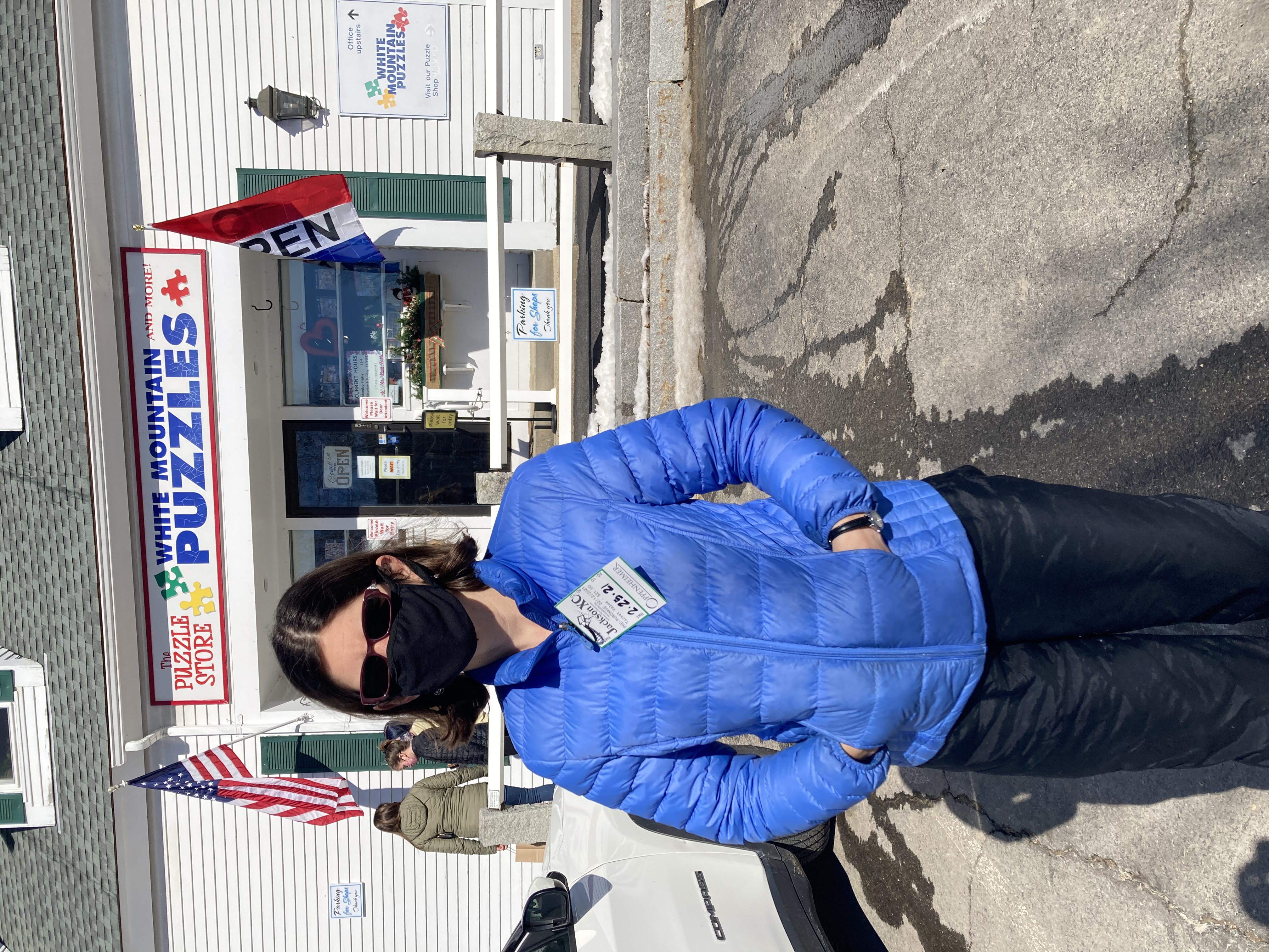
Unfortunately the first requirement for a road trip is a car, and we have encountered some challenges in this area.  We expected to take our “new” car (a seven-year-old Honda Fit) but after a deer collision in late January we are STILL waiting

You can go stand on that little triangular platform up there! On a glass floor! And they make you pay money to do it!

Inside the library

for repairs to be completed (local readers, avoid Midway Collision!)  The trusty old minivan has acquired a distinctive aroma after Bob spilled some kind of weird lamp oil in there a couple of years ago — plus we had loaned it to Zoe at Easter so she would have room to move herself out of her apartment at the end of the semester.  This left us with the kid car — a 90s-era Pontiac Vibe with close to 200,000 miles and a lack of such modern features as power locks and power windows.  We figured that even if it made the trip successfully, we’d be taking years off its life.  So, we’re traveling in a Nissan Sentra rental car with Maine plates.  (The guy at Enterprise said, “Well, it’s better than if people thought you were from Massachusetts!”  Massachusetts drivers don’t have the best reputation.)


Library BeReal

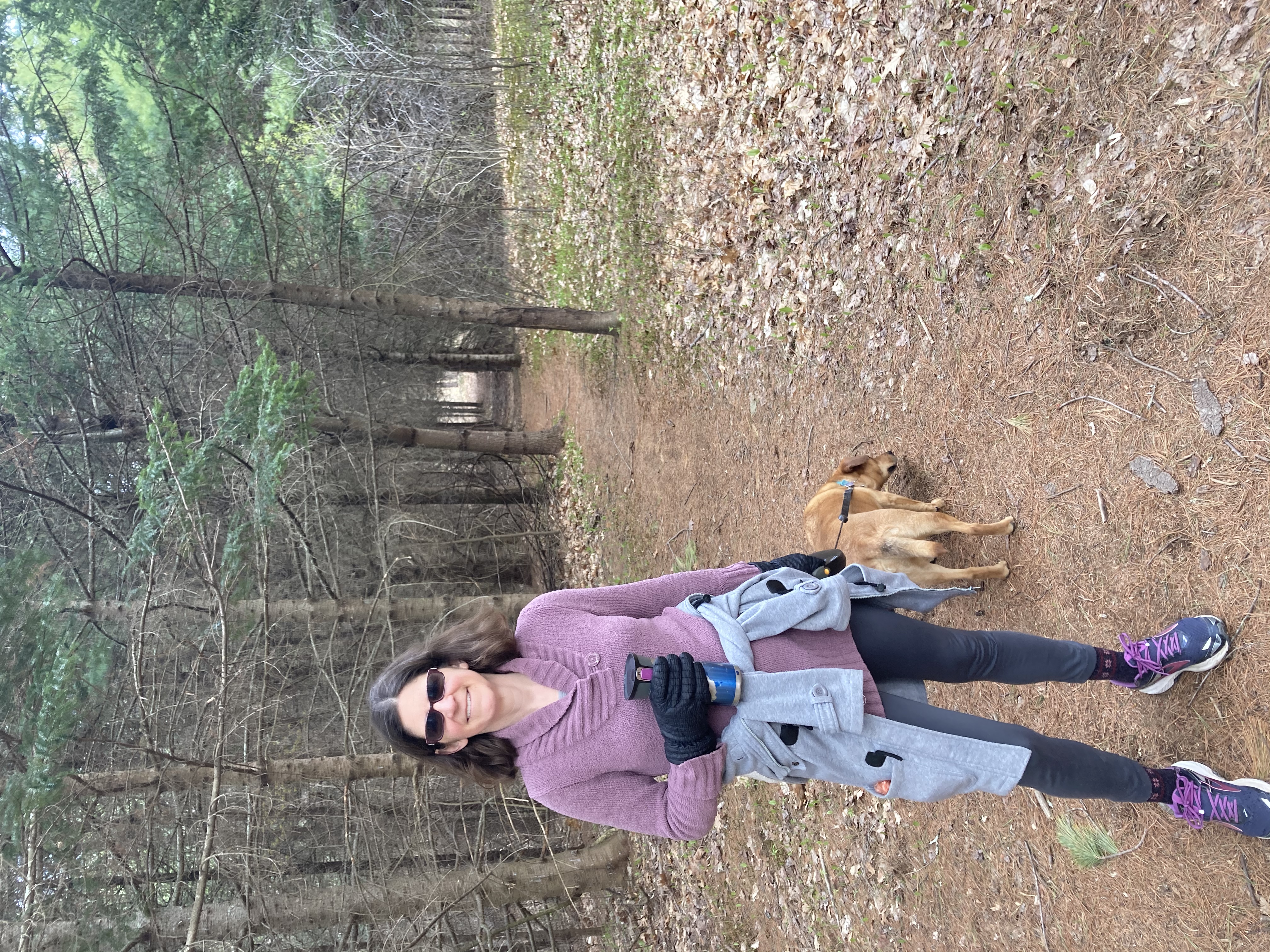
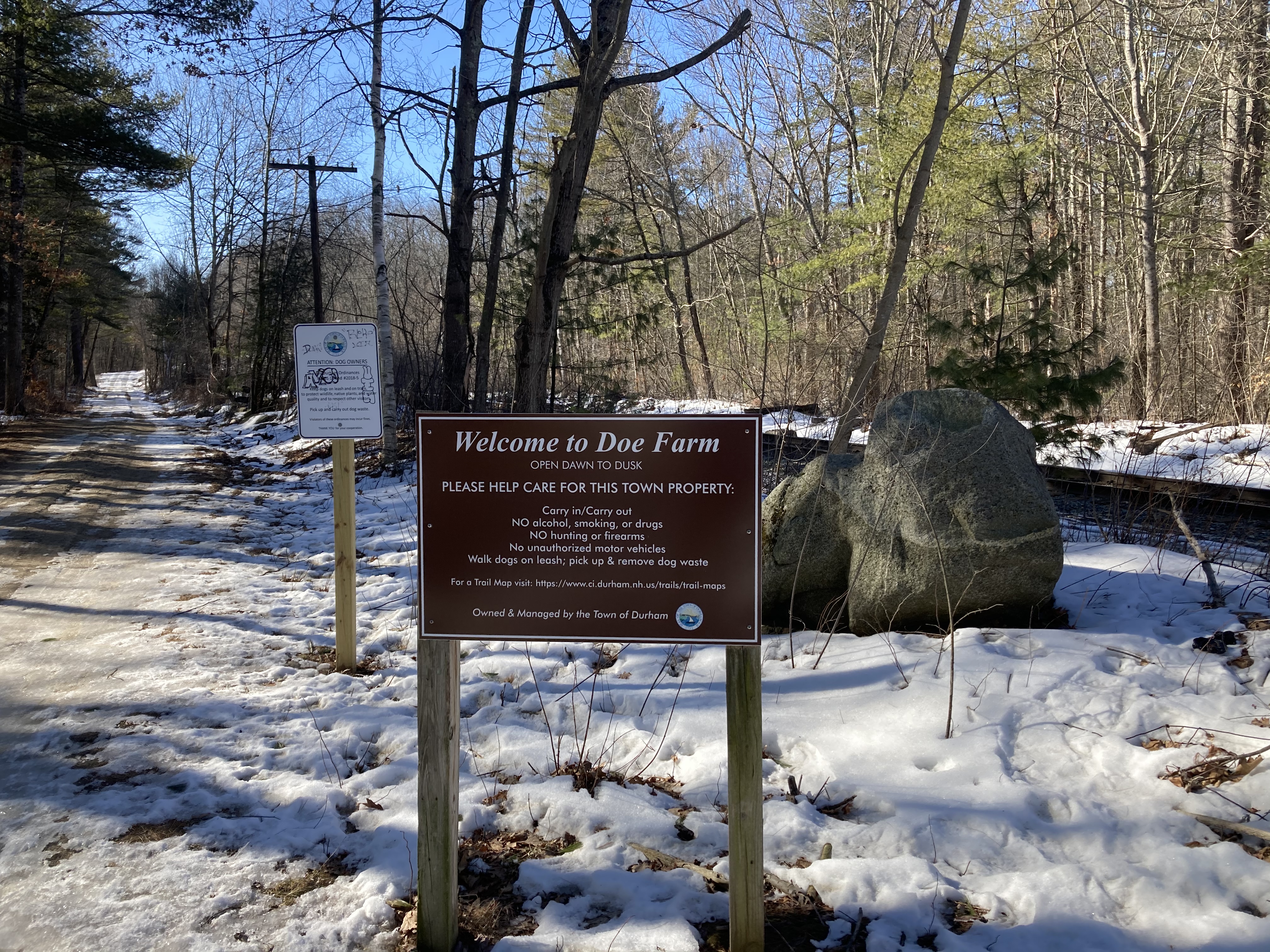
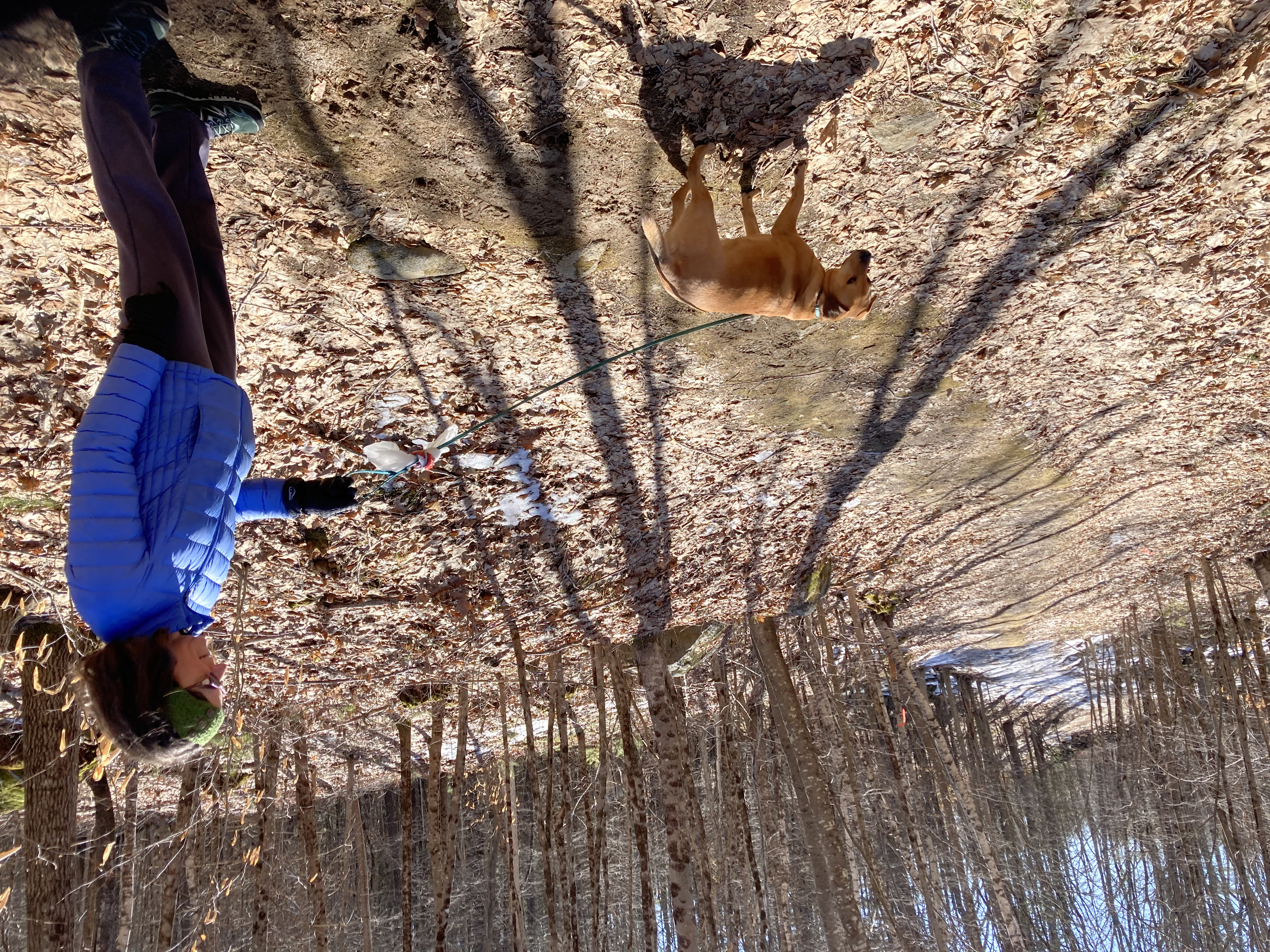
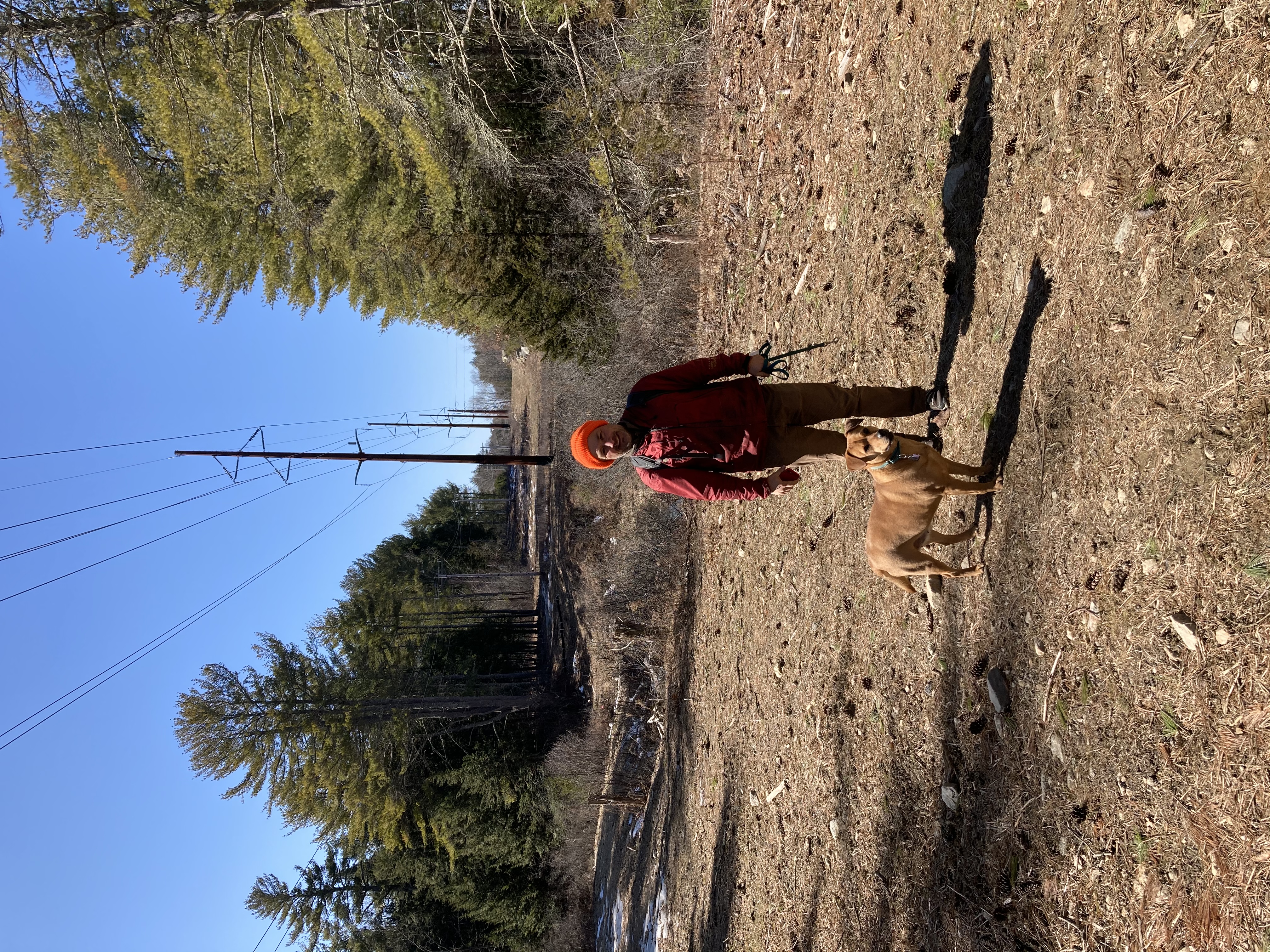
Our first stop was a visit to Nadia, who is conveniently on the way.  We picked her up late on Friday and headed to an airbnb in Mount Vernon, which is between where she lives (in Pleasantville) and the city.  There were a lot of logistical complications involving getting her back home again on the train and having a place to park our car, so this seemed like the best solution.  It turned out to be a great spot — spacious and easy to get to, with easy parking and a 15-minute walk to the Metro North to take us into the city on Saturday.

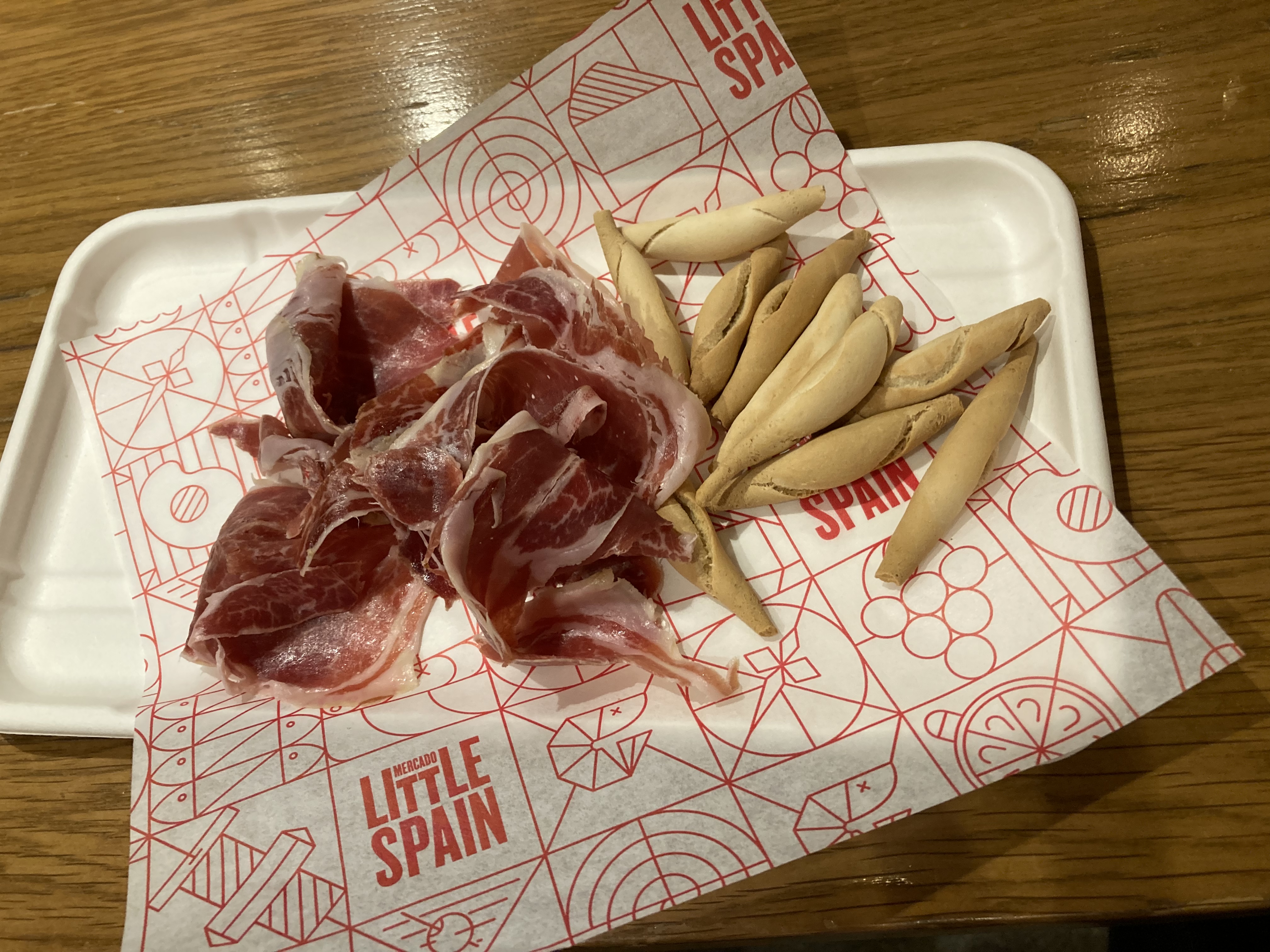
Jamon Iberica at Mercado Little Spain

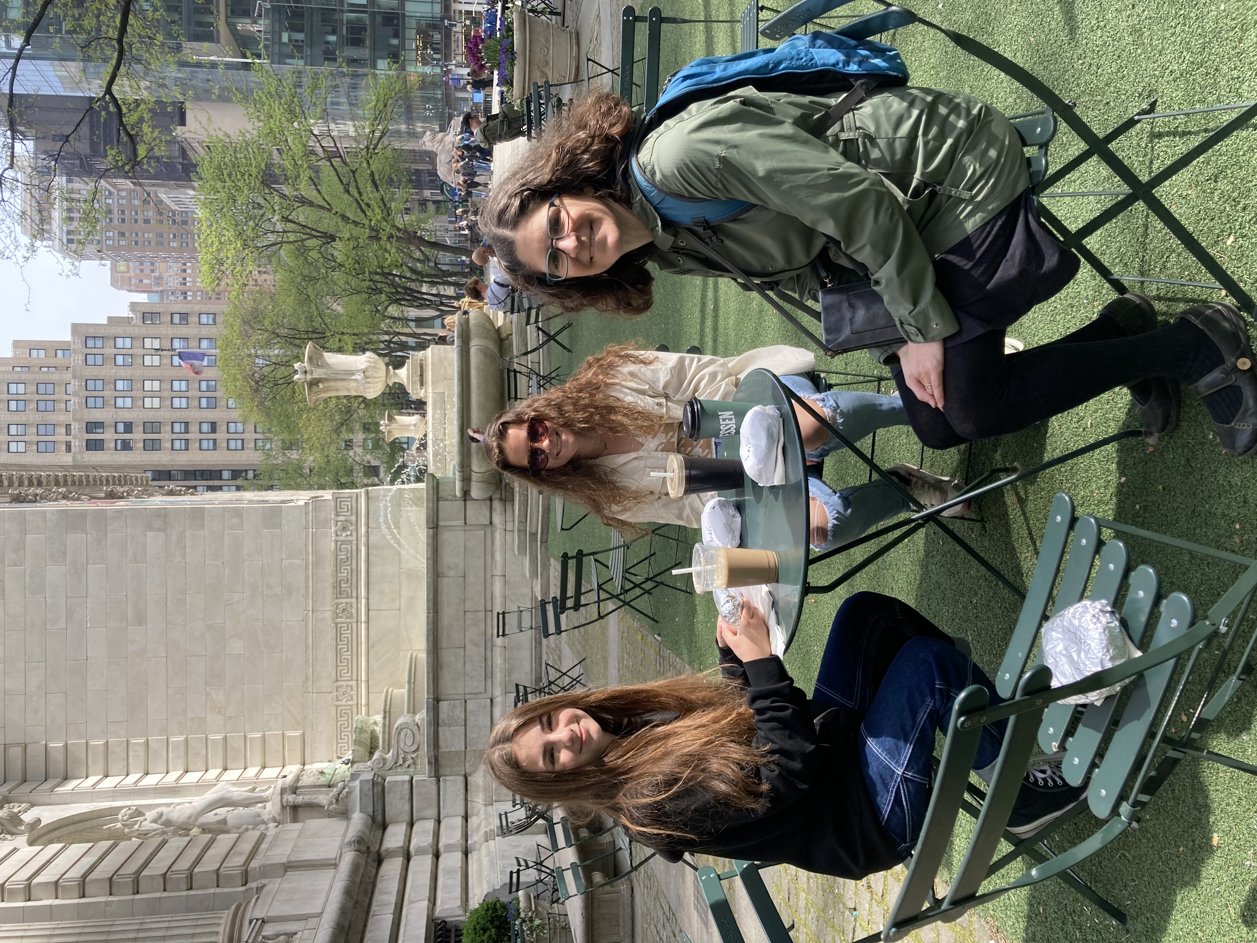
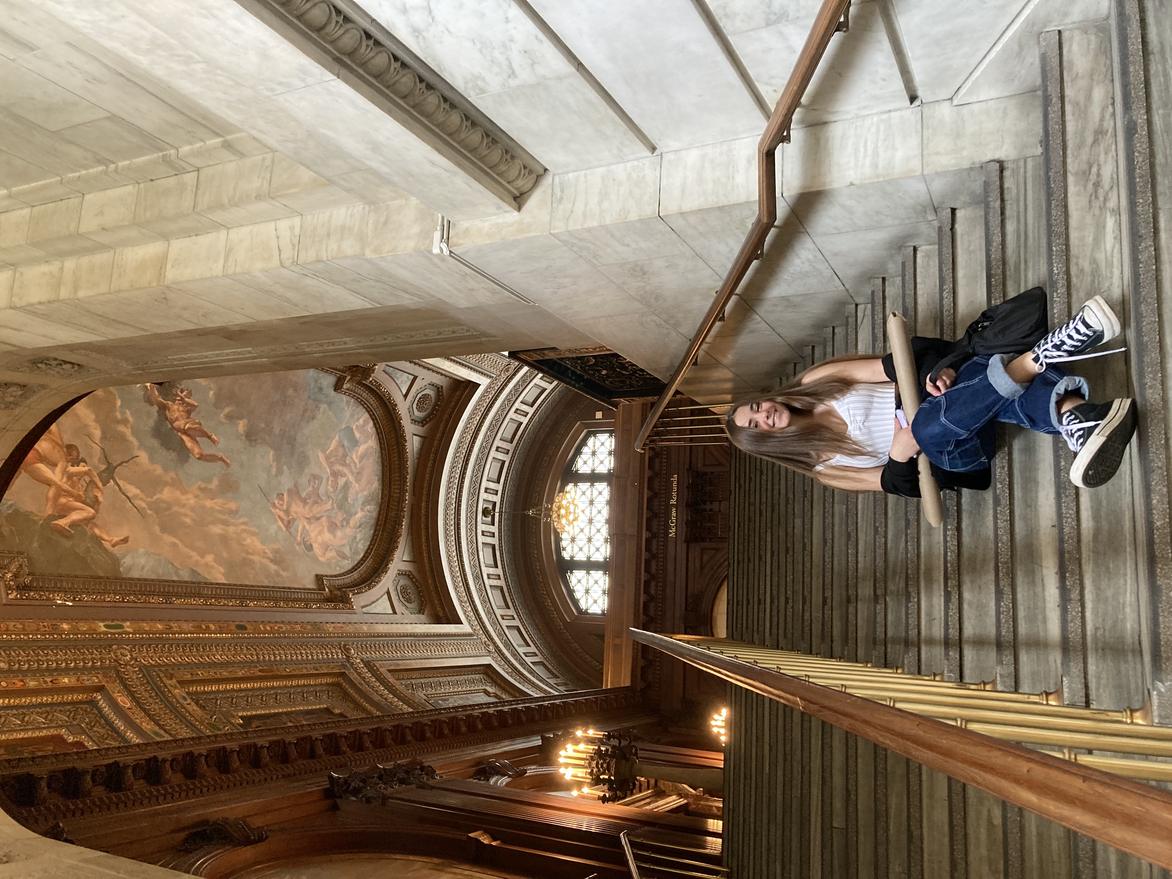
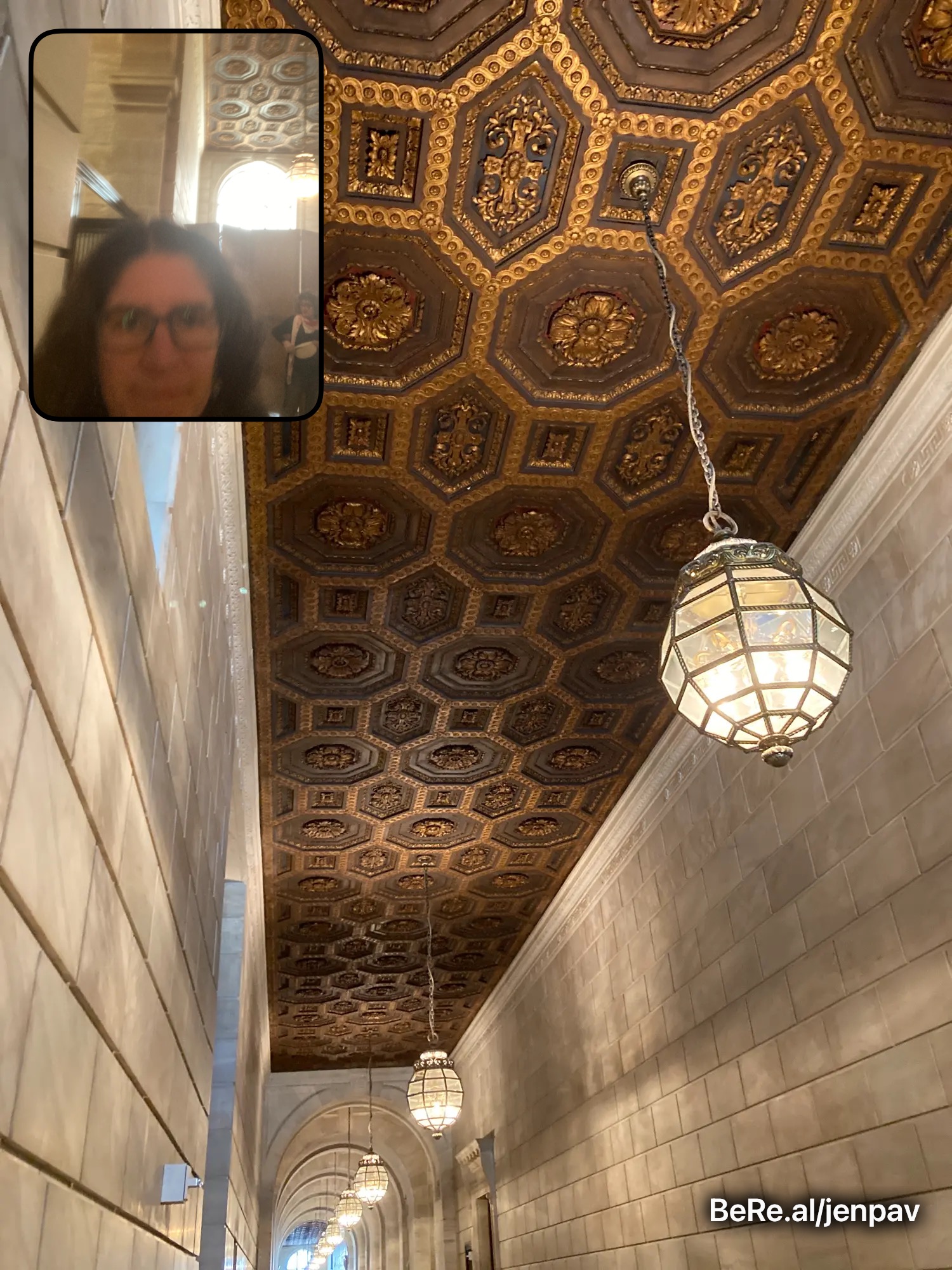
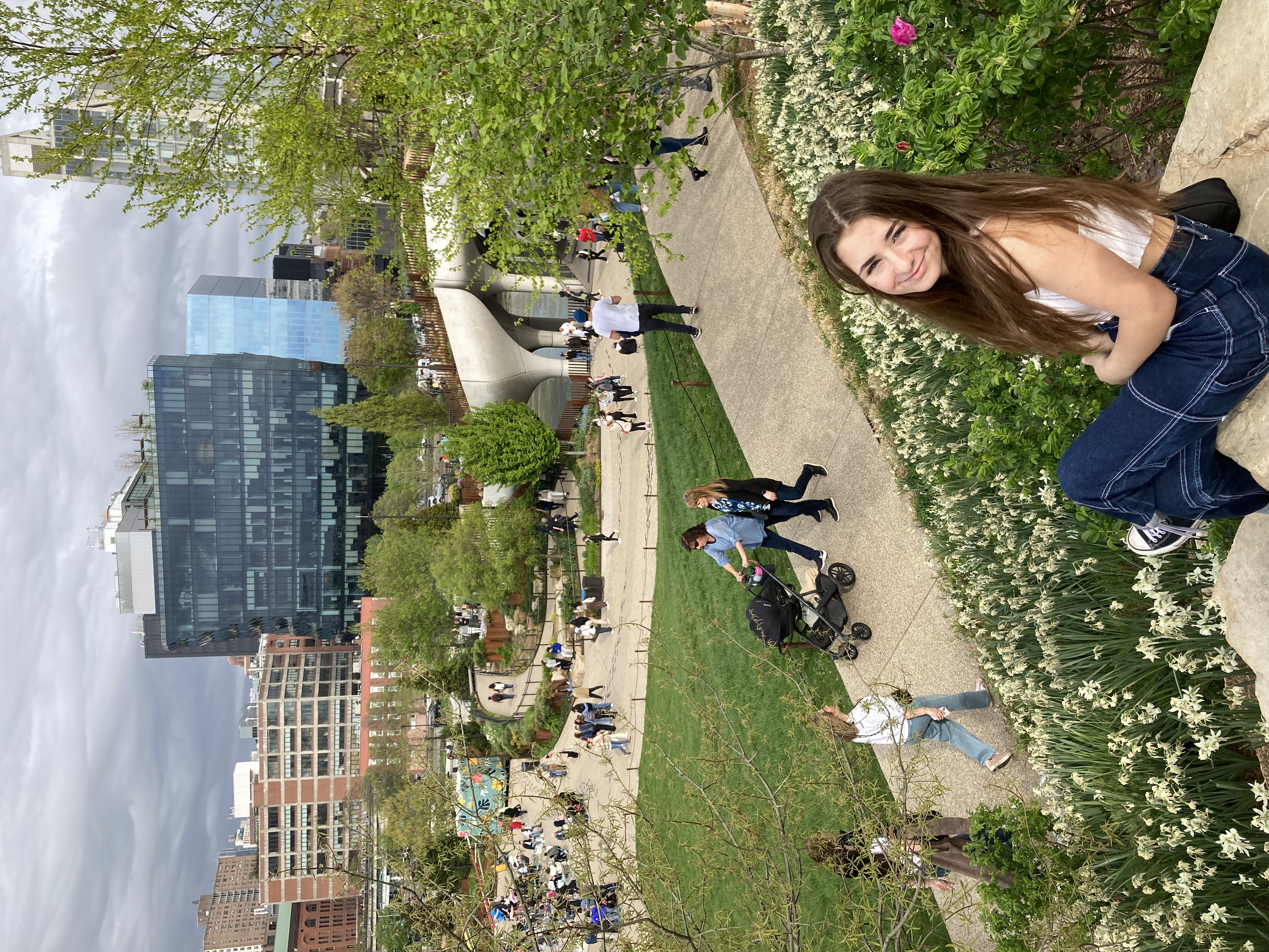
Our first mission was coffee and bagels, which we accomplished without too much trouble.  Luckily we found ourselves right by the NYC Public Library, so we ate in the little park there and then took a quick trip inside.  I love the Hogwarts-style reading rooms and the ornate ceilings.  The girls particularly loved the gift shop.  We came out with a couple of posters in a cardboard tube (which would later provide a fun challenge to protect as we walking long distances in pouring rain).

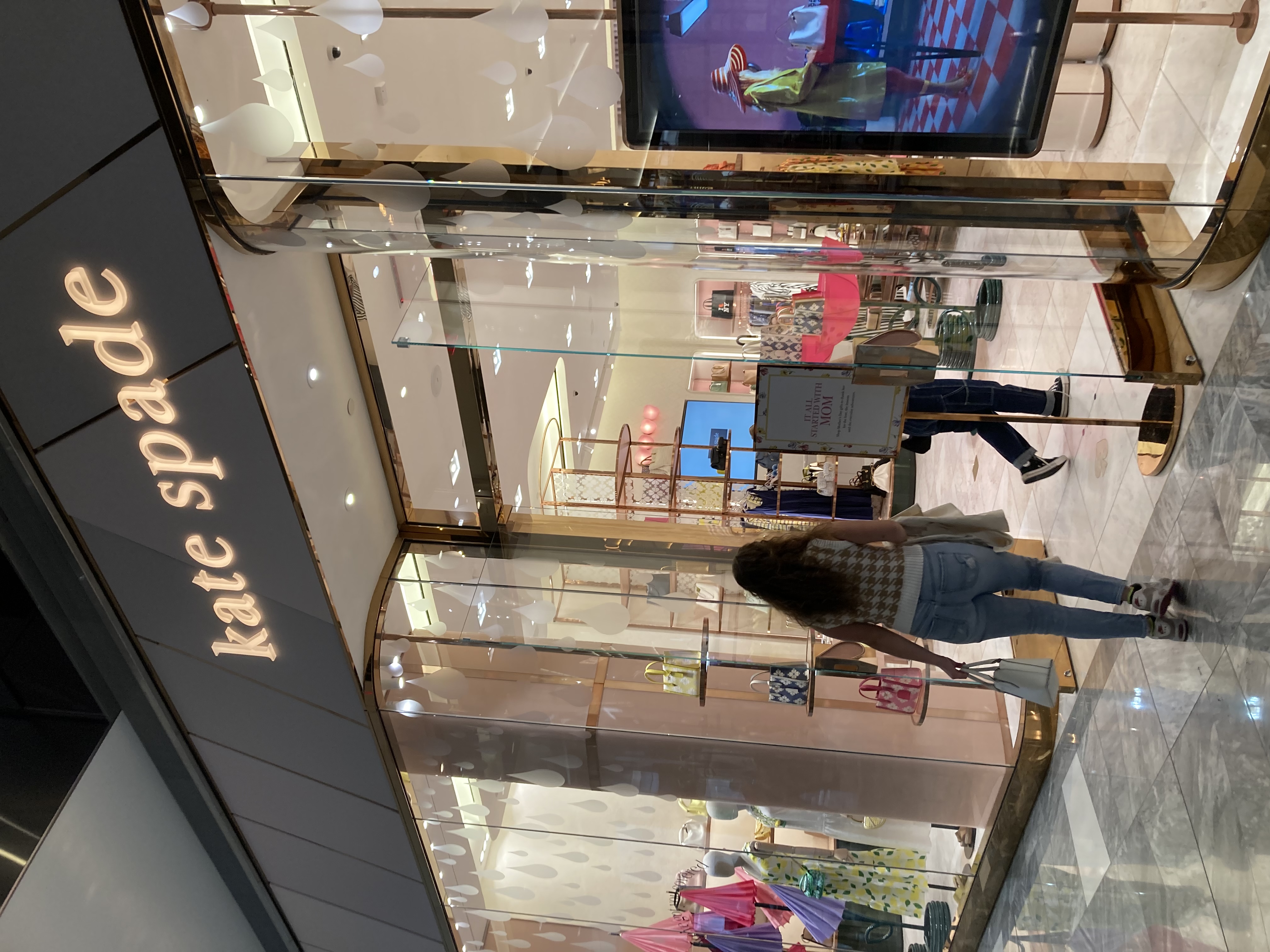
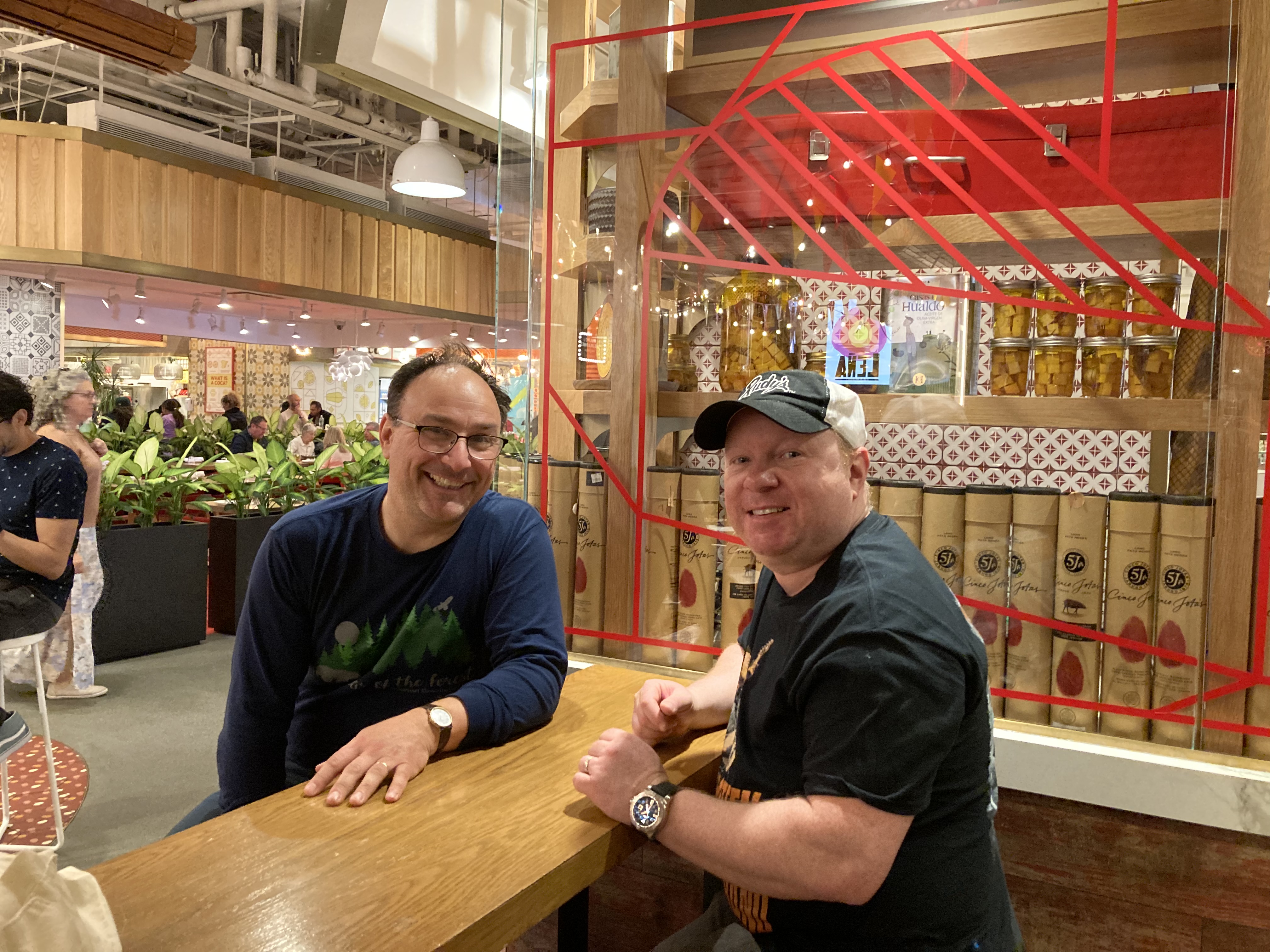
We made our way over to Hudson Yards to meet our friend Justin for lunch.  This is a large mall-type area with very high end stores.  Luckily Zoe, never a big fan of shopping, did not have to suffer through it.  The other girls enjoyed a little browsing even though there was zero chance that we’d be making any purchases.  We had lunch at a cool place called Mercado Spain, with lots of kiosks selling different types of Spanish foods.  We tried a fancy kind of Jamon (apparently from pigs that ate only acorns or something like that), sandwiches, Spanish pizza, 
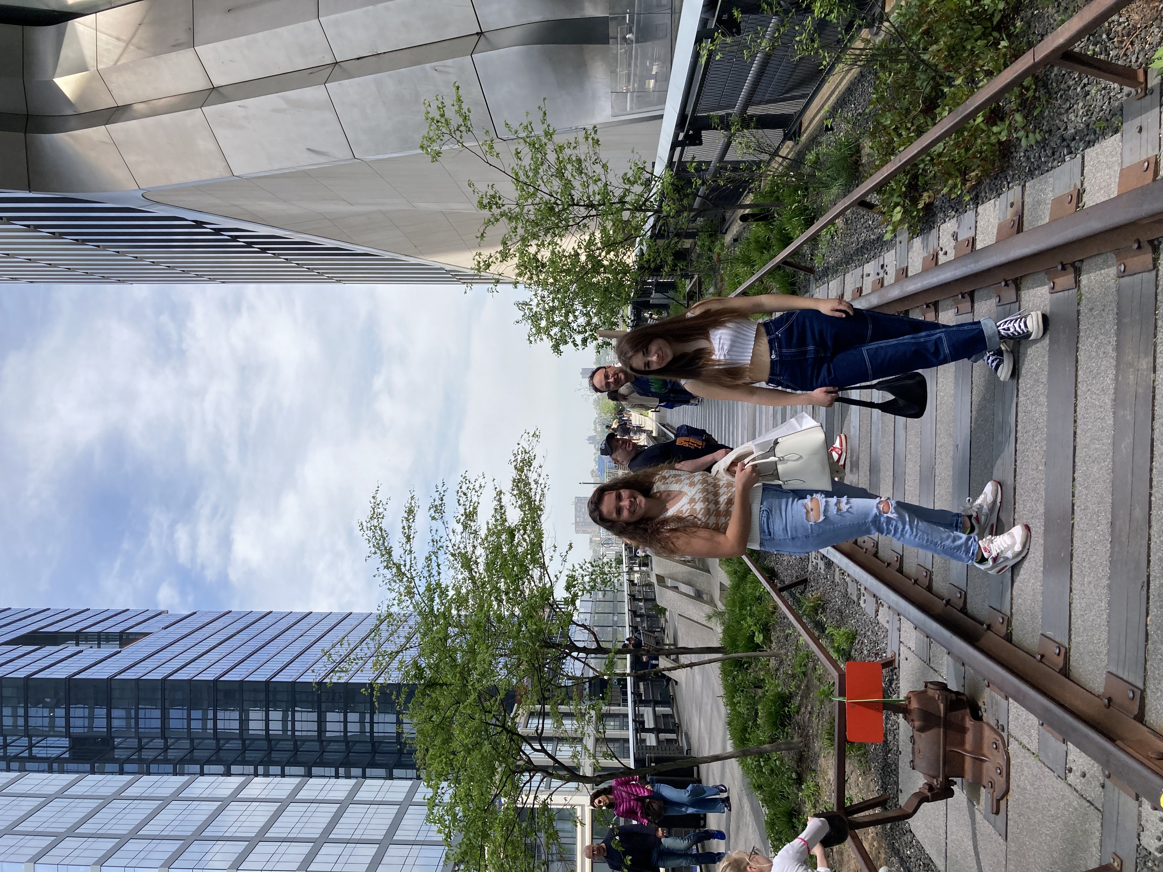
churros, and some desserts.  It was a great success apart from when I tried to order horchata as a treat for us to share, and was instead given a tiny cup of espresso (“cortado”).

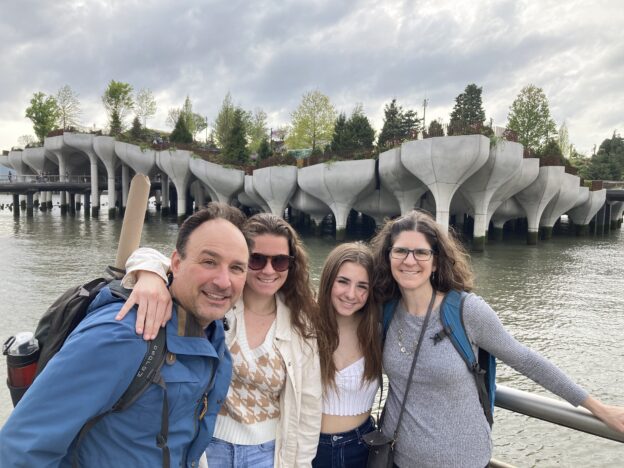
It was a lovely spring day and we spent some time walking the High Line park with Justin and his wife Robyn, enjoying the sunshine despite the mobs of people.  We got down as 
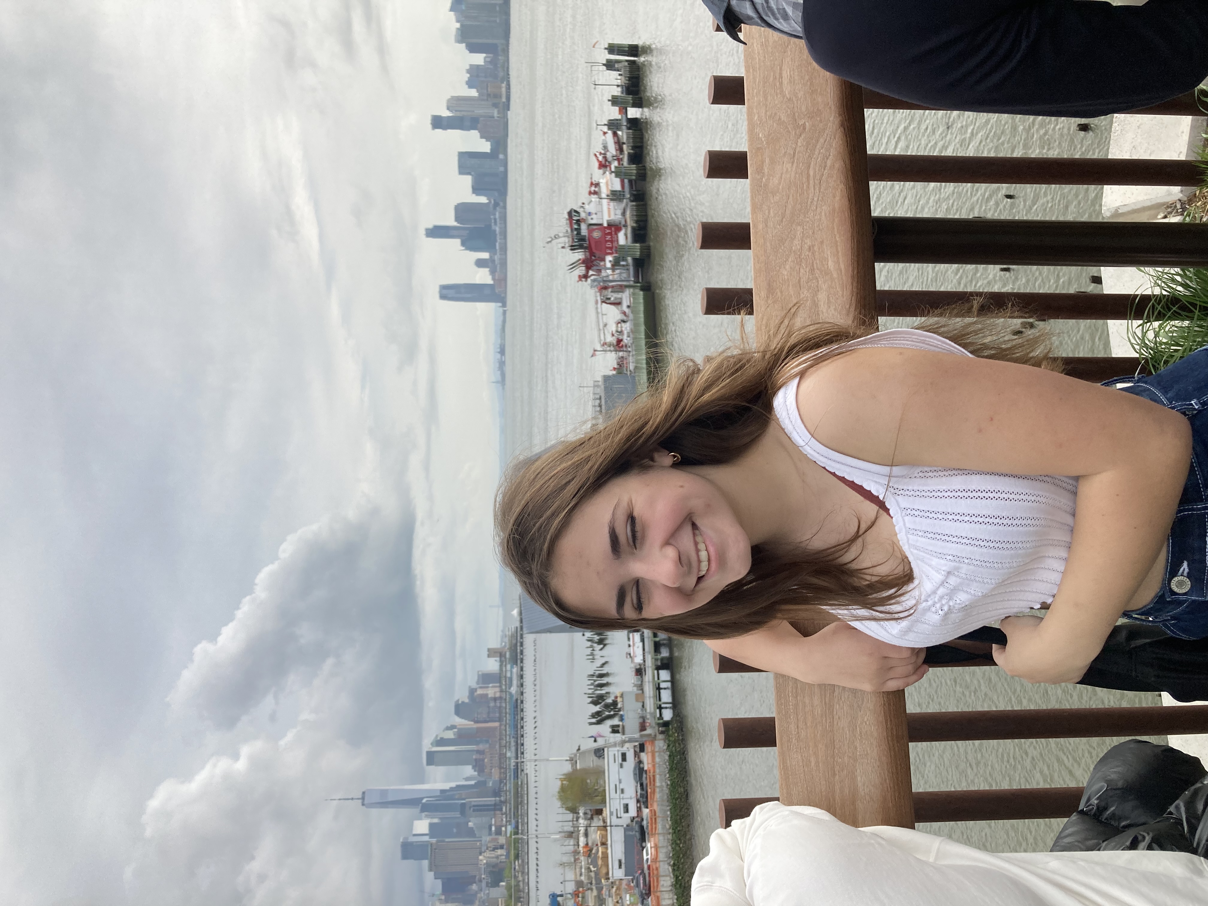
far as Little Island, the quirky new park built entirely on concrete tulip-like supports (see photo at top).  Zoe and I came here in December and had the place pretty much to ourselves, but today it was wall to wall people.  We persevered and fought our way to the top for views across the water and to the Statue of Liberty.

Near the top of Little Island Park

We can always count on Justin, a born and bred New Yorker, to show us something that we never would have found on our own.  This time it was a “sample sale” (a misleading name, according to Justin) for jewelry.  You had to be on a special mailing list to get an invitation, but fortunately Justin and Robyn frequent lots of these sales so they brought us along.  We had to check our bags then go up to a big room, empty except for a large square jewelry counter in the center.  They broke us into pairs and assigned us each our own salesperson, who followed us around on the other side of the counter, helping us look at and try on anything that interested us.  The jewelry was beautiful, and 70% off the sticker price — but however good a deal it was, 70% off of four-figure jewelry was still not something the Pavlik familly was likely to purchase.  Nadia and I had a whispered consultation 
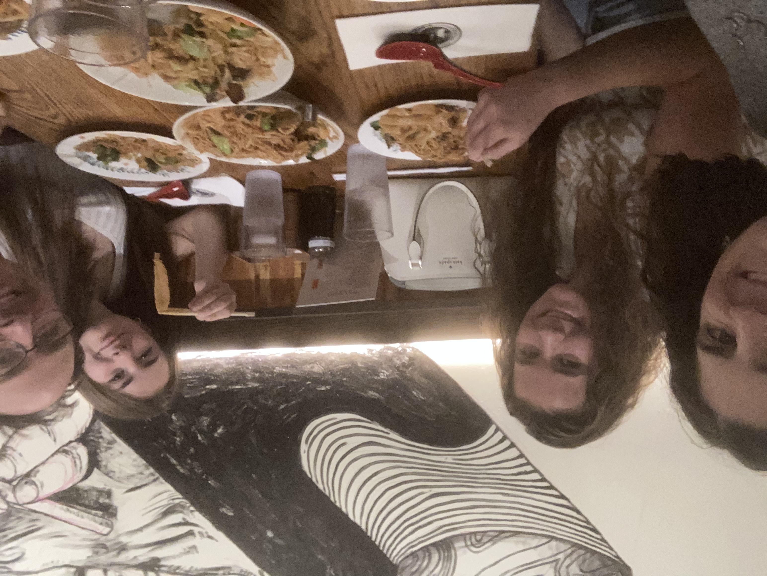
on whether it was more polite to just breeze by and not look at anything, or to give our jewelry minders false hope by trying on jewelry that we had no hope of purchasing.  Luckily we eventually found some more reasonably-priced items that we were at least willing to try on.  (Our salespeople then followed us around hopefully with them on a velvet tray as we finished our circuit.)  I had to 
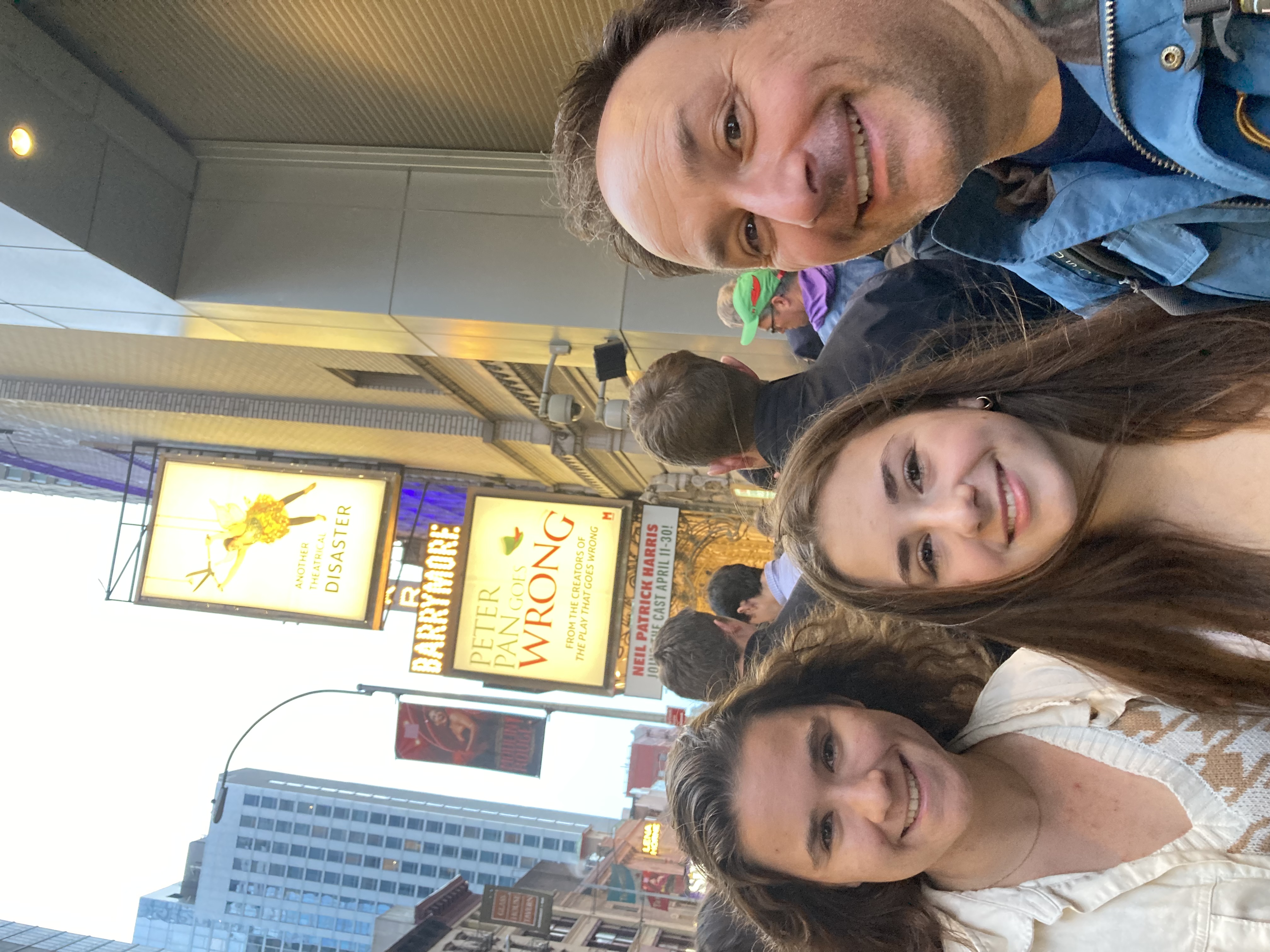
talk Nadia out of a $200 necklace, but Bob and Lanie did make a secret purchase that I think I may see next month.  Regardless it was an interesting experience that we definitely have never had before.

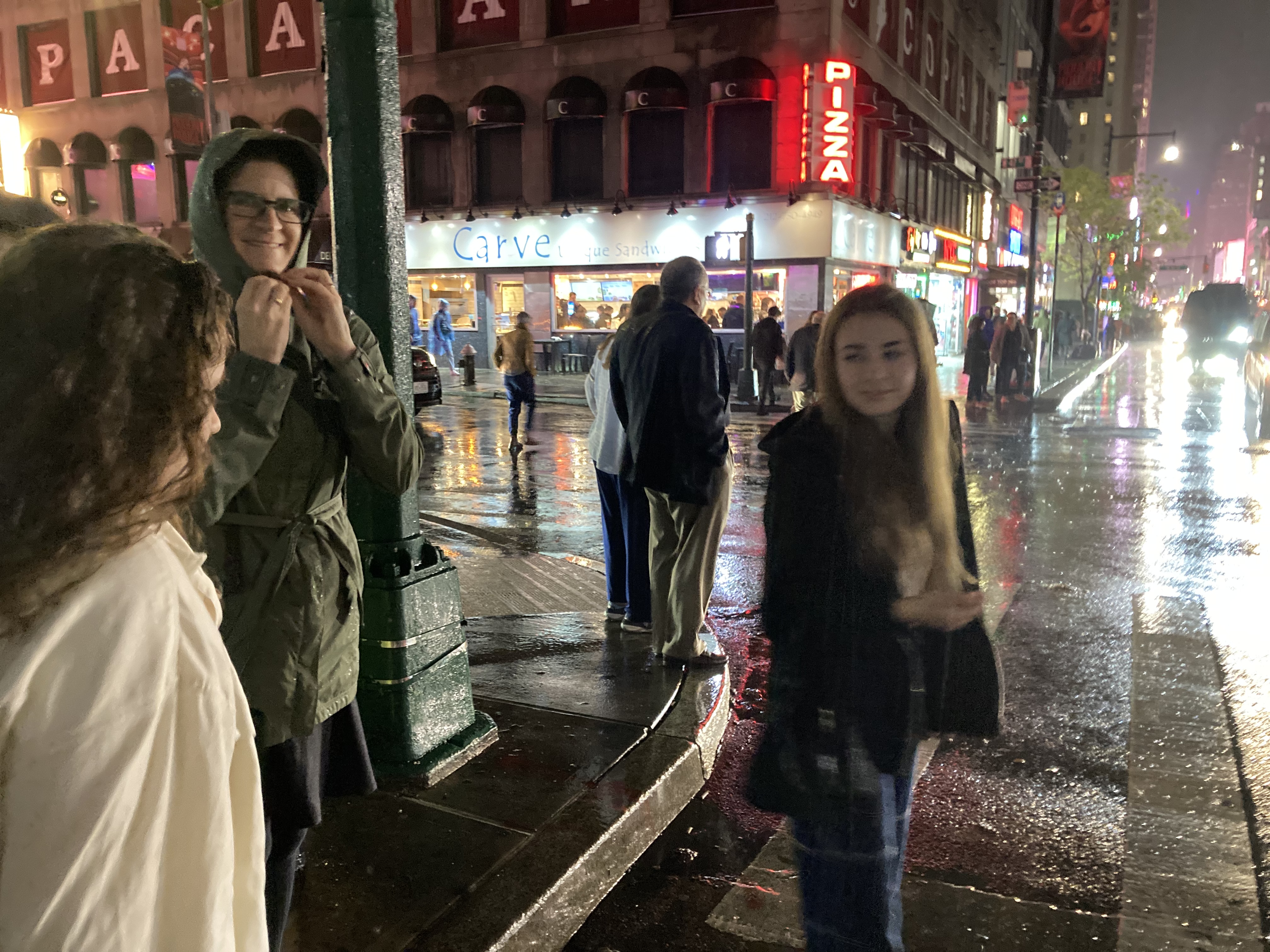
We said goodbye to Justin and Robyn and headed to an old favorite, Kung Fu Kitchen noodle house, also recommended by Justin.  We had a little time between dinner and our entertainment for the evening, the Broadway show Peter Pan Goes Wrong.  We mostly filled this time with a frustrating and ultimately fruitless search for a public bathroom near Times Square.

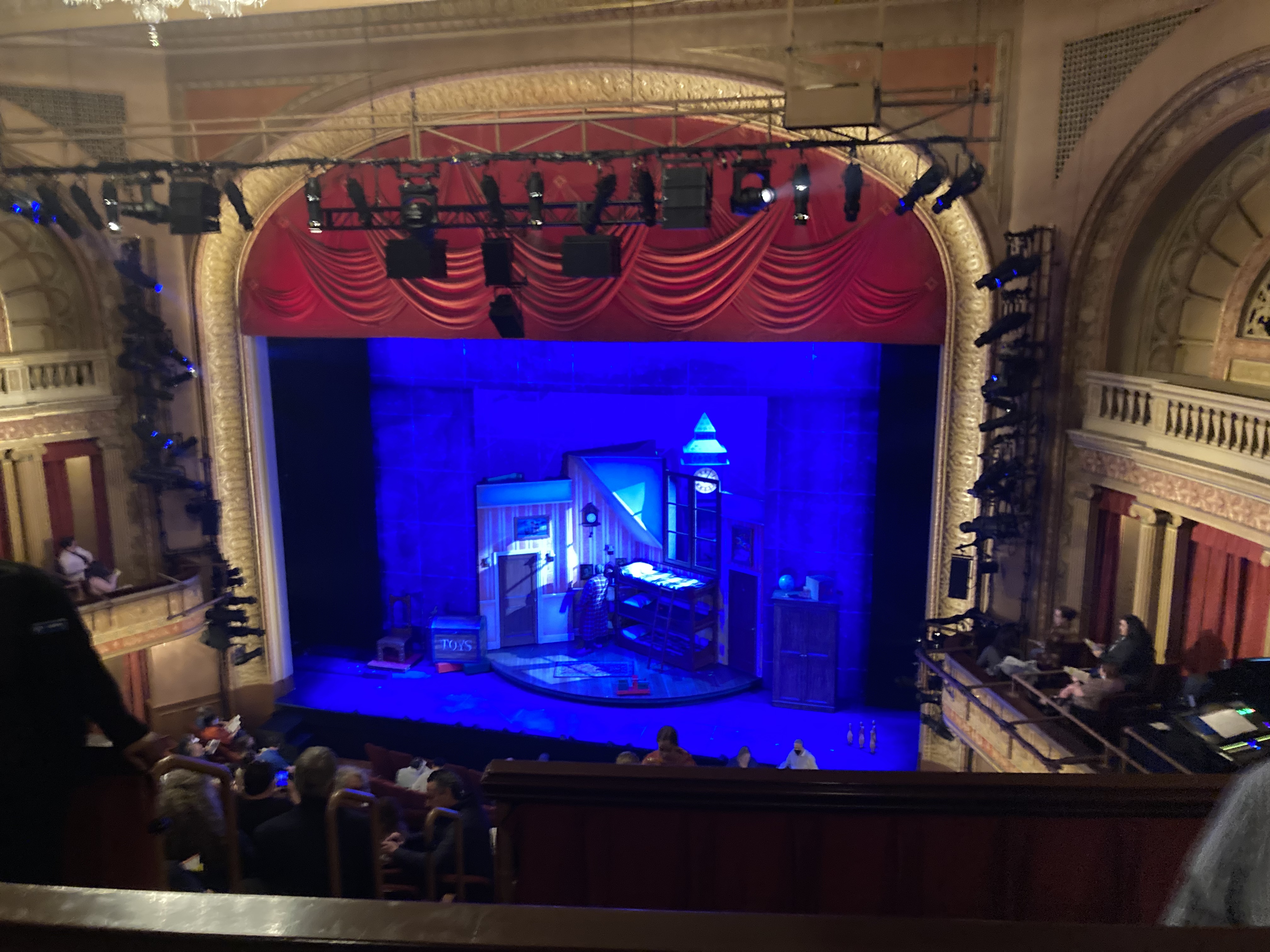
Before things go wrong for the Peter Pan crew

Bob and I saw The Play That Goes Wrong last summer and laughed ourselves silly, so we were thrilled to find tickets to this sister production that just opened a couple of weeks ago.  And for the first few weeks it is featuring guest star Neil Patrick Harris!  We all laughed for two hours straight, while admiring the amazing talents of the cast and crew.

By the time we got out, the rain had begun.  It should have been a fairly quick walk back to Grand Central, but (a) we went the wrong direction, and (b) I was attempting to shield our posters by keeping the long stiff cardboard tube beneath my raincoat, which greatly hampered any kind of quick movement.  (Lanie, who was the one who had 
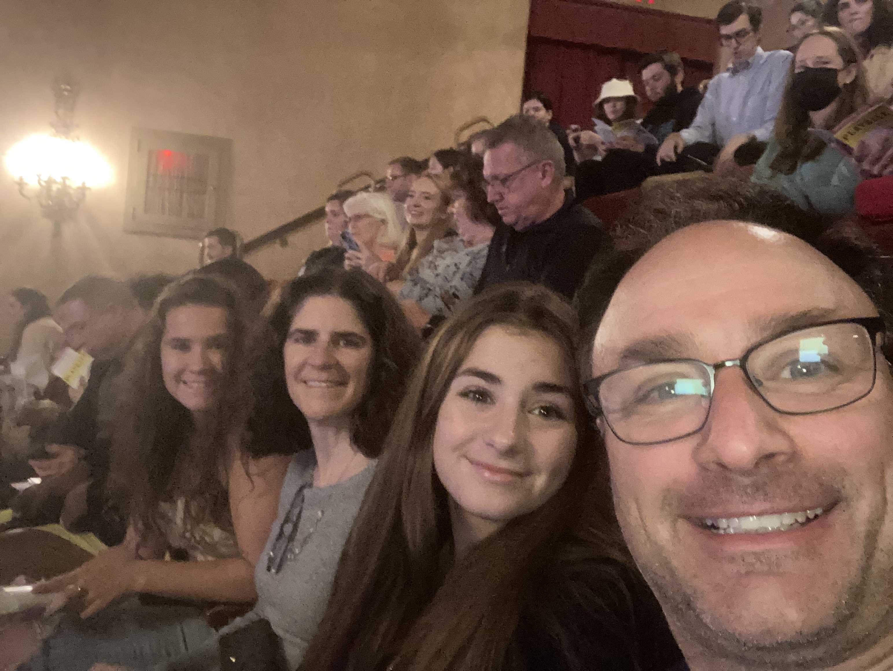
bought the posters, found this all very amusing.)  Luckily through some good luck and superhuman effort we made the 10:38 train with about five seconds to spare.  Less luckily, it was still raining when we got back to Mount Vernon and had to face the 15-minute walk back to our place.  Let’s just say that moods had soured a bit by that point.  But we made it eventually and as far as I am aware the posters are still dry (which is more than you can say for our shoes).


Summing up

We’ve had a few people ask us the details of our itinerary, so I’m listing it here.  Most of the credit goes to Rick Steves, whose suggested path we followed pretty faithfully.  We added in a few stops and took out a few others (mostly museums), and we didn’t visit too many of his recommended lodgings or restaurants (mostly due to price and/or availability), but we drove the route he told us to drive and slept in the towns he told us to overnight in.

And we all agreed that we would do it pretty much the same way again.  I don’t think there was anything on this list that we would skip, and not much we feel we missed out on either.  Most of the places we visited were right on the main route, with ample free parking, bathrooms, well laid-out paths, and informative sign boards.  Everything was clean and safe, and everyone was friendly and helpful.

Not what you would call a LOT of extra space

Our itinierary did involve a lot of driving, but the driving was so scenic that it could often be considered an attraction in and of itself.  Our full-sized sedan managed to fit five of us, plus all our stuff, in semi-comfort, and the middle-seat-rotation system that we worked out with the girls prevented too much strife in the back seat.

Making it all the way around the ring in 9 days meant staying on the move.  We spent only one night in each place, except for Lake Myvatn, where we stayed one extra night to see the many attractions in the area.

We stayed mostly in guest houses, which are kind of a cross between a hostel and a hotel.  We had our own room or rooms, but usually shared a bathroom and had access to shared kitchen facilities.  This proved to be valuable since restaurants in Iceland are so expensive, and for occasions where we were too late/too tired to go out.

Of course this involved a spreadsheet

This was an excellent destination during Covid times.  Iceland’s vaccine rate is very high and Covid rate was low (though this was starting to change towards the end of our trip).  Vaccinated Americans (as of this time) can enter the country without needing to test or quarantine.  To get back to the US, we had to present a negative Covid test, but Iceland simplified this by having a rapid test site (15 minute results) right next to the airport.  We spent the vast majority of our time outside — for the most part, we were only indoors in our hotel room (we even ate mostly outside) — so our exposure risk was low in any case.

For most of our trip, we were able to almost forget about the pandemic.  Other than hand sanitizer prominently displayed at the entrances to many hotels and restaurants, there didn’t seem to be many precautions in place.  But in the last couple of days, we saw a change — more masks and more caution.  We’re not sure if this is because we were in the more populous capital area, or because the state of things had worsened during our week.

Day 1: Keflavik airport to Borgarnes

Day 2: Borgarnes to Siglufjordur

  • Hraunfossar & Barnafossar waterfalls
  • Haalfell Goat Farm 
  • Grabrok Volcano Crater hike
  • Stroll around Siglufjordur
  • Lodging: Herring House guesthouse

Day 3: Siglufjordur to Lake Myvatn

  • Akureyri – botanic garden & walk; lunch
  • Godafoss falls 
  • Namafjall Geothermal Area 
  • Krafla Geothermal Valley
  • Leirhnjukur Volcanic Cone hike
  • Viti Crater
  • Lodging: Elda Guesthouse

Day 4: Around Lake Myvatn

All the attractions below except the nature baths are on a loop right around the lake.  I was originally hoping to do this by bike, but we were daunted when we saw the narrow, shoulderless road and fast-moving traffic.  It was just as well, since we encountered a fair amount of rain in the afternoon and ended up not having a lot of extra time (partly due to our kids’ chronic inability to get up early in the morning).

  • Hverfall Crater rim hike

    The Old Hospital was the loveliest place we stayed.

  • Dimmuborgir Lava Formations
  • Hofoi Promontory
  • Skutustadir Pseudocraters
  • Myvatn Nature Baths
  • Lodging: Elda Guesthouse

Day 5: Lake Myvatn to Seydisfjordur

  • Horseback ride at Safari Stables
  • Dentifoss Falls
  • Rjukandafoss waterfall
  • Stroll around Seydisfjordur town & lagoon
  • Lodging: Halfadan Old Hospital Hostel

Day 6: Seydisfjordur to south of Hofn

  • Roadside stop at unnamed pebble beach
  • Jökulsárlón Iceberg Lagoon
  • Fjallsárlón Iceberg Lagoon boat tour on Zodiac raft
  • Diamond Beach
  • Lodging: Gerdi Guesthouse

Day 7: South of Hofn to Hafnarfjörður (Reykjavik suburb)

  • Skaftafell Natl Park 
  • Reynisfjara Beach
  • Seljalandsfoss waterfall
  • Lodging: T10 hotel

(We intended to stop at the Lava Center museum at the end of the day — Rick Steves claimed it was open late — but found that it unfortunately had closed at 4.)

Day 8: Hafnarfjörður to Keflavik airport

  • Downtown Reykjavik
  • Covid test
  • Flight home!


Coming full circle

It’s hard to believe it’s already our last full day in Iceland.  Making it all the way around the island has made for a pretty busy schedule, but our Rick Steves Iceland book has not led us astray and there’s really nothing we would have skipped or done differently.  It’s been a lot of driving, but the scenery has been so incredible throughout that we don’t really mind (despite the unnerving lack of guardrails).

Last night we stayed at a guest house in a pretty remote area on the southeast coast — our room even had a view of the chilly, gray ocean.  As we set out today down the lonely road, with mile after mile of nothing but mountains, ocean, and the occasional sheep, we started to get a bit worried about where we might next find a gas station.  Fortunately when I was finally able to get phone reception and ask Google, Google managed to materialize one literally about a quarter mile down the road.  (There was a little difficulty about the shared payment kiosk and Bob accidentally paid for the gas of some French person, but luckily the French person was nice about it and handed him a wad of cash to compensate.)

Puffins in flight

Relieved of our worry that we might need to hitchhike to Reykjavik, we were able to enjoy our visit toSkaftafell National Park.  It was a raining for much of our drive today and threatened to start again anytime, so we contented ourselves with a short and easy hike to get up close to one of the tongues of the glacier.  We were rewarded with lots of wildflowers and another remote iceberg lagoon.

Our next stop was the spectacular Reynisfjara Beach, with its pebbly black sand, amazing rock formations, and abundant bird life — including a colony of puffins nestled in the rocks high above us.  The sky was full of hundreds of wheeling birds — graceful ones that glided smoothly through the air, and madly flapping puffins with their short wings and red feet.  The beach had towering basalt rock columns (perfect for climbing) and intricately shaped caves. It was also one of the most crowded places we’ve been — we’re definitely noticing the difference it makes being within day-trip distance of Reykjavik.

Lastly there was one more waterfall.  We’ve been talking about how we’ve seen so many waterfalls here, but all of them have been different.  Today’s was a tall, delicate stream falling straight down over a concave area, allowing you to walk around behind it.

By evening we’d made it to our hotel in the suburbs of Reykjavik.  It’s in kind of a weird area — sort of light industrial — and did not look particularly appealing from the outside.  But our room is surprisingly nice, with hardwood floors, ample space, a couch, refrigerator, and our own bathroom.  We made a quick trip to the nearly Noodle Station for dinner (a local chain with only one thing on the menu — Vietnamese noodle soup) and a trip to the town center on the waterfront in search of ice cream, and the evening was complete.  Tomorrow we explore Reykjavik for a few hours, then it’s off to get ourmandated Covid test en route to the airport.

Excellent views with a side of terror

You can see us trotting happily along before things turned terrifying.

As Bob mentioned yesterday, we ended up canceling our 4 pm horseback ride due to the rain (which my iPhone told me was going to last for hours, but which actually cleared up about two minutes after I made the phone call).  All was not lost, however, because we had a little extra time this morning and were able to squeeze in a 10 am ride before hitting the road.

Bob elected to skip this one, which was probably for the best.  We meandered through stunning scenery, until we rounded a bend and found ourselves right on the edge of the lake — or, I should say, quite a long ways above the lake, with a very narrow path and a sheer drop off to our right.  Our guide told us we were riding on the edge of a pseudocrater, which is a large, round bump that was formed long ago by bubbles in lava flows.  Nadia and I were both very concerned

The walk to Detifoss, through cool rock formations.

about our horses taking a wrong step and plunging us down the slope into the waters far below, but fortunately they handled it like pros.  This was not a trail that would be considered suitable for beginners in the U.S.  (“No one has ever fallen off,” the woman who runs the farm later told me cheerfully.  “If they did, we probably would not go there anymore.”)  My midge-proof head net, which was actually necessary for the first time, blew off my head and I barely even noticed.

We were also supposed to experience the “tolt”, which is a special gait unique to Icelandic horses.  It’s kind of like a trot but supposedly much smoother and more comfortable for riding.  I was very skeptical about this, because I found it plenty bumpy, but the kids later told me that my horse was rebelliously trotting rather than doing the tolt.  Between the cliff ride and the trotting, I spent most of the ride holding onto the saddle with both hands like grim death.


After thanking our horses and our guides, and a quick visit to a week-old baby horse that our hostess was kind enough to introduce us to, we hit the road again.  Today we made our way from the inland lake back out to the east coast, to an area called the Eastfjords.  All along our route, you could barely turn your head without seeing a spectacular waterfall.  The most spectacular of all, Detifoss, was a bit off our route, but well worth the detour.  Google tells me it’s the most powerful waterfall in Europe, and this is easy to believe.  Just a short walk down the road is another large waterfall, Selfoss — somewhat less powerful, but probably even more beautiful.  We’ve been really struck by all the different waterfalls we’ve seen here — from massive, thundering falls to tall, lacy cascades.

Seydisfjordur

We had to cross another high mountain pass on our way to our destination, Seydisfjorder.  All our drives have been pretty breathtaking, but this one probably takes the prize.  What with the steep drops and lack of guardrails, despite the beauty it was a relief to drop back down to this quaint little fjord-side town.

We loved Seydisfjorder — a tiny, colorful village at the innermost point of the fjord, surrounded on three sides by high mountains streaked with waterfalls — from first glance.  Our hostel is called the Old Hospital, and is in a beautifully restored historic building.  There is a sauna in the basement and white-capped mountains towering outside our windows.  We were almost disappointed to not be cooking dinner tonight, when we saw the lovely kitchen and dining areas on the first floor.

Luckily (especially since the grocery was closed) we actually managed to eat inside a restaurant for the first time on the whole trip.  (Normally this would be because Bob and I are being cheap — the food here is VERY expensive — but really, this time around we’ve tried several times and been foiled for one reason or another.)  A short stroll around the town and its lagoon, and we’re ready to call it a night. Onward and southward tomorrow!

Waterfalls, gardens, volcanos, and a big lake

View of Akureyri from possibly the world’s most scenicly located gas station

To make it all the way around Iceland in the course of our week here, we have to keep on the move almost every day.  We’ve been hampered a bit by our seeming inability to get up at a reasonable hour of the morning.  My assumption going in was that Bob and I would be up bright and early, ready to go for a stroll and maybe work on our blog before the kids arose.  But our sleep schedules haven’t quite arranged themselves, and we’ve been sleeping late too.  Competition for bathrooms (we’ve been staying in guesthouses with a shared bath) has also slowed down our morning progress.  So once again it was close to 11:00 before we managed to hit the road from Siglufjordur.


Strolling above the fjiord in Akureyri

After a quick stop for coffee and pastries at what was billed as “Iceland’s most popular bakery”, we were again on our way. Our progress down the winding roads was sped up a bit by two very long tunnels, burrowing deep through the mountains that line the fjords.

Our first stop was the cut little city of Akureyri — Iceland’s second largest city (though that’s not saying much).  We took a stroll through the charming streets and up the steps to the art deco church.  At this point we were high above the fjord, with the sweeping views that are the norm here.  After a stroll through the botanic garden and some delicious grilled sandwiches in the town square, we were ready to move on.

Godafoss Falls

Next stop: Godafoss Falls, yet another impressive waterfall right along the main Ring Road.  Iceland has done an excellent job with these roadside attractions — there are lots of paths leading to different viewpoints above and below the falls, and the option to descend down to a black sand beach near the base.  There’s a footbridge over the river to allow views of the horseshoe-shaped falls from both sides.  (We had to wait to cross it to allow the large group of horses to be marshalled across.)  Zoe would have stayed here all day if she had the option, and watching the powerful falls was mesmerizing.

Our route has now taken us away from the coast, to our next destination at Lake Myvatn.  After a quick stop to check in at our guest house near the lake, we headed a bit further along the road to the nearby geothermal and volcanic area.  (Even when we get a late start, we can get a lot of sightseeing in since it barely gets dark here.  In fact, I haven’t seen darkness at all — even when I was awake at 2:15am last night.)

The Namafjall Geothermal Area is the Icelandic Yellowstone — steaming craters, boiling mud pits, dazzling colors, and choking sulphurous air.  It’s not nearly as crowded or developed as Yellowstone, though, and you can get up as close to these attractions as your nose can bear.

A little further up the road is the Krafla Geothermal Valley.  The first interesting site you come across is a functioning shower in a parking lot in the middle of nowhere.  No one seems to know who erected it, but it’s hooked up to the geothermal spring beneath it and seems to be perfect showering temperature.  Continuing along past the huge geothermal power plant located here, we came to the Leirhnjukur Volcanic Cone.  This provided an amazing hike.  The crater itself was pretty impressive, but we were able to continue past it into the lava fields that stretched out as far as we could see.  The lighting always seems to be very  dramatic here, with lowering clouds and occasional bursts of sunbeams, and we could see forever in every direction.  We spent a lot longer here than we planned, but we couldn’t drag ourselves away.

There was one more stop along the same road — Viti Crater.  This is yet another crater, this one containing a bright blue lake, that Iceland has helpfully built a hiking trail all around.  However, the day was getting late and some of the troops were growing mutinous, so we contented ourselves with

Viti Crater

walking the fifty feet from the car to the crater’s edge, having a quick look at the lake, then retreating back to our guest house.  It made for another late dinner, but fortunately we’d learned our lesson in Siglufjordur and secured provisions from the nearby grocery before heading out.  The girls produced a delicious pesto alfredo pasta from the guest house kitchen, and all was well.

Starting off with a bang

    We’re in Iceland!  It’s strange and amazing to have been able to take an airplane somewhere.  And Iceland seems to have been a great choice.  I read yesterday that their full vaccination rate is over 85%, so we’re safer here than at home.  And after showing our own vaccination cards at the airport, we’ve been free to roam the country without tests or quarantining.

It was only a 4.5 hour flight to get here.  We were a little nervous that all the pieces would fall into place, but the whole process was very smooth.  Despite our worries, our carry-ons were not declared to be oversize or overweight.  (Checked bags cost $60 each way, so we relied heavily on carry-ons.)  They invited us to check them for free, so we didn’t even have to fight for space in the overhead compartments.  We took off from Boston right on time at 8:50 pm, and barely had time to close our eyes before touching down in Iceland at 5:15 am (1:15 am NH time).  Our bags appeared quickly and before we knew it we were behind the wheel of our rental car.

Our normal strategy when flying overnight to Europe is to power through the first day then go to bed early and sleep for 12+ hours, then wake up at a normal time and (hopefully) be done with jet lag.  Iceland made this very easy for us to do.  Two of our top destinations were close to the airport, so those were planned for Day 1.

After fortifying ourselves with ham and cheese croissants and coffee from a 24-7 gas station (the nearby cafes and grocery store unaccountably not opening until 11am), we set off into the Keflavik countryside in search of the Fagradalsfjall volcano.  This has been erupting since March of this year, and we’ve been enthralled watching youtube videos of fountains of orange lava splashing above the cone, and lava rivers spilling into the adjacent valleys.  The eruptions have been slowing down lately, with long periods of relative inactivity, so we were crossing our fingers that our timing would be lucky.

When your plane lands at 5:15 am, you tend to beat the crowds.  There were only a few cars in the parking lot when we arrived, and we were not entirely sure we were in the right place.  Iceland and some nearby landowners have built walking trails around the volcano to allow for viewing access (and new routes have been constructed a few times, as old ones are overtaken by lava flows.  We geared up in all our warm layers, plus hats and gloves (it’s pretty cold here, especially early in the morning!) and set off down the trail with a few other early birds.

Soon a large lava field came into view, with black lava coming over the nearby hills and stretching across the valley.  The scenery was beautiful even if there was no volcano at all — otherworldly mountains stretched out in either direction, and the gray ocean spread out behind us.  There were no trees to block our view.  And, after hiking an hour or so, we summitted a small peak and were rewarded with a view of orange lava flying up and splashing down into a distant crater.

After a few minutes of observations and pictures, we continued up the next (very steep) peak and lost our view of the lava for a while.  We continued on and on, and still — no lava.  Eventually we realized that the morning’s eruption had stopped.  We regretted the extra minutes we’d spent at the gast station and in the parking lot, which prevented us from getting a close-up view — but were very happy that we’d gotten to see it at all.  We continued hiking quite a ways further — rewarded with the sight of orange lava flowing down a distant hillside — but the volcano didn’t start up again during the next couple of hours before we left.  By the time we were on our way out the paths were thick with tourists, so we hope that they evetually got rewarded.  (Also, alas, the old lava flows that we were able to access were not hot enough to roast marshmallows over, as we’d seen others do on youtube.)

The view from our lodging

Next stop: the nearby and world-famous Blue Lagoon.  Things are less crowded than usual this year, so we were able to give them a call and head straight over there without waiting for our reservation time.  The warm, mineral-rich waters were just what our tired legs needed and felt wonderful against the chilly air.  The sun had emerged, and it was blinding in the whitish waters of the lagoon.  It was a somewhat pricy excursion (except for Lanie, who scraped by under the policy that 13 and under is free), but we enjoyed our included silica mud mask treatments and “free” drink at the swim-up bar.  (Bob and I sampled Gull, a local beer, after the people in line in front of us warned us against the cider being too sweet — and were not impressed.)

Then it just remained for us to make the hour and a half drive to our first night’s destination in Borgarnes.  We’ve taking a week to drive the Ring Road around the perimeter of the country, so we wanted to get a slight head start rather than staying near the airport.  After a night of no sleep, a long hike, and a soothing soak, it was a little challenging to stay alert, but we made it.  We unanimously agreed to skip finding a restaurant and instead visited a Bonus supermarket along the way for frozen ready-to-eat meals as well as breakfast provisions.

Soon we had driven down a gravel path, past roadside sheep and ponies, and were ensconced at our airbnb, a farm right on the ocean across an inlet from the city of Borgarnes.  Most of us were in bed by 7pm.  (And then briefly up a little while later, when Zoe awoke at 9:30pm and thought it was 9:30am.  It stays light almost around the clock here, so it’s hard to assess the time.)

Trails of Durham: April edition

April 3: We see two bald eagles on the Durham Greenway

Given that we’ve been stuck pretty much in the same place for over a year, it’s tempting to wish ourselves somewhere else.  But, really, we’ve got everything we need right here.  Look at all the great hiking experiences with in few miles of our house.

AND LOOK AT THESE TWO BALD EAGLES WE SAW ON OUR MORNING WALK TO THE TOWN LANDING THIS MORNING!

No, that’s not Alaska.  That’s the two tallest trees looming over the Three Chimneys Inn.  The two tallest trees looming over the Three Chimneys Inn were each adorned with it own bald eagle this morning, and we were there to witness it.

It was not the first time we saw a bald eagle on our walk along the Durham Greenway, but it was the first time we, or probably anybody else, saw two awesome bald eagles standing out in full relief against the light blue morning sky over our town, which is in New Hampshire and not Colorado, or somewhere else where one might expect to see such a thing.

God Bless America.


April 18: Moharimet Woods/Powder Major Trails 

Technically, this walk is not in our back yard, but major portions of today’s hike were extremely familiar.  We have had an association with Moharimet Elementary school since at least 2006, when Zoe started kindergarten there.  I currently walk a portion of the trails every day (at least twice) for work.  I was able to show off some the trees kindergartners and I identified and tagged last fall.

Then we hit the portion of the walk — leading up to and circumnavigating Tibbets Field — that were part of the high school cross country course when Zoe was an underclassman.  The U10 girls soccer team that was practicing did not seem to notice us as we went by.

After that, we entered the woods on the far side of the fields for some unexplored territory.  The Powder Major Trails are pleasantly flat, sufficiently wooded, and wonderously complex.  That is to say that beyond  three or four marked trials the property is honeycombed with seemingly dozens of paths.  Many of them beckon exploration.

They also seem to defy explanation.  Is this an snowmobile park?  Was there a neighborhood here in colonial times?  Was this land once worked by generations OCD farmers?  How many people are at this moment wandering the side trails of the Powder Major Perseve, trying to find their way out?

Fortunately for us, the map we have in the Trails of Durham folder shows some of this intricacy.  We noticed all the lines and made firm plans to stay on the yellow-blazed trail that follows the perimeter of the preserve;  we would stick to the yellow trail even if presented a whole field of poppies.

So we were alright.

Though there was a left turn that promised exposure to even deeper, darker Madbury.  Who knows what was waiting in that direction.  Maybe even Lee.  It will have to wait for another hike.

We stuck to our plans, and, despite all the trails we did not walk down, we still managed to rack up a four-mile loop.


April 24: John Hatch Park/snow mobile trails/Audubon Society preserve

Local hiking does not get the attention it deserves from the extreme sporting community.   Not only is there addictive thrill of seeing what’s behind the next turn.  There’s also the not-entirely-uncommon threats to life and liberty — actual threats to actual life and actual liberty — that we encounter on the trail.  Within the past year we’ve verbally threatened with gun violence for wandering on the wrong trail.  It’s a trail we won’t be wandering on again.

Mostly, though, the threats come in written form, like the sign we saw along the banks of the Lamprey River.  The sign was near a gate and a fence that not only blocked our path but extended all the way down to the river.  Someone was taking no chances that we might ignore the sign that promised prosecution or death if we followed the pleasant trail east towards Packer’s Falls, impinging, I guess, on someone’s back yard.

That was on the north bank of the river.  Having crossed the dam and followed a similar trail on the south bank we eventually came to another sign.  This one merely posted no trespassing sentiments and forewent threats and fences.  We turned around here, too, giving us a little more time along the lovely river as we headed back to dam.  Here’s one more view of the inviting island, free of No Trespassing signs, that we would like to storm and claim for wanderers everywhere — as soon as we can sew up a flag and as soon as the river level drops enough that we can hop the rocks across.

Property rights are property rights, and I’m not really interested in finding out how vaild those threats are, but this was not going to get us to the 3.5 mile goal my phone app was expecting.   Luckily, we are good at noticing things, and we’re often ready for adventure.  So when a well-worn path departed from the bank, and when we looked and did not see any No Trespassing signs, we decided to follow it for a while.

Here we got into “just around the corner” mode, and we found ourselves in an extensive forest.  Portions had recently been harvested for timber, but they were not clearcut.  We still felt like we were in the woods, under a nice canopy, but we could see for quite a distance between the sparse tree trunks and follow the rocky landscape for a fair distance in all directions.

The path turned into a network of snowmobile trails punctuated by a few traffic signs nailed to trees.  Jen went on her phone to find out when we’d come to a street, or to a building with a no-trespassing sign, but things looked pretty empty for quite a while on her phone map.

Talk about adventure!

We enjoyed a nice walk through this thinned forest, but we did not encounter any boundaries — or any other hikers.   We turned around with plans of returning sometime soon to try to see around a few more corners of these trails.   On the way back, we notice a few signs announcing the boundary of an Audubon Society preserve, but it was not clear if we were inside the boundary or outside of it.  There sure was a lot of land around.

When we made it back to the car, we had not only had our hearts full of extreme sports and adventure, we also reached our mileage goal.  All was right with the world.

April 30: Marion J. Stolworthy Wildlife Sanctuary/Merrick Conservation Easement

Once more on familiar grounds, we stomped our way through two seprate trail areas in one morning’s walk.  Parking in an Oyster River High School parking lot emptied by April Break, we had quick access to the Stolworthy preseve after short sidewalk trek along Bagdad Road.  We have walked here before, and our children certainly have spent time in this preserve.  It’s brimming with middle schoolers when school is in session.

Today was a quiet stroll, brushing against neighborhoods where so many of our friends live.  Still, you can find yourself in the middle of the woods here and not see schools or houses in any direction.  You have to be in the heart of the preserve, though; and you have to ignore clues like the carpet of virginia creeper, or the overgrown Japanese holly bushes, if you want to imagine you’re not practically in someone’s back yard.

It was quite interesting and different to come upon so many domesticated plants in a wild setting.  Daffodils and hyacinths were popping up in random clumps.  There is a patch of pulmonaria like the one in our garden.  Myrtle stretched off in several directions.

Then, we looked up and saw the imposing wall supporting the new middle school parking lot.  It does not seem like there is currently any access to the school from the trails, which makes sense, given that the school is construction site.  Hopefully, middle schoolers will be able to get into the Stolworthy again once the dust settles.

We rebounded off the wall and forked onto a side trail that led to the high school athletic fields.  Then we swerved back and found ourselves on Bagdad again.  About a quarter mile up the sidewalk, past the high school, our car, and route 4,  we found the entrance to the Merrick Conservation Easement.  From this entrance you enter the trails via a well-maintained boardwalk that keeps you out of the mud and gives a nice view of the backyards of the adjacent Nobel K. Peterson neighborhood.

The trail marked in white on the map carried us a full 3/4 of the way around the property, past  a grand view of Riverwoods Durham across route 108 and back along Canney Road.  The white trail dropped us off in a large patch of fir trees that were planted in a grid formation, perhaps by someone intending to sell them as Christmas trees a long time ago.  A spooky, tunnel-like trail led through the heart of this grove, and after that we were ushered on to the blue trail that led us the final 1/4 of the way around the loop.

Two loops in two parks forged into a figure eight in the heart of a lot of people’s back yards.  There wasn’t even much elevation gain, and the parking lot had plenty of spaces on a Friday morning during April break.  There really is no reason not to go walking in this town.  Unless maybe if you don’t have a dog.

Trails of Durham – March edition

It’s part 2 of our quest to walk every Durham/UNH trail in 2021!  You can read part 1 here and part 2 here.  Also, we are enjoying our ten minutes of fame after this was published in the UNH newspaper (see page 6).

Ah, March — my least favorite month.  You feel like it SHOULD be spring, but in New Hampshire it generally isn’t.  It teases you with a warm day here and there and then plunges back into cold that seems even worse by comparison.  It’s either snow and ice or rivers of mud, the ground and trees barren and gloomy.  Winter activities are either not possible or not appealing, but it’s not warm enough for much else.  But this year March gave us a bit of a break, with lots of sunshine and temperatures ranging from a little chilly to very pleasant.  In a year when we’re waiting for spring even more desperately than usual, this was much appreciated.

March 6: Doe Farm with special guest Zoe Pavlik!

We had a special treat for our walk today — Zoe was home from college for the weekend and decided to join us.  In addition to enjoying her company, it also meant we could get a rare non-selfie photo of the two of us!

This was another area where we somehow had never been before, even though it was only a couple of miles from our house.  (We did leave for our Doe Farm to Foss Farm walk from this location, but didn’t actually venture into Doe Farm itself.)  And it was another hidden gem.  The path we followed was bordered by the beautiful frozen river almost the whole way, sometimes on both sides.  We probably could have walked or skied right across the river itself, but with March and slightly warmer weather having arrived, we’ll save that adventure for next year.


The path started out along the railroad tracks, and we got to see the train go past at one point — maybe the same train Zoe will be taking to Portland tomorrow en route to Orono.  But soon we left the train tracks behind for the quiet of the woods and the river.  We barely saw another soul during our whole 3+ mile walk, other than one man who was there with a chainsaw to clear the path of trees that had fallen during the recent high winds.

We also discovered yet another lovely picnic area, complete with a picnic table and charcoal grill.  We are mentally filing away the locations of all of these areas, and are geared up for lots of outdoor socializing this summer (although we are very much hoping to be in a place where indoor socializing is also a possibility).

March 13 – Wedgewoord/Faculty/Bennett loop

With the warm temperatures earlier this week (sadly, not today), we knew we would be likely to encounter mud anywhere we chose to go.  We decided to do a long loop walk, partially on trails and partially on the roads.  AND we had heard on good authority from our friend Yvon that the new Kenny Rotner bridge is actually, really in place this time, as opposed to how things turned out on our last attempt.

The view from the new bridge

We left from our home in the Wedgewood neighborhood, starting off with our usually walk to the town landing.  From there we headed into the Faculty neighborhood and down to the site of the new bridge on Mill Pond Road.  It is a thing of beauty, and bore us safely across onto Foss Farm Road and the start of the Foss Farm trail system.  We had to start out by retracing our steps from our last time here (the missing bridge incident), but this time were traveling in reverse.  We then took the trail that we’d intended to take last time, but missed, which would lead us to Bennett Road.

We stopped a bit short of actually going onto Bennett itself — not very pedestrian-friendly — and instead walked under the power lines all the way to 108.  (We did this accidentally last time we were walking in this area; this time it was intentional.)  The power lines are built on a series of rolling hills, and we more than once found ourselves in difficulties getting through wet and marshy sections without soaking our feet.  The final culvert, just before hitting Rt. 108, was a particular challenge.  Daisy ended up wet and muddy from her belly downwards.

Anyway, we eventually made it across 108 and onto Longmarsh Road — and from there back to our starting point at home,  two hours and almost 6 miles later.  We were tempted to keep following the power lines down to Cutts and Ffrost, closer to our house — but we deterred by the marshy areas we could see (and also slightly uncertain if getting out would require us to walk through someone’s yard).  We plan to try it eventually, once we’re into a drier season.


March 21 – Adams’ Point (Perimeter)

Great Bay is considered by many people around here to be the thing we have to drive around to get to the ocean.  That’s when people think of Great Bay at all.

I had this in mind today when I floated my theory about Adams Point being a mini-Mount Desert Island, both in shape and setting.  I was prepared for pushback.

But, really, all we could come up with to separate today’s hike from one in Acadia National Park were:

  • Almost the Precipice Trail

    No mountains here

  • No waves here
  • This place is 3 1/2 hours closer to our house.

All three are valid points, but third one made up for a good portion of the drawbacks of the first two, as we walked Adams Point this weekend.

Great Bay shone in the early-spring morning sun, and it accompanied us the entire way along the perimeter path around the point.  The water perhaps even benefitted from the calmness of the day.  It reflected the clear sky and surrounding forest almost perfectly.

Muddy trails in the field

The paths through the wooded sections unfolded in stone and pine needle carpeting, though the open field segments were quite muddy.

Adams Point is a popular spot, as the full parking lot and the bootprints in the mud can attest, but also like Acadia, it has lots of folds and nooks where people can hide themselves away and look out over the mostly un-molested surface of the bay.  (Two kayakers left from the boat launch as we were walking past, but other than them, two islands, and a bunch of water birds, Great Bay’s surface was unoccupied. )

Almost full parking lot at the boat launch

Sometimes we would glimpse a portion of someone seated among the rocks, but who knows how many people we walked past and didn’t see.  The park did not seem crowded, though both parking lots were close to capacity when we walked past.

There are more trails criss-crossing the interior of the park, but the one drawback of being so close to home is that we are closer to things we have to get back to.  No wandering all morning long like we did in the Tin Mine Conservation area.

We will get to those interior trails on another trip; today we were content to stay near the water and follow the point’s perimeter loop.  And we managed to get home before the breakfast Lanie had prepared for us had gone cold.


Trails of Durham – February edition

It’s part 2 of our quest to walk every Durham/UNH trail in 2021!  You can read part 1 here.

(We also headed a bit further afield this month; if you are interested in hearing about our exploration of the Trails of Jackson, NH, check this out.)

As usual, Jen and Bob collaborated on this post, so figuring out who the narrator is at any given time is an exercise left to the reader.

Spruce Hole Bog – 2/6/2021

After some fresh snowfall this week, today we traded in our walking boots for our cross-country skis.  Unfortunately this meant Daisy couldn’t accompany us, but she seemed to consider staying home and lying by the fire to be a fair substitute.

No map, no problem.

Now that we have our Strava app, we’ve gotten a little nonchalant about consulting maps and having a plan as to where we’re going.  I neglected to bring a copy of the map, and in fact didn’t even glance at it before heading out.  (This later proved to be a bit of a mistake.  Unlike our last walk, Strava was sadly unaware of the location of the trails, so while we could see where we were as a dot on the map, there was no way to see how to actually get back to where we wanted to be.)

This place is great for skiing, though.  We initially found wide trails with actual Nordic grooves along the sides (either actually groomed in or possibly skied repeatedly by skiers more talented than us, who can keep their feet straight and evenly spaced).  We passed through woods, fields, and marshland, and even made it down a not-very-steep hill without falling over.

Eventually we had a fork in the road and decided to stay out in the open marshland rather than heading into the dark forest.  (The dark forest started with a substantial hill.  While many XC skiers may be deterred by a steep uphill climb, Bob and I are usually more terrified thinking about getting back down.)  The trail we took proved to be one of those paths that start out looking very much like a trail, and then gradually get narrower and more overgrown, until finally you’re skiing over underbrush and come to the conclusion that something has gone wrong somewhere.  Despite the ski tracks continuing on ahead of us, we decided to backtrack and try the woods instead.

Maybe the turkey tracks will lead us out of the woods and back to civilization.

Alas, this did not last very long either.  The hill proved as difficult to surmount as we’d feared, and we’d no hope of getting back down.  We finally decided to consult Strava, and found that we were not, as we’d hoped, heading back in the direction of our starting point.  Instead, the trail we’d abandoned seemed like it had been the way to go — it seemed that if we’d continued on a little further in that direction, we’d have come back to the main trail.  So, off with the skis to walk back down the hill, and then back off on the possibly-not-a-trail again.

Skiing among the stubble — this might not have been a trail but we skied across it twice.

The trail got more overgrown.  We met some people walking the other way and assumed they must have come from SOMEWHERE, so we persevered.  We discovered that the yellow part on the map that we’d wondered about actually signified a marsh.  Eventually we were following a single set of ski tracks on a seemingly random path through trees and underbrush.  At one point we could see the roof of the nearby assisted living facility and thought maybe we could make our way to their parking lot, but were foiled by a thin strip of forest and an impregnable-looking yew hedge.  In the end, we had to give up and backtrack yet again.

(By the time we got back to the trail junction , our four total trips up and down the possibly-not-a-trail had made it look even more trail-like.  We passed some walkers and, looking behind us, saw them veer off in that direction.  A few minutes later we could see them across the field, scratching their heads and consulting their maps.)


Wagon Hill Farm – 2/13/21

Here’s a tip from a few locals:  You have to choose your time wisely when you’re going to Wagon Hill Farm.  Town-approved off-leash hours are extremely popular, we have found since we got a dog.  More than once this summer we failed to find parking during Saturday morning free range time.  We eventually stopped going , and now we’re making a big deal about hiking all the other trails in town, just to punish Wagon Hill.

But to really complete our goal, we have to do Wagon Hill; and to do that we either had to get lucky or have a plan.   Well, we could go at a time when Daisy would have to be on leash, but then we would be ignoring the unique opportunity to let her run free.

So we went with having a plan, and the plan was this:  Maybe it’s too cold this morning for people to go to off-leash hours.

What do you know — our plan worked.  There were plenty of parking spaces and lots of space on the 1.5-mile perimeter loop.  There were sunny skies, gleaming fields, and sparkling water.  There was the urge to keep moving and not linger on the scenery, because it was 16 degrees.  It was ok, though.  Daisy has a good coat.

Now, at home by the stove, we can linger on the pictures.  Wagon Hill is one of the four Crown Jewels of Durham hiking (along with the Sweet Trail/Longmarsh Conservation Area, Adams Point, and College Woods).  Wide open field views, plenty of space, shoreline hiking, scenes across the bay into the wilderness side of Newington — these all make for a can’t miss hiking experience here, even if the whole round trip is just over a mile and a half.  You don’t have to rush through it (when it’s, like, 25 degrees or warmer) and you shouldn’t.

As for the canine riff-raff on a Saturday morning, the cold might have kept people away, but the Town of Durham was not taking chances.  As we returned to our car in the still-mostly-empty parking lot, we passed two occupied police cars.

The police officers were probably justthere to keep an eye on things; but it is interesting to note that in a college town, so much of the public safety resources on a Saturday morning were dedicated here.  Sure, they would likely switch to downtown and the UNH campus as the students woke up and began moving around and the townies emerged from their homes, but Wagon Hill is still important enough to our community to keep an eye on it, too.

Oyster River Greenway (Town Landing)

Turtle pond

We’re a bit light on hikes this month — the snow finally arrived and we’ve been spending some of our weekend days skiing instead of walking.  So I’m going to include this walk for February, which could be documented anytime because we (or at least I) walk it almost every day.

Through all seasons and weathers, first thing in the morning we’re generally taking Daisy for the half-hour round trip walk down to the Town Landing on the Oyster River.  The actual “greenway” is kind of comically small and doesn’t include any kind of actual trail — “park” would really be a more appropriate word.  But it’s hard to beat for easy-to-access beauty in all seasons.  Plus the town actually does include a “trail map” for it on its website, so we’re going to go ahead and count it.

Even though most of this walk is along the road (and a busy road at that), I really love the whole thing.  The first thing we pass is the small, marshy pond at the edge of our neighborhood where turtles sun themselves on rocks in the summer.  In spring, when we’re so thankful to feel the temperatures begin to rise, we always slow the car and roll down the windows when passing at dusk to hear the spring peepers begin to sing.  In winter it is a lovely picture of snow and ice.


We pass by stately Colonial-era houses and barns, fronted by old stone walls dug out of the fields by the farmers who first settled here.  Across the street is a rolling field, always lovely in the morning light.  (This past year the stone wall fronting it had to be moved back, and the town planted purple lupins all alolng the front of it — an unexpected delight in the spring.)

We pass the General O’Sullivan house and monument, which played a key part in the Revolutionary War (though apparently General O’Sullivan himself was actually not such a great guy).

When we eventually reach the landing, a graceful wooden footbridge invites us across the river.  Glancing to the left reveals the waterfall coming off the dam that forms the Mill Pond (at least for now; dam removal may be coming to restore the natural river).  This is a tidal river, and thus is different every day — sometimes just a trickle with mud flats stretching on either side, sometimes flooding over its banks and partially submerging the picnic tables along the shore.  We walk down the road to the end of the park, then loop back by walking along the stone wall that defines the edge of the river.  (One time Daisy somehow managed to fall off the edge; luckily that was a mud flat day so she was able to walk to safety.)

Bob has fond memories of this walk as well — all our girls went to preschool at the (now sadly defunct) Old Landing Children’s Day school, so this is the path they would walk to be dropped off in the morning or picked up in the afternoon.  Now we’re happy we have Daisy to motivate us to revisit it each morning.

Colege Woods – 2/24/2021

Right at the center of it all is College Woods, where more people walk their dogs, jog around, cross country ski, and just generally hang out, than any other trails around.  Not as scenic as Wagon Hill, it is much larger and more heavily criss-crossed with trails.  It is easy to get lost, or at least to feel lost in College Woods.

So it will come as a bit of a surprise that we did not get lost on our walk this week.  The closest we came was a little anxiety over whether we allowed to walk along the concourse behind the football stadium, and how close to the cross country trails we could get before we caused damage to the skiing.  We decided to risk the avenue behind the stadium and to try to keep our from the ski ruts as well as we could.

From past walks, skis, and runs through the woods, we had a pretty good idea of our bearings.  Today we started and ended at the NH Public Television station parking lot where we used to drop Zoe off for high school cross country practice.  We passed the main crossroads at the center of the woods, in front of the dinner table-sized sign announcing the presence of a natural area.  I always considered this the Grand Central Station of College Woods.  Lots of people always seem to be coming and going to and from this semi-clearing.

Not today, though.  We passed fellow dog walkers at either end of our walk and one runner who might have been a member of UNH’s womens cross country team, but no one else.  Even the football stadium and adjacent athletic fields were empty.

We made such good time and the trails were so pleasant that we decided to tack on an extra loop before we wrapped it up.  Side trails wandered off sporadically.  We will have to pay multiple visits to College Woods to cover the majority of its trails.  Jen suggested we come back once a month, and that might be enough to keep the college students reading the blog.

Right now passage is easy, but mud season is coming.  College Woods seems to be one of the less swampy trails, so it will be a good place in the spring and summer.  It will very likely factor into our “Longest Continuous Hike in Durham” that we’re planning for sometime later this year.   Right now it looks like we can walk from Doe Farm on Bennett across (on the proper trail) to Foss Farm, then cross Mill Road and enter College Woods, which should allow us to connect to the Spruce Bog Hole trails.

That sounds like a nice day of walking doesn’t it?  If we can tack anything onto that basic framwork, we shall.  Stay tuned to the blog for more details.

Our first winter anniversarymoon

The Riverwood Inn

We generally alternate planning an anniversary weekend getaway each year, but I’ve been slacking off a bit.  I should have planned one for fall 2019, but we were so busy with school stuff and college visits and kids’ sports — plus a fun weekend trip to NYC with friends — that it didn’t quite happen.  Then 2020 rolled around and things were even worse — lockdowns and travel restrictions, Zoe starting college and the other kids stuck schooling at home, social distancing preventing them from staying with various friends and family while we were away.

At the Wildcat Tavern — first time in a bar in almost a year!

So when winter 2021 dropped a getaway opportunity in our laps, I seized it.  Lanie is skiing at Sunday River with one of her friends in her “pod”, and Nadia is visiting colleges with her best friend.  That, combined with Bob’s recent big birthday, made a perfect case for our first ever winter anniversarymoon trip.  Options were, of course, somewhat more limited than usual.  Because of COVID concerns and travel restrictions, we needed to stay in NH or ME.  I wanted to have kitchen facilities so we wouldn’t have to eat at restaurants.  And any activities we planned to do would need to be outdoors.

Fortunately, we found all of these things at the Riverwood Inn in Jackson.  Our room included a kitchenette that allowed us to make most of our food.  And its location in the mountains, directly on the Jackson XC cross country ski network and nearby to all manner of winter outdoor adventures, was perfect.

Terraforming Mars by the fire

We arrived in the late afternoon on Wednesday and had the whole place to ourselves.  We got a warm welcome from one of our hosts, James, who showed us around the first floor of the inn.  (We stayed in the carriage house, a separate outbuilding, but were welcome to spend time in the inn’s lovely living room in front of the fire, sipping coffee, tea, or cocoa.)


We decided to treat ourselves to dinner out for our first evening, assuming that if we went very early we’d avoid any crowds.  Accordingly we strolled down the street to the Wildcat Tavern at 4:30, and initially were successful in our strategy.  The Wildcat must get a big apres-ski crowd after the mountains close, though, because by the time we finished our (delicious) dinner, the place was pretty packed (at least by COVID standards).  It was very odd being in a bar with live music and lots of people.  Though it was a fun interlude in a way, we didn’t linger.  Instead, we returned to the inn for a solitary evening playing a game by the fire.

Setting off on our skis, with our inn visible on the hill

The next day, after a delicious breakfast prepared by James’s wife Susan, we headed out the back door to hit the cross country ski trails.  Jackson XC maintains a huge network of groomed trails, and is one of the best places in New England for Nordic skiing.  Bob and I are enthusiastic skiers, but not very skillful ones, so we started off skiing the loops around the large, semi-flat golf course right in Jackson village.  We then crossed over the iconic covered bridge and headed out on the Eliis River Trail.  This was rated as “easy” but still contained plenty of challenges for us, especially with the somewhat icy conditions.  (We just cannot figure out how you are supposed to stop, or turn, on these skis.  If your instincts take over and you attempt to do it the way you would on downhill skis, disaster quickly ensues.  So we approach every downhill, especially those that involve a curve, with great trepidation.)


Well, we managed to get out and back on the river trail without serious incident, and wanted to keep going.  We were hoping to make our way to the Eagle Mountain House for a trailside snack and some skiing on the network of green (easy) trails surrounding it.  Unfortunately there was an ominous section of blue — 1.1 miles, to be exact — that we would have to traverse to get back to the green area.  We decided to give it a try, figuring we could always take off our skis and walk down any particularly scary hills.

Throwing in the towel

A few tenths of a mile in, we were rethinking this plan.  We’d been duck-walking the whole way (nearly falling over repeatedly in the process), up a trail that climbed ever more steeply.  We already knew there was no way in hell we’d be able to ski back down — in fact we couldn’t understand how it would even be possible for ANYONE to ski back down, without careening off the icy path into the trees at very high speeds.  After close to half a mile of this, with no end in sight, we threw in the towel.  Fortunately, we were close to a snowshoe trail that was sufficiently packed down for us to walk on — so, carrying our skis, we retreated in defeat.

Luckily we were able to console ourselves with wine and cheese followed by a delicious dinner that we’d set up in our crockpot that morning.  We enjoyed another evening of games by the fire (we’re still the only guests here) followed by a much-needed early bedtime.

Because we’d skied earlier this week at Sunday River, and because Lanie was telling us ski conditions weren’t great, we decided to go for a winter hike the next day rather than pulling out our downhill skis.  Fortified by another excellent breakfast and large pot of coffee, we drove up to the Tin Mountain Conservation Area on the infamous Tin Mine Rd.  (We were in Jackson last month with the whole family and our friends the Halls, in a big rental house way, way up on the mountain.  After a semi-disastrous day attempting to ski in a blizzard, we found ourselves unable to drive up said Tin Mine Rd., and had to abandon our cars and hike the rest of the way back to our house while jumping into the snowbanks on the side of the road anytime a car came skidding by.)  Luckily the weather was clear and we were able to make it up the steep track without incident.

That’s snow-capped Mount Washington in the background

This was a beautiful place for a hike.  Technically these are snowshoe trails, but they’ve been packed down enough that we were able to walk in just our boots –– though stepping off the side of the trail resulted in sinking up to your knees.  The nice thing about this area is that it’s crisscrossed with many trails, but there are signs at every junction and they all loop back on each other — so you can just wander pretty freely with confidence that you’ll eventually end up back at the Grand Junction.  We eventually made our way to the summit, up some pretty steep paths, and earned great views of Mount Washington as well as Attitash and Black ski areas.  Getting back down was less elegant, and we sometimes resorted to sliding on our bottoms.  We were enjoying our walk in the woods so much that we just kept taking new side routes to visit the various landmarks mentioned in the signs — the summit, the pond, the old tin mine, the stone boundary wall.  It was a very pleasant, if strenous, few hours.

James had noticed that we had brought some of our complicated strategy games with us, and so that morning he’d shown us a game that earlier visitors had accidentally left behind — Wingspan.  We’d heard of this and were eager to try it out, so that’s how we spent our late afternoon.  (Seemed like a good game, and not too difficult to learn, although neither of us felt like we had much of a grasp on the strategy.)  We also took the opportuntity to visit the nearby White Mountain Puzzles store and stock up — I’ve been doing a lot of puzzles these days.

Today was Saturday — time for us to head back home.  The inn had filled up the night before, so there were a lot more people at breakfast than we were used to.  (This did allow us to overhear a funny conversation — a rare instance of womansplaining.  Wife: “These tablecloths have really nice embroidery.  Embroidery is when you take a needle and –“.  Husband (testily): “I know what embroidery is.”)

Along with the new guests, snow also arrived — just in time for our drive home.  Given the weather we didn’t linger — though we did make a quick stop in North Conway to visit the Naked Bohemian store and pick some cool garden art for the lake.  The kids don’t return until tomorrow, so we’re taking the opportunity to have a dinner that they wouldn’t like and one more quiet evening.