 There was a lot of traveling necessary for our trip to Florence to see Nadia. I guess, when you get down to it, it’s all traveling when we’re on these trips, but we’ve pretty much spent the last day and a half in constant motion. Also, we’re not actually going to be in Florence for a couple of days. So the traveling will continue.
 It all started early Friday afternoon when I skipped out of school during lunch time, leaving the first graders with a substitute for the last 45 minutes of the day. We were facing Boston traffic on the first major leg of our trip, and we wanted to make sure we got an early start. Who knows what might be waiting on Route 1A in Roxbury?
Actually, we know because it was yesterday and it already happened. The answer is not much was waiting for us. We got to our parking lot and then the shuttle without any fuss. Security check was smooth. We arrived at our gate in plenty of time. We didn’t even have to find food in the the terminal because SAS airlines was giving us dinner and also a little breakfast on our way to our Copenhagen, where an hour-long layover waited for us.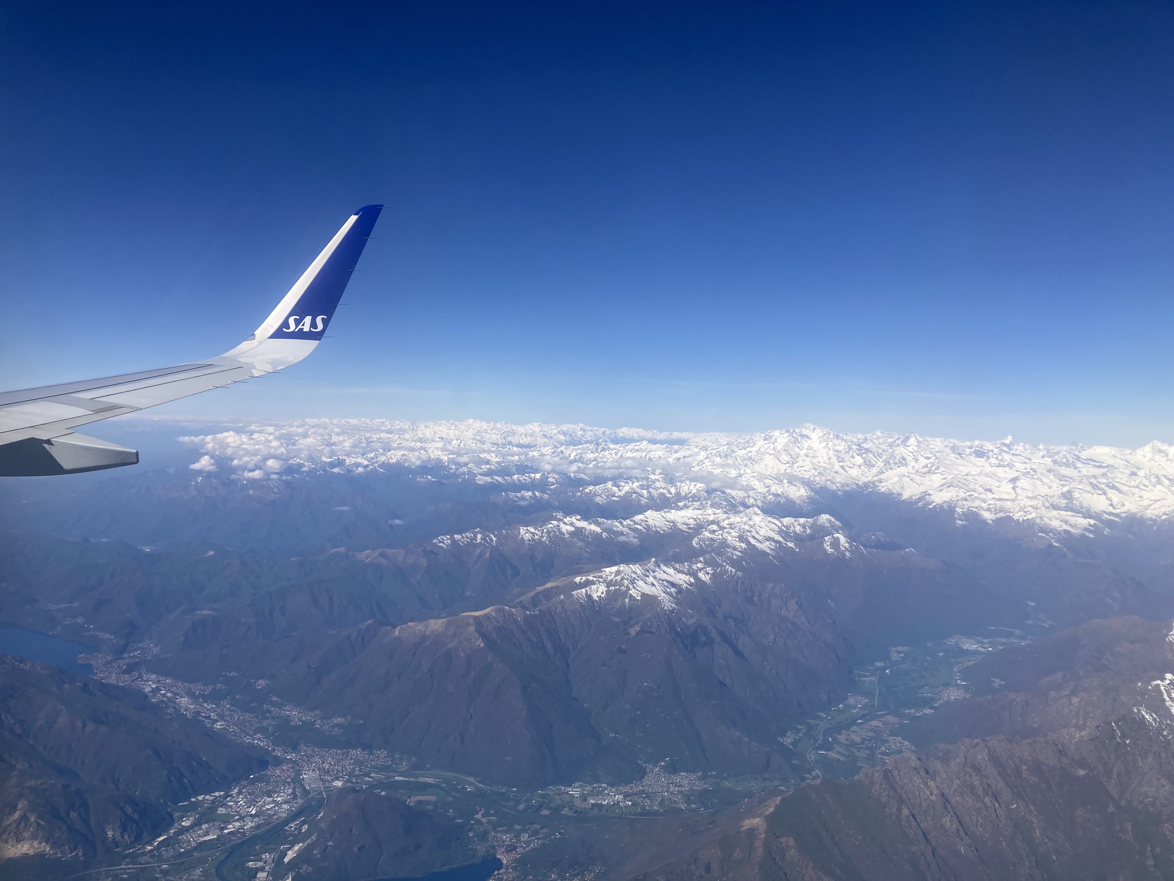
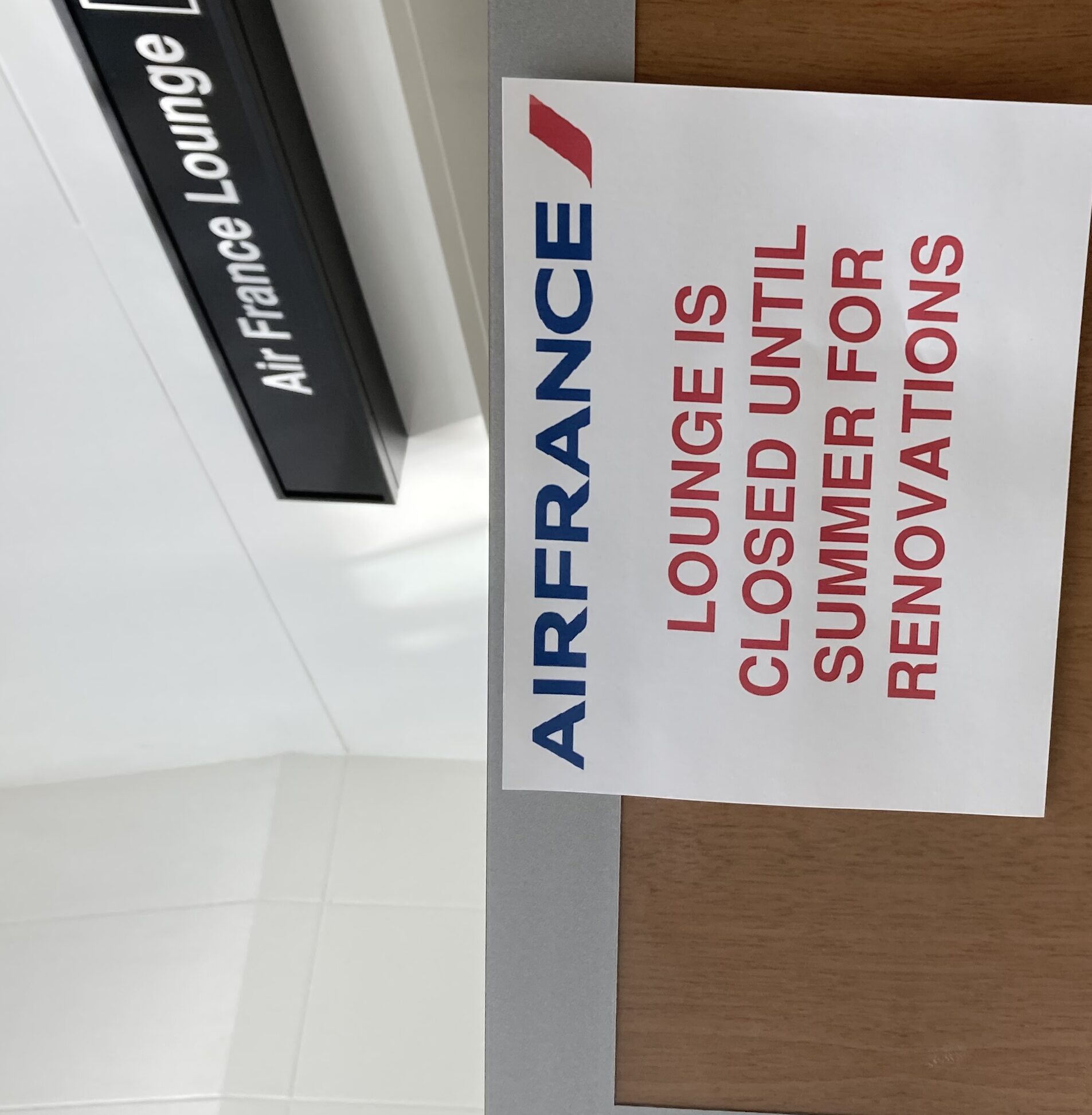
Still, we had plenty to do with our time. Task 1 was to check out one of the travel lounges that our new credit card promises us access to. It costs us extra money in the form of an annual fee, but there is supposed be free food and drinks, and we’re travelling sorts of people, so we thought it would be worth it. This travel lounge was sponsored by Air France (I will not mention the name of the credit card company unless they offer to sponsor us or at least give us the travel lounges for  free). It was very close to our gate. We took a special elevator to get there. There was a sign out front that said it was being rennovated and would be closed until this summer. We were disappointed, but not despondent. There was another lounge in Copenhagen that would surely have coffee and stuff for us during our hour-long layover tomorrow morning.
Instead of gorging ourselves on food we paid an unnamed credit card company to give us access to, we returned to our gate and played the game that we like to play that goes like this: We tell them we are carrying on our luggage; then, when they inevitably offer to gate check bags for free, we take them up on it. It costs a lot of money to check bags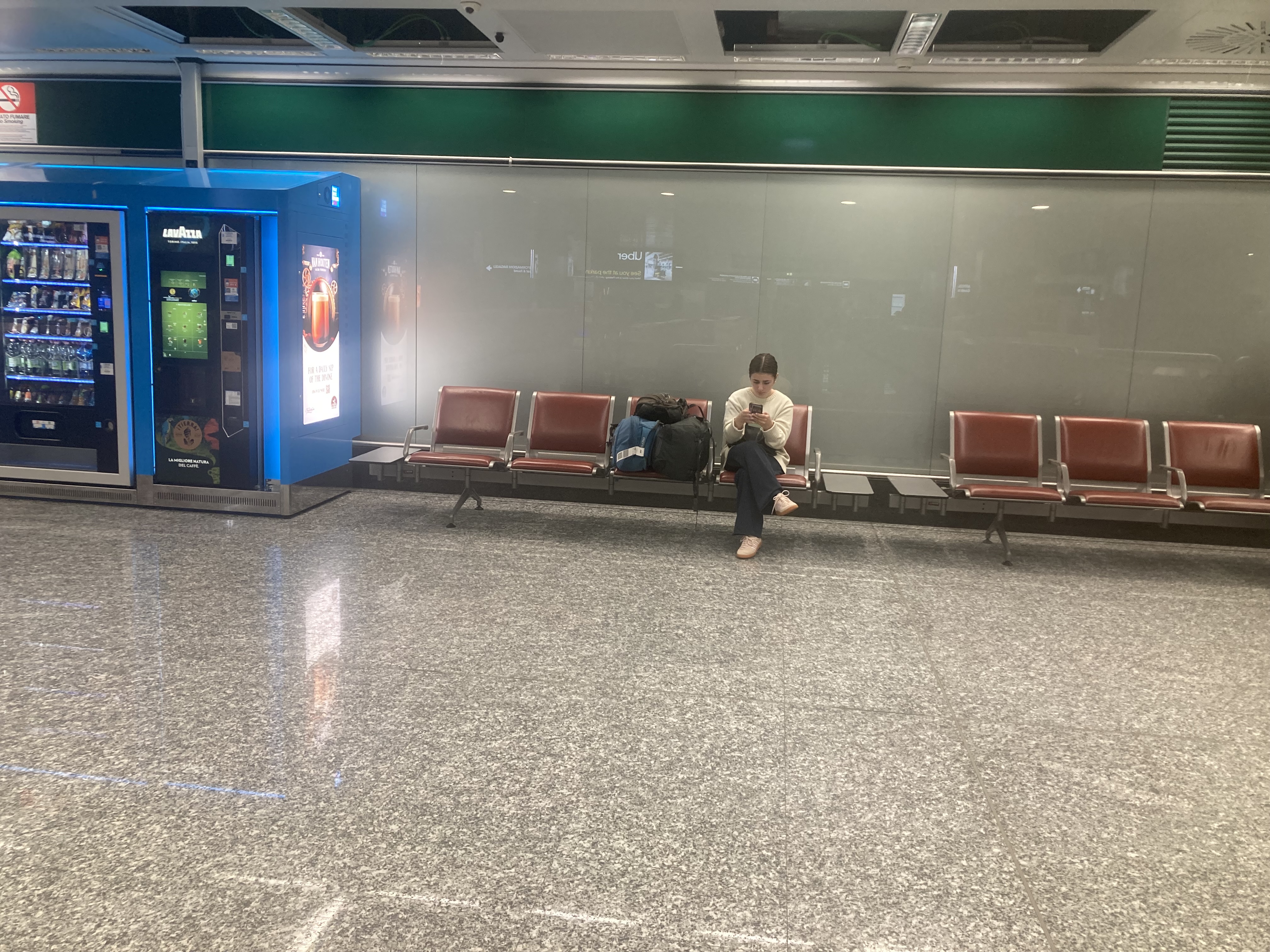 otherwise. We travel a lot and are very savvy.
Pleased with ourselves, we got onto our plane and started watching some movies while they fixed somthing that was preventing takeoff. It’s easy to distract us by putting screens in front of us, and we didn’t really catch what was going on. All three of us remember hearing it said that someone was fixing something and we would be leaving late, but we would not be arriving very late because of tail winds.
At some point during our movies, the plane took off. A lttle later we were fed — good stuff on SAS. We slept a little, watched stuff, read some things. They eventually brought us nice breakfast sandwiches and coffees. We got to Copenhagen to finish the second major leg of our travel day and a half, and wouldn’t you know it, the tail winds must not have been that great after all. We were 45 mintues later than we were supposed to be. We no longer had an hour-plus layover. We no longer planned to visit a travel lounge. We were worried we were going to miss our flight to Milan.
So began the shortest, but most exciting, leg of our travel day. We were in the E terminal and we had to get all the way to the A terminal. In between was passport control. We had about 20 mintues.
Don’t worry, everyone, we made our flight. Here’s what we had to do to make it: We had to wait patiently while every other row of the plane took their time getting their bags down and stretching and all else. When we finally got off the plane, we ran ran ran. This was made easier because we didn’t have our big bags. We gate checked them because we are clever.
 All the running came to a stop when we crashed into the considerable passport control line. It did not look good, friends. Even after Jen informed a woman in an SAS uniform that we had an pressing need to get over to Gate A21, and even after the lady moved us 3/4 of the way up the line (as soon as she did that, EVERYONE started telling her about THEIR pressing connection concerns, and she stopped moving people up — she told us moving up in line wouldn’t make a difference, anyway, and she said they would not be holding flights for people arriving late), it still did not look good. The Copenhagen airport appeared to be expecting 40 people to need their passports checked, and
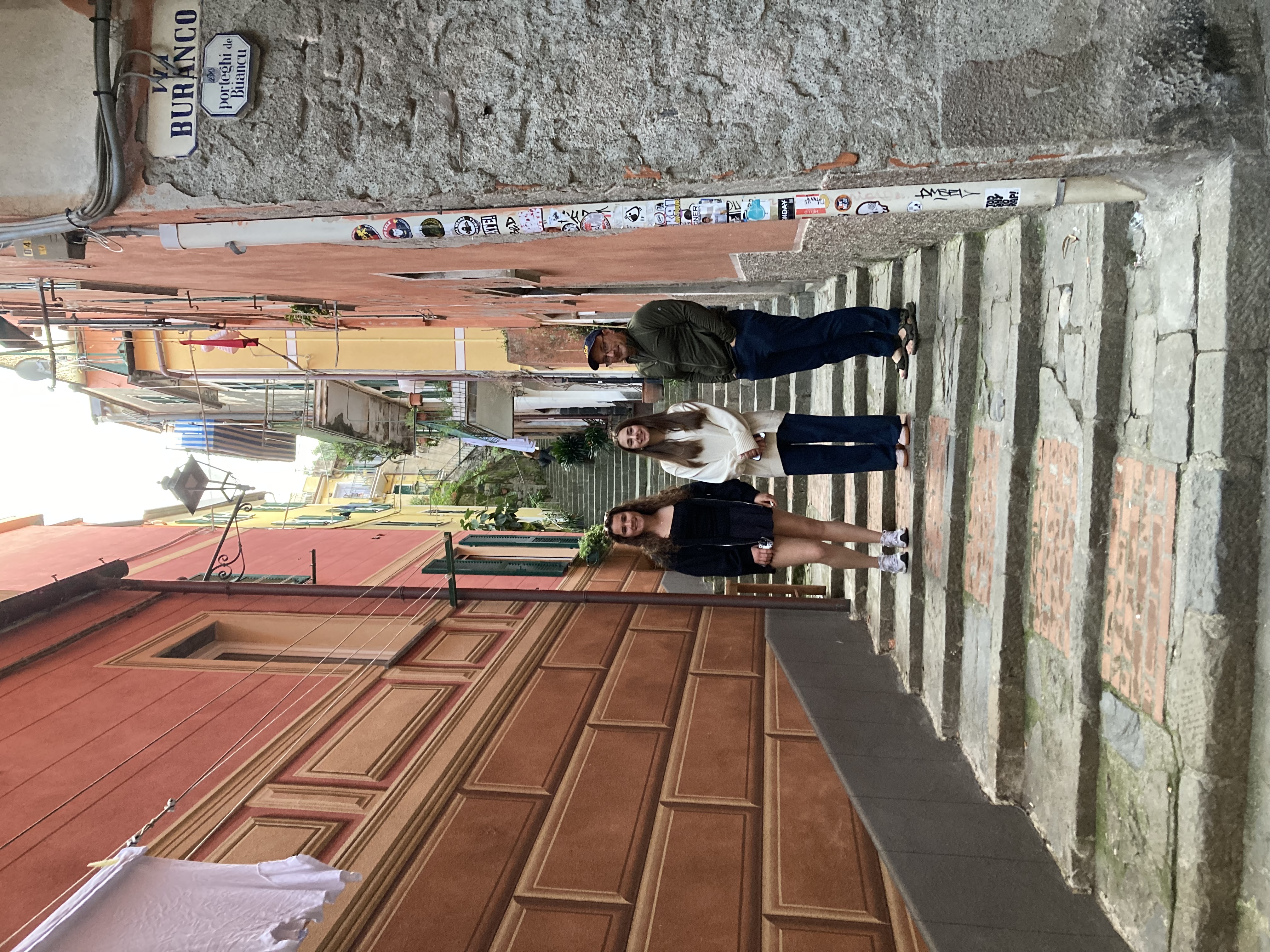 there were 400 people who needed their passports checked. There were only two booths open! Eventually, they opened two more booths and we got through passport control.
Then we ran ran ran some more. It was about a mile of running, weaving in and out of people. I was clearly the weakest link, lagging behind Jen and Lanie. Then I saw the sign for Terminal A and I dodged around some people, cutting a corner close, and suddenly I was in front, leading the way. I was running and dodging and out of breath when everything fell out of my unzipped backpack. We were right about at Gate A14. Ugh.
Jen and a lady I had just dodged help me get my thing back in. We scurried the last seven gates fearing the worst.
 And then, like I told you, we scanned our boarding passes and got on the plane, panting and coughing from our sprint.
After that we sat around on the plane for a while (panting and coughing) and the pilot came on to say we were waiting for people whose connecting flights were a little late.
At least we didn’t have to run across the airport with our big bags. Very wise of us to do the gate check.
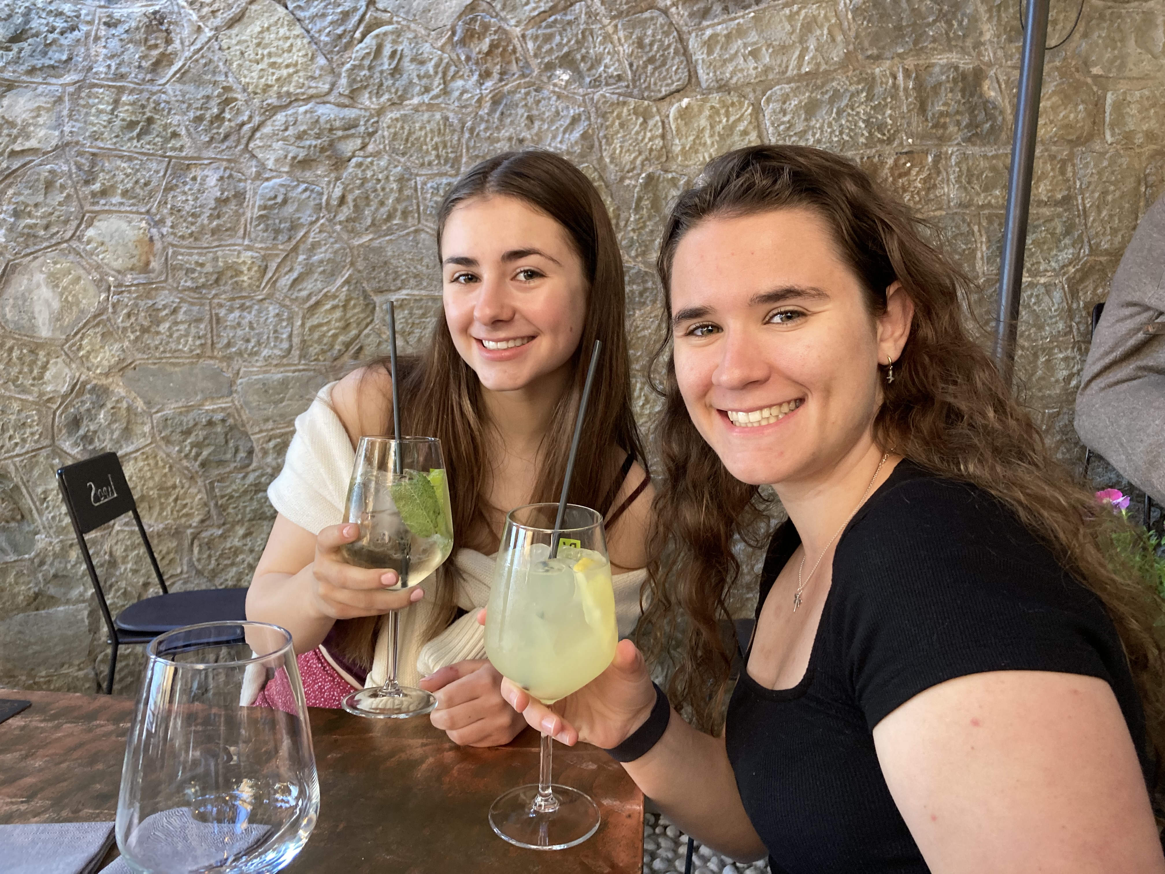
Nadia gave us a lesson on wine tasting
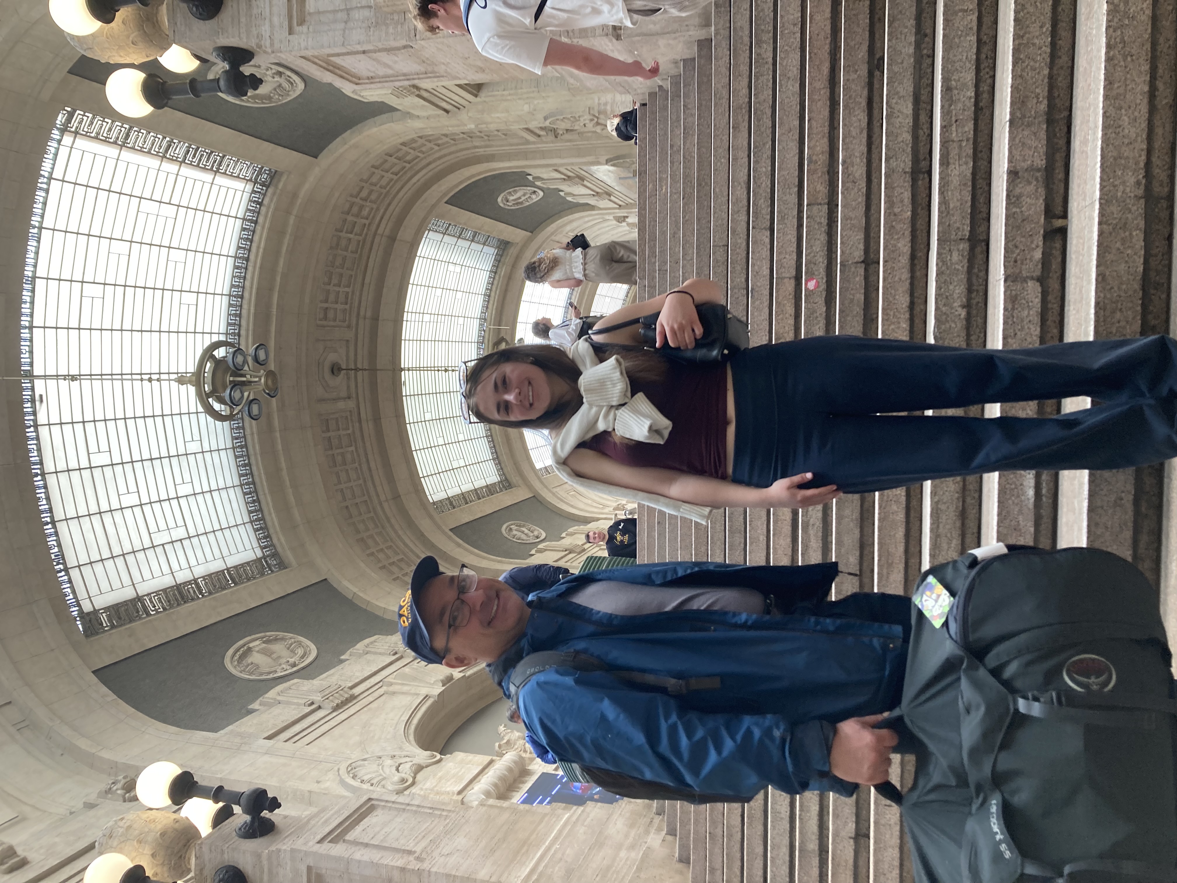
Exhaustion helped us sleep a little on the hour long flight to Milan, though we got a cool view of the Alps as we started our descent. We had plenty of time to catch our train for leg…5, think. In this airport we just strolled leisurely to baggage check. We didn’t even have to have our passports checked because they did that in Copenhagen.
There was some concern as we walked that maybe our luggage didn’t manage to move across the Copenhagen airport as quickly as we had done, but that was followed by great relief when my bag and Jen’s bag were the practically the first ones we saw on the carousel. We refilled our water bottles — airport sprinting is dehydrating — and watched on as Lanie waited for her bag. We drank some water and watched and waited. We drank some more water and waited. Her bag didn’t come out. As we got less 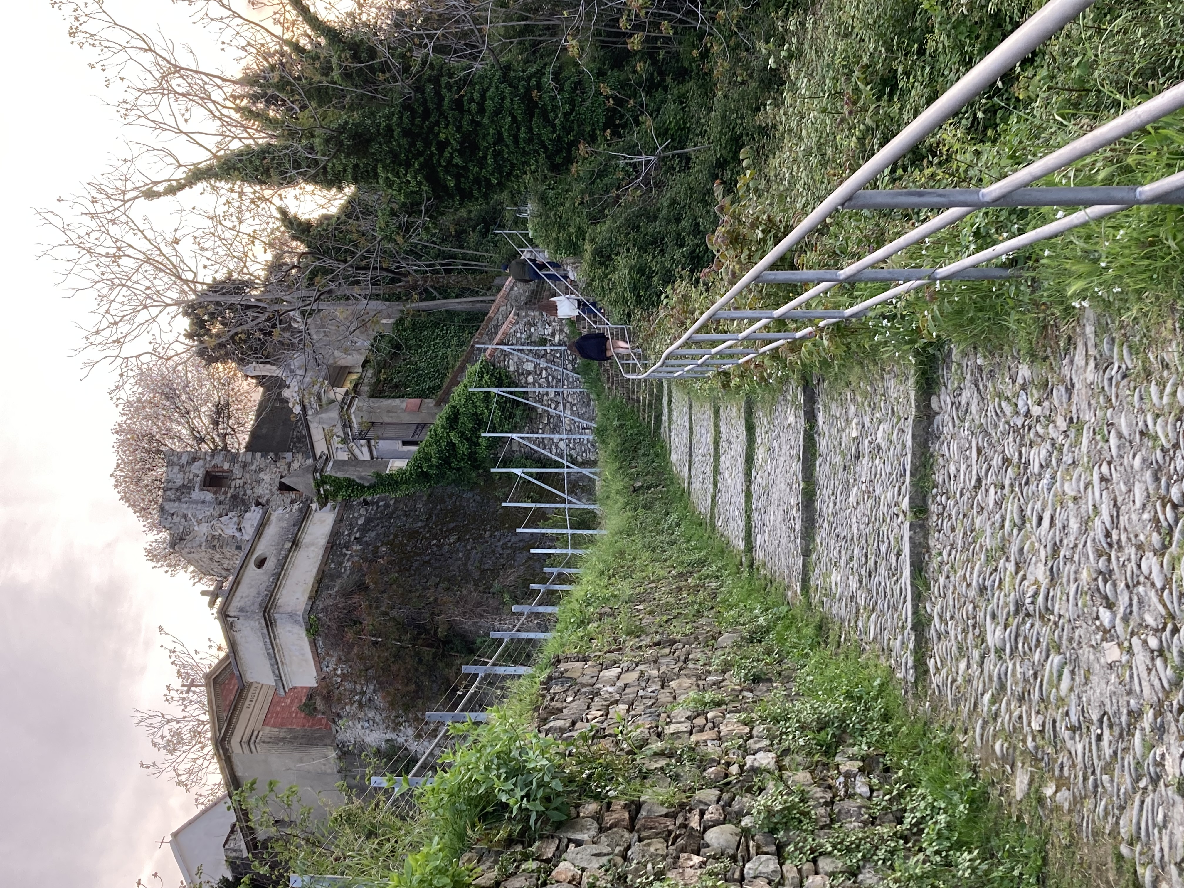 dehydrated, our hopes of finding Lanie’s suitcase sank.
It turns out, as Jen was able to ascertain, that Lanie’s luggage had not been left in Copenhagen like the bags of many people in line with Jen at the lost luggage desk. True, it did not get sent to Milan, but it wasn’t still in Copenhagen. What kind of fools gate-check their luggage?
SAS airlines knew where it went, though, and they told Jen they would drive it over to us at our temporary living accommodations when it comes in tomorrow.
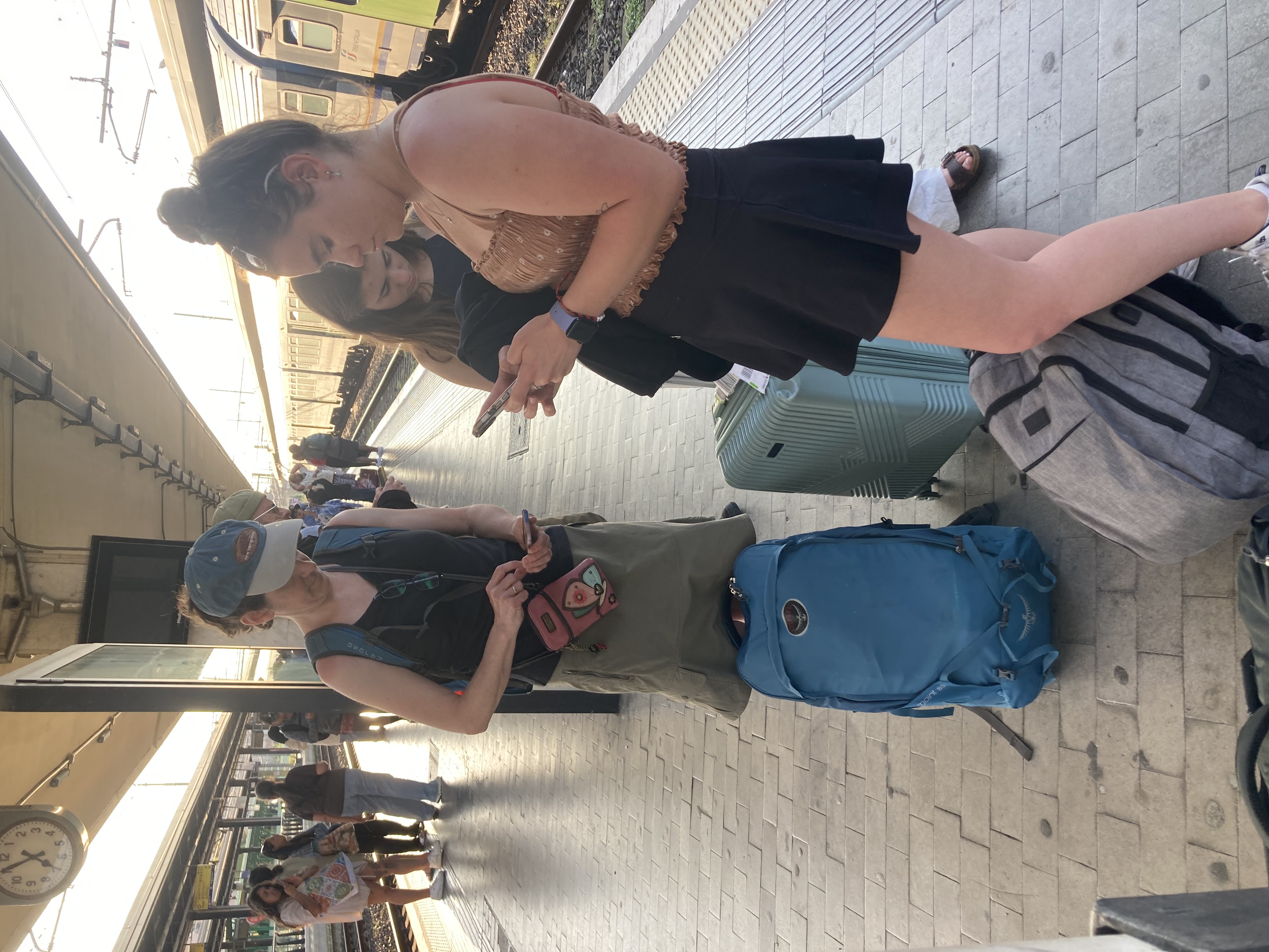
This would have been a good time for there to be an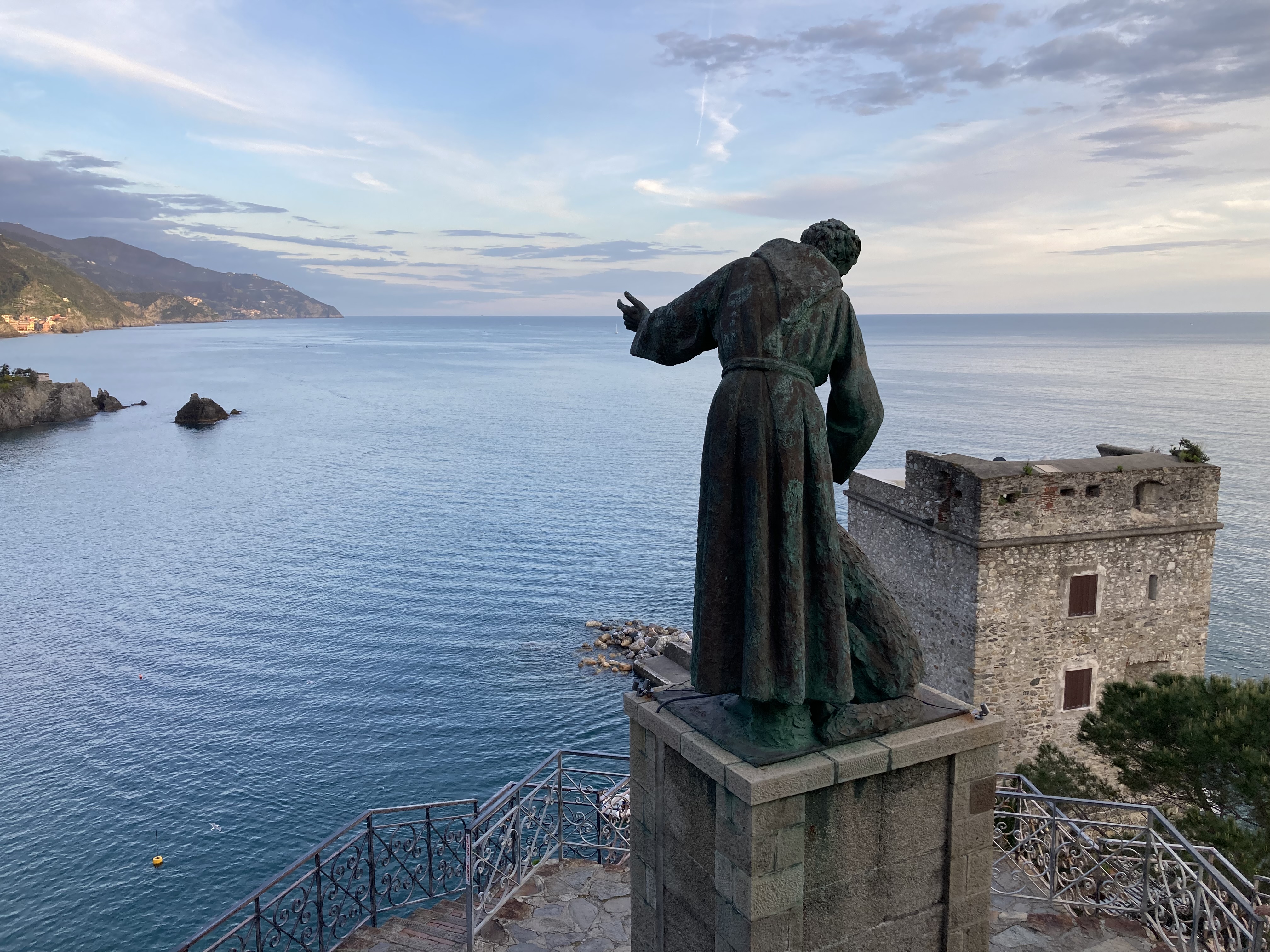 airport lounge in the train station, but our credit card company does not offer such perks, even though we pay them extra money. We did manage to get onto our train to Milan Center — actaully, we got on a train that left 20 minutes earlier than the one Jen bought tickets for because the train manager said it was ok.
In Milan’s lovely train station, we admired the architecture, which combined classical and early 20th century elements with a special focus on hiding the bathrooms. I would call this leg 7 — finding the bathroooms in the Milan Center train station because we had to walk all over 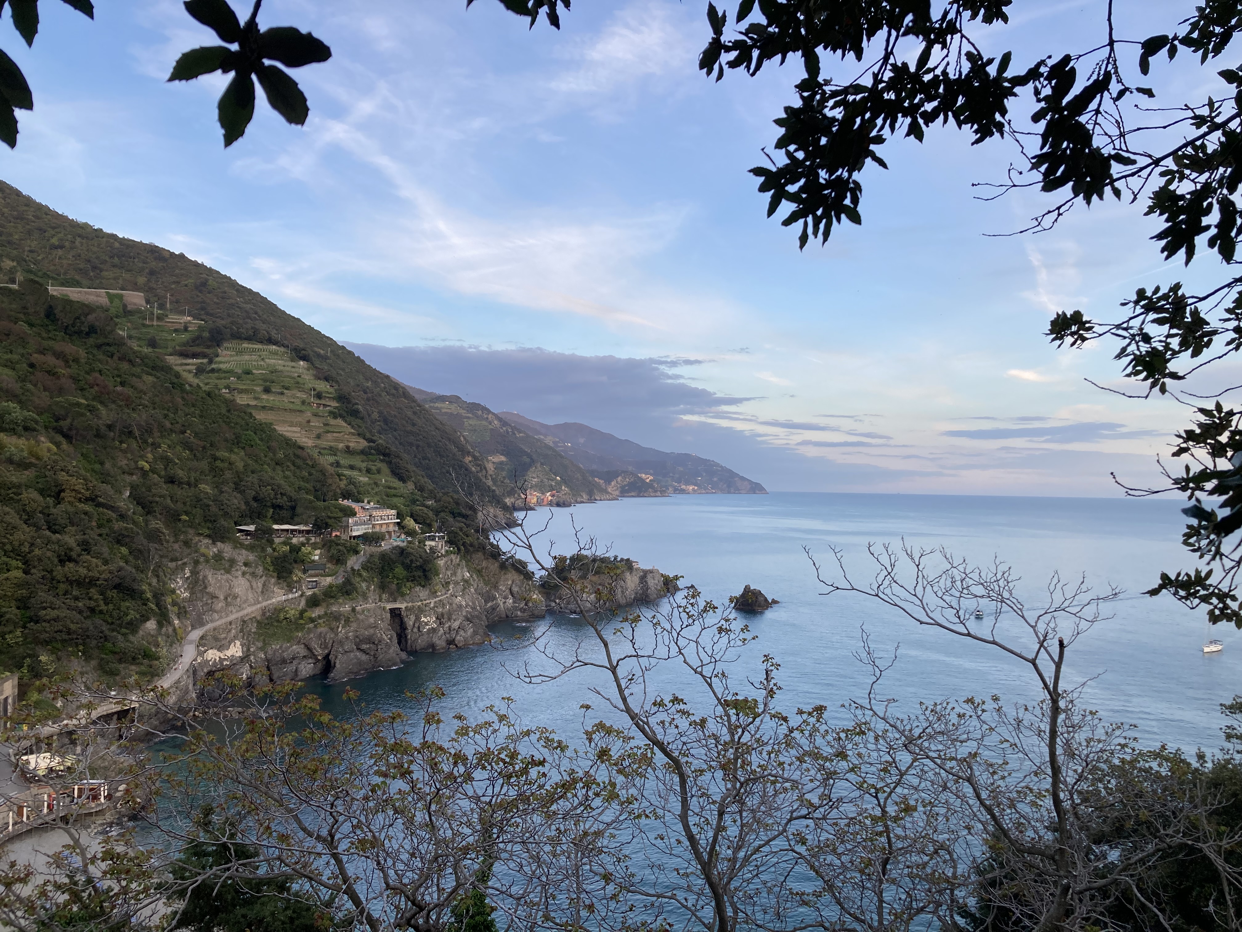 the place to find it.
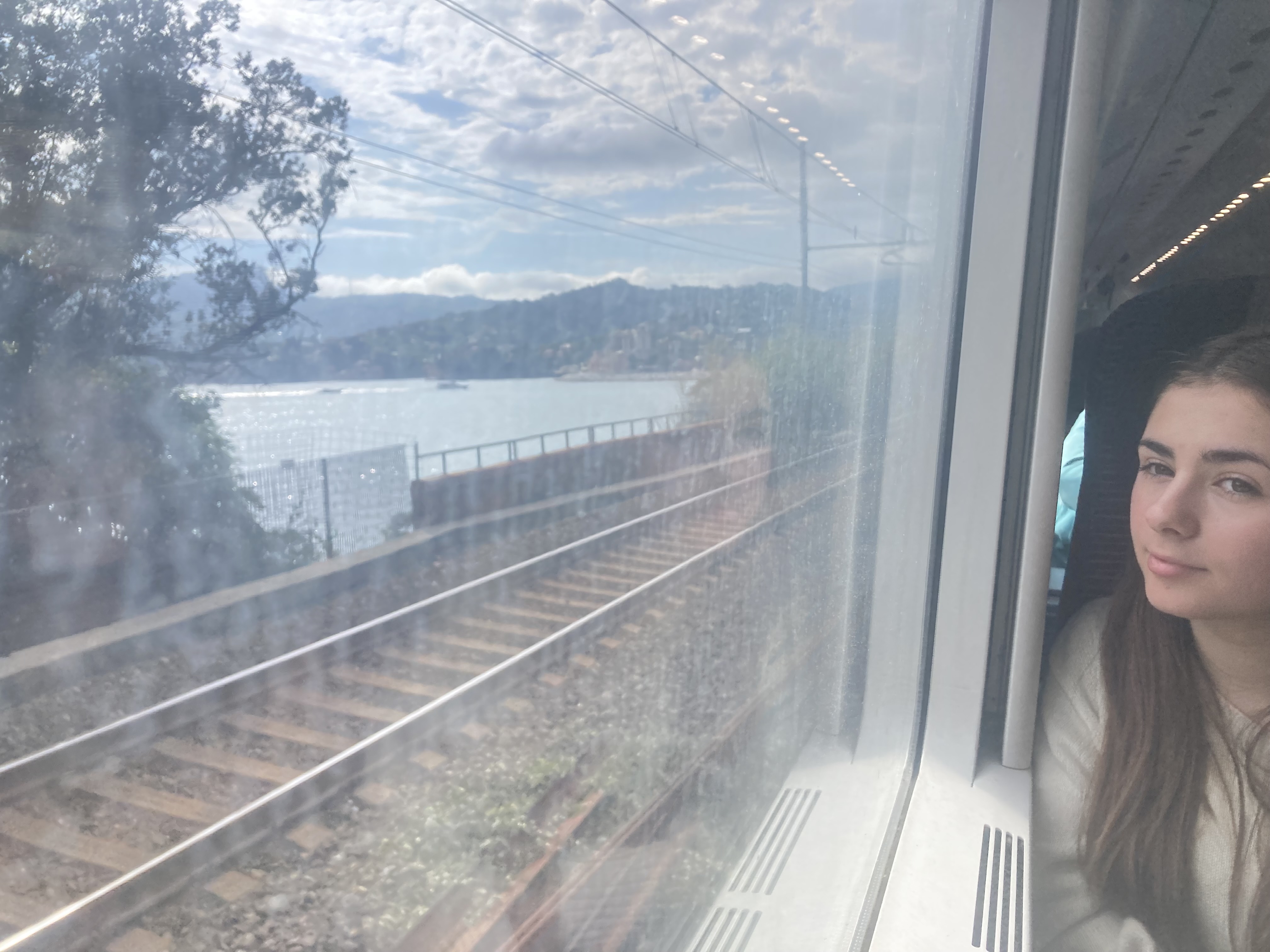
We were not out of legs yet. Leg 8 was a three-hour train ride to the coast. Our stop was not the last one on the line, so someone would have to stay awake and pay attention to where we were. Jen set an alarm for 5 (our stop was scheduled for 5:10), just in case.
I wrote a lot of blog on that train, peeking out the window from time to time to take in the Italian scenery. Eventually, I could start to see the ocean between the buildings. The towns we traveled through startd to take on a seaside flavor — there were beaches and people swimming in the snippets I saw.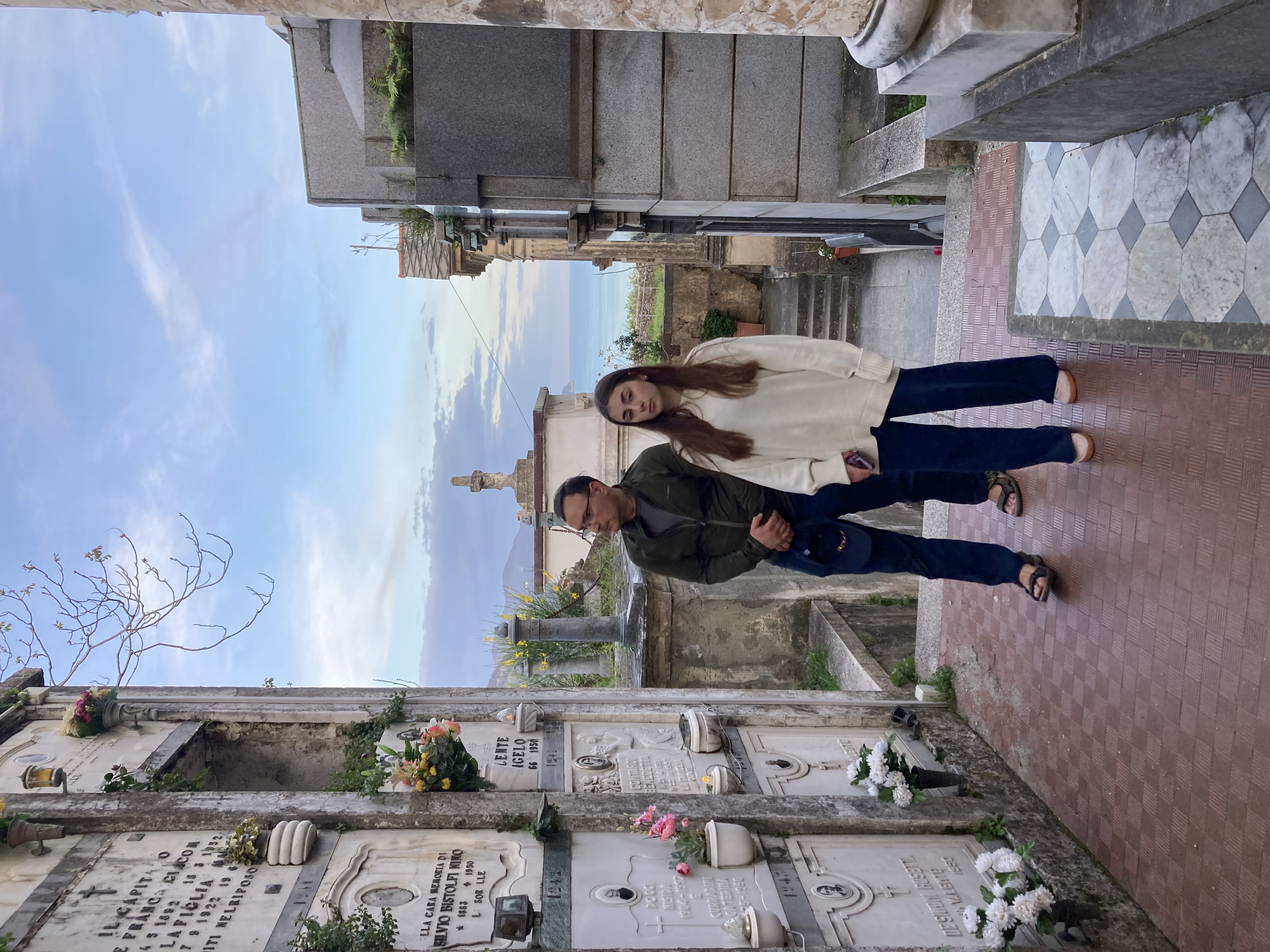
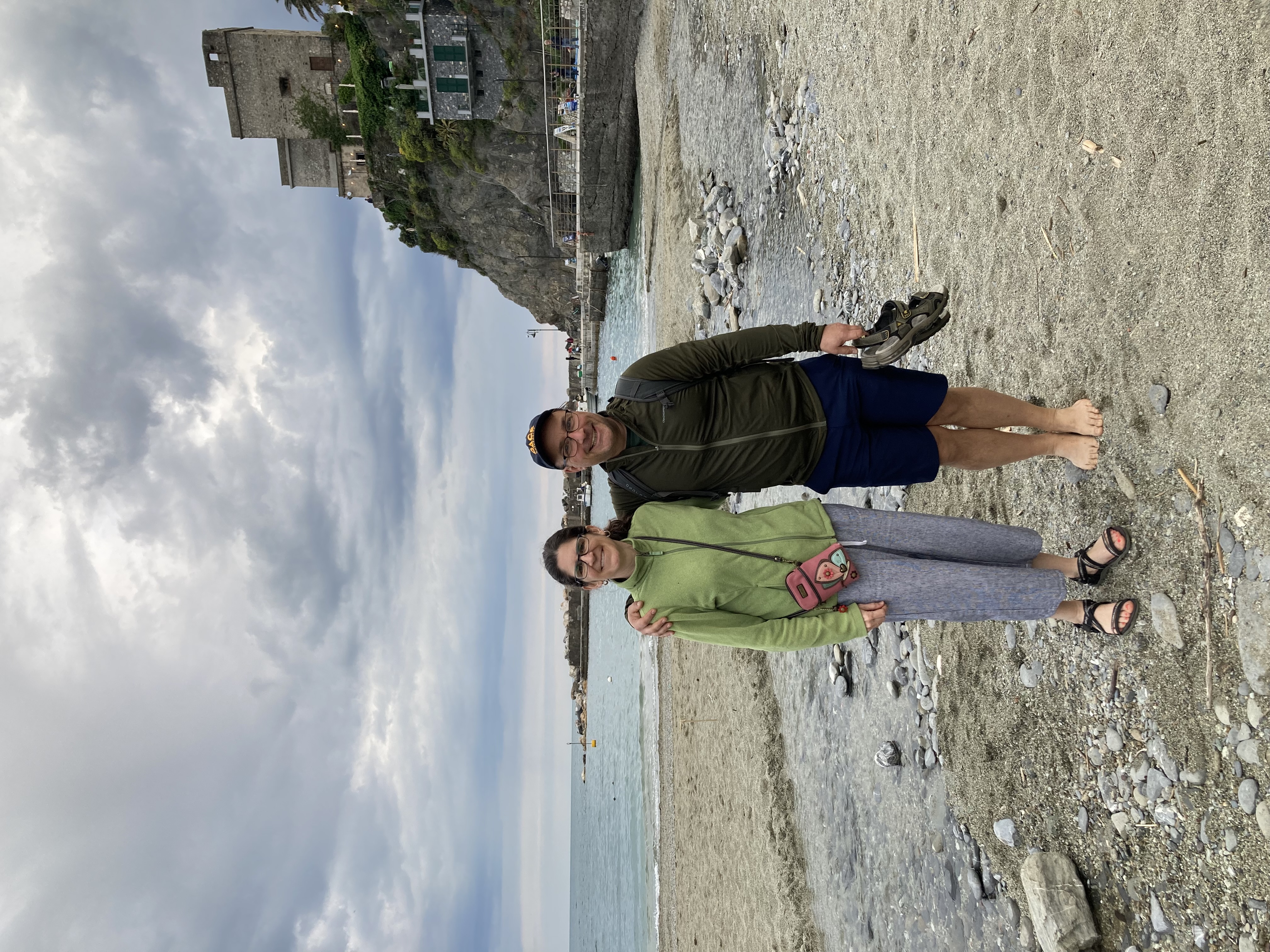
We finally made it to our stop in Monterosso, where Nadia and a nice apartment waited for us. We found Nadia right there at the station. Then we started Leg 9 of the trip, which was to walk to our accommodations. This is not a car-heavy place. There is a road that snakes along the cliffside and through a tunnel, but it was filled with pedestrian traffic. Eventually, we noticed a taxi or two beeping their way through the crowds, and at one point this evening an ambulance made its way through, but mostly it’s just people walking around.
After snaking our way along the hillside we turned a corner and village spread out on the far side of the beach. Most of the alleyways we walked through would be too small for a car, but 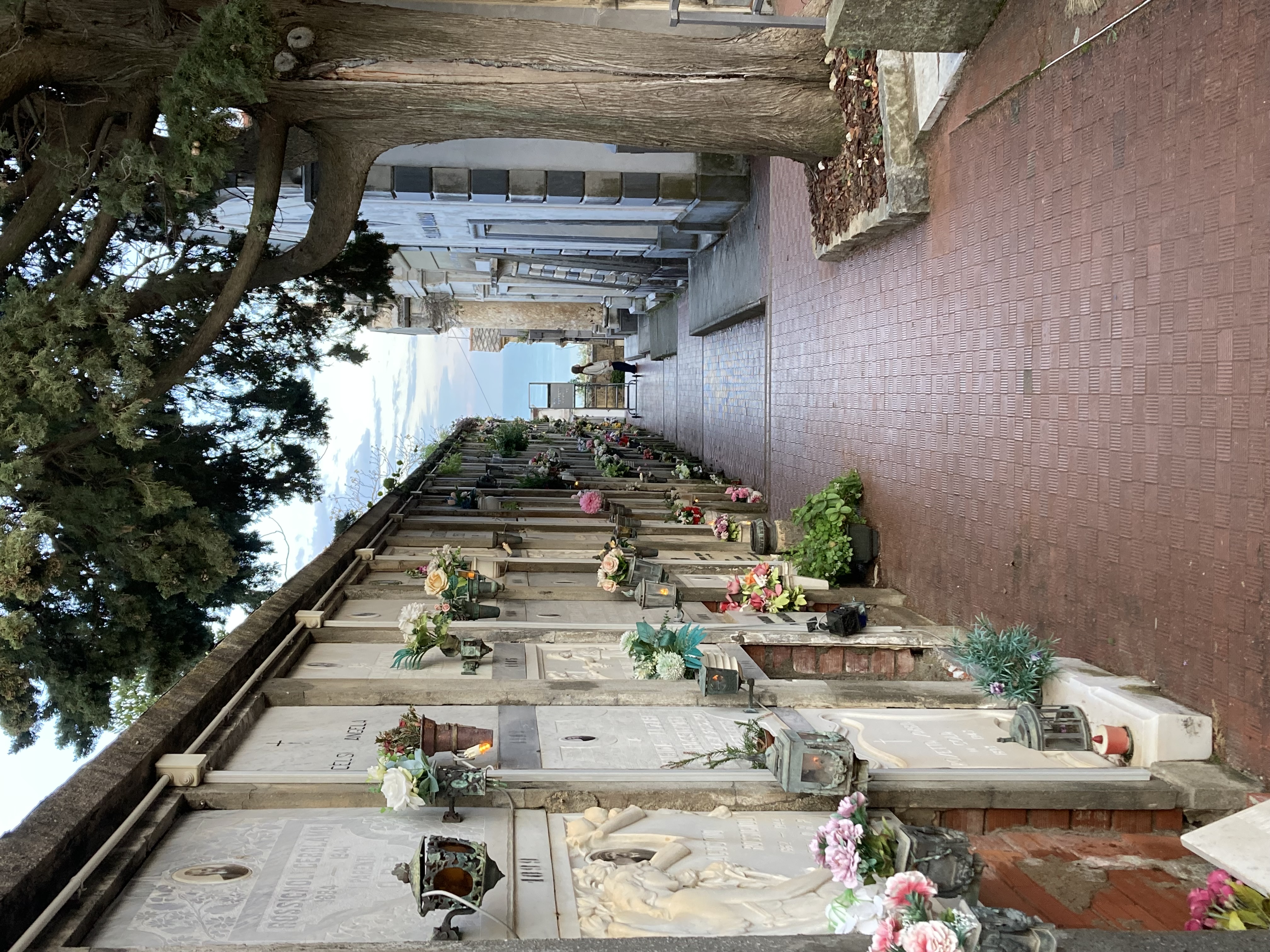 we did pass a tiny pickup truck, which must be how they get things around here.
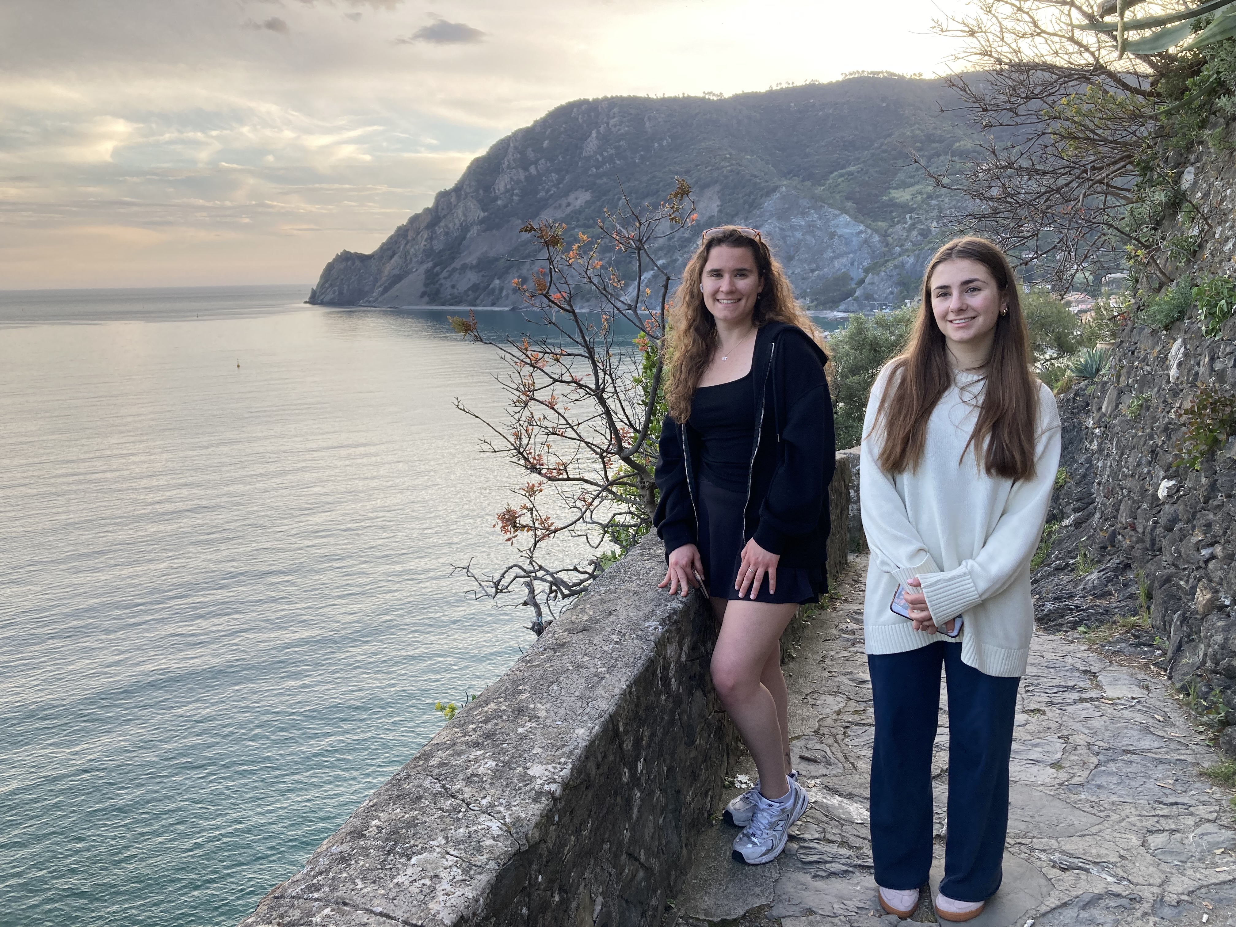
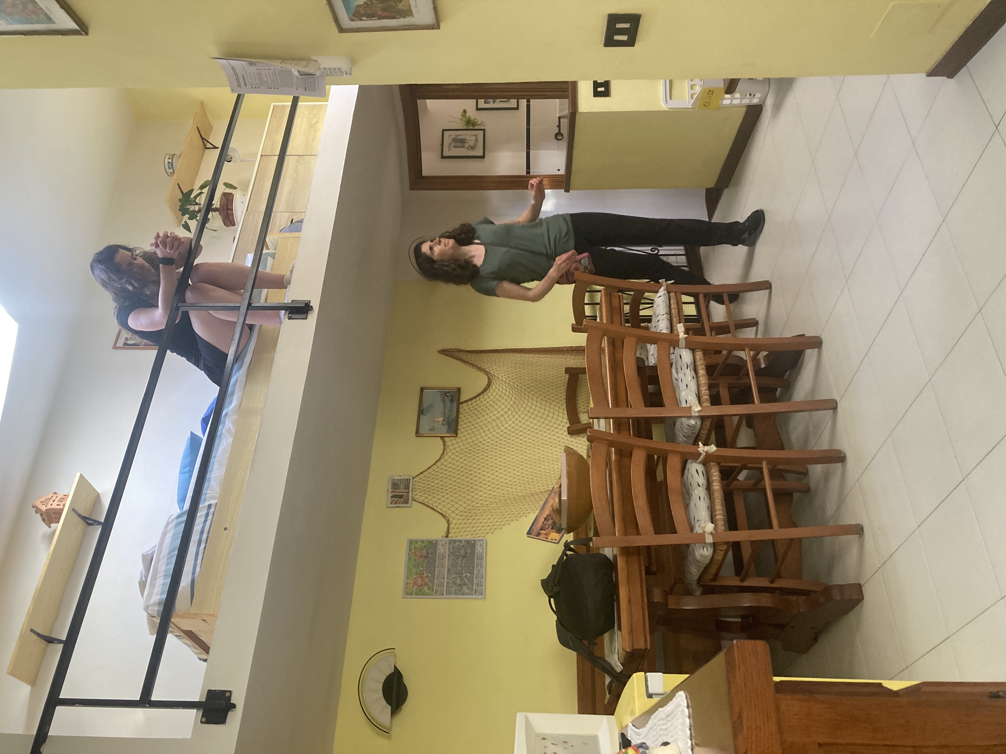
We were instantly charmed by the place. It is old and rustic and vibrant with beachgoers and hikers. From here, we will be able to walk to four other villages similarly tucked into crags along the coastline.
They won’t technically be counted as legs of our travel because we’ll be staing in this apartment for a few nights.
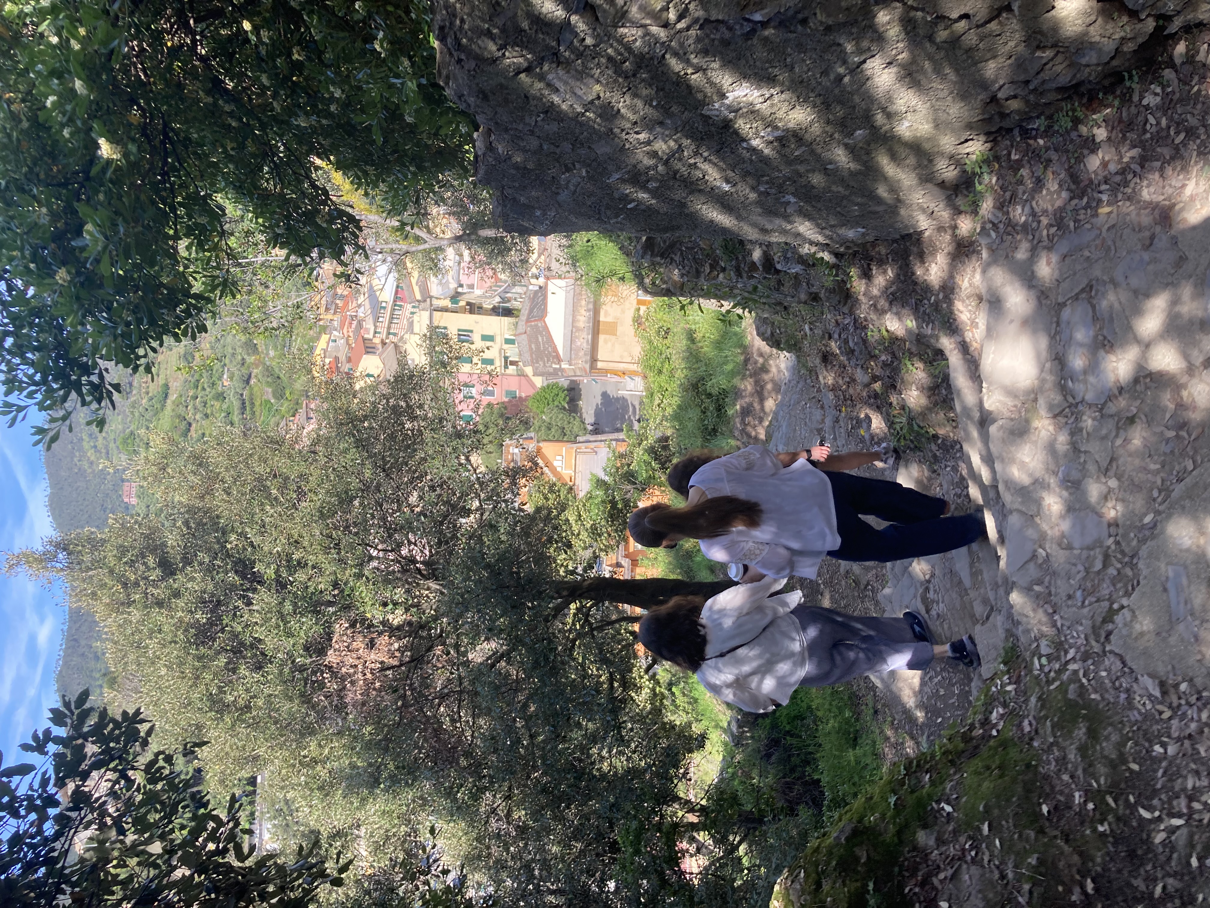
So, walking around to find a restaurant was just for fun, and finding a gelato shop afterwards was, too, even though we decided to go the long way. Our path led us up a series of ramps and many stairways to a hilltop convent that was crowned with a graveyard that offered views of the ocean and terraced hills. Even though we’d been awake for about 34 hours at this point, we were in no rush to get back to our apartment.
It was well-earned sleep when we finally stopped moving around for the day.
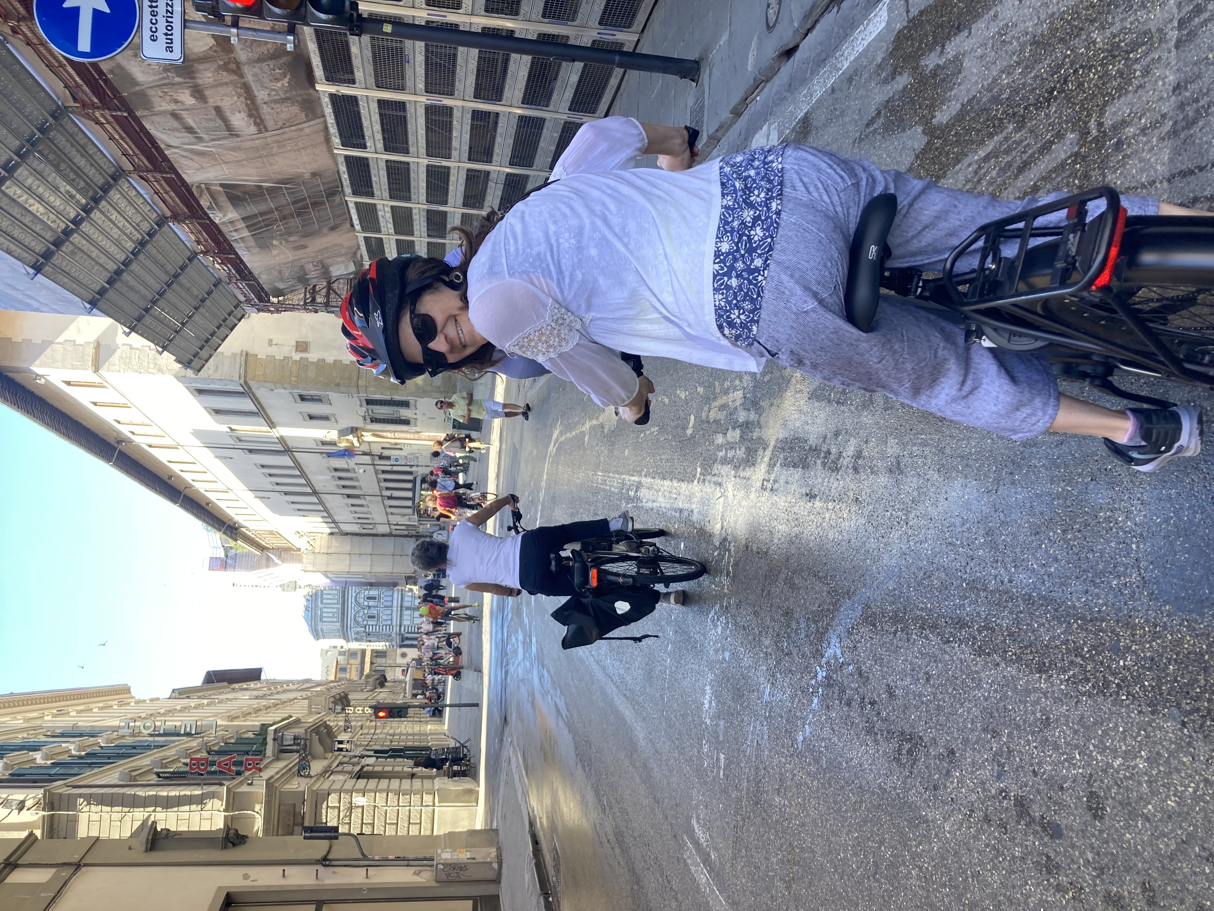 Nadia suggested that sometime during the trip we Bob and I might like to do some kind of wine tasting tour, while she and Lanie went shopping. It may have been a ploy to get rid of us for the day, but it was a suggestion that we were on board with. I found a winery tour of Chianti (the region of Tuscany that we’re in) by e-bike, and we were sold.
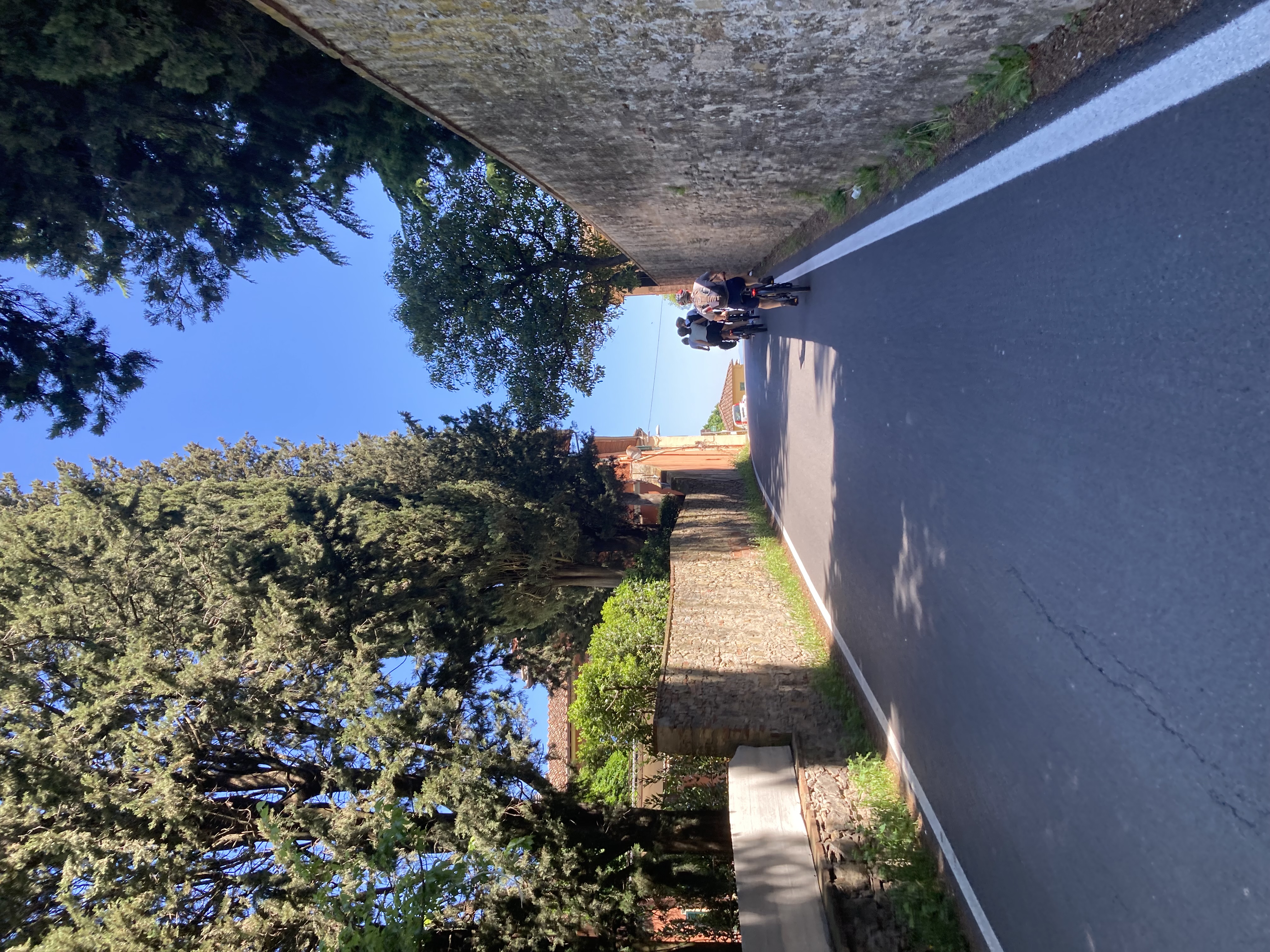
 Iacopo was an excellent guide — knowledgeable and funny and friendly — but he was not one to dawdle. A little way outside town we found we’d lost three members of our group somewhere along the way. Our route had had several twists and turns, and apparently they hadn’t kept up. Eventually Iacopo decided that we had to continue on without them. He sent his friend Simone (who was along for the ride and had no affiliation with the tour company at all) back to try to round them up. (“He has a map,” Iacopo declared confidently.)
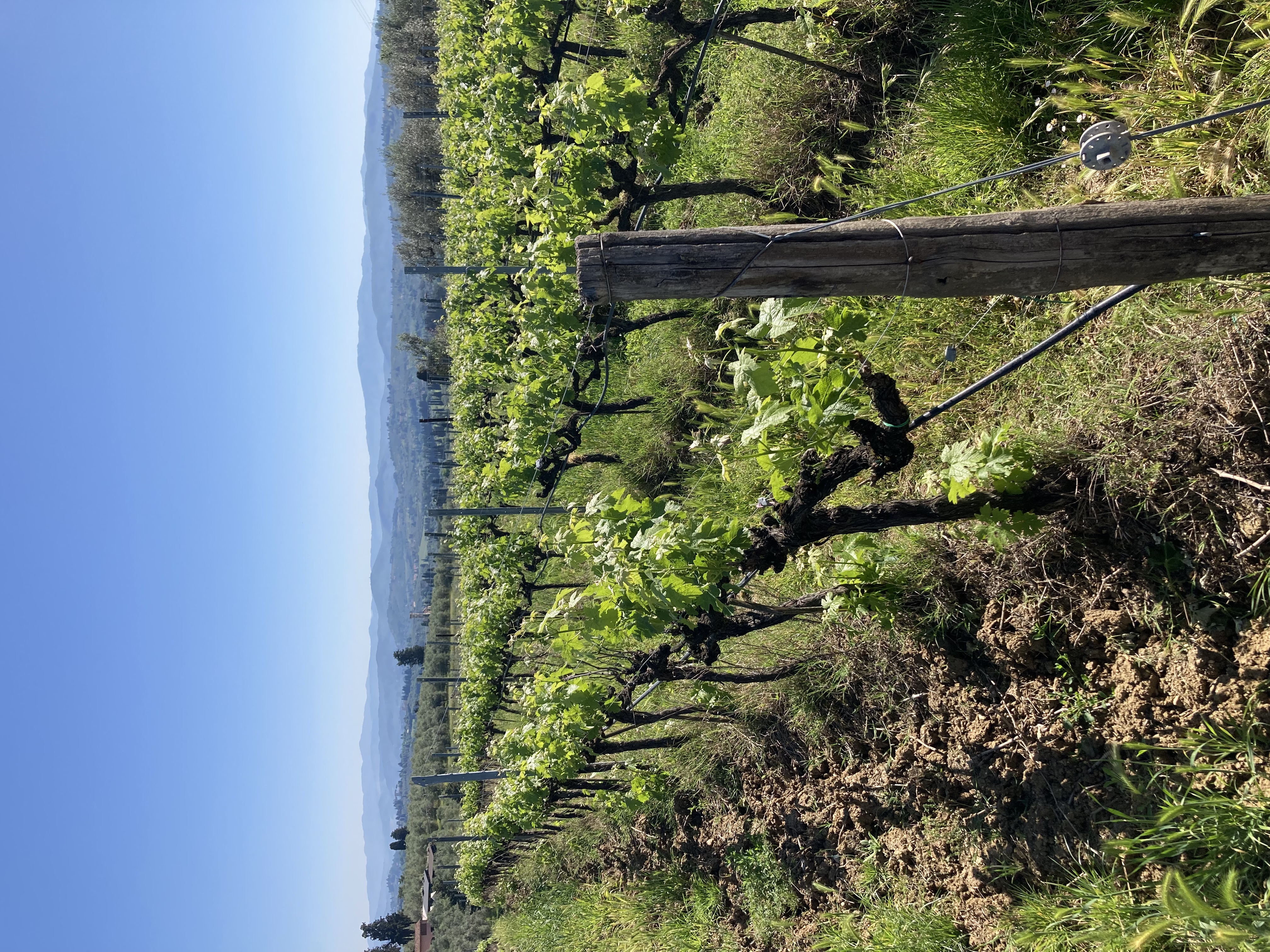
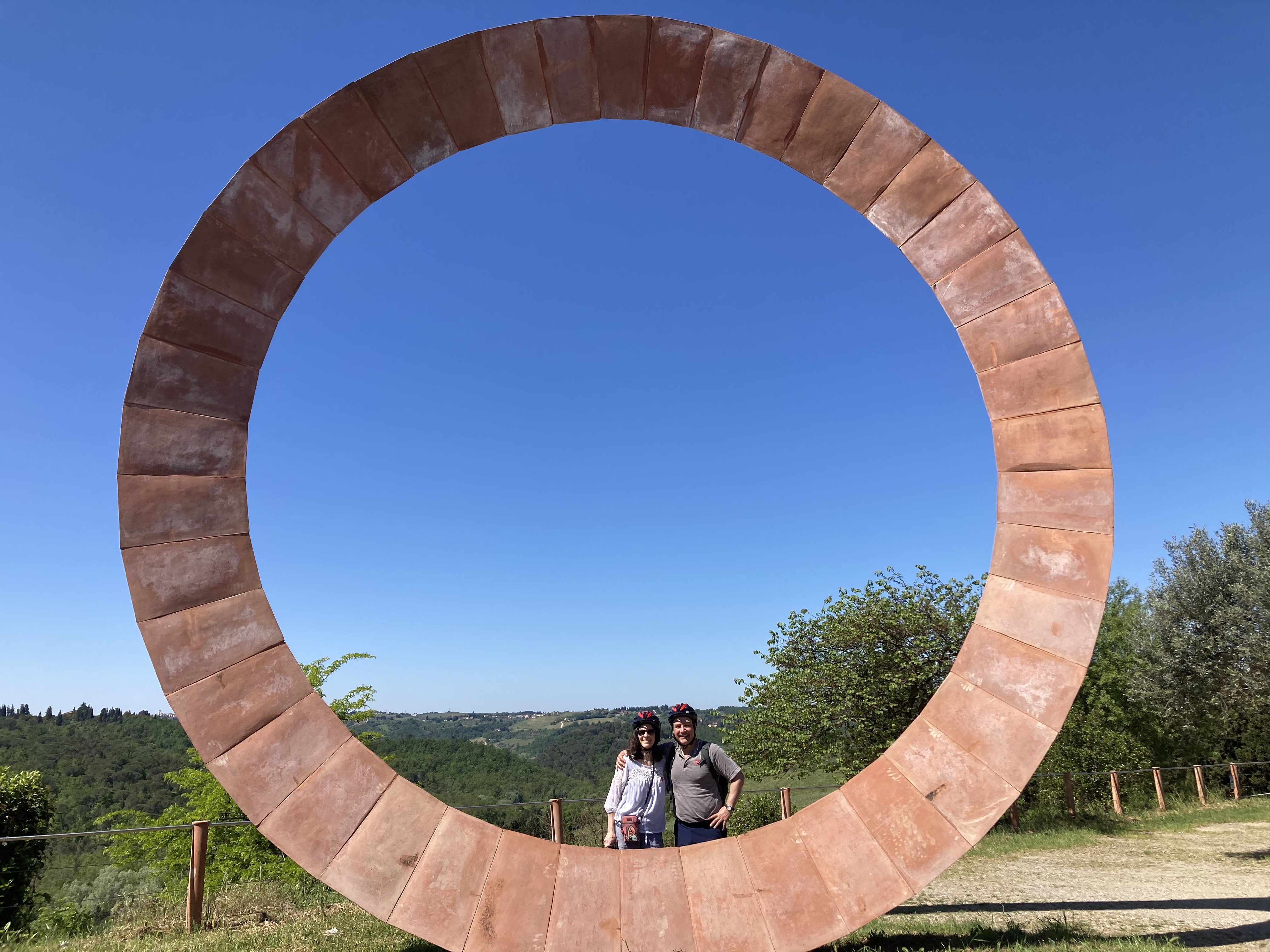
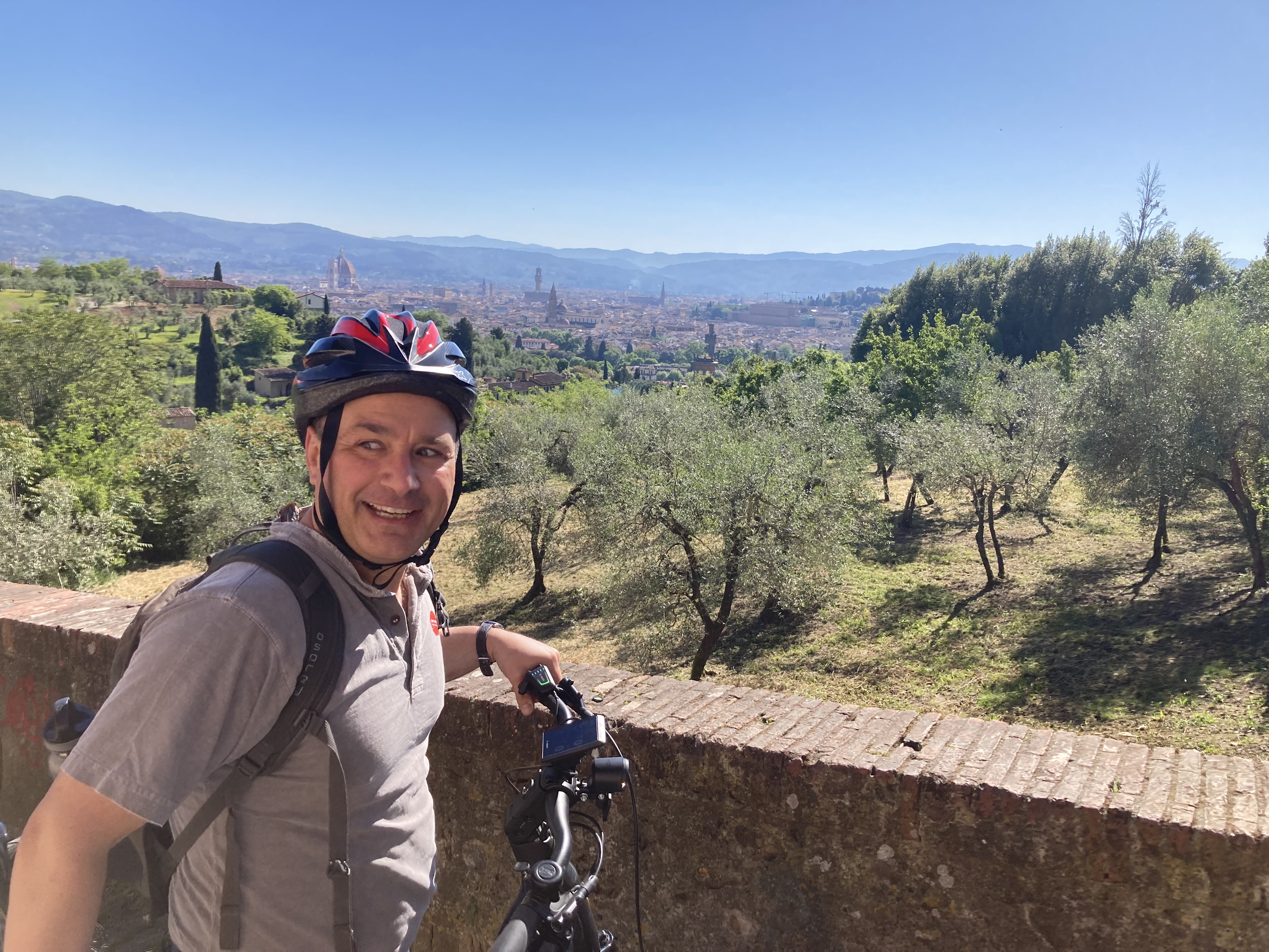
 We stopped at a family winery for lunch and wine tasting. The food, as always, was delicious. The winery also makes olive oil, but apparently this is so labor-intensive that it’s not very profitable. We got to enjoy some with our lunch, though. On the way back we stopped at a couple of viewpoints with amazing views back over Florence (and very steep downhill descents). After we returned to the city we went to another bar for some more wine tasting and snacks. (We declined seconds on the wine, being mindful of the upcoming periously journey back through the city.) Even though I ended up at the very back of the line and there
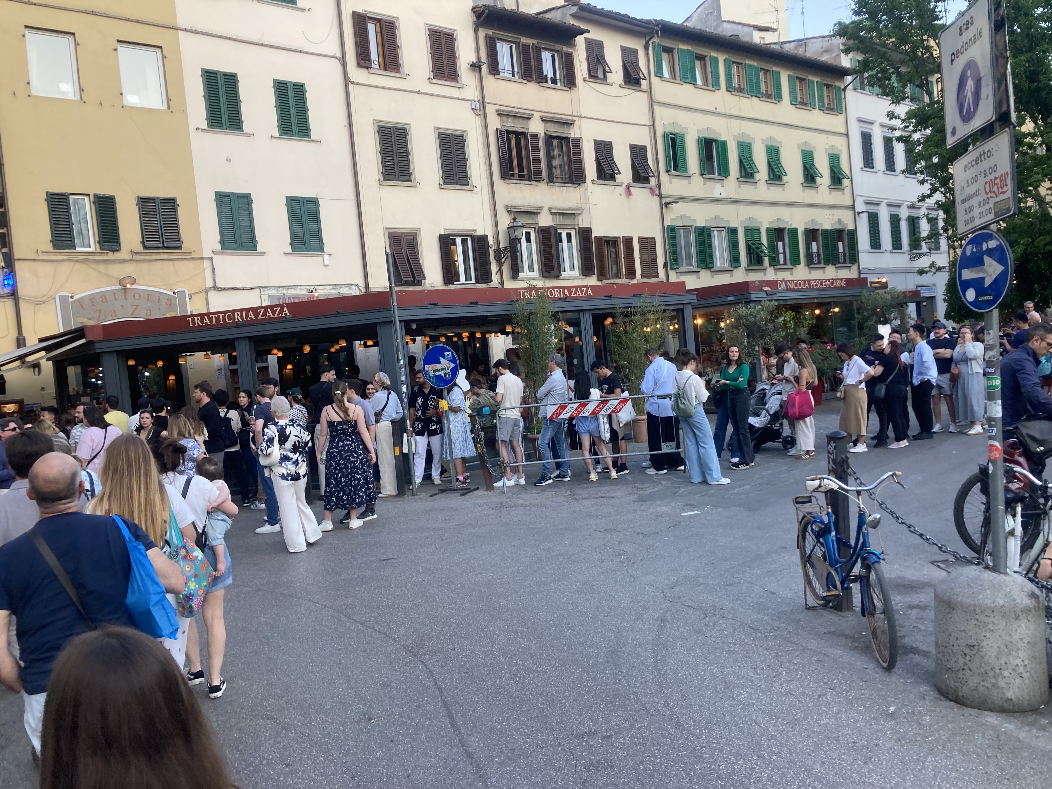
 way over, and they were pretty good even though we accidentally bought still water instead of sparkling water.


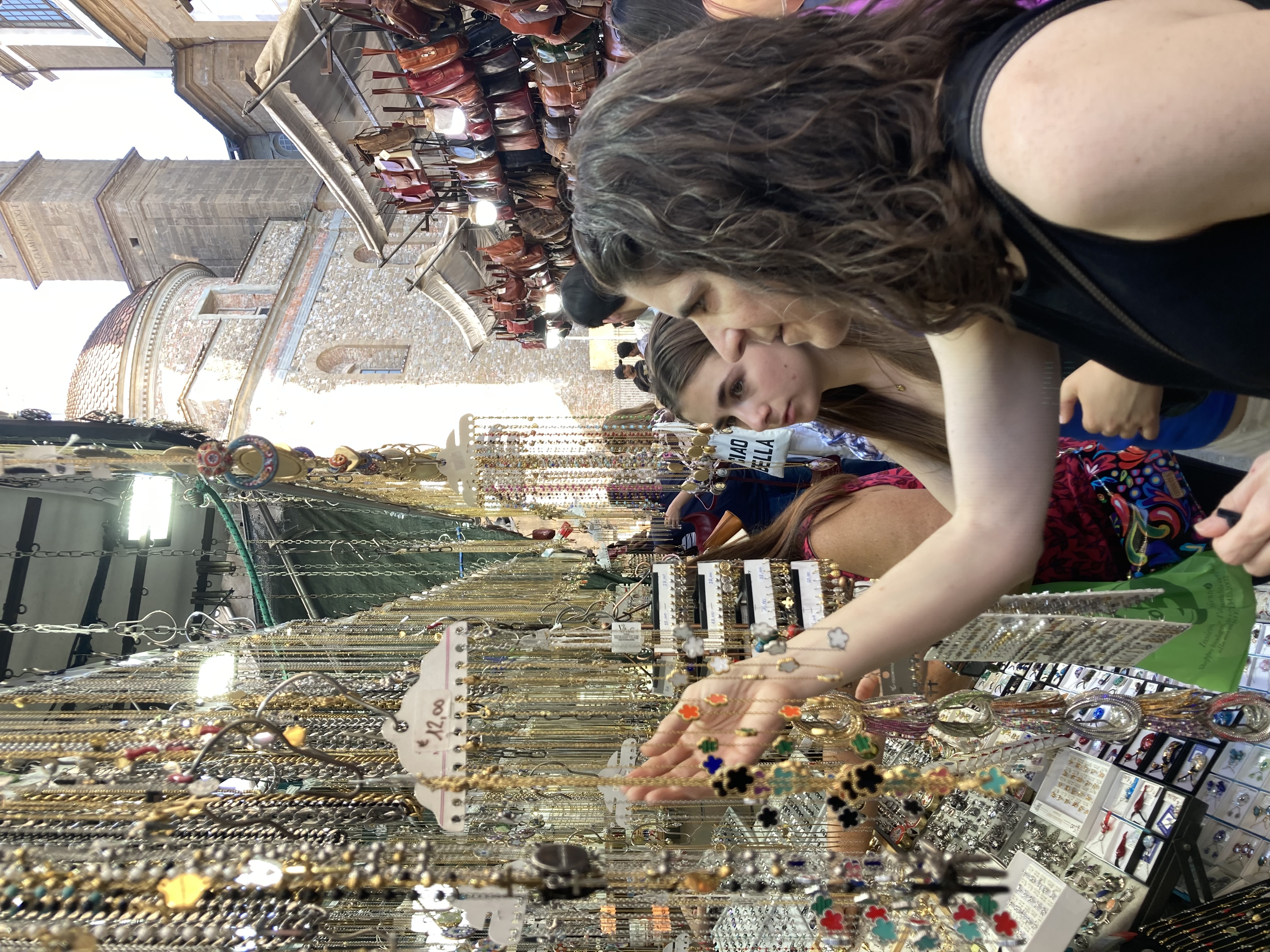
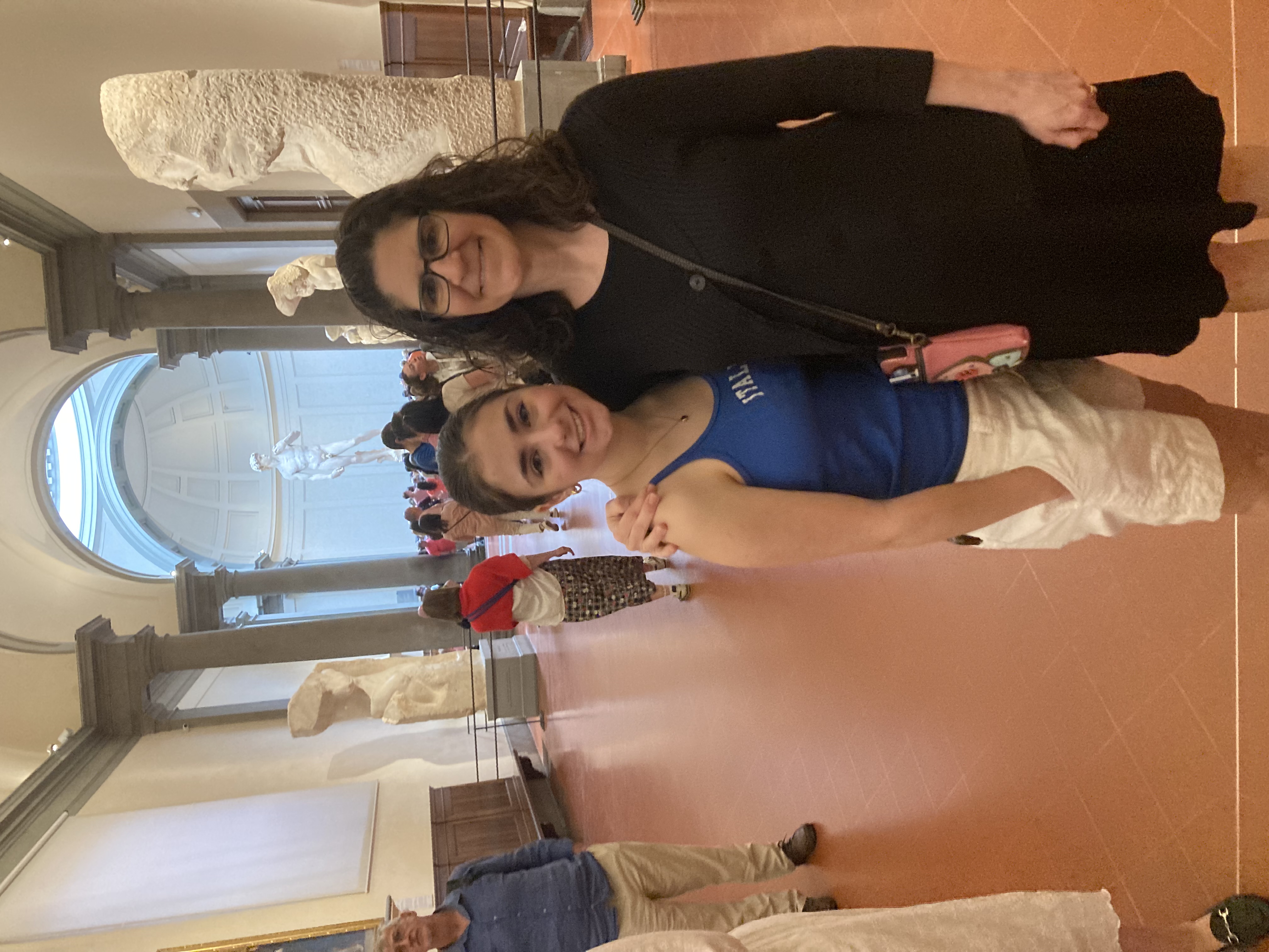
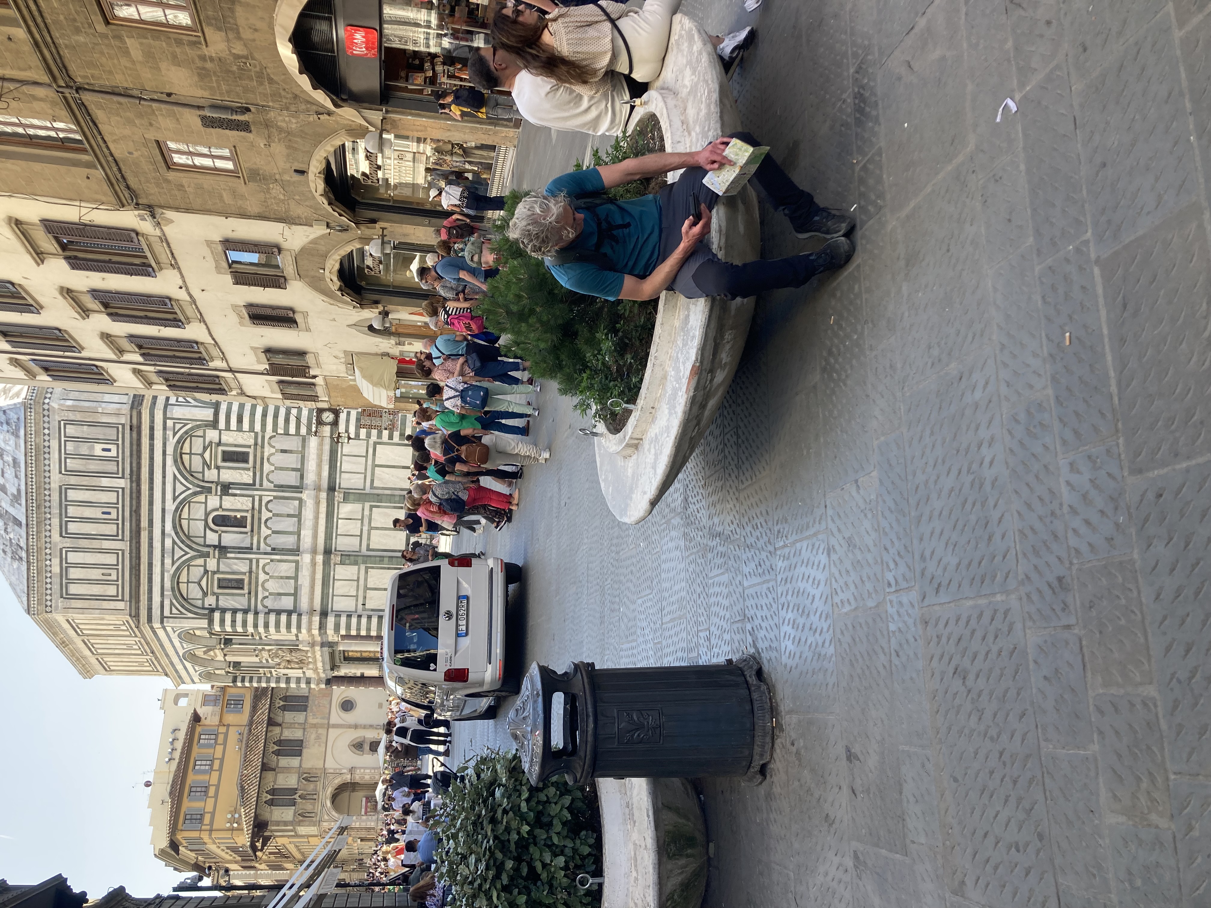

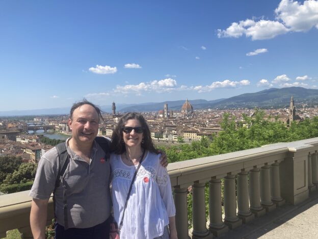
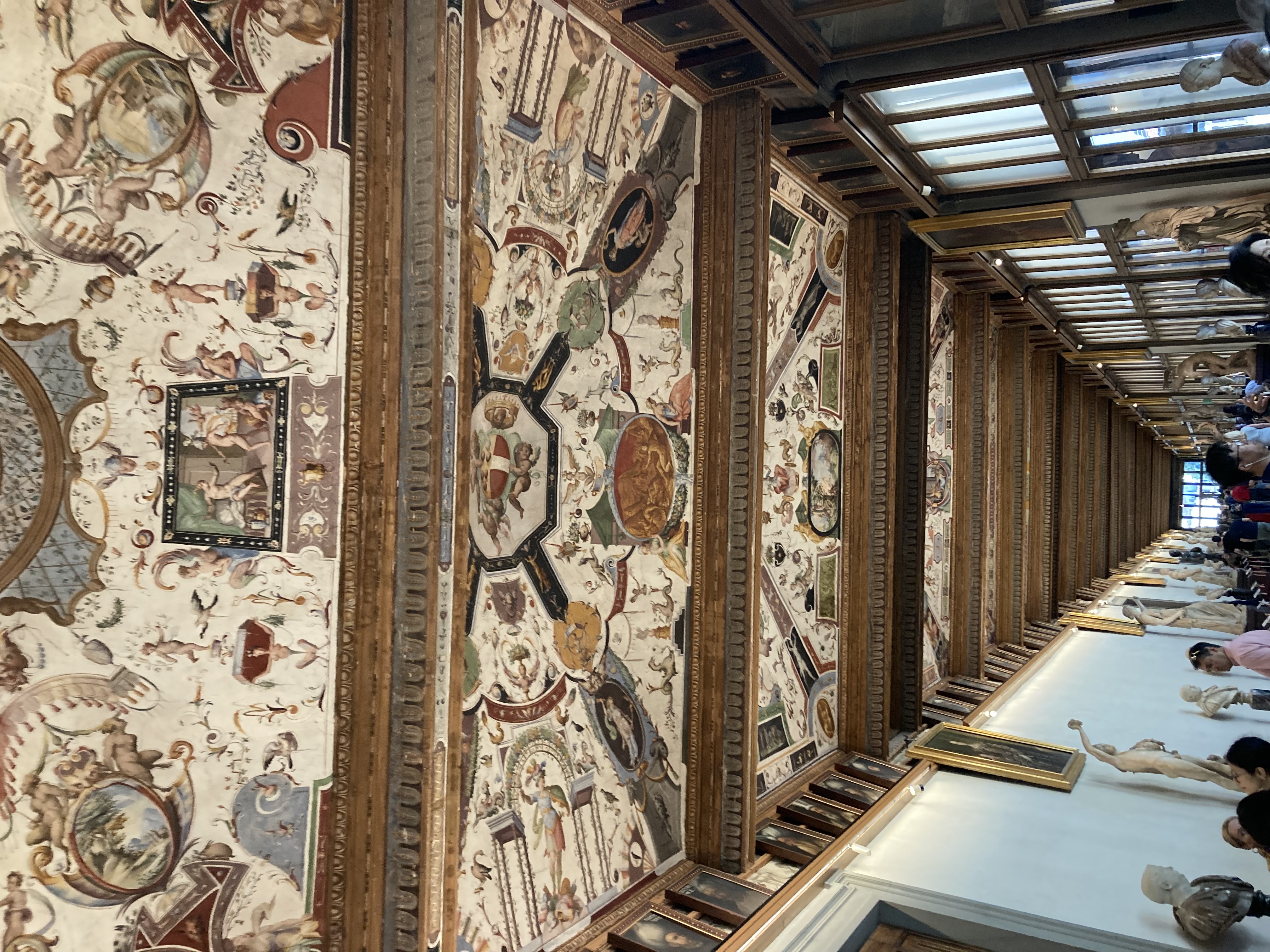
 We’re still not totally adjusted to European time, and the 8am alarm came early today. We had to be up and about to get to our 9am reservation for the Uffizi museum. Last time we were in Italy you could just pay your money and wander in to any museum you wanted, but these days you need to reserve well in advance. Nadia is in class this morning, but the rest of us managed to straggle out a bit later than planned.
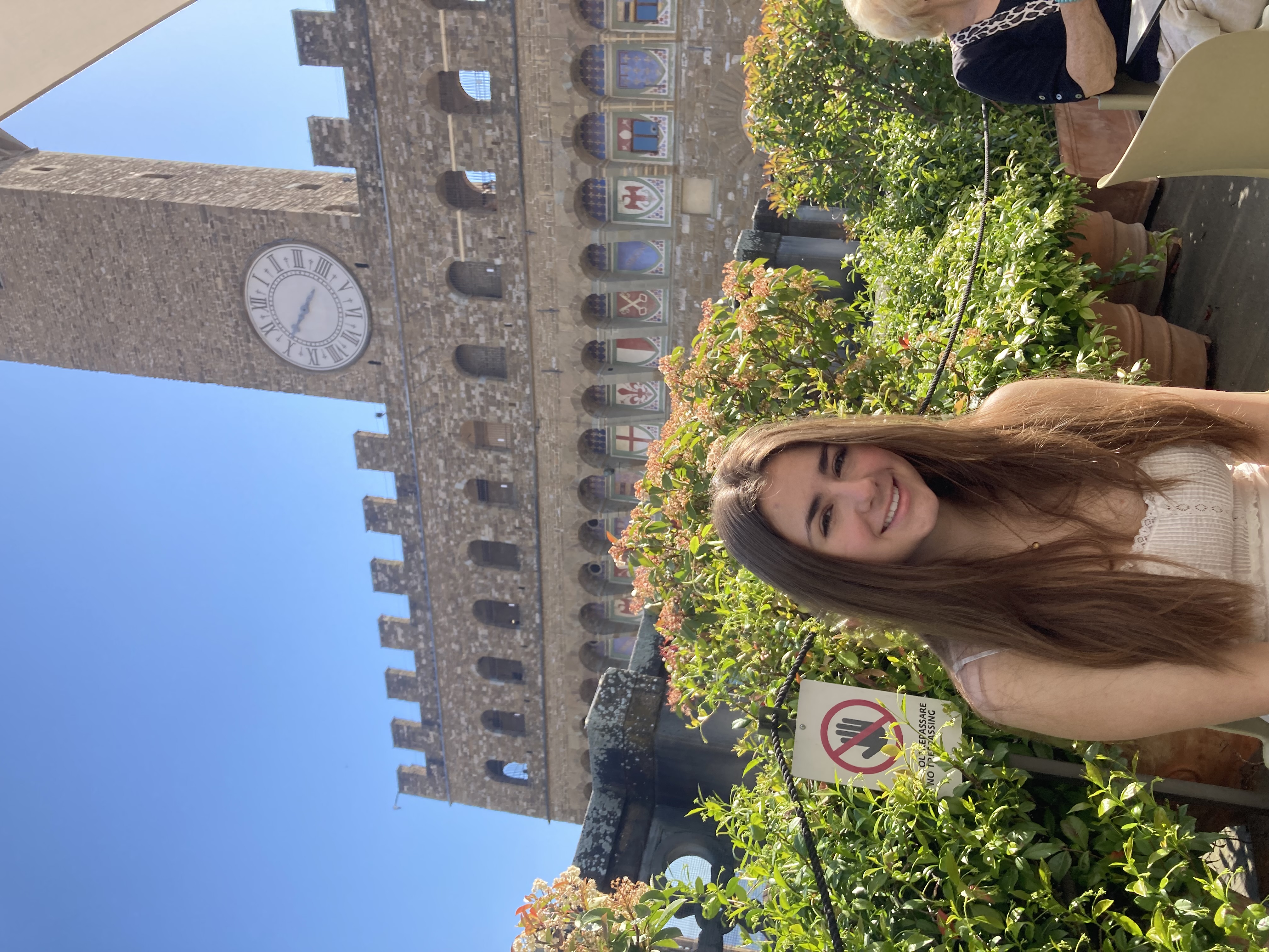
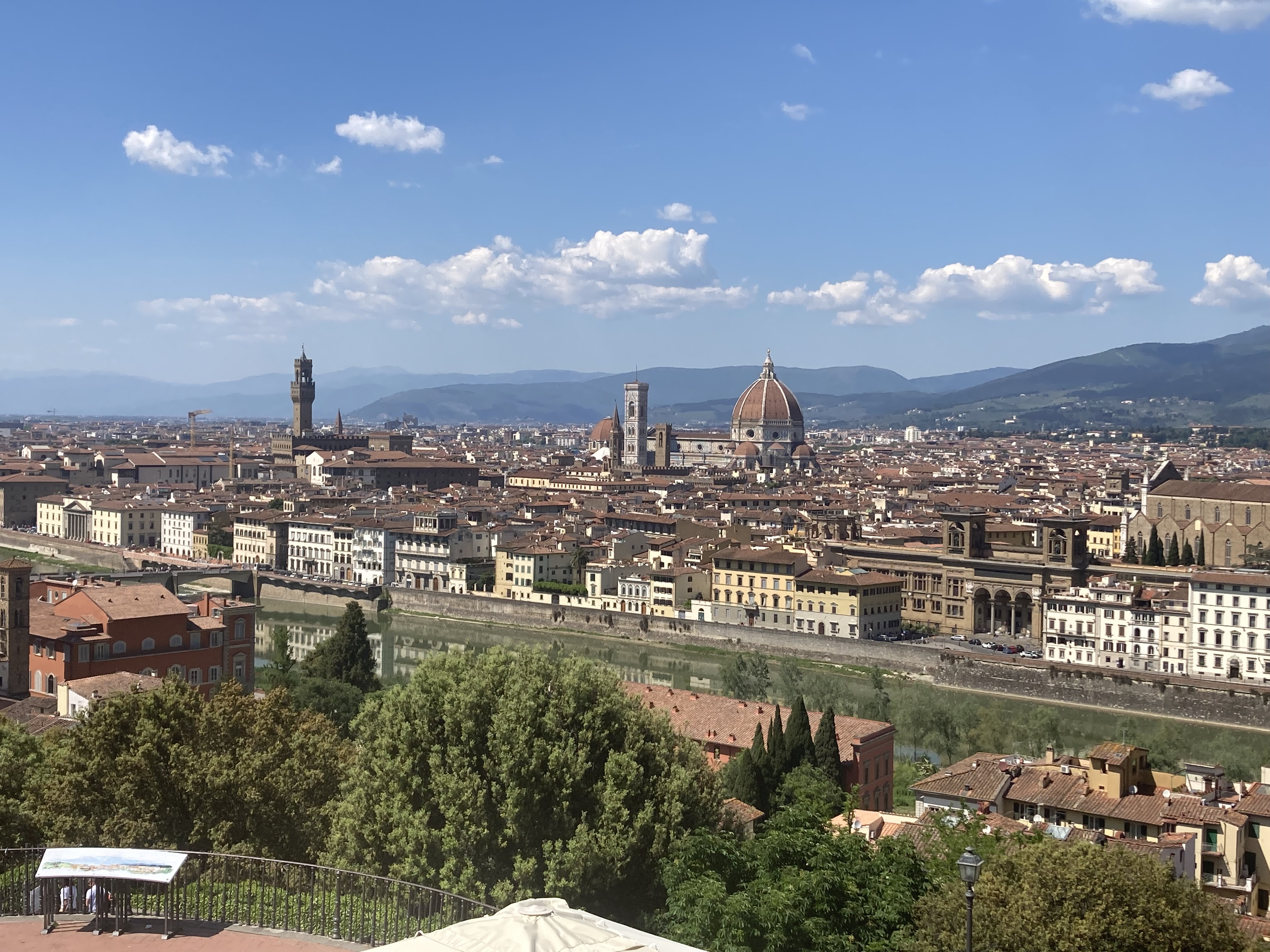
 arrangement — just a couple of minutes walk from the center of everything (Uffizi, Ponte Vecchio, Palazzo Vecchio) — and her room had a large open
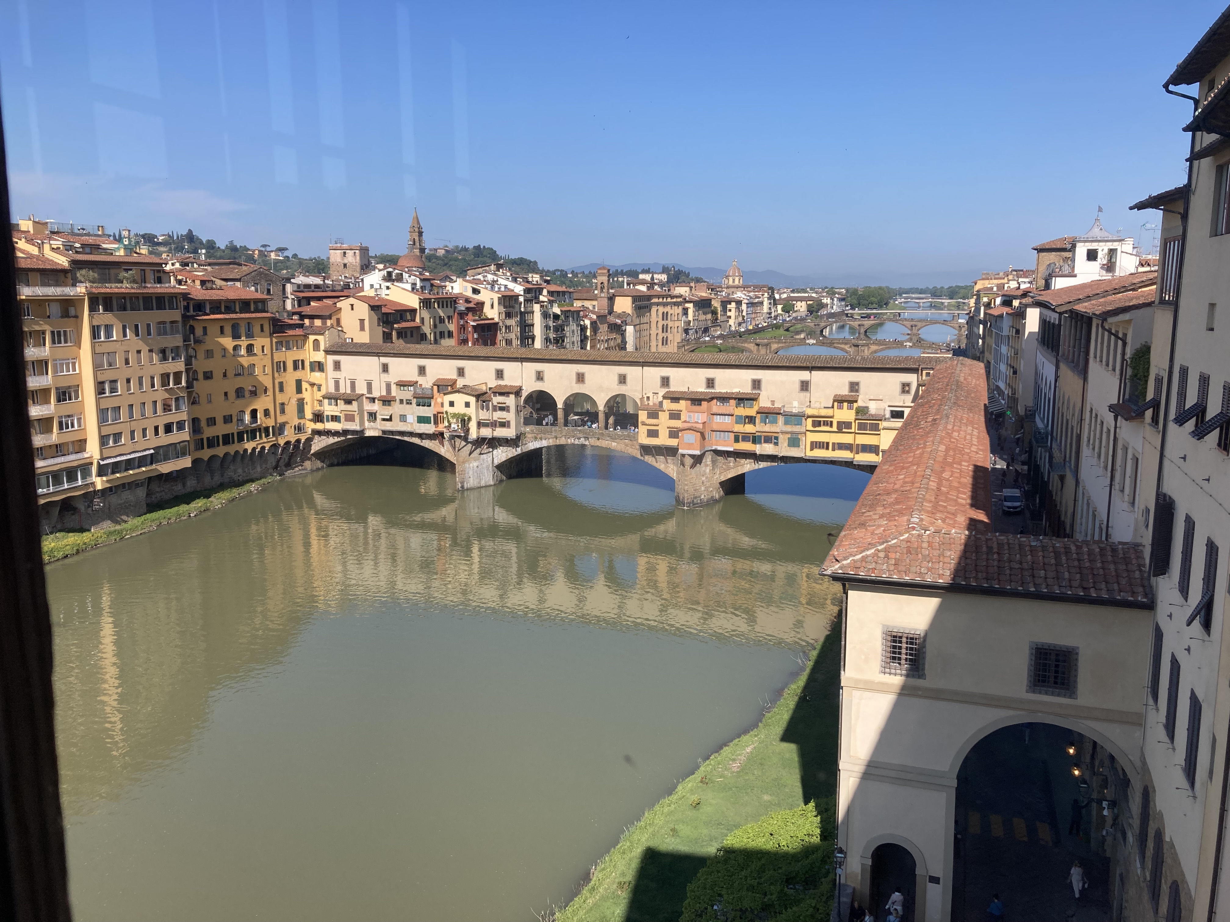 window looking out over the river. (I will never not be jealous of these Europeans who can have wide open windows with no screens, and somehow no bugs.) Her apartment is also fairly close to the Brandy Melville store, which was a big draw for Lanie. Apparently the Brandy Melville store in Florence has different merchandise than what you can find on the Branch Melville website, or the Brandy Melville Boston store. Looking for Lanie in there was a challenge, because the store seemed to a veritable sea of little Lanies, with long straight flowing hair and white tank tops everywhere you looked.
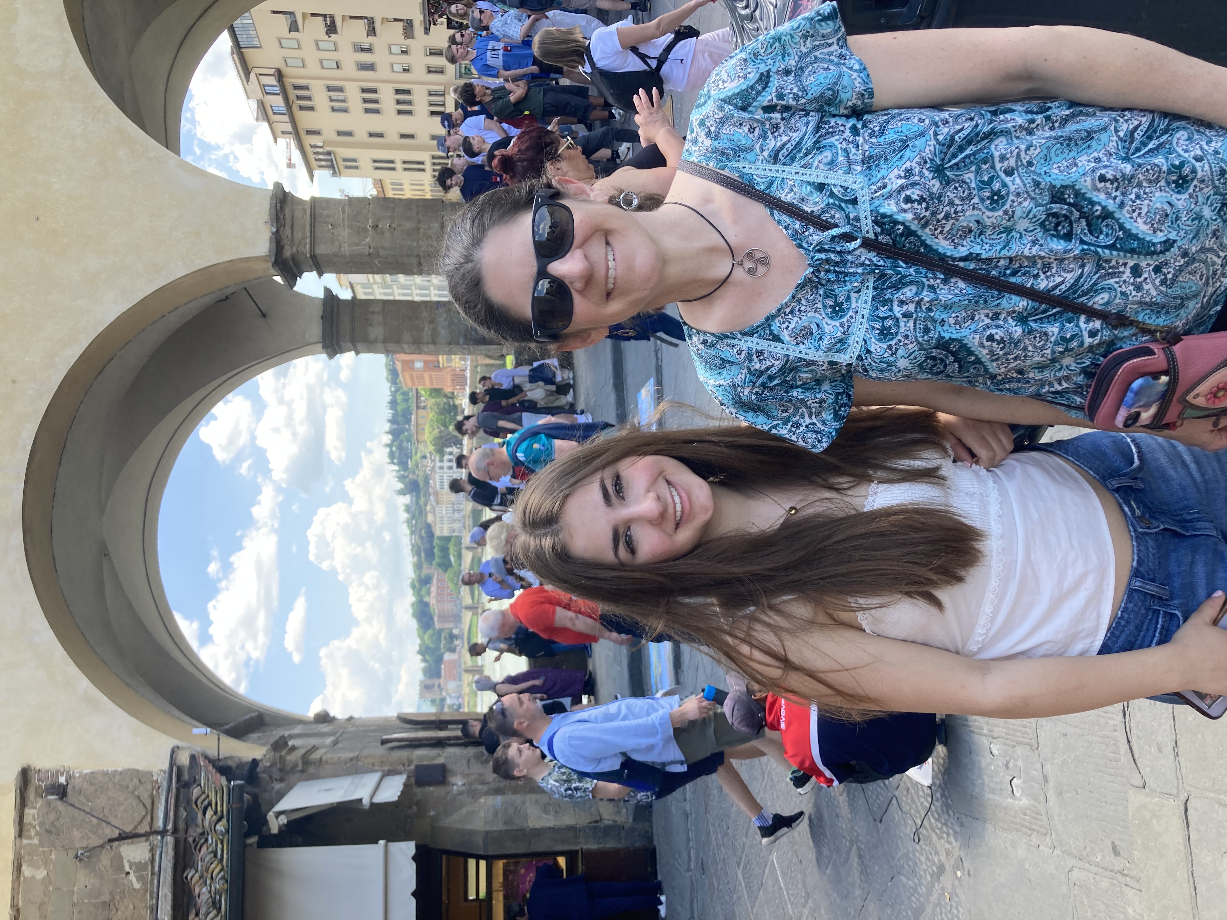
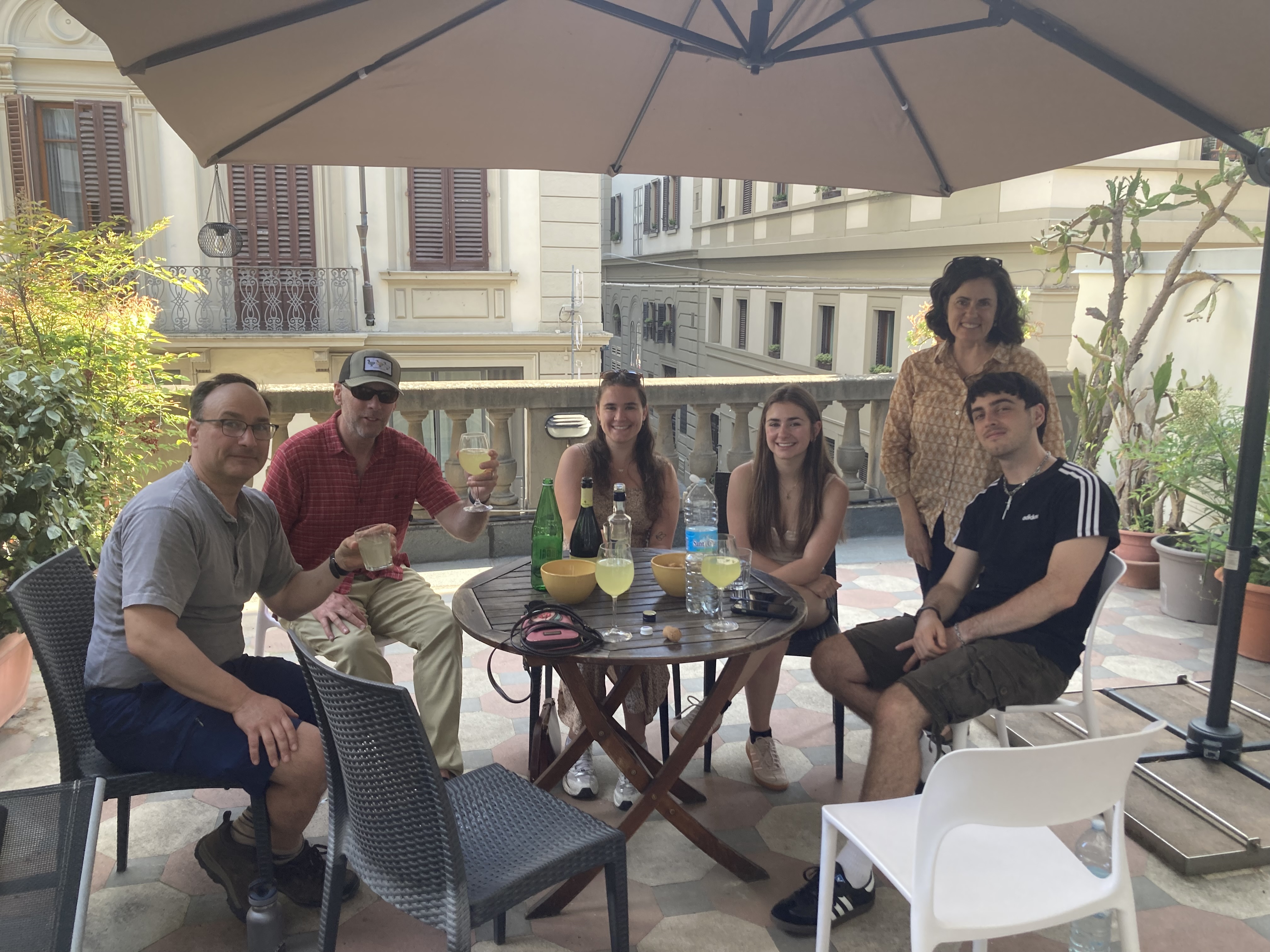
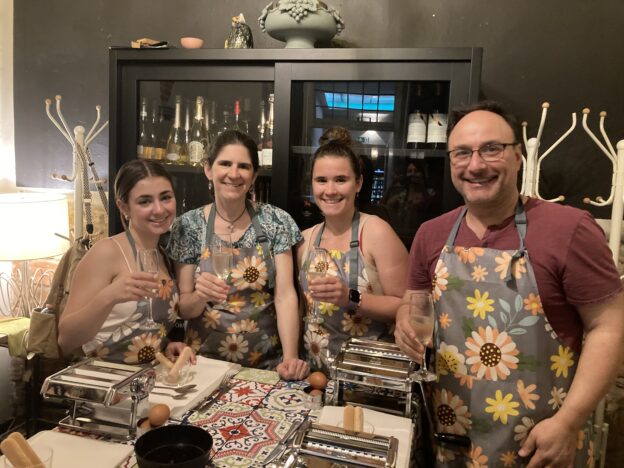
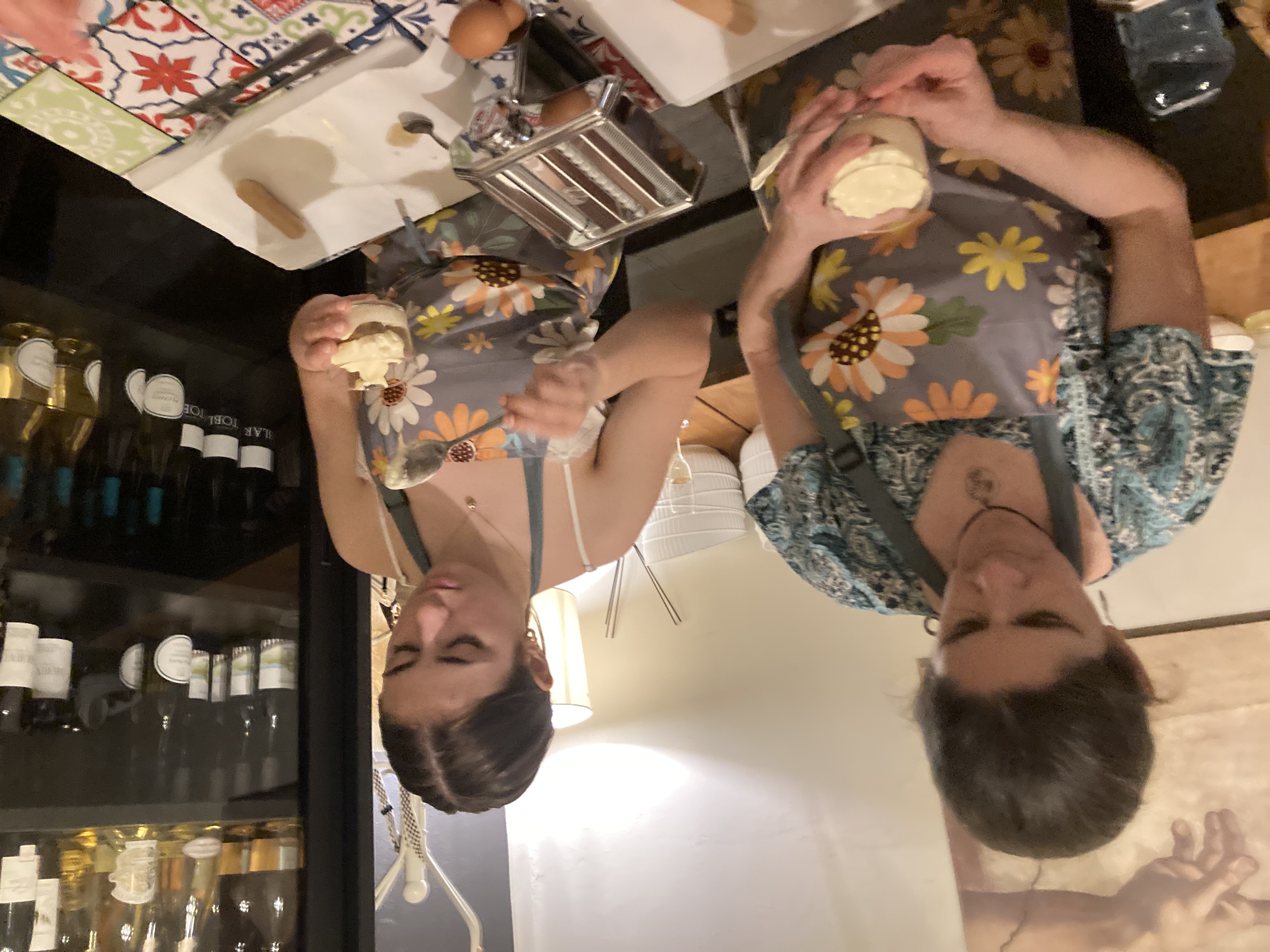 For the afternoon Nadia joined us for a pasta and tiramisu-making class at a nearby restaurant. We learned some excellent Italian cooking tips from our very skilled and entertaining teacher, though there was also a lot of wine involved so we possibly won’t remember them. We’re not sure whether the ravioli and tagliatelle we were served at the end was actually
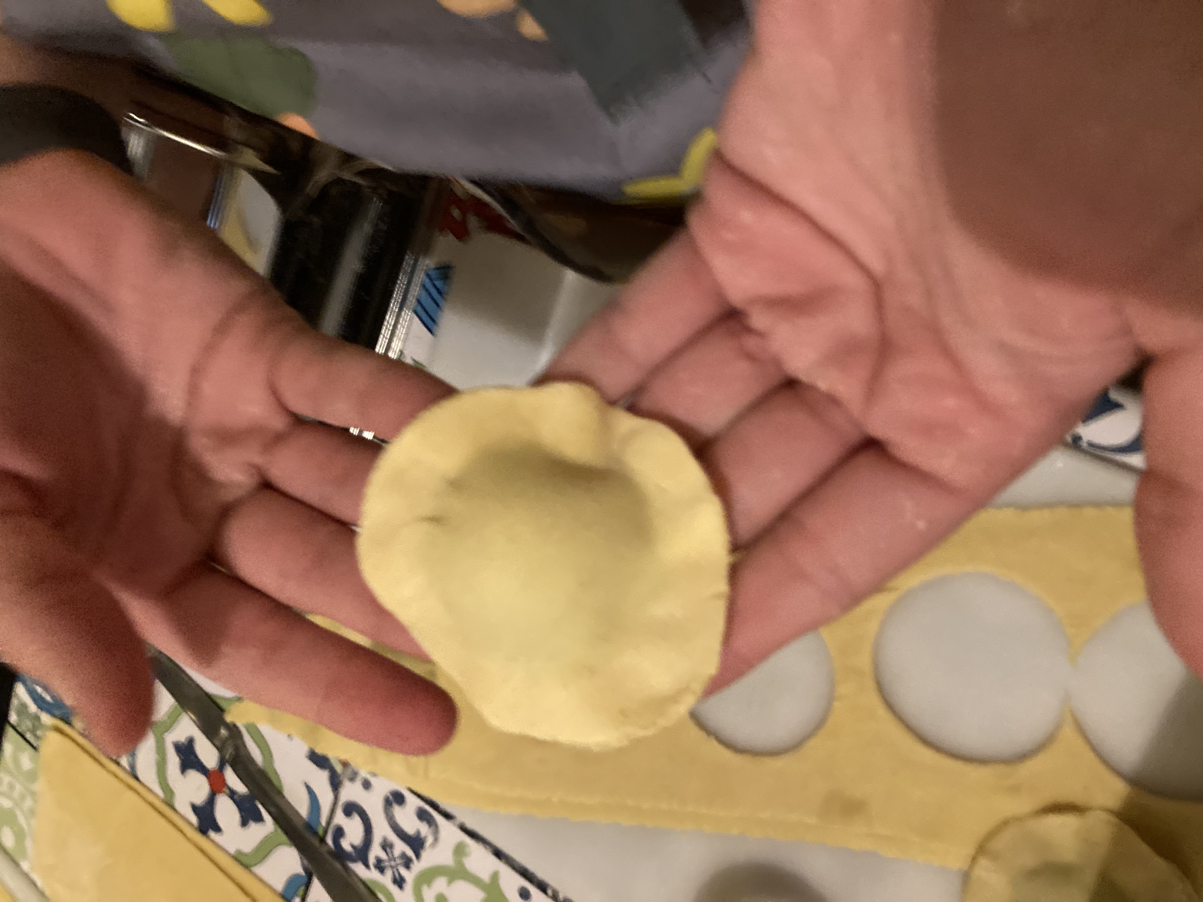 what we’d made, or whether they’d immediately thrown that away and given us something made by more highly skilled people, but either way it was delicious.

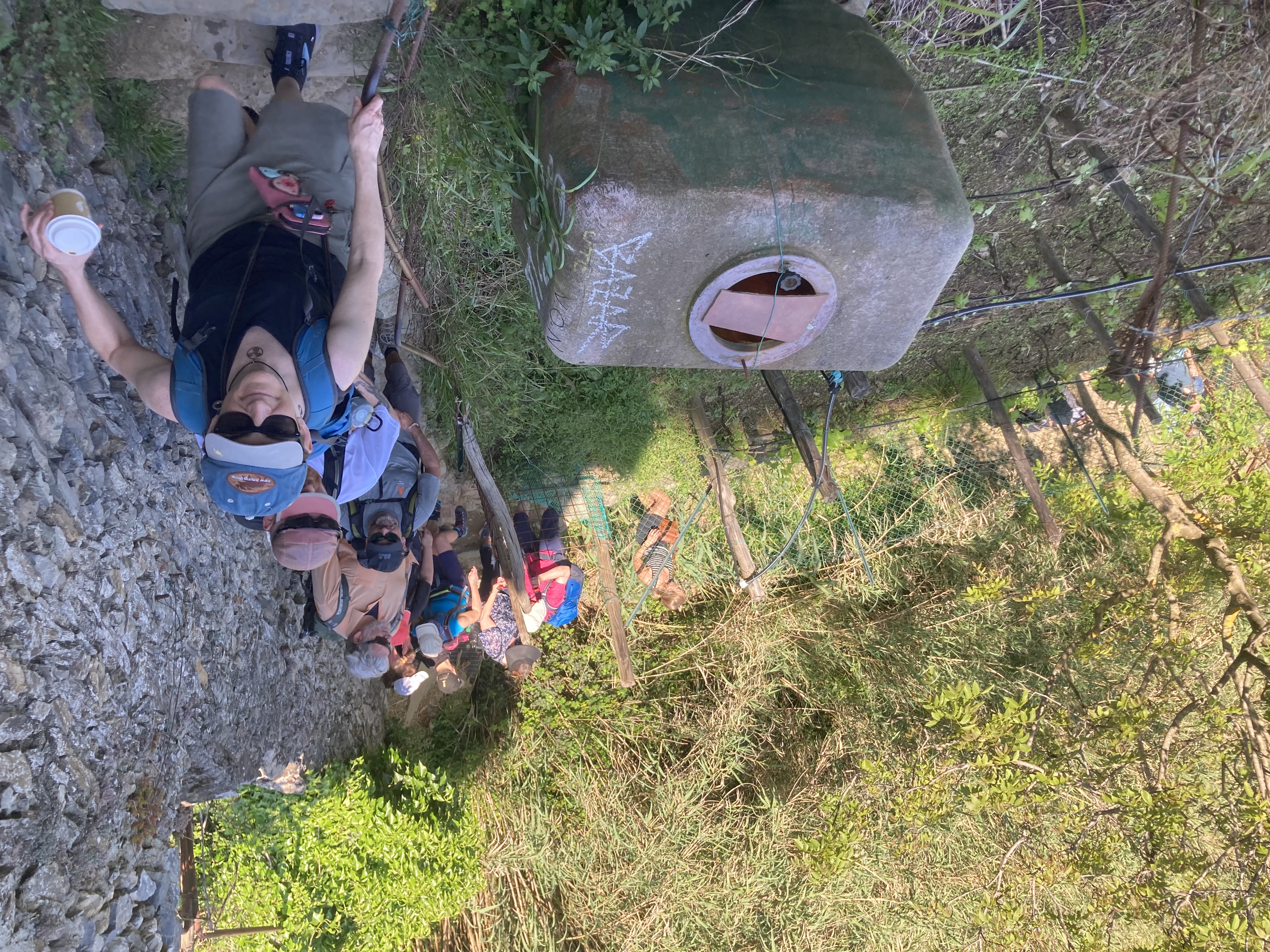
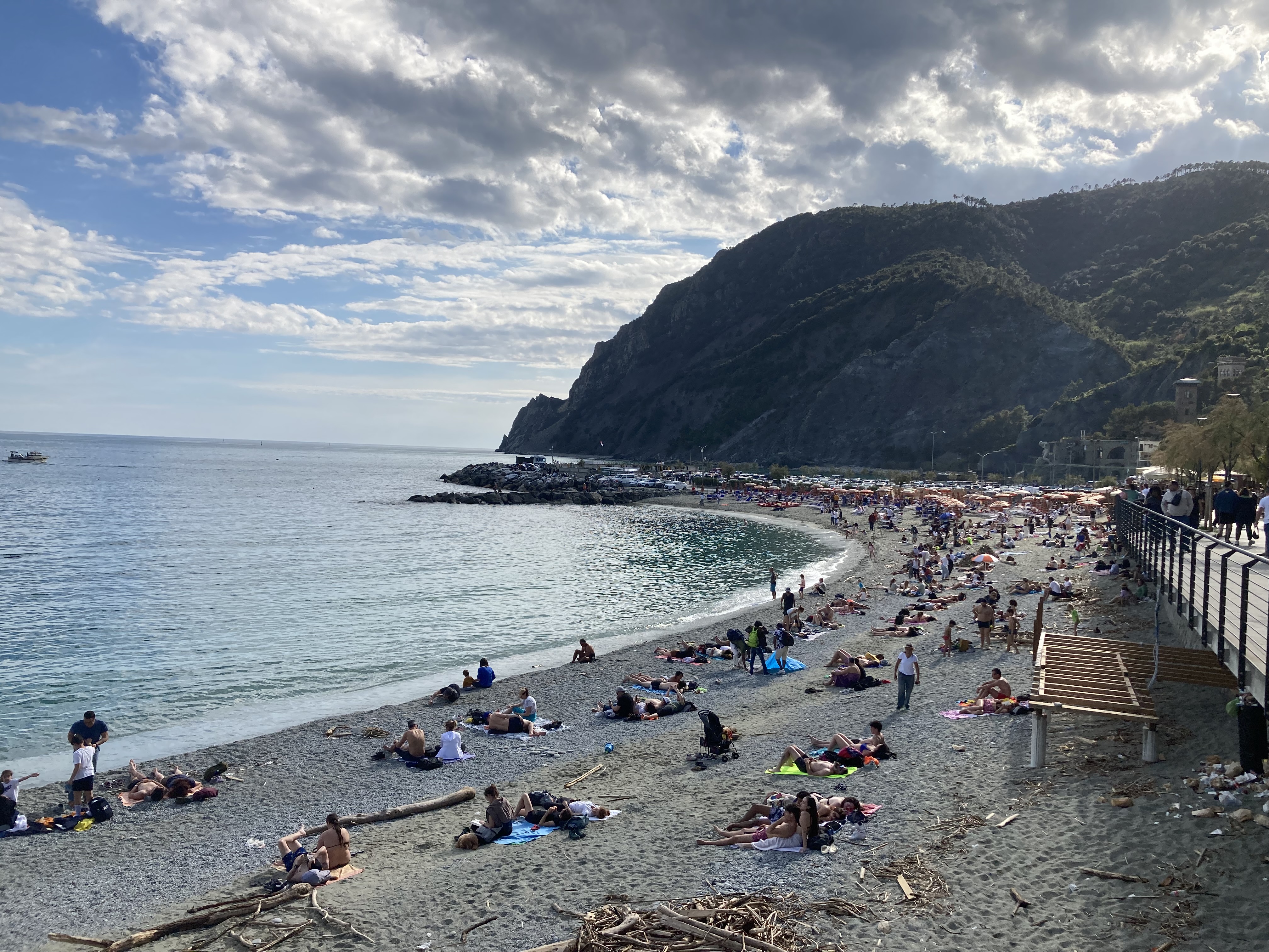
 3. It’s not actually super expensive here. This is especially true on Mondays (see #1 above). Our walk from Monterosso to Vernazza was absolutely worth the 7 euro per person we paid. It was my third favorite hiking experience ever (after the Bright Angel Trail at the Grand Canyon’s South Rim and the Franconia Notch loop). It was a strenuous two miles of absolute pleasure. Honestly, it was worth the whole extravagance of getting here. After a few hundred meters of climbing stairs with dozens of other tourists, things spread out and we were able to climb stairs pretty much in our group of four.
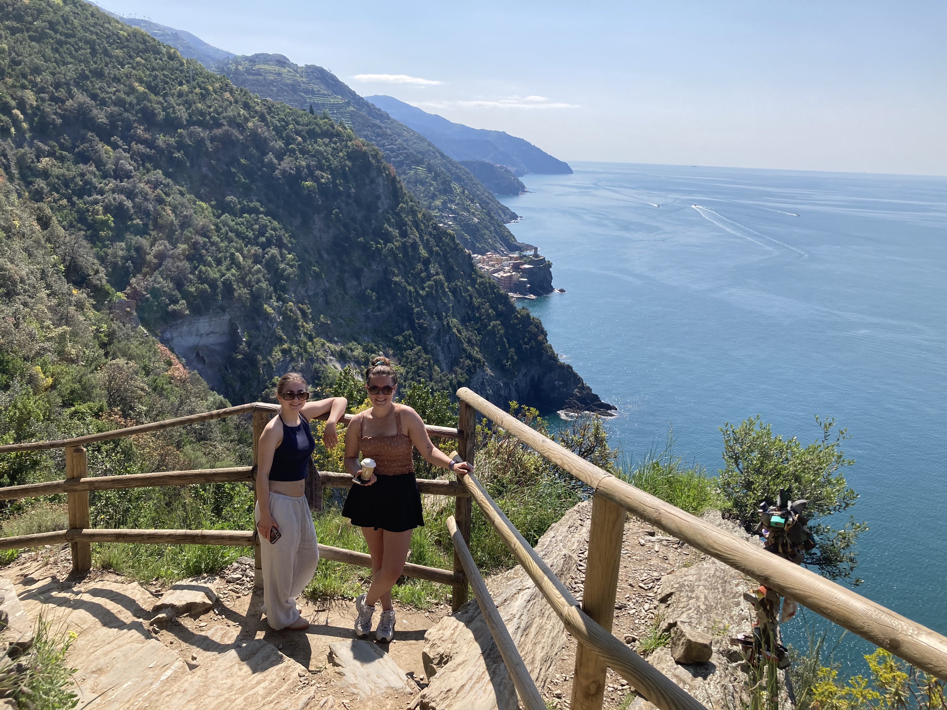
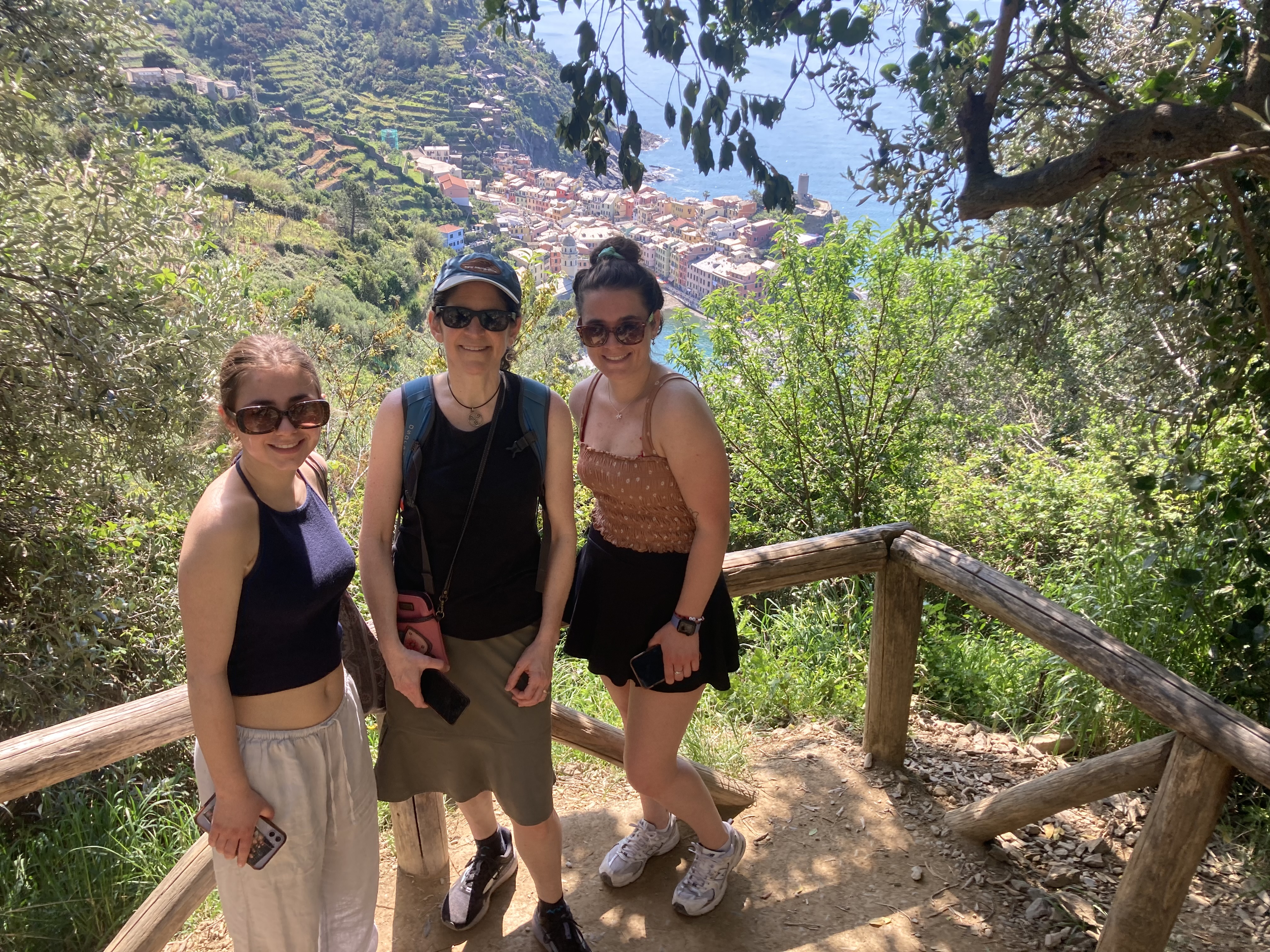
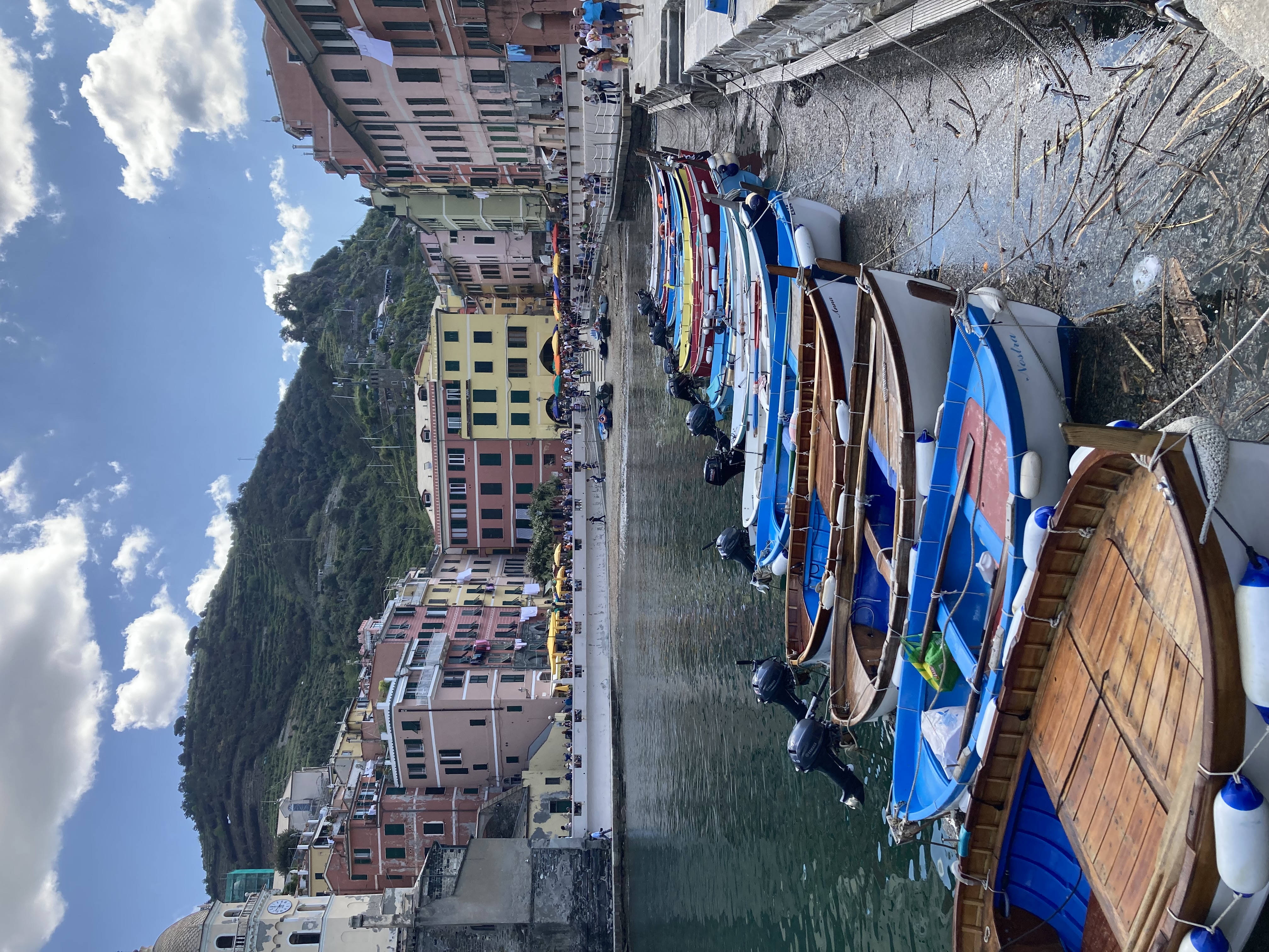
 Eventually we started getting glimpses of the pink buildings or Vernazza. We began imagining ourselves under one of the multicolored umbrellas in the harbor-side piazza. Soon enough we were there, eating lunch under one of those umbrellas. From time to time we would look up into the hills above us and see the people we had passed on our way over, still making their way along the path. It’s not totally that we’re fine specims of health — I mean, we’re not bad, but there were a lot of people much older than us on the trail, and it was not an easy trail. Lots of stairs to climb along the way, and lots of twists and turns in the trail. It was not as tricky as yesterday’s hike, where there were not dedicated steps and a lot of the rocks were covered in moss, making them slippery. But it was not a total walk in the park, either.
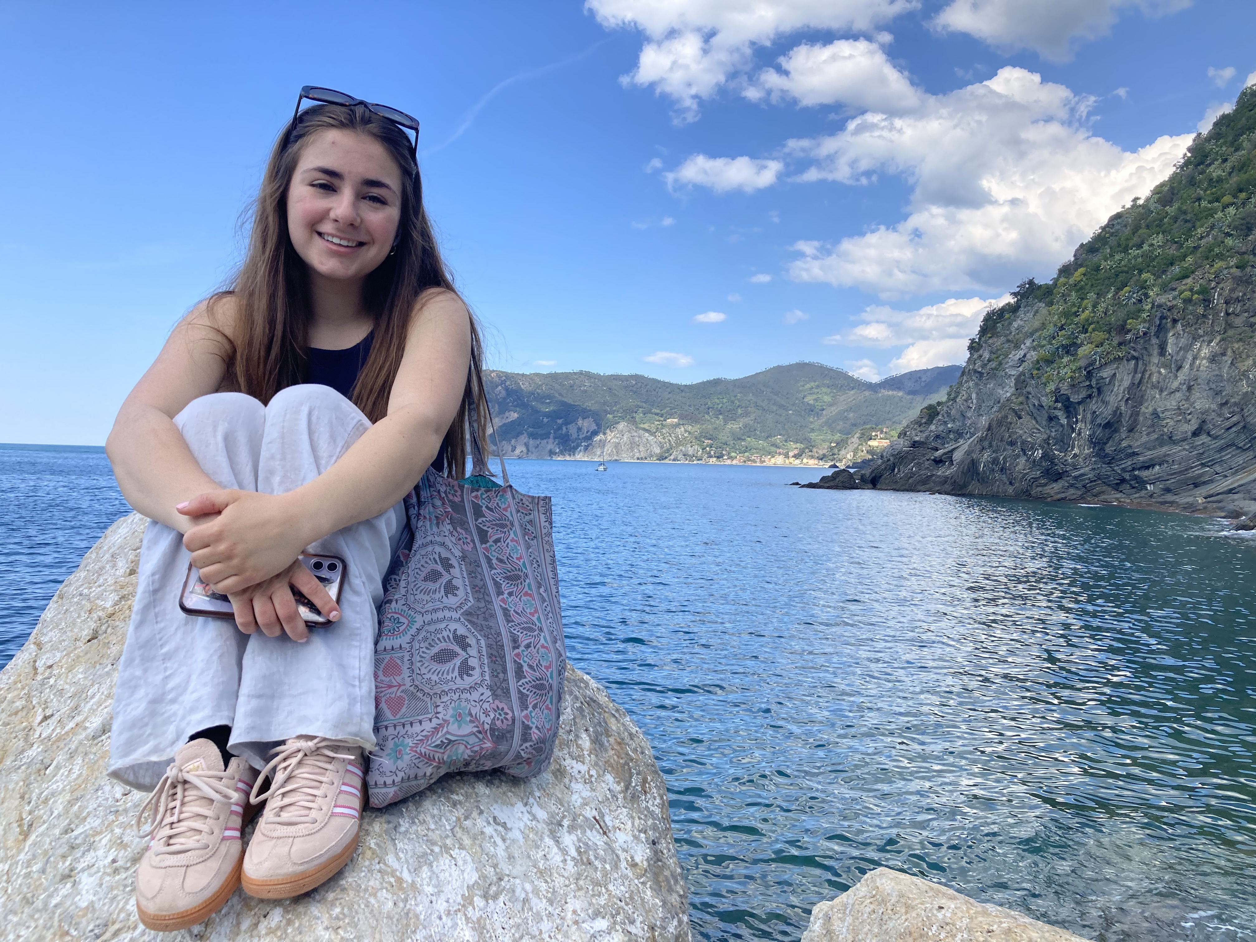
 In terms of expense, we ate lunch in a seaside resort, on the main piazza of what most people think is the most scenic of all the town in the Cinque Terre, and we paid about 85 euro for the four of us. I think we would have paid a lot more in the US, and the food was better than it had to be, given the prime real estate. We have found some nice value here. A liter of sangria at a cafe right above the main Monterosso beach — 20 euro. And they gave us snacks. We ordered another round because we still had an hour before our train left. That’s right, we were in a cafe five minutes from the train station, staring our at the Mediterranian Sea, and they didn’t really gouge us for booze. That price includes the tip. Did I mention that?
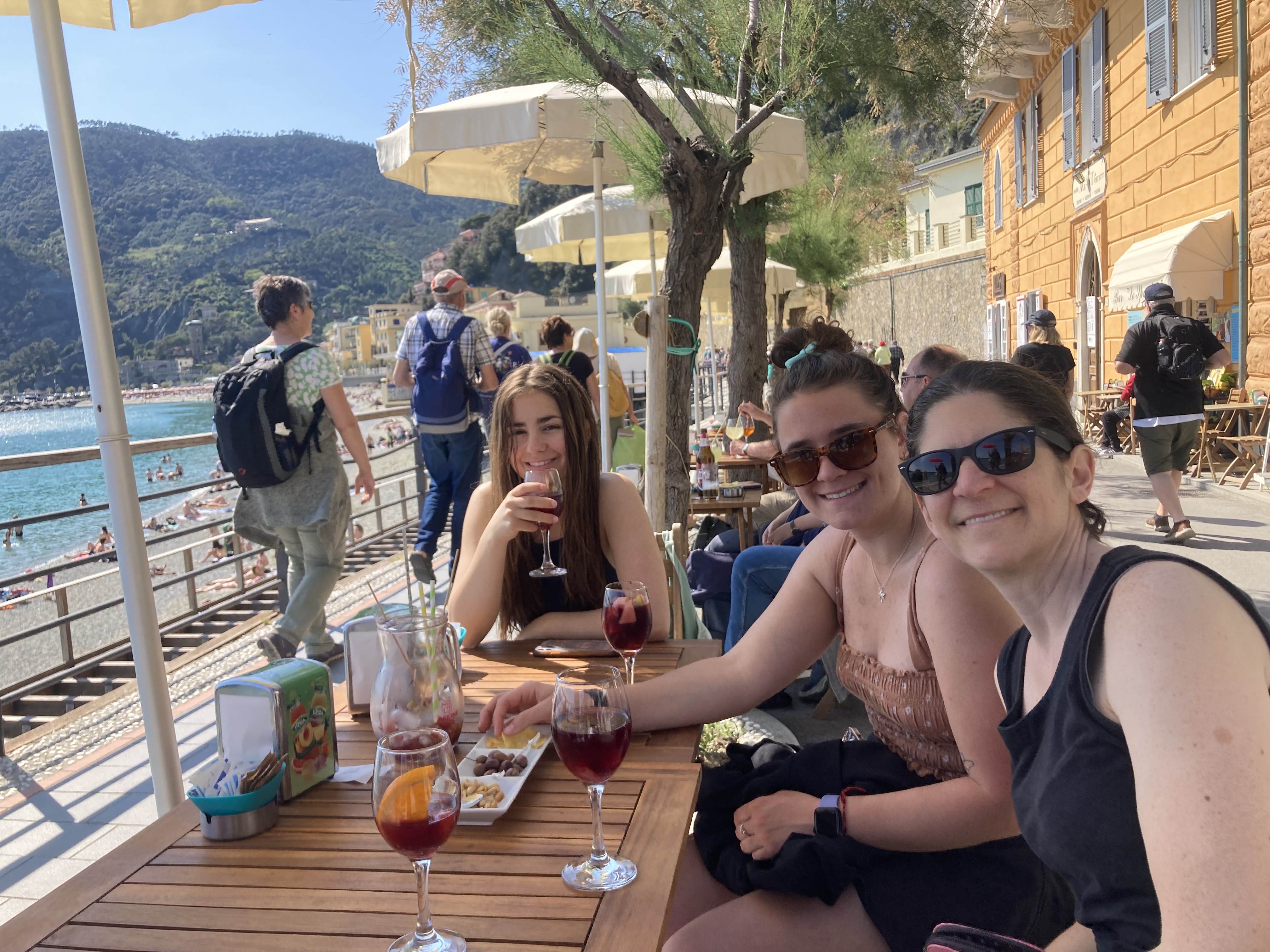
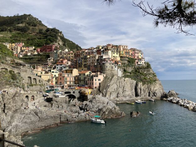
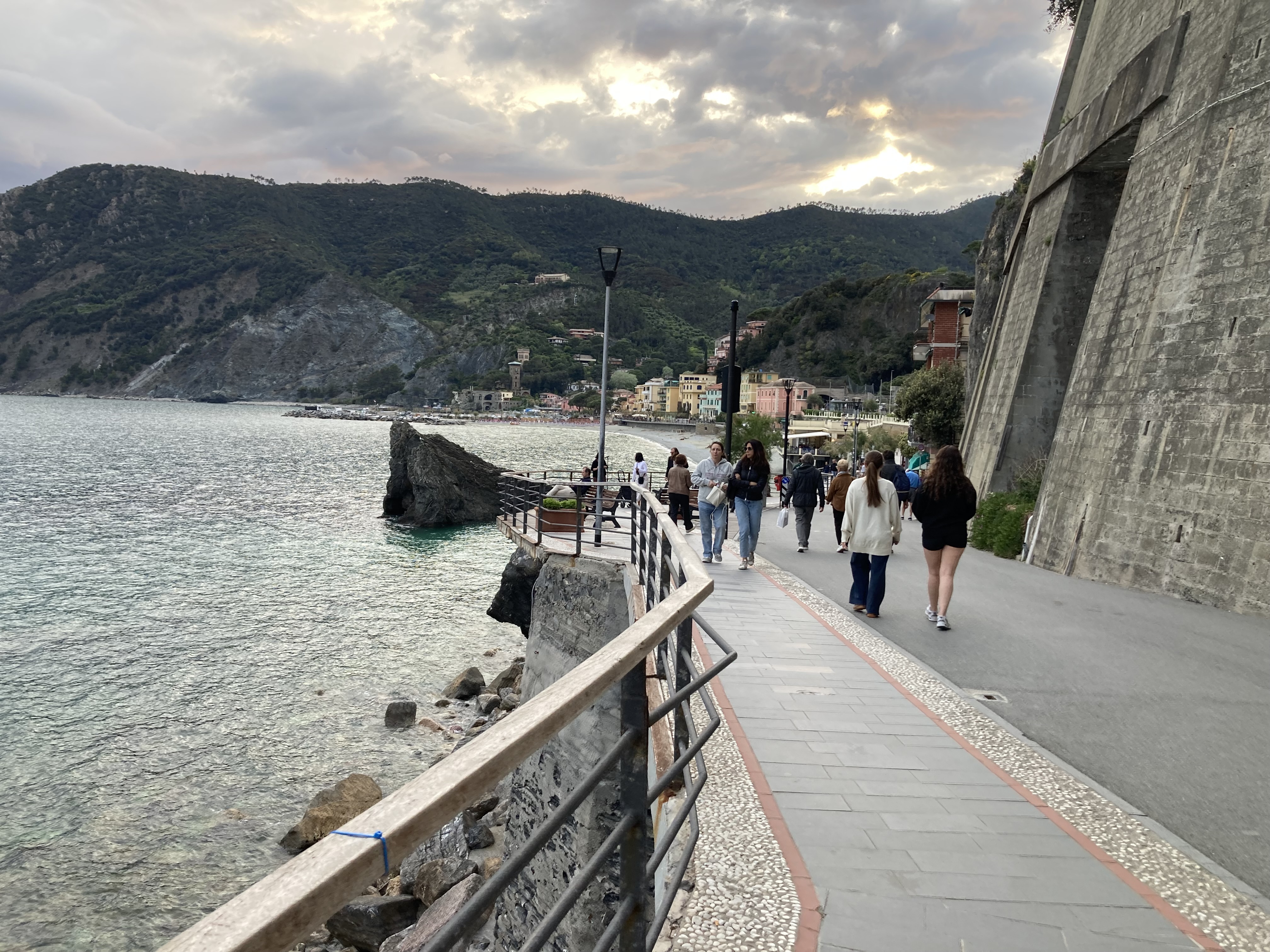
 Cinque Terre has done its best to live up to all our expectations. The town we’re staying in, Monterrosso al Mare, has all the the tourist guides promise — towering cliffs, blue-green waters,
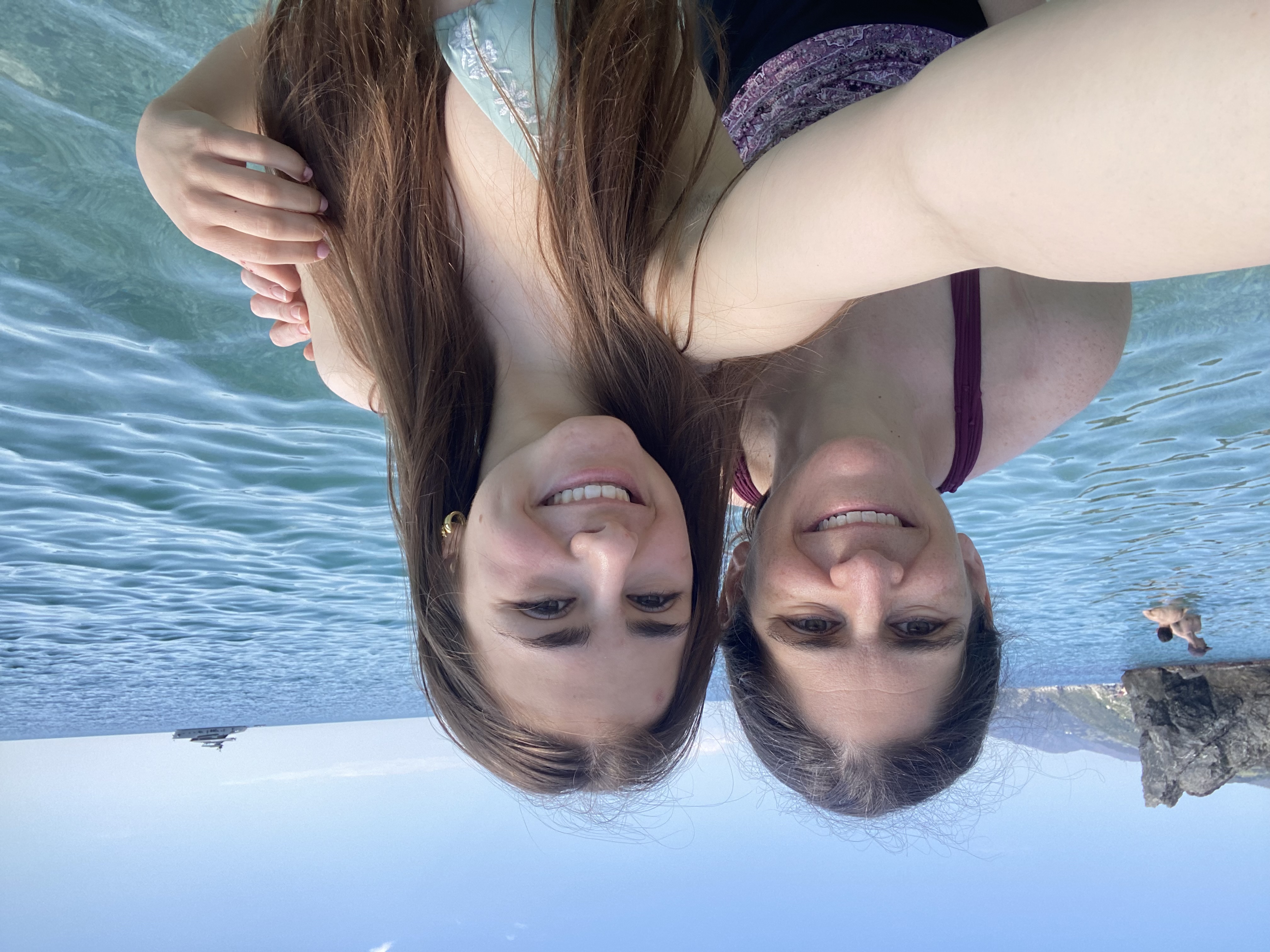
 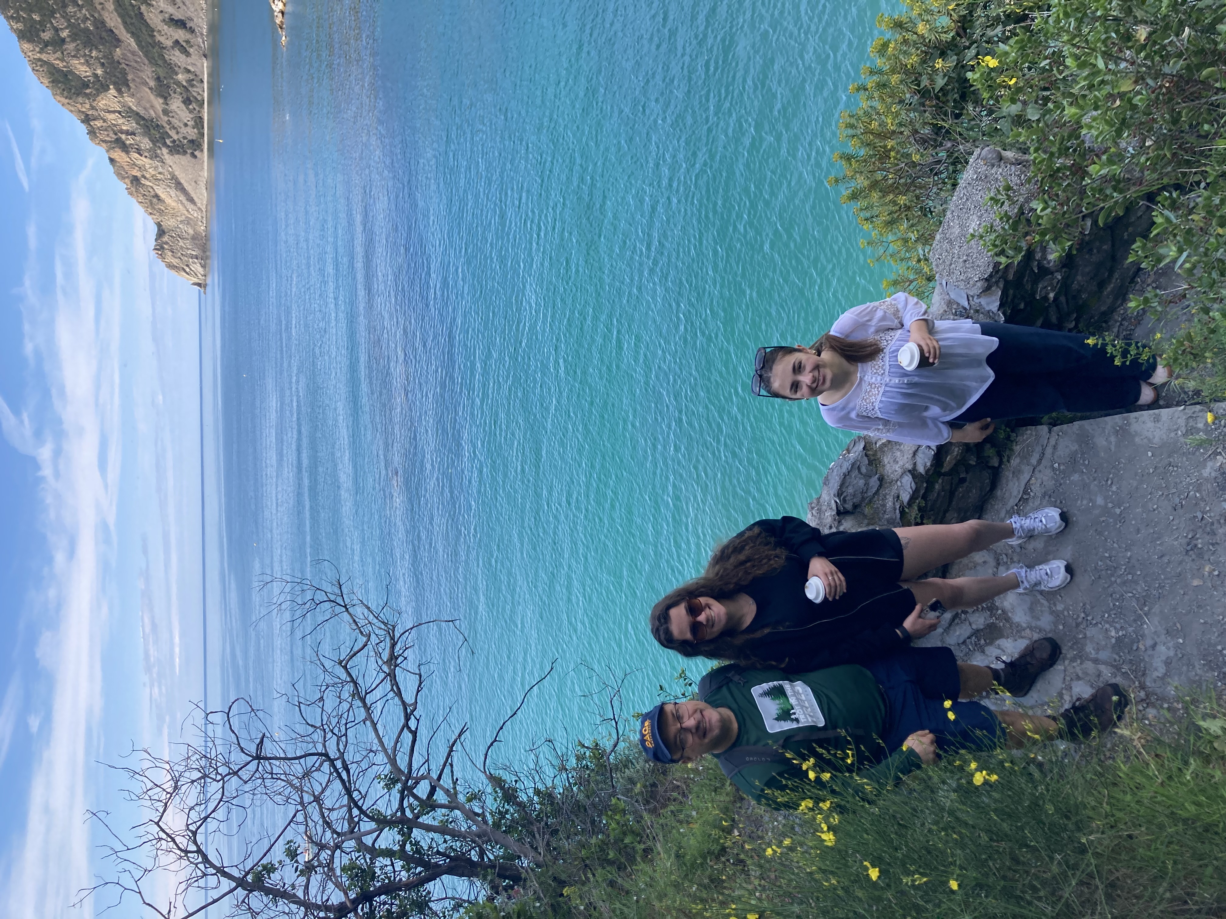 colorful buildings, copious walking paths. It’s not Monterosso’s fault that we’ve been forced into being preoccupied with a less happy focus — how to reclaim Lanie’s lost luggage.
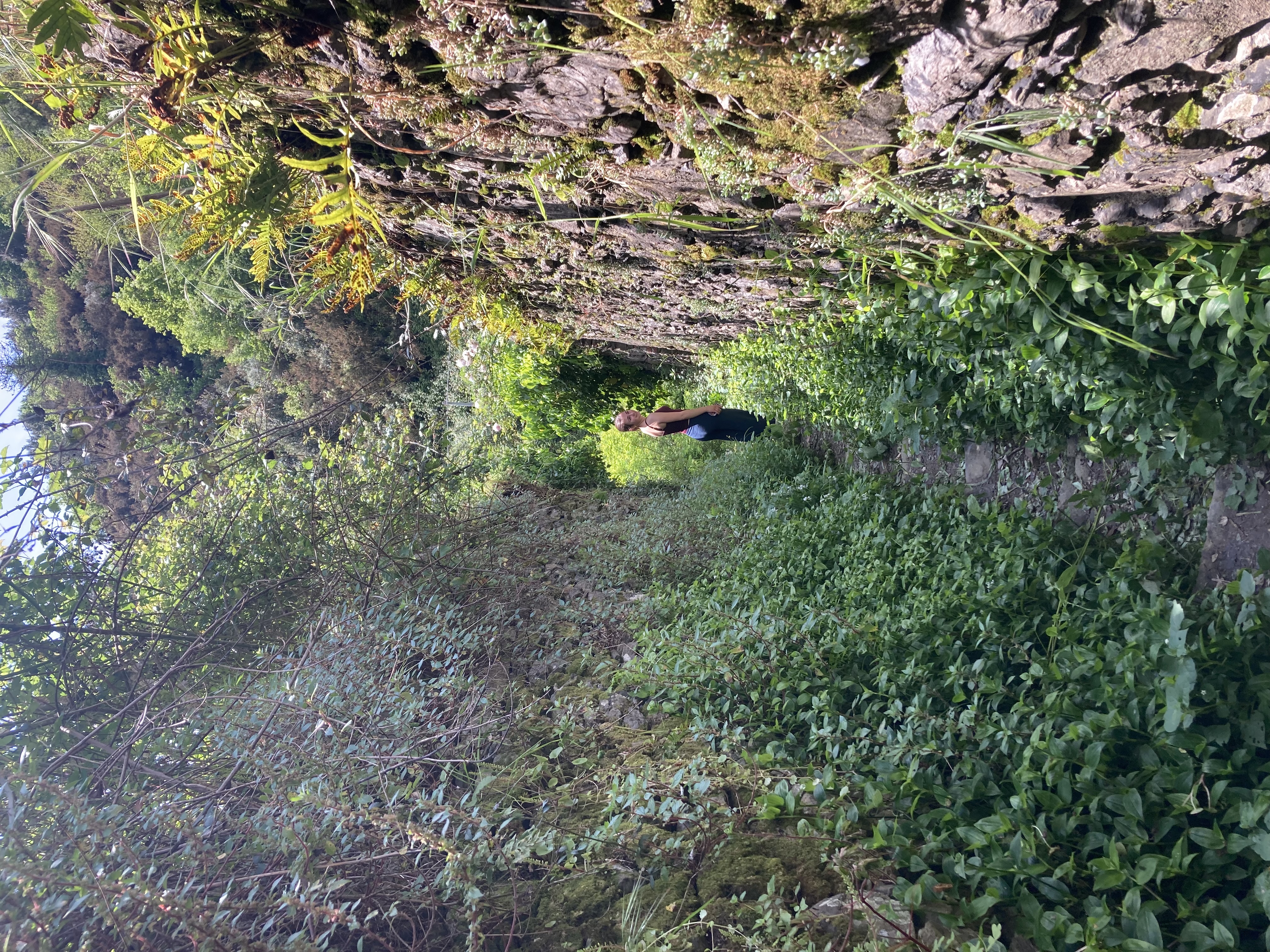 into a lemon grove. This proved to be a delightful walk along a river with frequent waterfalls, lemon trees overarching the path from the hillsides above. Eventually the path led way, way up the steep hillside, and eventually we got some nice views of Monterosso and the sea in the distance. We were hoping the path would lead back down — and possibly it did somehow — but we hit a fence and a gated road and decided to avoid a potential trespassing situation.
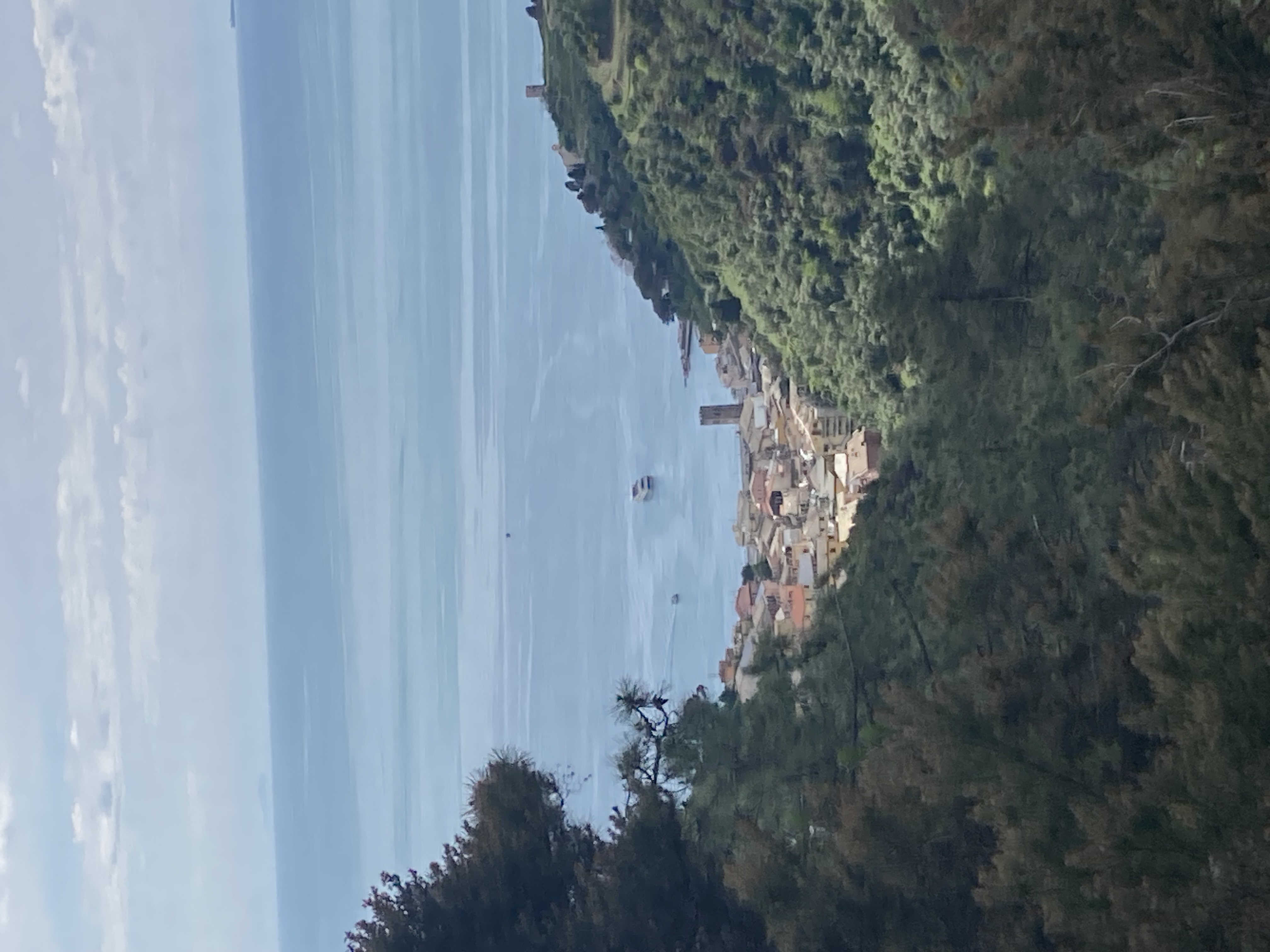
 Throughout this time, we’d been checking approximately every 5 minutes for word from the luggage courier. But our emails and calls were going unanswered, and the day was wearing on. After
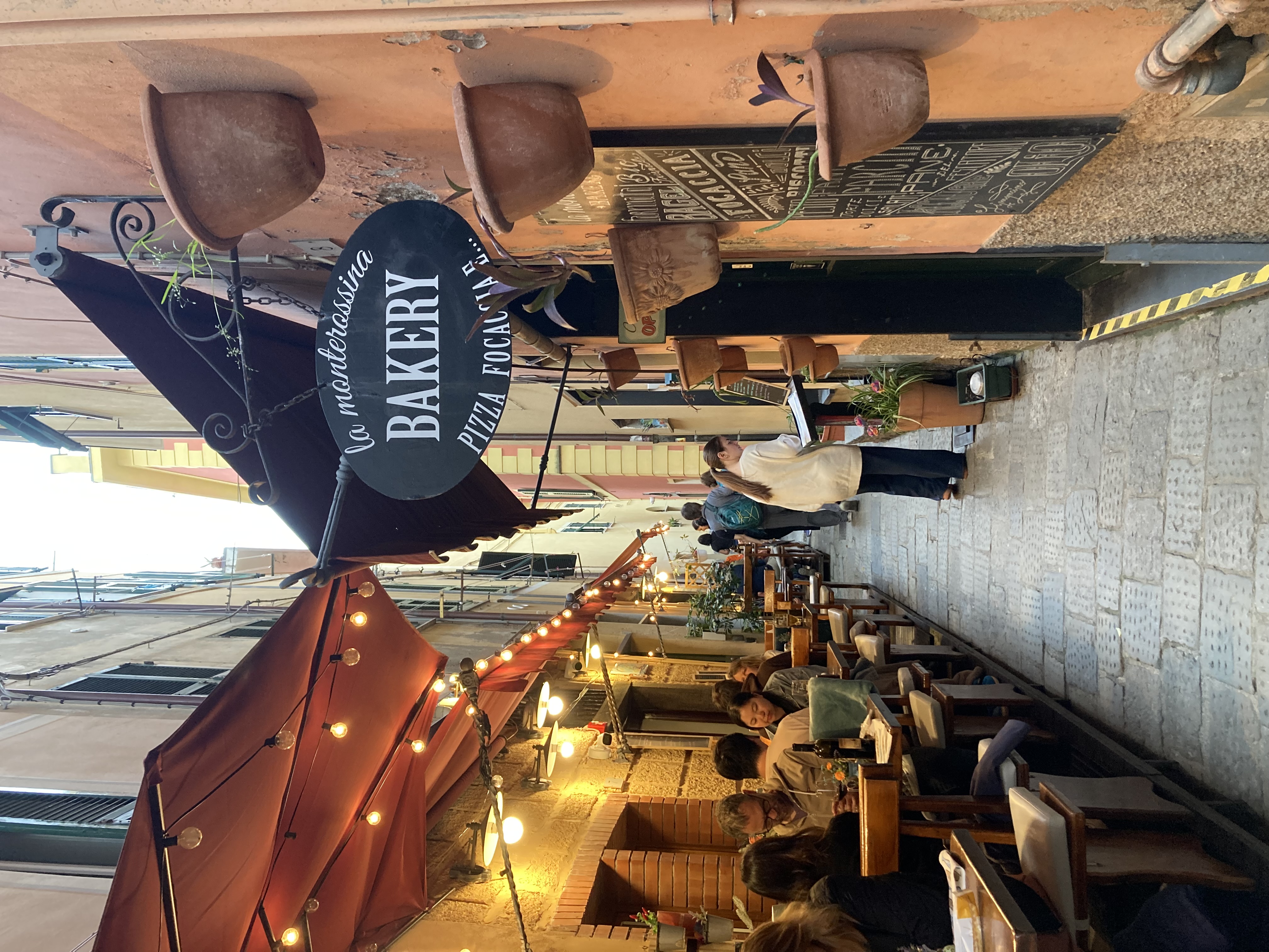 another email asking them to PLEASE give us advance warning of their arrival, we decided to hop on a train to the village at the far end of Cinque Terre, Riomaggiore. (The train runs every 20 minutes and takes only 11 minutes, so we figured we could get back pretty rapidly if needed.)
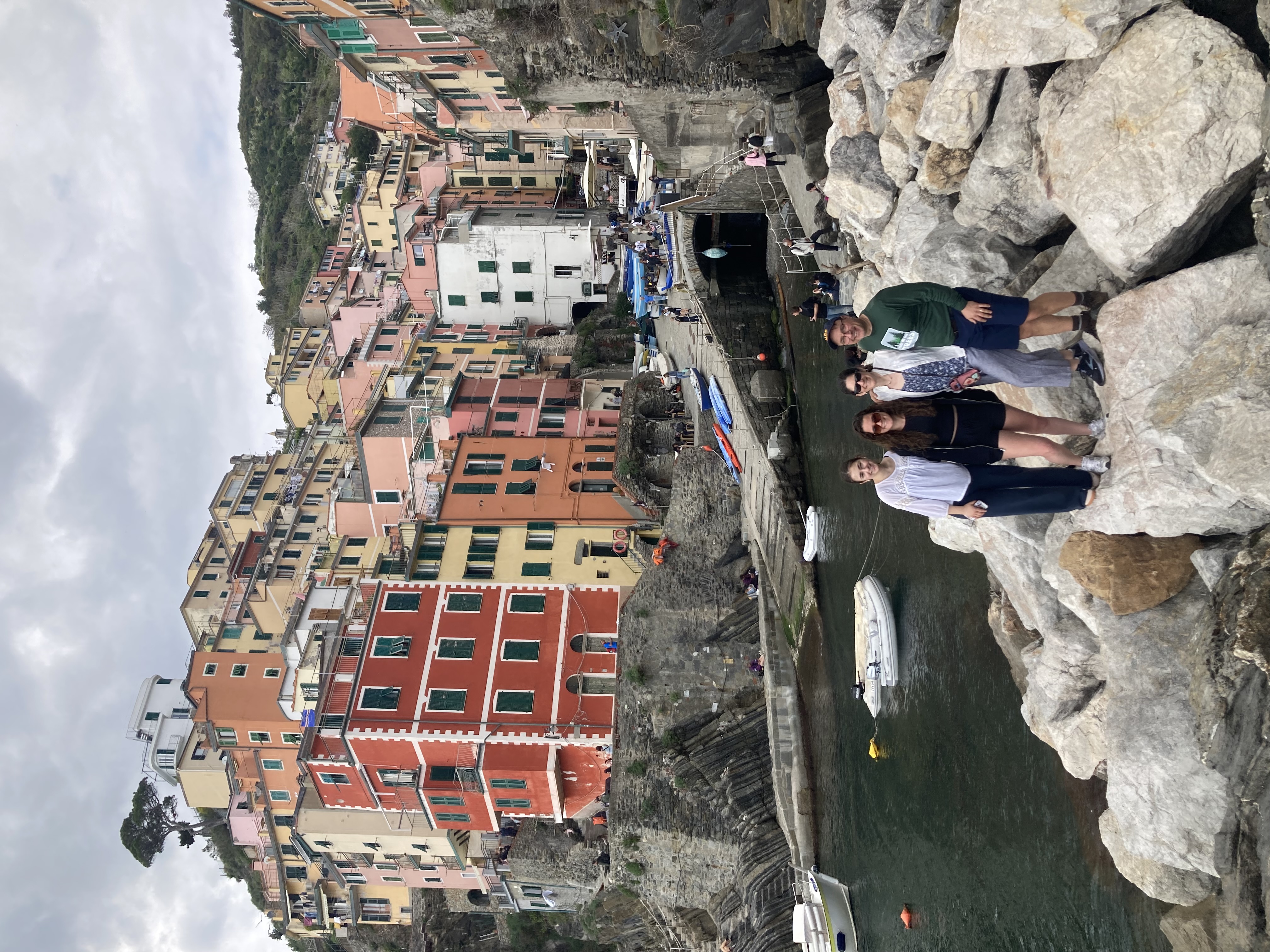
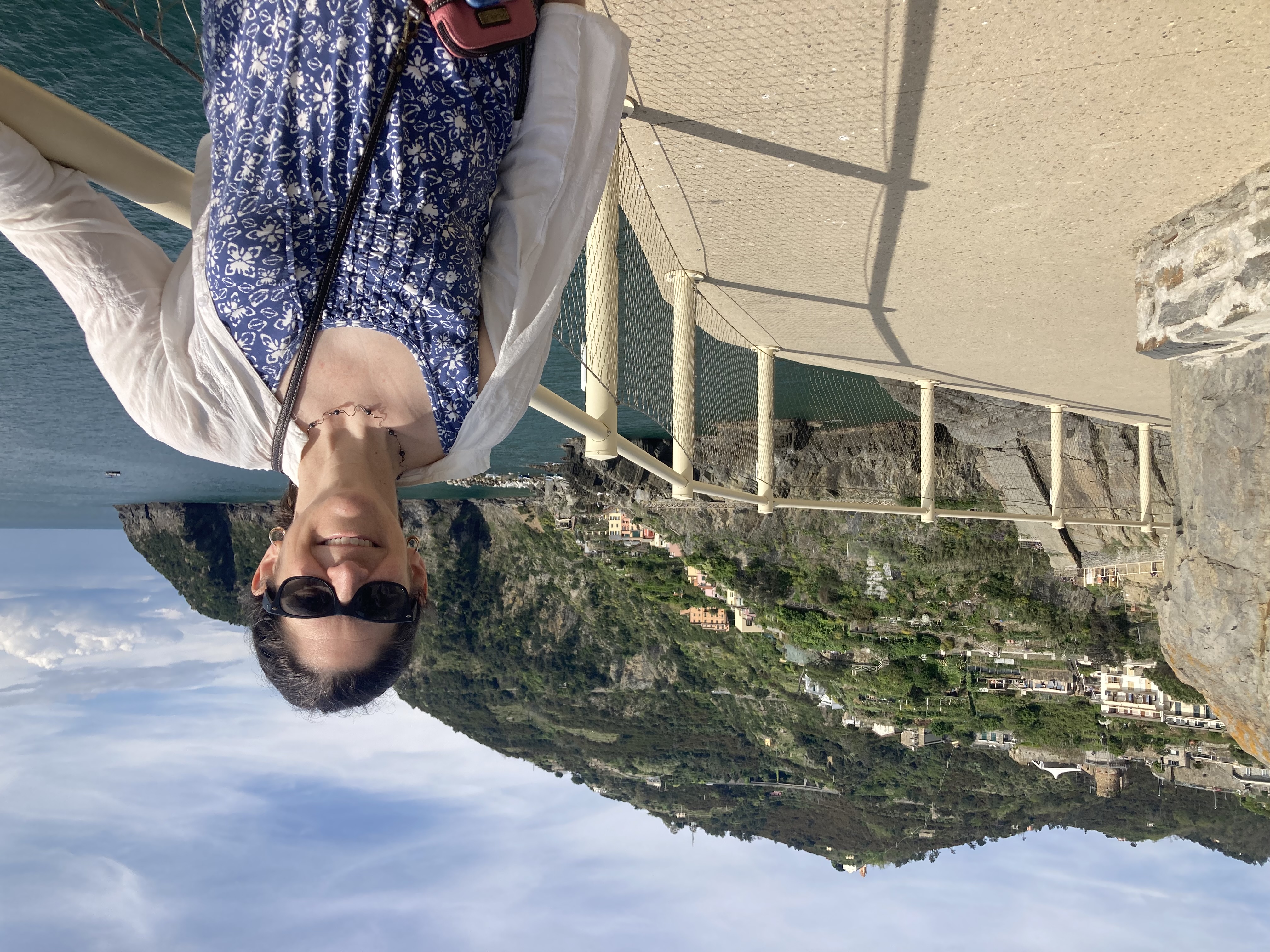 Riomaggiore was another lovely little town. There was an area down by the water where you could climb on rocks (or jump off them into the water, if you were adventurous) and take in the views of the brightly-painted buildings rising up the cliffs above. Bob and I were a little more ambitious and wanted to walk to the next town, which didn’t look to be very far. The girls decided to bail on this plan — Nadia’s shin splints were acting up from the morning’s hike, and Lanie was feeling jet-lagged — so they stayed to explore the town and take the train back while Bob and I set off down the path.
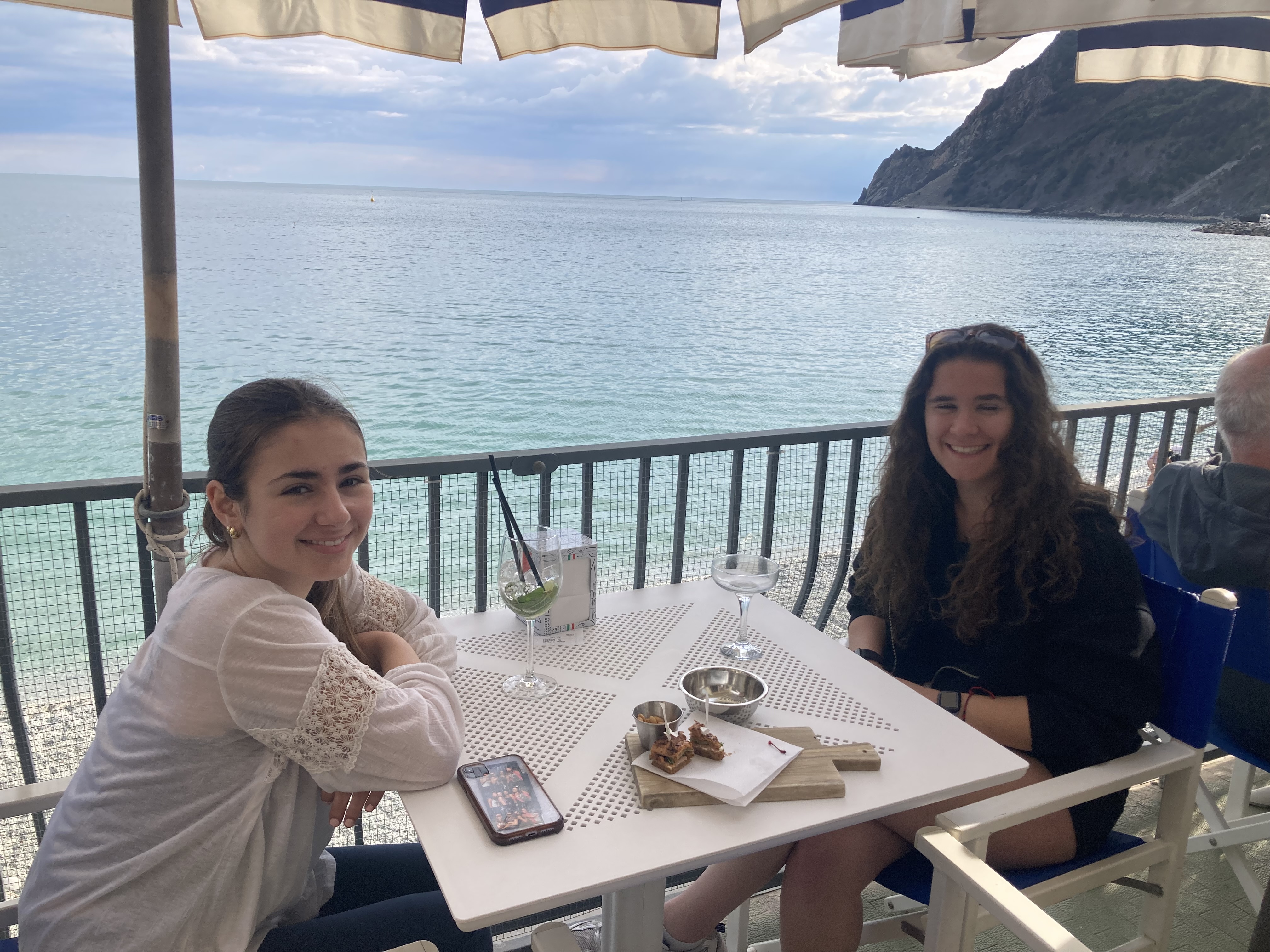 We quickly found that to walk the path required both the Cinque Terre card (which was what we’d declined to buy that morning) AND a supplemental payment for this leg of the trail, called the Via di Amore. When we heard the 25 euro per person price tag, we walked away — but then weren’t sure what else to do with ourselves, so decided to grit our teeth and pay it. It must be pretty spectacular, right?
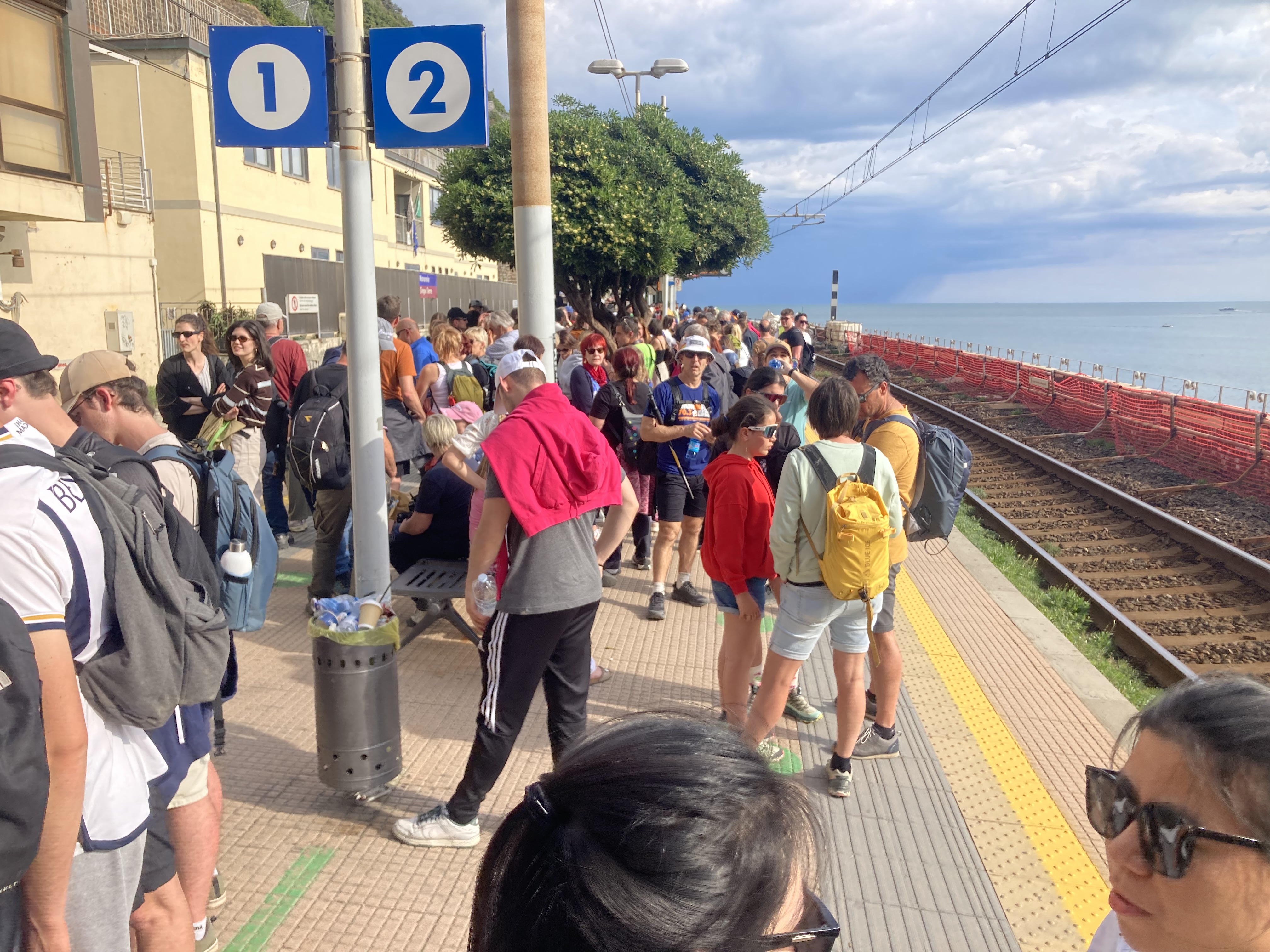
 gelato (and checking my phone for word from the luggage courier).
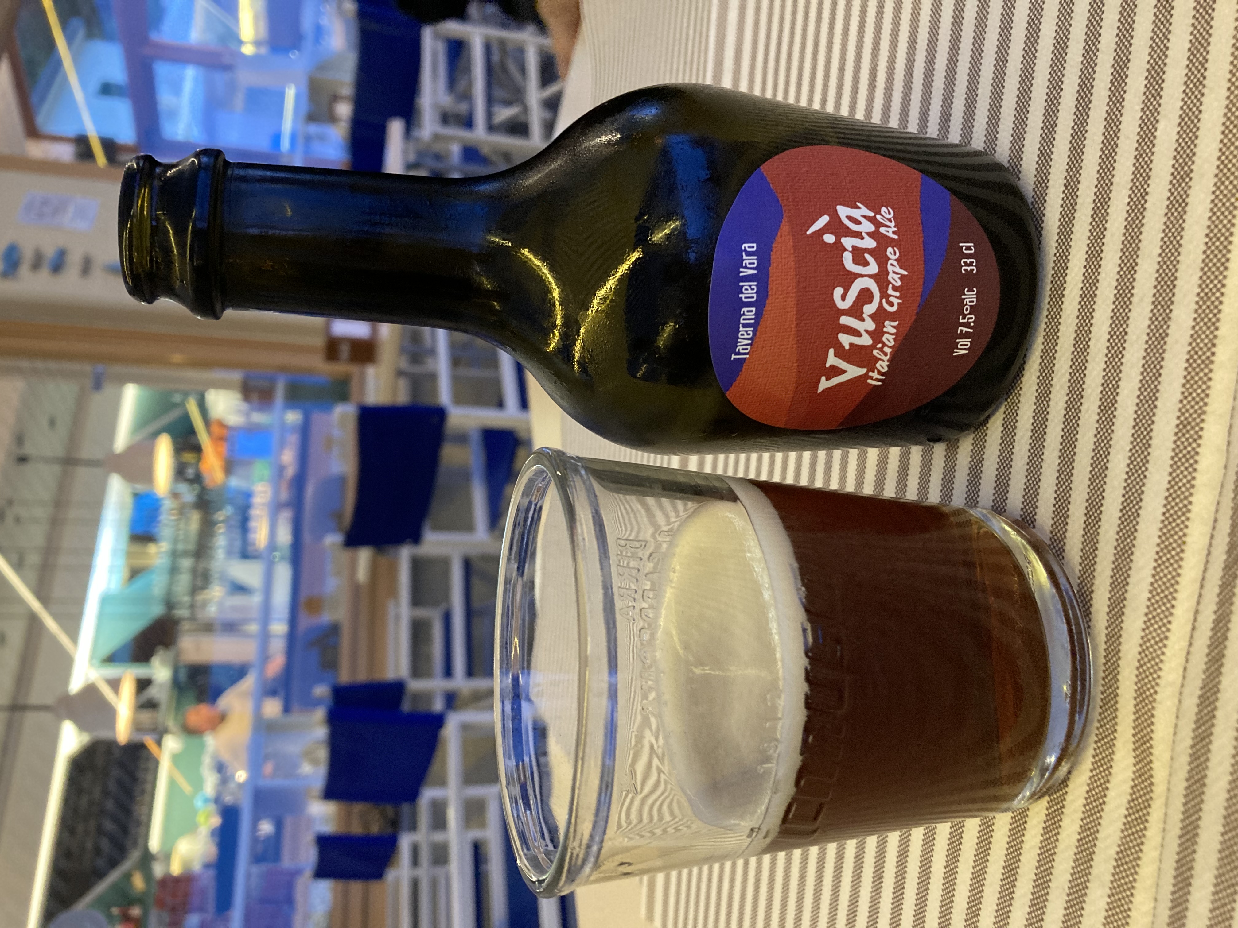
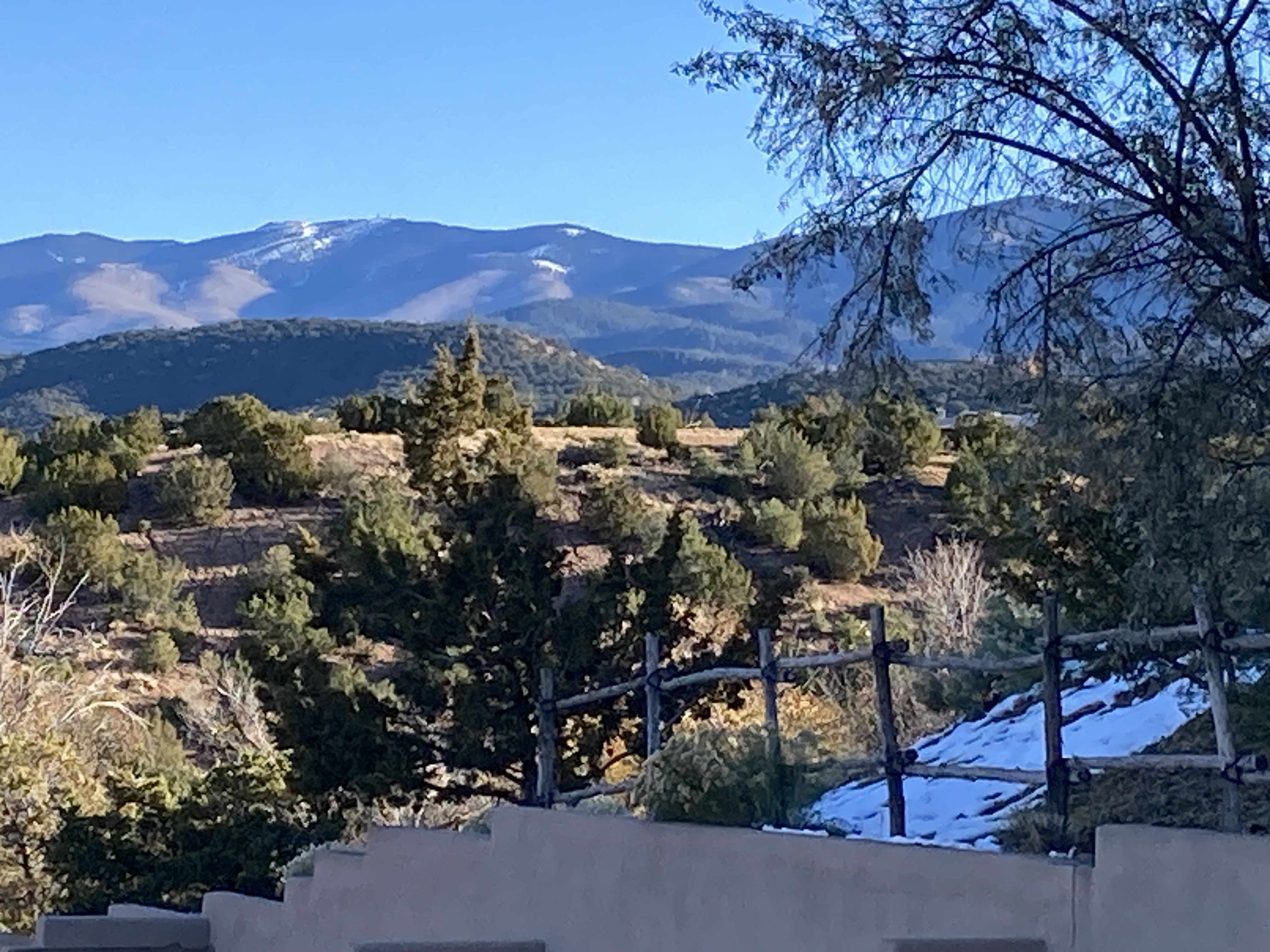
 Today it was time to say farewell to Santa Fe, and head off for our last couple of days in Albuquerque. This was heading down in both the literal and figurative sense, as Albuquerque is a couple thousand feet lower than Santa Fe, and correspondingly warmer.
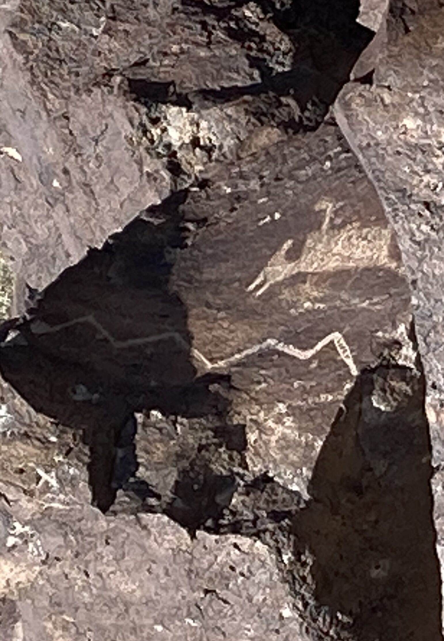 with bright fall colors had taken the place of pinion and juniper. The city itself appears fairly flat, but there are still mountains in the distance everywhere you look.
 Our first stop was Petroglyph National Monument, just a little ways outside the city. There are a few different disconnected areas of this park, but we elected to go to the Rinconada Canyon section. We walked through the canyon alongside a steep hillside covered with volcanic rocks, many of which had been decorated with petroglyphs. We learned that in addition to the Native Americans, the early Spanish settlers also copied the technique — so in some cases, it’s not known which culture created a given piece of artwork.
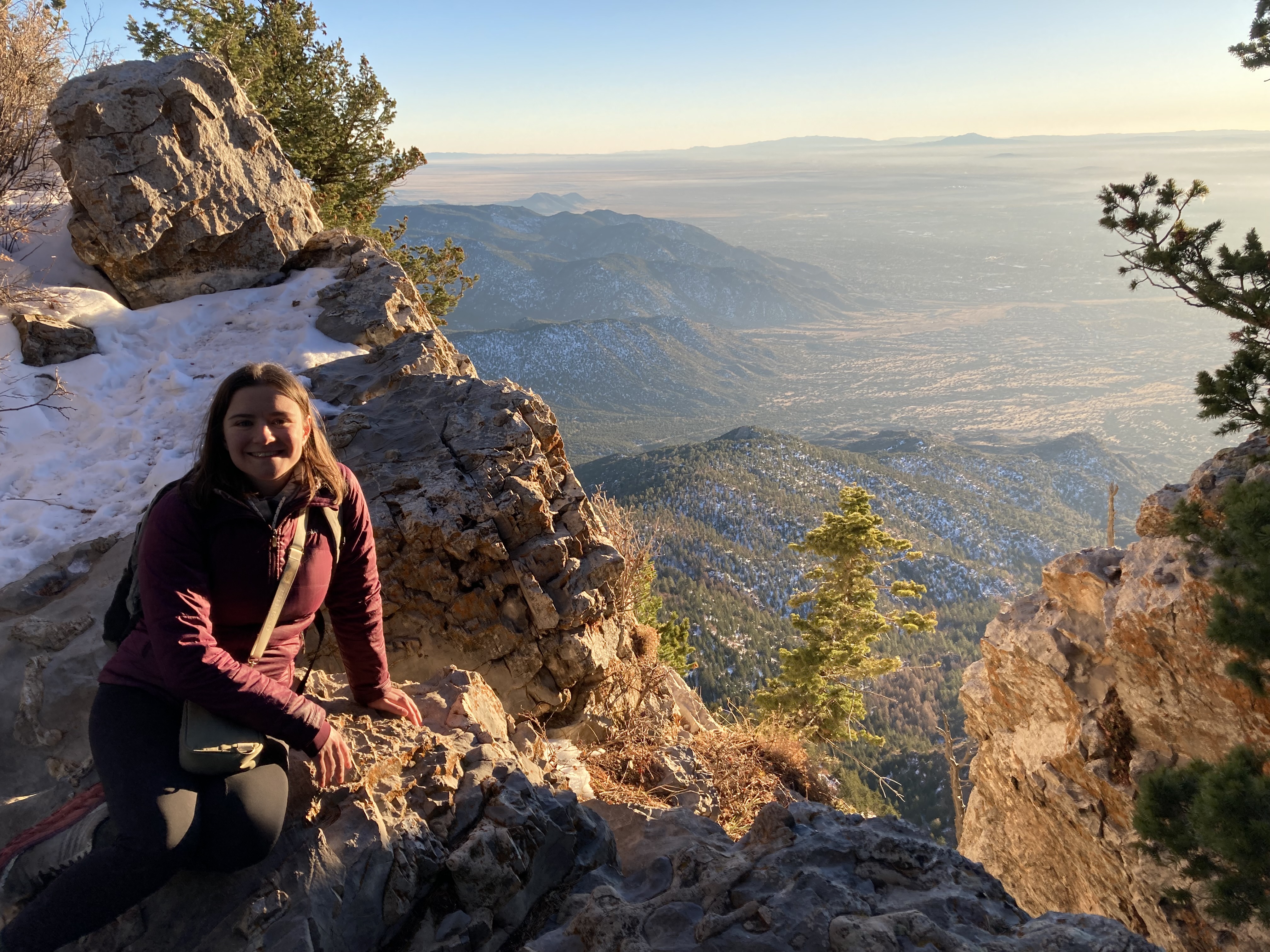
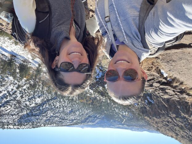
 The afternoon turned out to be my very favorite part of the trip. Just outside the city, which is at around 5000 feet, you can take an aerial tramway to the top of the Sandia mountains, at over 10,000 feet. As you can imagine, the ascent is quite dramatic. It reminded me of a similar trip we did in the French Alps, but with a very different landscape.
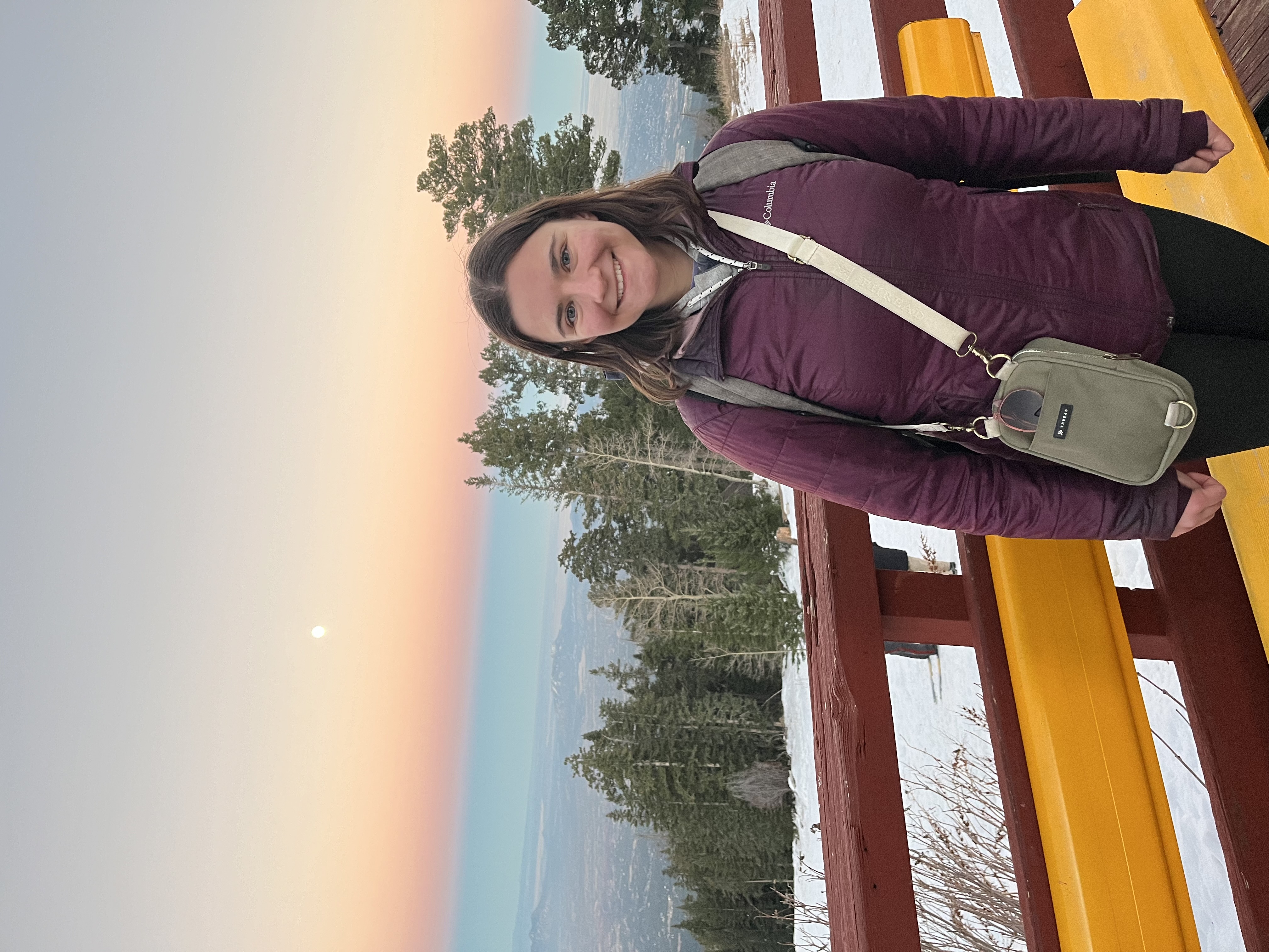 hike around at the top, then watch the sunset and the emergence of the city lights of Albuquerque. We didn’t get very far on our hike due to the snow, which was several feet deep here. We followed a packed-down path in the woods for a while, but eventually decided that it was becoming too treacherous. So we returned to the safe platforms and viewing areas around the tram to watch the sunset. The views, especially in the light of golden hour, were spectacular — even as the temperature plummeted. We stayed up on the mountain until darkness fell and the twinkling lights of the city emerged. After a delicious dinner at a nearby Vietnamese restaurant, we were both ready for bed.
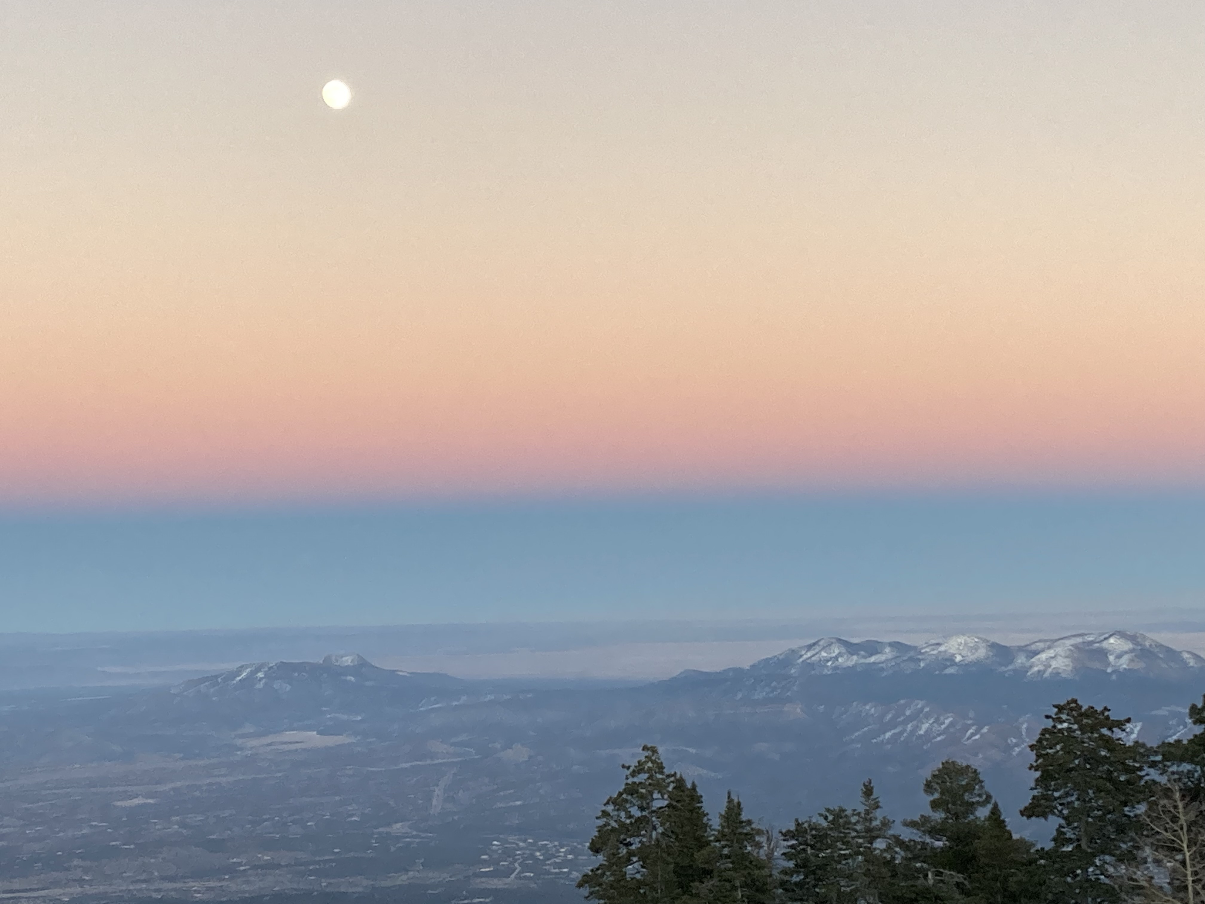

 $5, while the latter, which was larger and much more elaborate, was free.) Both were very text-heavy, so even though the information was pretty interesting, eventually we began to get a bit of the dreaded museum life-suck effect. Fortunately we were able to revive ourselves with a delicious lunch at the noodle house next door.
 Turns out they also had delicious street tacos for dinner.
 challenged. But we also have a secret ambition to someday compete on The Amazing Race TV show. We know that navigation will be our downfall, so tonight we challenged ourselves to walk back from the town center to our apartment without consulting Google Maps. This was not a particularly impressive feat, given that we were covering ground that we’d been over several times over the last few days, but we still had a few moments of indecision. Fortunately we persevered and arrived back home without incident.
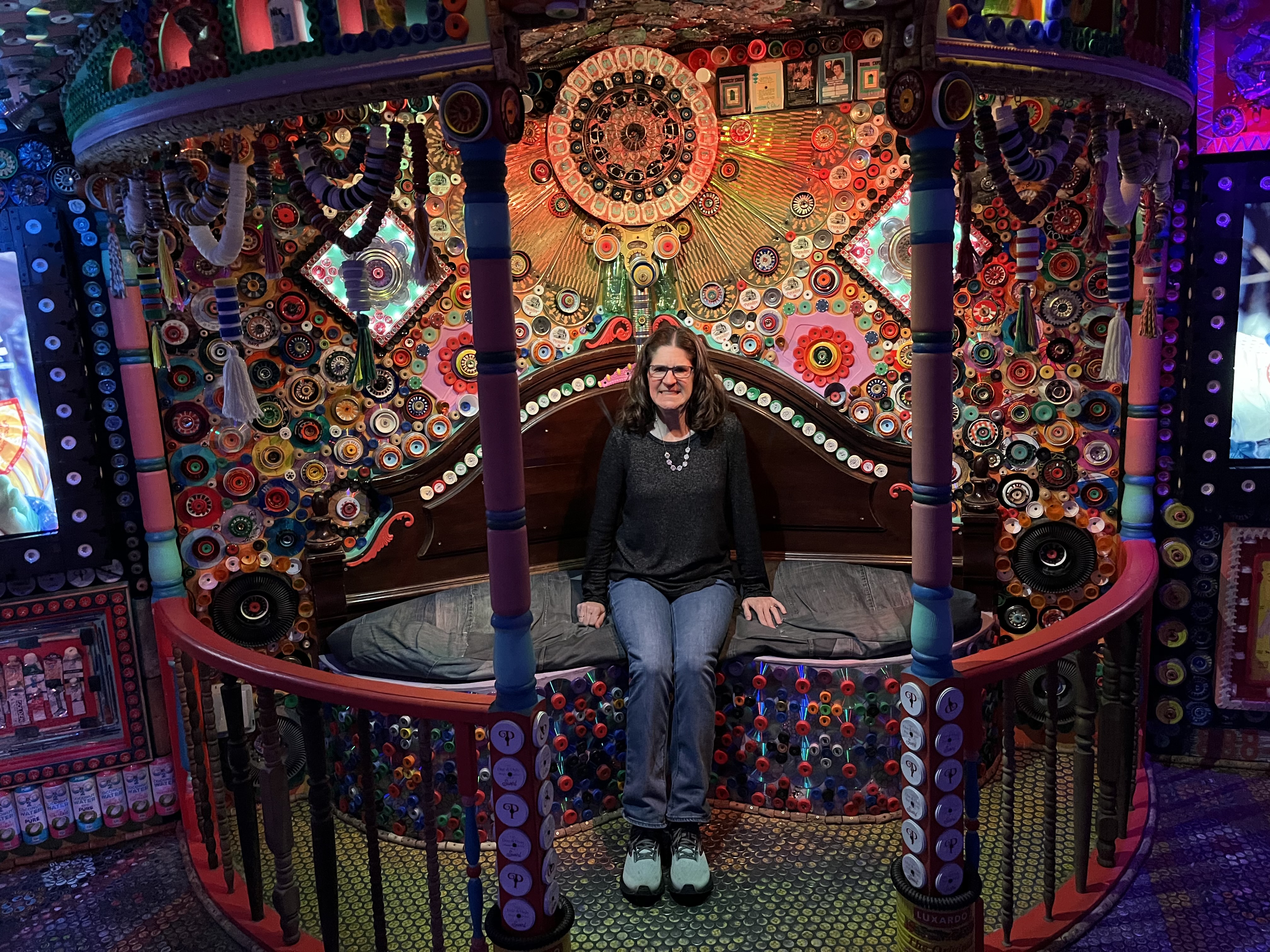
 It would be hard to imagine a greater contrast between yesterday’s Meow Wolf experience and today’s activities. The House of Eternal Return was delightful and fascinating, but also tended toward overstimulation. Today’s trip outside the city was the perfect antidote.
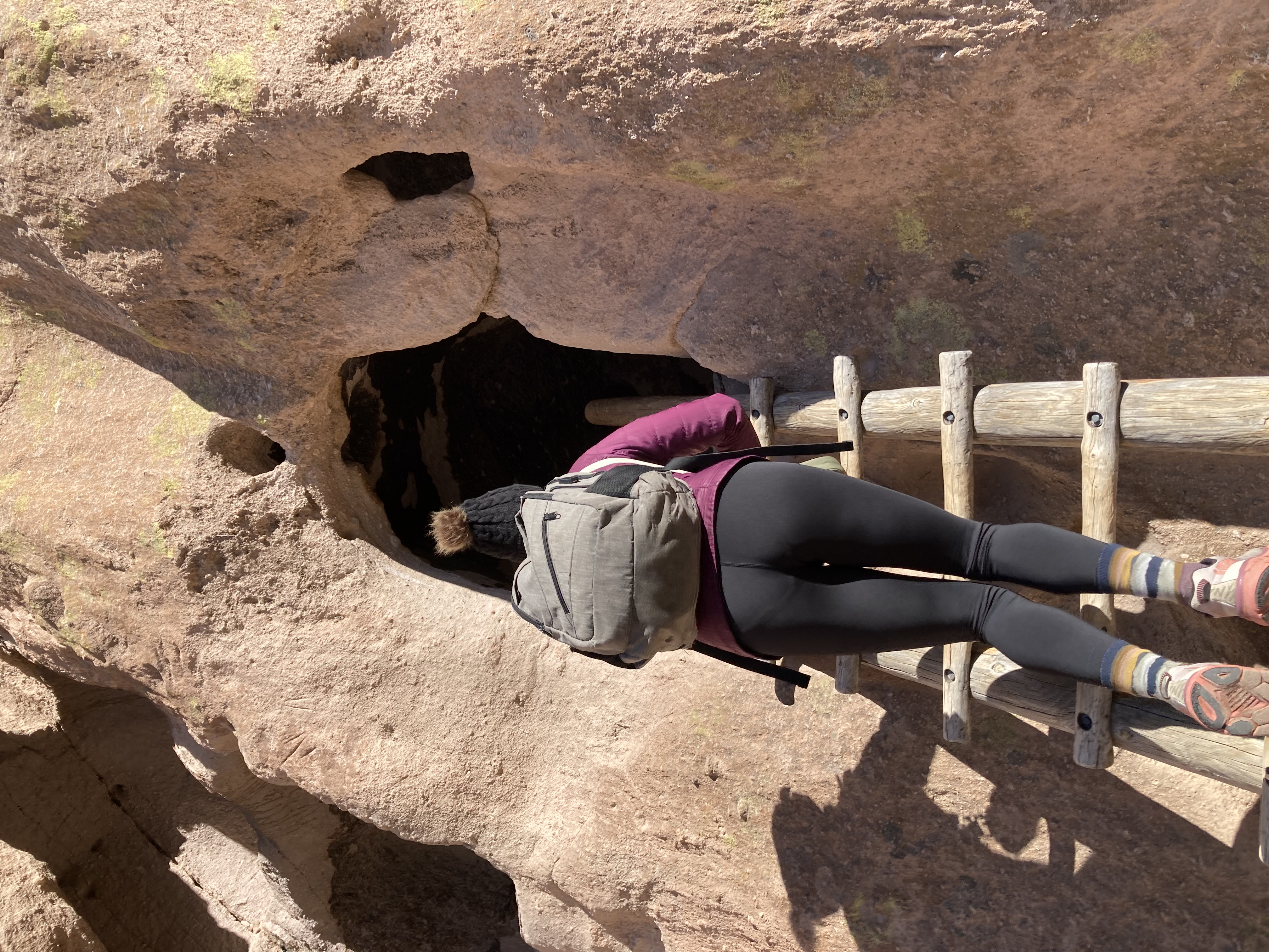 basically just involved going straight.)
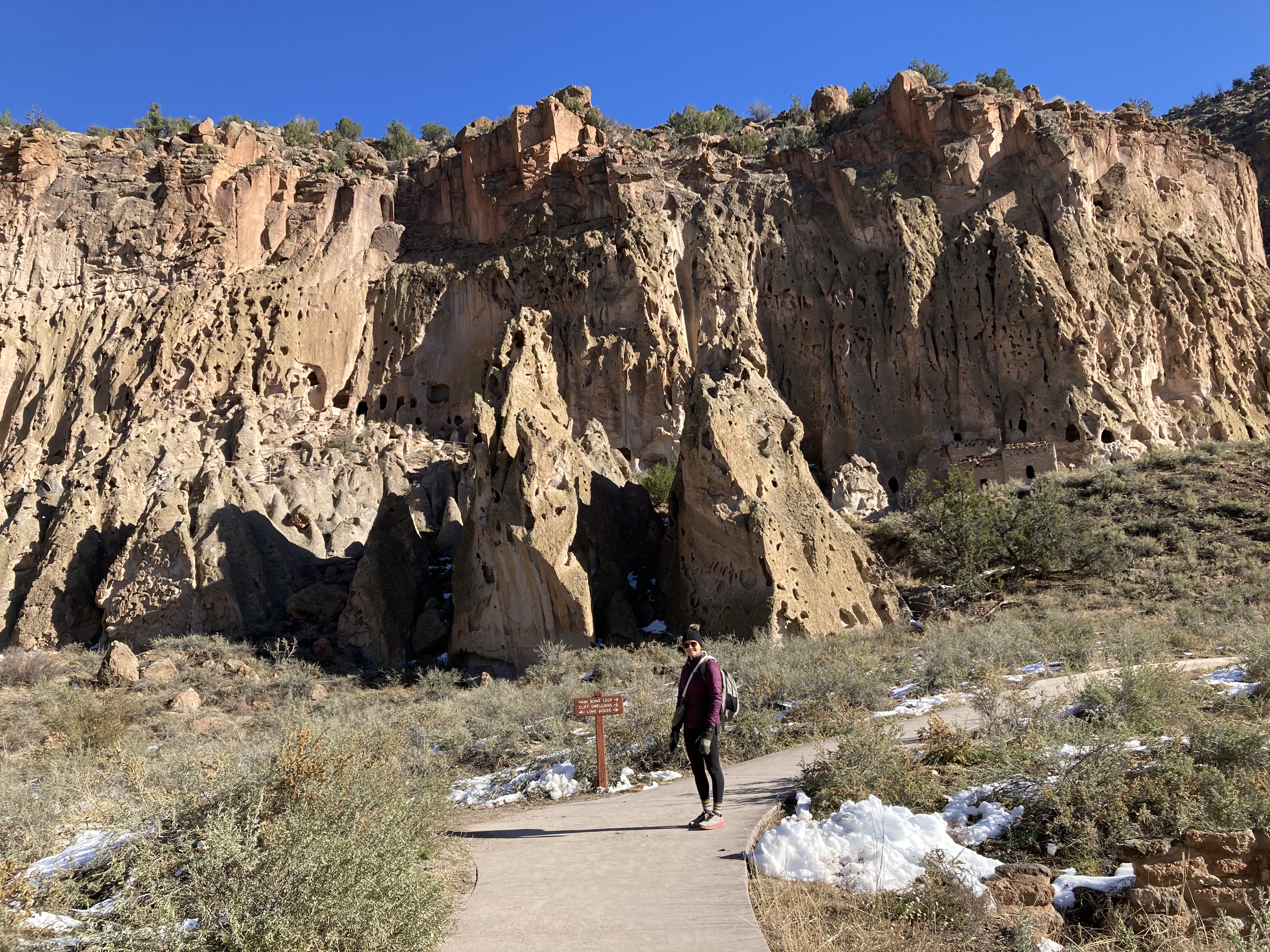
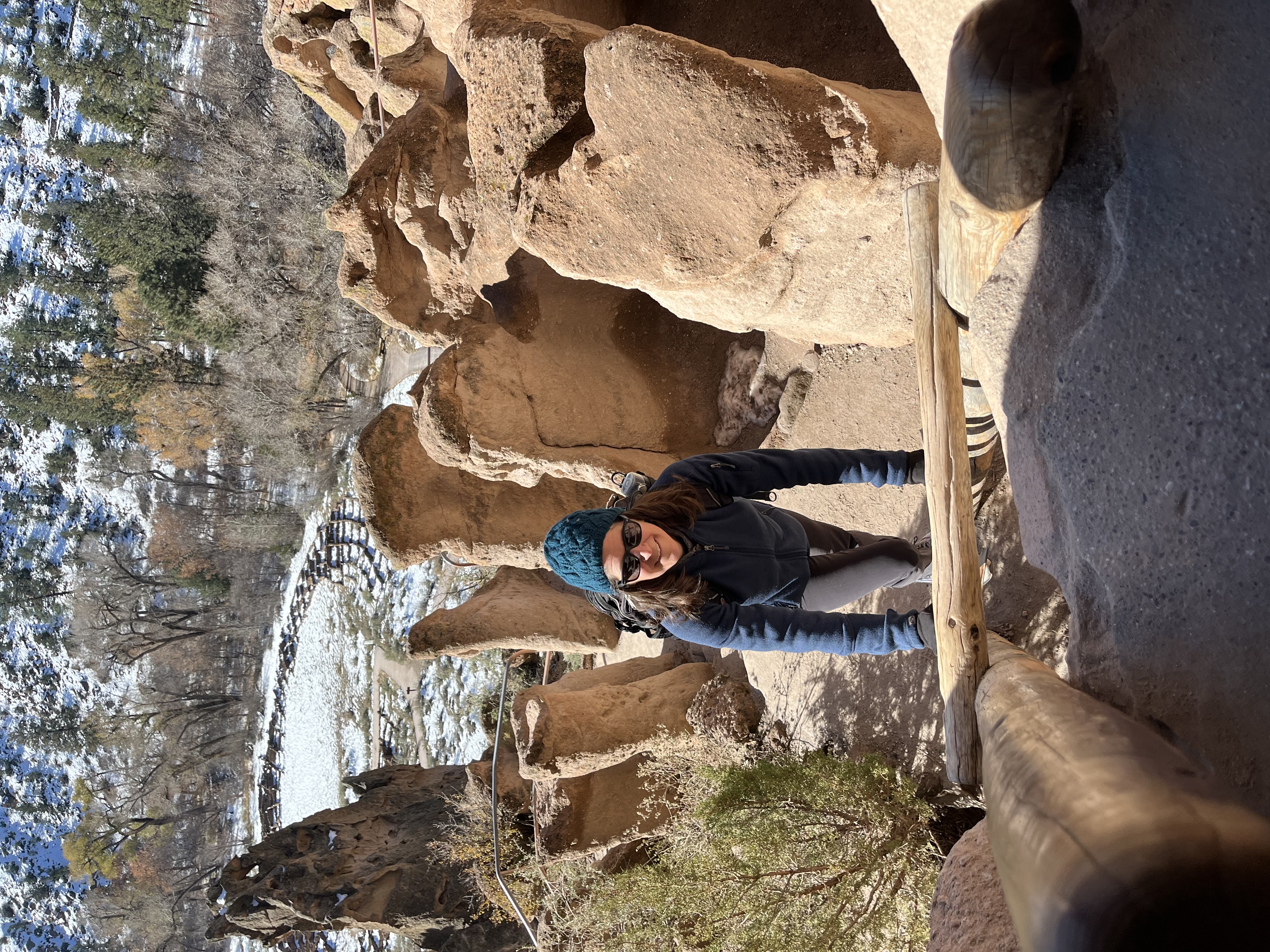 Bandelier is less than an hour from Santa Fe, and was well worth the trip. The drive there was beautiful, winding through the mountains with a new vista around every corner. We were first to arrive in the parking lot, just as the park opened at 9am. Setting off on the main loop trail, we had the whole park to ourselves.
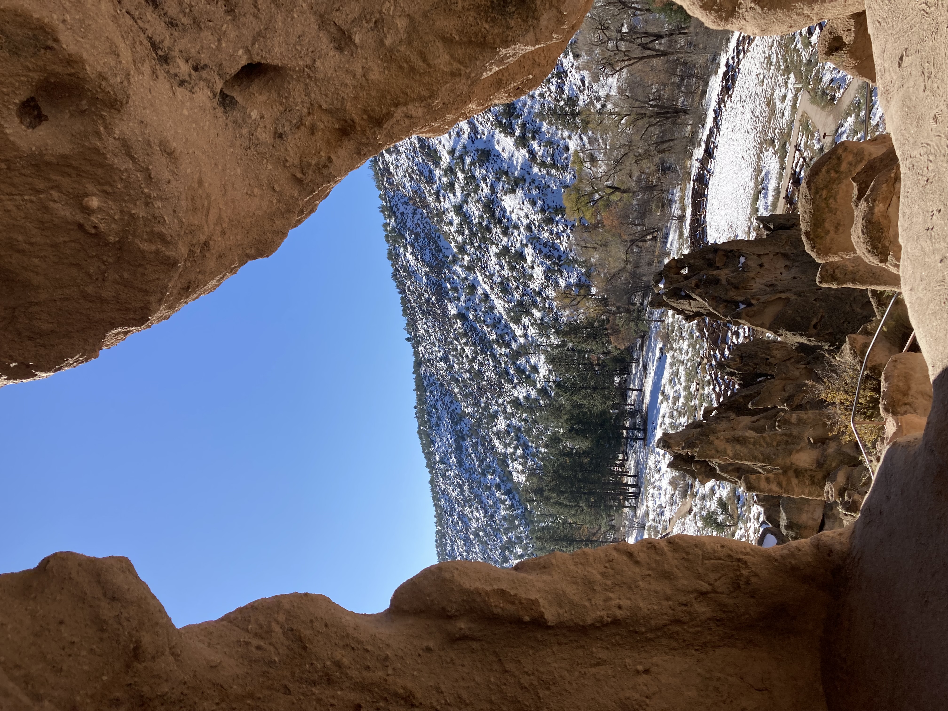
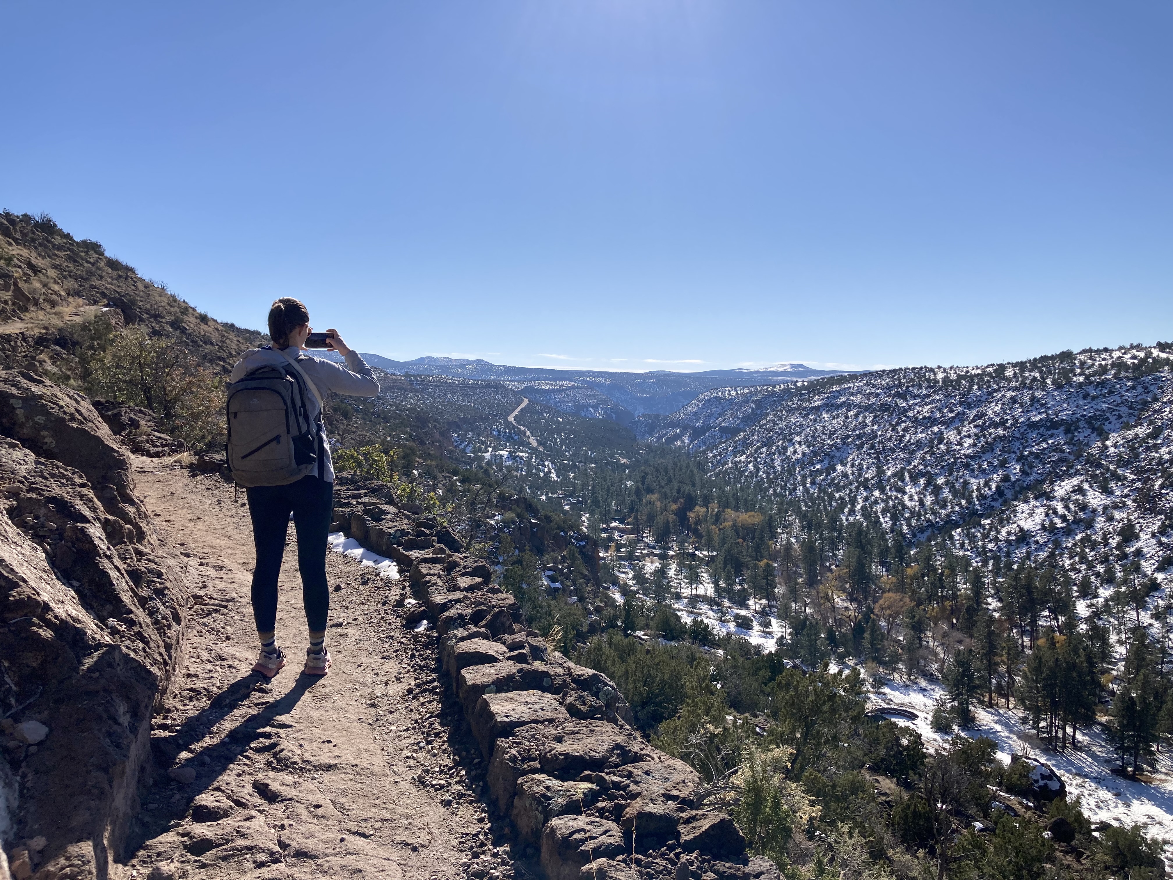 Unfortunately the section of the trail that is known for its long, steep ladder ascents has been closed since September due to flooding, so we didn’t get that adrenaline-pumping adventure. Instead we took a side trail that climbed steeply to the top of the canyon and through a juniper forest. The views were stunning and the silence was amazing. With only one road (the park entrance road) within miles, and very little traffic on
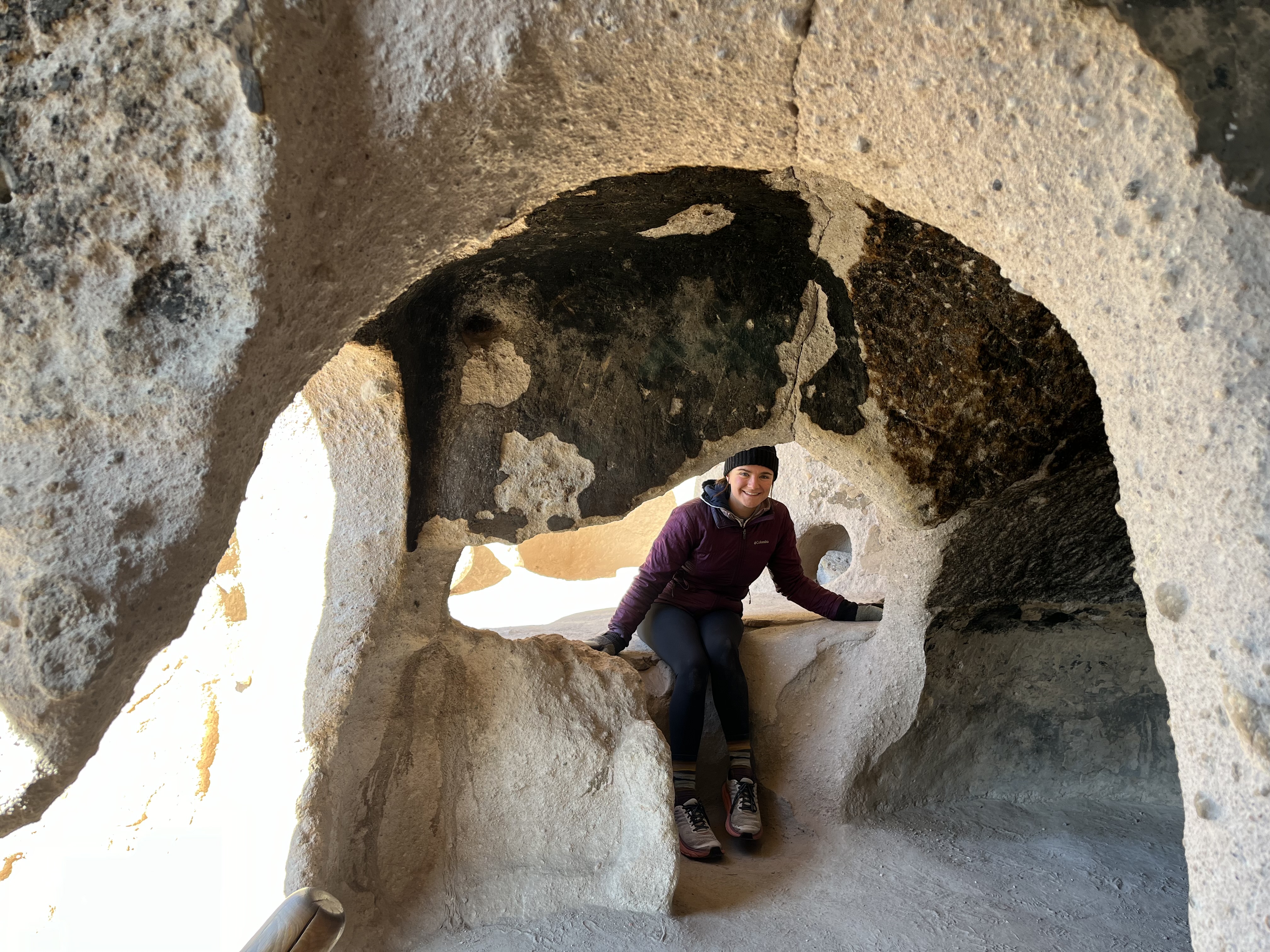 that, we could hear nothing except the rustle of wind and the occasional bird. It made us realize how seldom we are able to experience that kind of silence in today’s world.
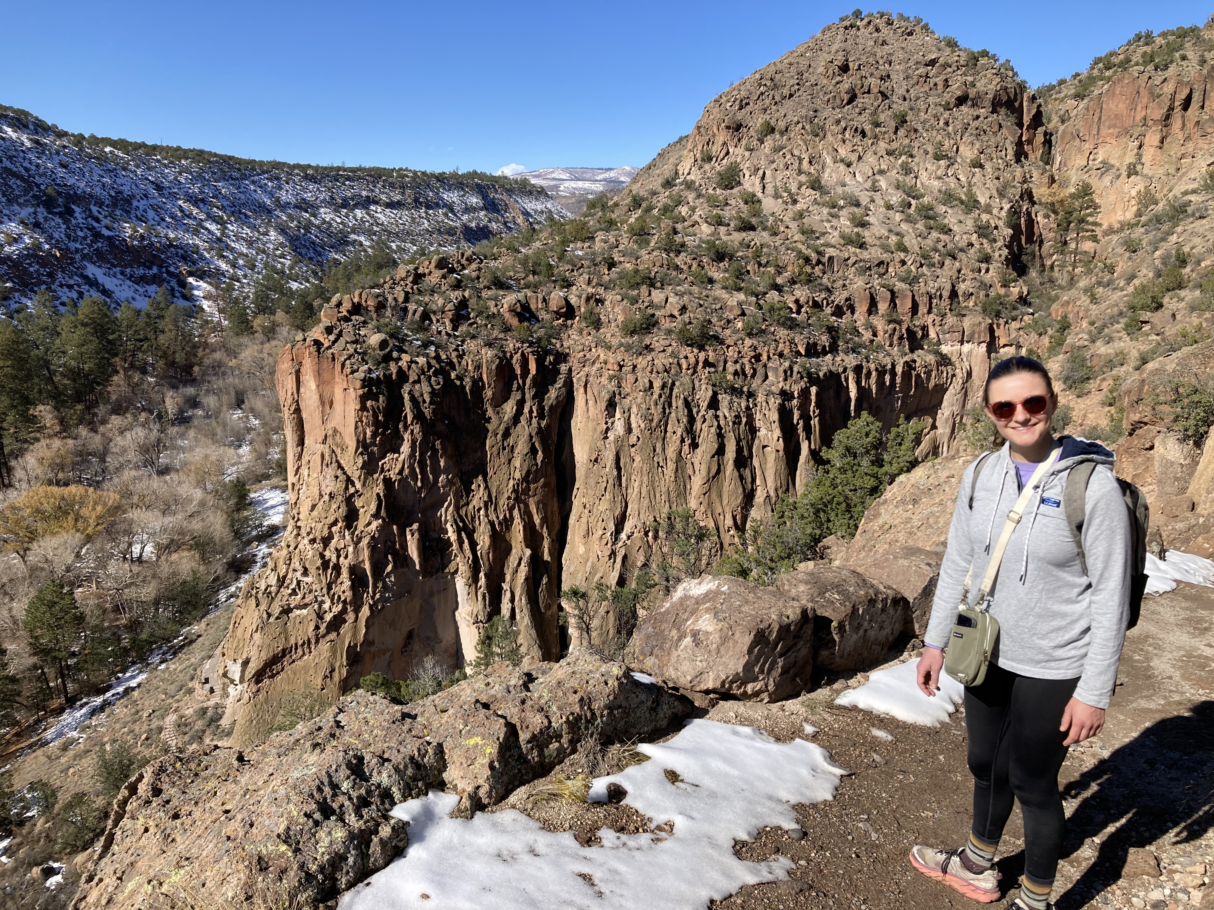 By the time we got back we’d worked up an appetite. Bandelier’s cafe (at which we were the only customers) is supposedly known for having the best burger in New Mexico — the “Doug”, which comes with American and mozzarella cheeses, carmelized onions, green chilis, and a whole chili relleno on top. The lone restaurant worker recommended having the Doug made with an elk burger, so we went with his suggestion. It was delicious. (But luckily we decided to split one, along
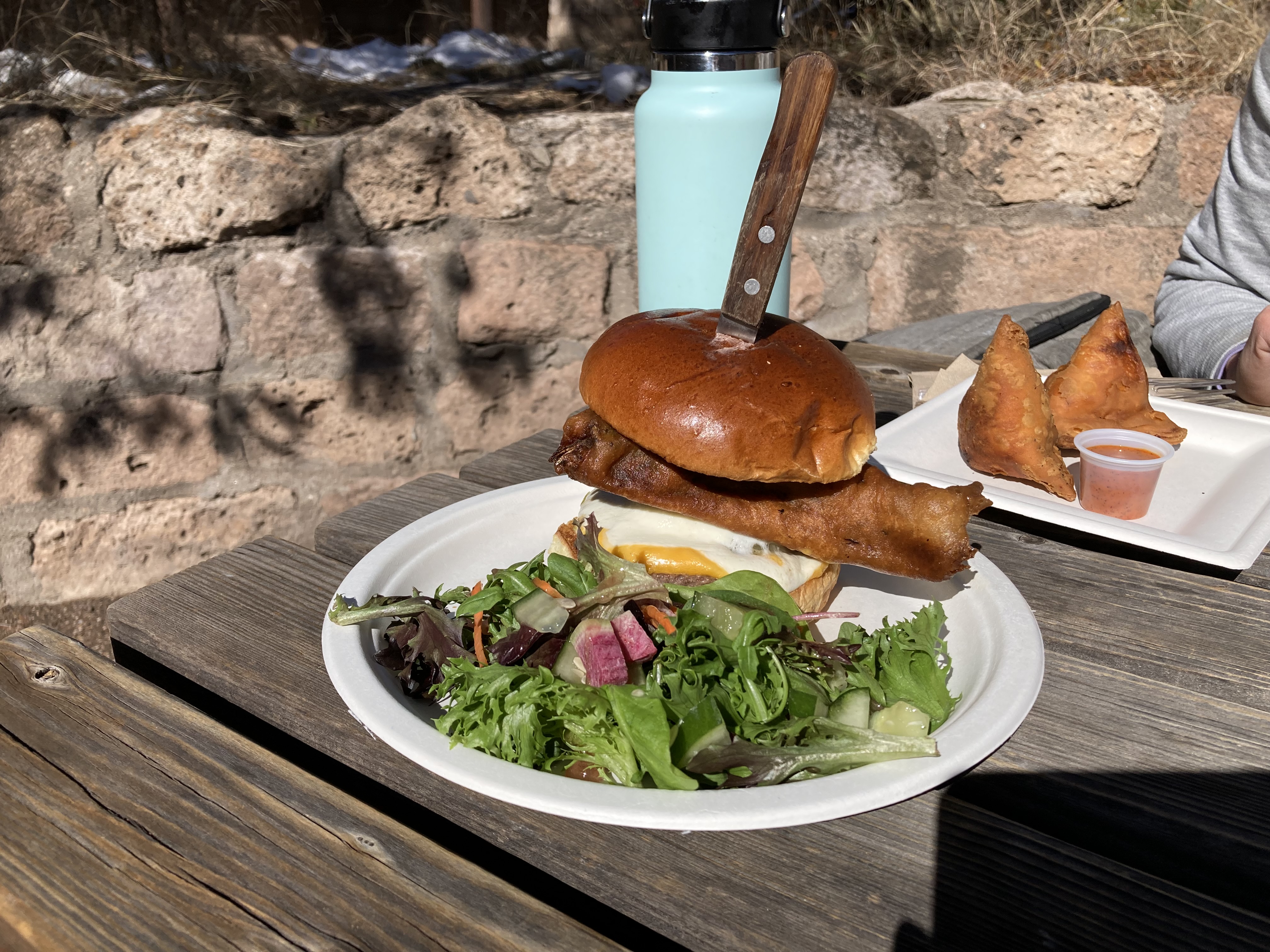 with a few other snacks. I wasn’t even able to finish my half.)
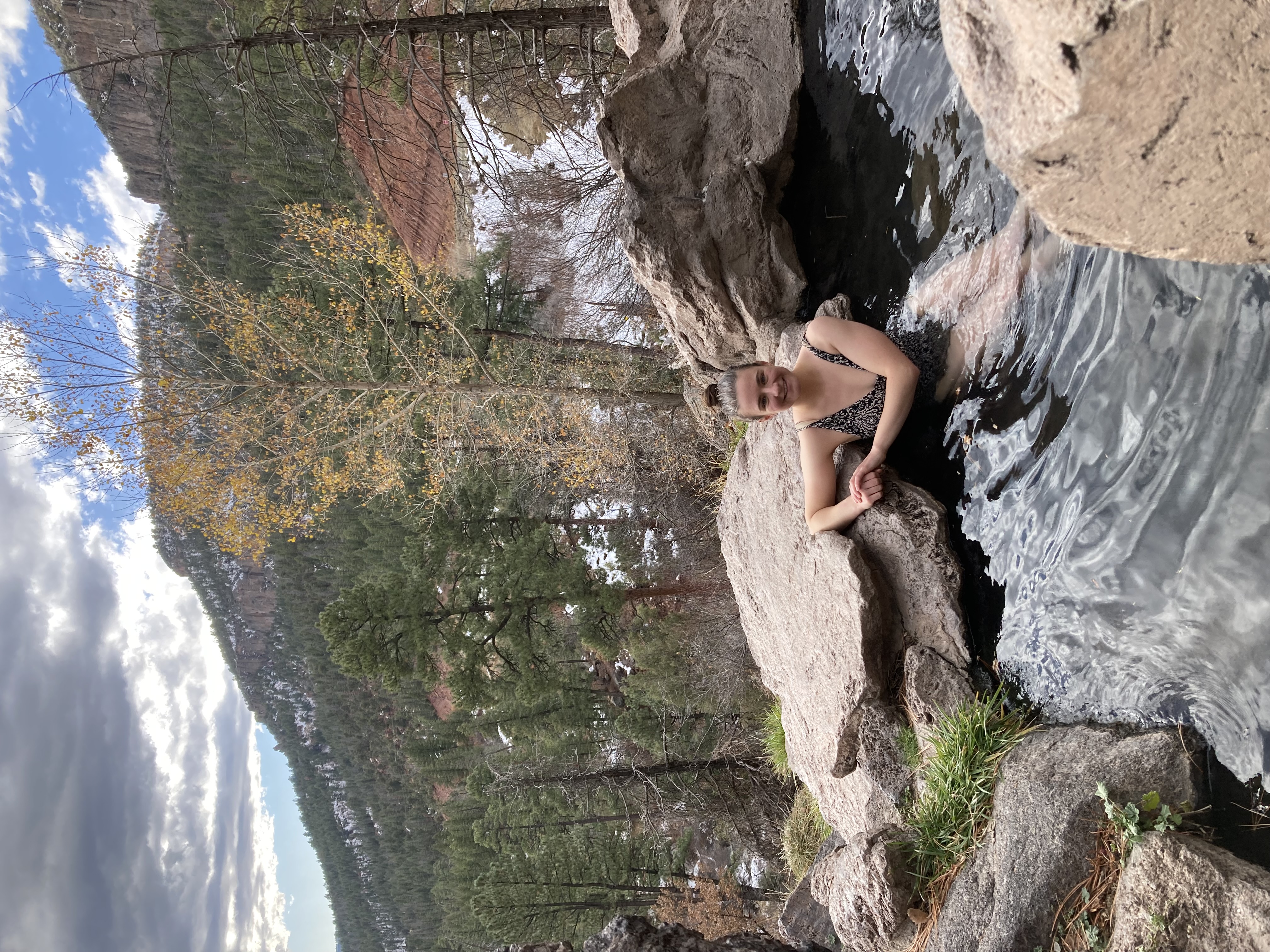 be the same). There were two other people there soaking and we decided to go for it despite the chilly air. It was pretty amazing sitting in the warm water, surrounded by snow drifts, with a view out over the surrounding mountains and no signs of civilization. There was a cave on one side that you could barely squeeze into, and one of the guys who were there told us it was like a sauna inside. Neither of us (nor his friend) were brave enough to do more than stick our heads in, despite the chill.
 No evening adventures today — we were both too tired to walk into town and didn’t feel like getting back into the car, so a quick board game, Door Dash, and an early bedtime it was.
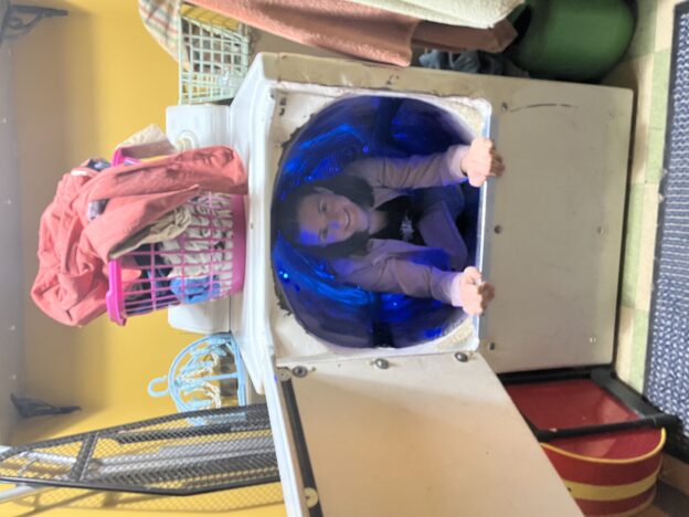
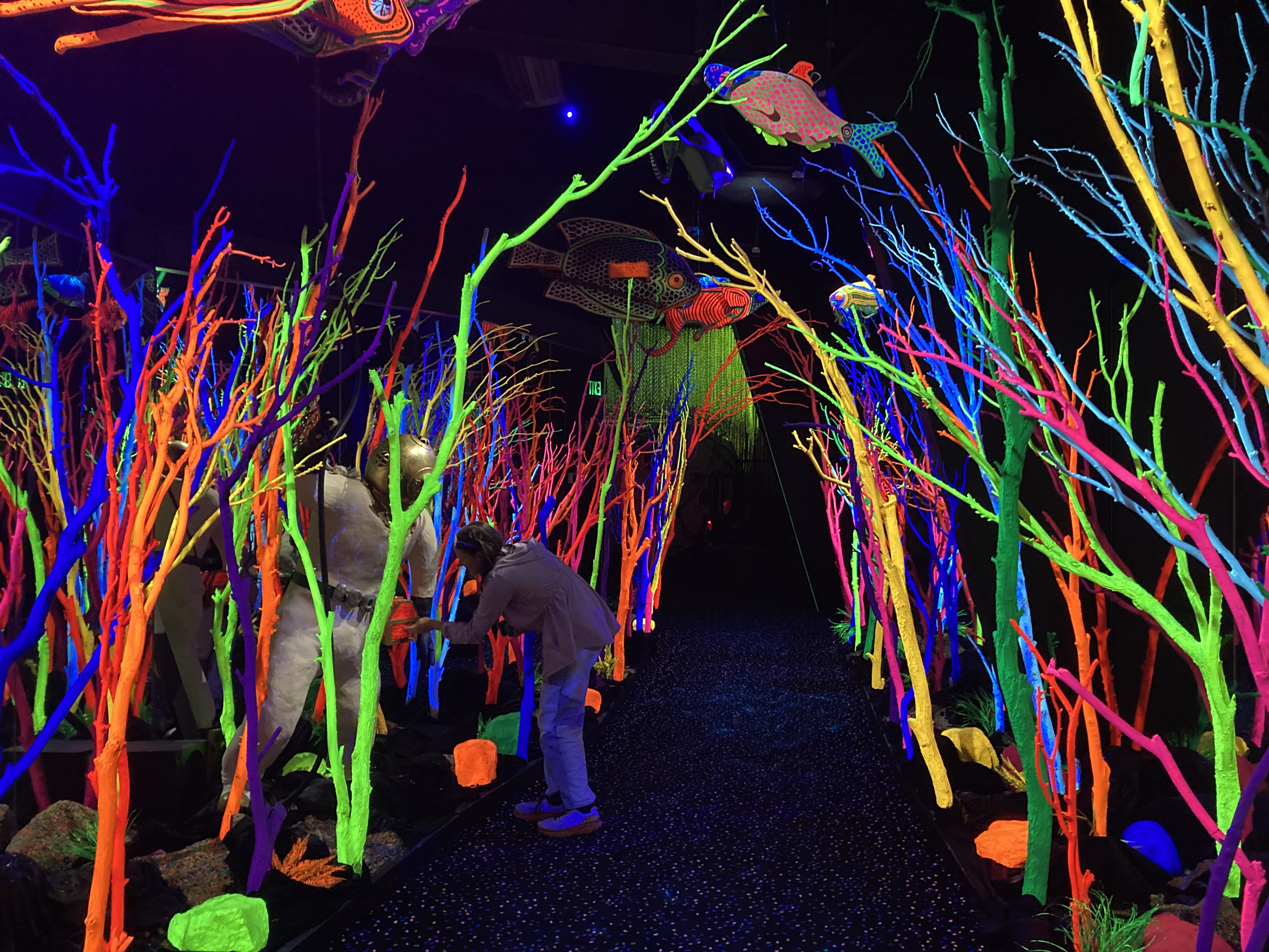
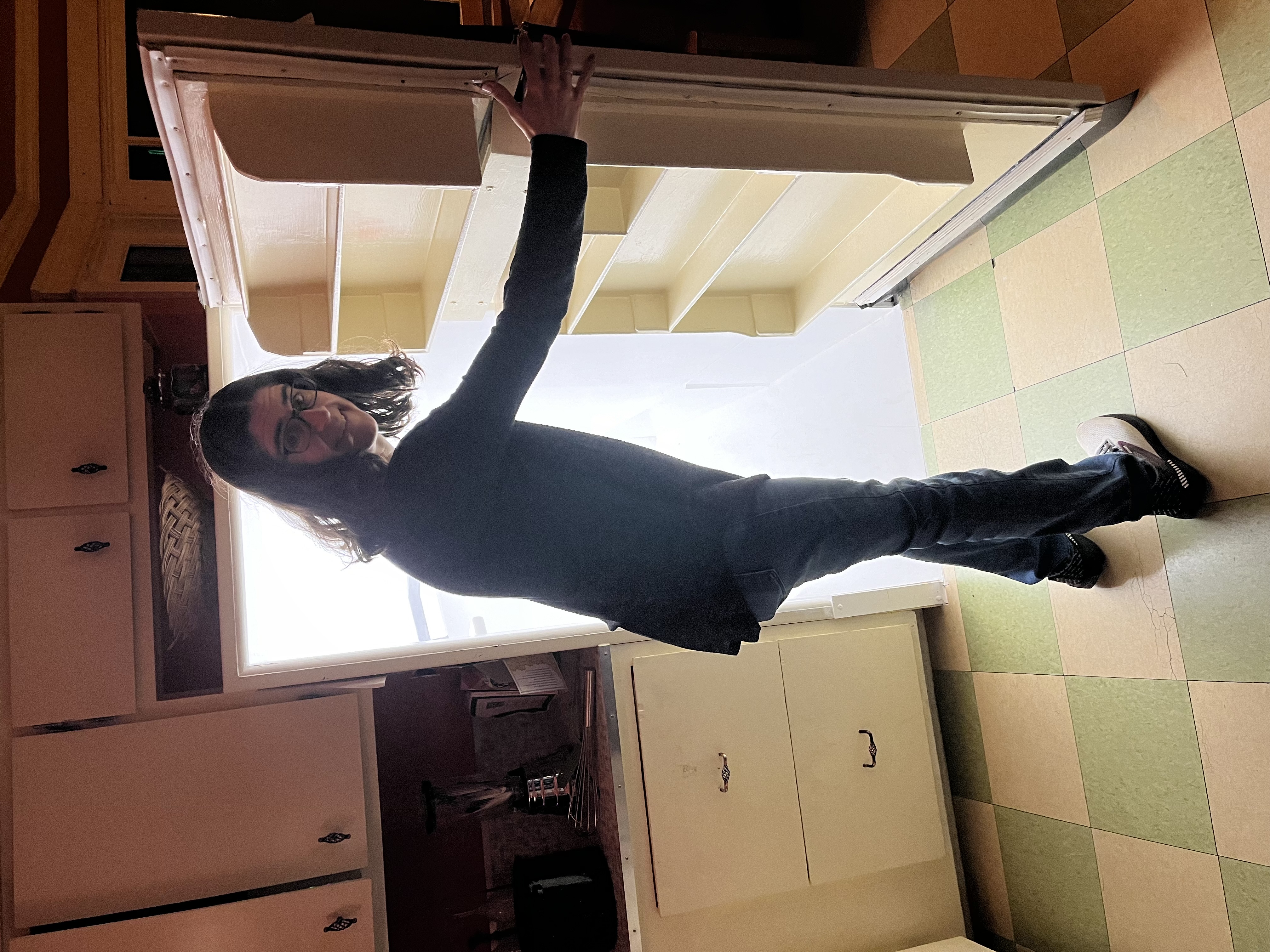
 On our second full day in New Mexico, we visited Meow Wolf’s Santa Fe installment. House of Eternal Return was one of, but not the only reason I wanted to come to Santa Fe in the first place. I was already a fan of Meow Wolf’s Denver exhibit, Convergence Station, which the whole family visited on our trip to Colorado this summer. I had a great time there but it left the rest of the family feeling tired and over stimulated. I felt a little bit bad about dragging everyone along on my whims, but that didn’t stop